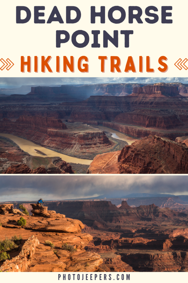
Dead Horse Point State Park Hiking Trails
There are about seven miles of Dead Horse Point State Park hiking trails to enjoy the stunning views! Dead Horse Point State Park is one of many Utah State Parks that’s a must-stop destination to visit, photograph and explore.
Dead Horse Point State Park, situated in southeastern Utah, is a hiker’s paradise, boasting an intricate network of trails that crisscross its rugged, picturesque landscape.
If you’ll be visiting Canyonlands National Park Island in the Sky, be sure to make a stop at this State Park.
The trails at Dead Horse Point cater to all fitness levels, from the leisurely, family-friendly trails with spectacular panoramic views to the more challenging routes that test the mettle of seasoned hiker
We live just hours away so we’ve been able to visit Dead Horse Point during every season and all types of weather. This guide is based on our experiences over the years.
There are two tips we want to share right off the bat! First, pack your camera gear so you can capture Dead Horse Point State Park photos of the stunning views you’ll see here!
Second, be prepared for the weather and temperatures you’ll experience based on the time of year you visit. Use our Utah Packing Lists to make sure you have the right clothing and gear for visiting any season! Grab your free printable packing checklist by clicking the image below!

This site contains affiliate links which means WE may receive commissions for purchases made through these links. We only provide links to products we actually use and/or wholeheartedly recommend! As an Amazon Associate, we earn from qualifying purchases. Read the full Disclosure Policy.
What to Pack for Hiking at Dead Horse Point
When hiking at Dead Horse Point you must be prepared with the right clothing and gear for the seasonal weather and temperatures when you’ll be there.
- Wicking clothing: Loose-fitting, light-colored, wicking clothing for spring, summer, and fall.
- Sunhat: Sun protection year round.
- Fleece jacket: Layers are key during the spring/fall.
- Insulated jacket: You’ll want a heavier jacket, hat, and gloves during the winter.
- Darn Tough hiking socks: Do not wear cotton socks. Darn Tough Socks are comfortable, breathe well, and prevent blisters!
- Sturdy hiking shoes: Hiking shoes or boots should be sturdy with good tread and traction. Use waterproof shoes in the winter.
- Water: Carry and drink at least two liters of water. Use refillable water bottles or hydration packs. We carry Propel powder packets to add to our water to help replace electrolytes.
- Sunscreen: Apply sunscreen to all exposed skin! Due to the dry heat, you’ll also want lip balm and lotion!
- Snacks: Pack salty and easy to digest snacks to replace electrolytes.

List of Dead Horse Point State Park Hiking Trails
Dead Horse Point should be on your list of places to visit in Utah! This Utah State Park is located near Moab, Utah near the entrance to Canyonlands National Park Island in the Sky.
The hiking trails at Dead Horse Point run along the top of the mesa and connect to each other. Because of uneven slick rock, sturdy footwear is highly recommended.
Dogs are allowed on hiking trails, but must be kept on a leash at all times.
Dead Horse Point Overlook Trail
- Hike Length: 200 feet one way
- Hike Difficulty: Easy
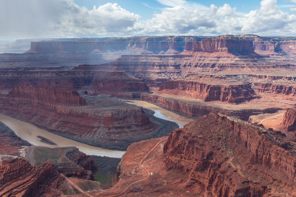
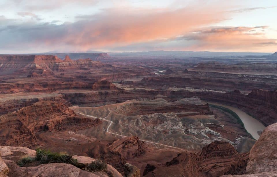
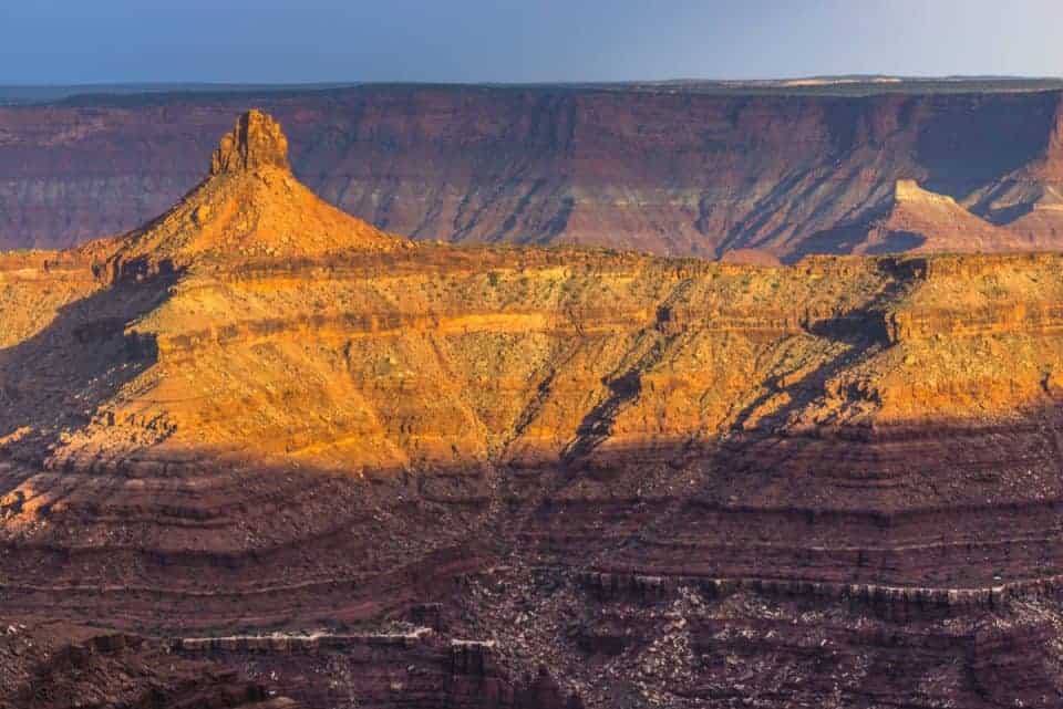
The Dead Horse Point Overlook trail is the main attraction at the park. From the parking lot, there’s a short paved pathway that takes you to the famous view of the bend in the Colorado River 2,000 feet below. There is a large covered shelter at the overlook where you can sit, relax and get relief from bad weather or harsh sun.
The paved pathway leads in both directions from the shelter, providing additional viewpoints that link up with both the East and West Rim trail systems.
Keep in mind the primary overlook and shade shelter are accessible, but the eastern and western spur trails are not. The trails have steep inclines and short sections of rough slick rock integrated with the pavement.
Visitor Center Nature Trail
- Hike length: ⅛ mile round-trip
- Hike Difficulty: Easy
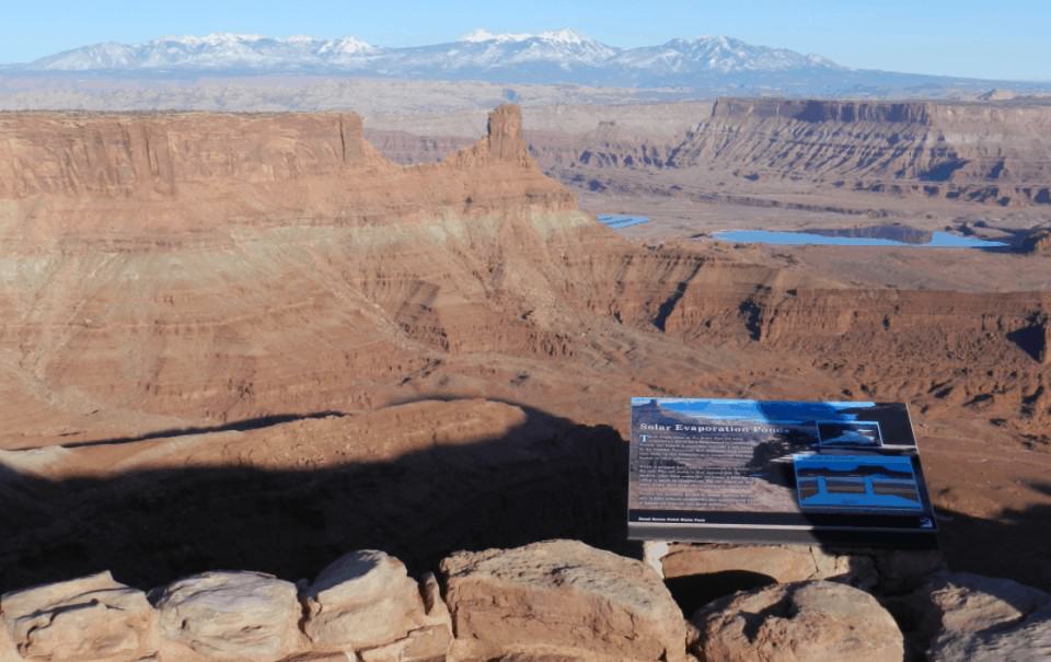
The visitor center at Dead Horse Point is the starting point for this trail. There are eight exhibits and other interpretive signs along the trail that overlook the eastern view. You’ll find information about the common desert plants and trees that you’ll see in the park.
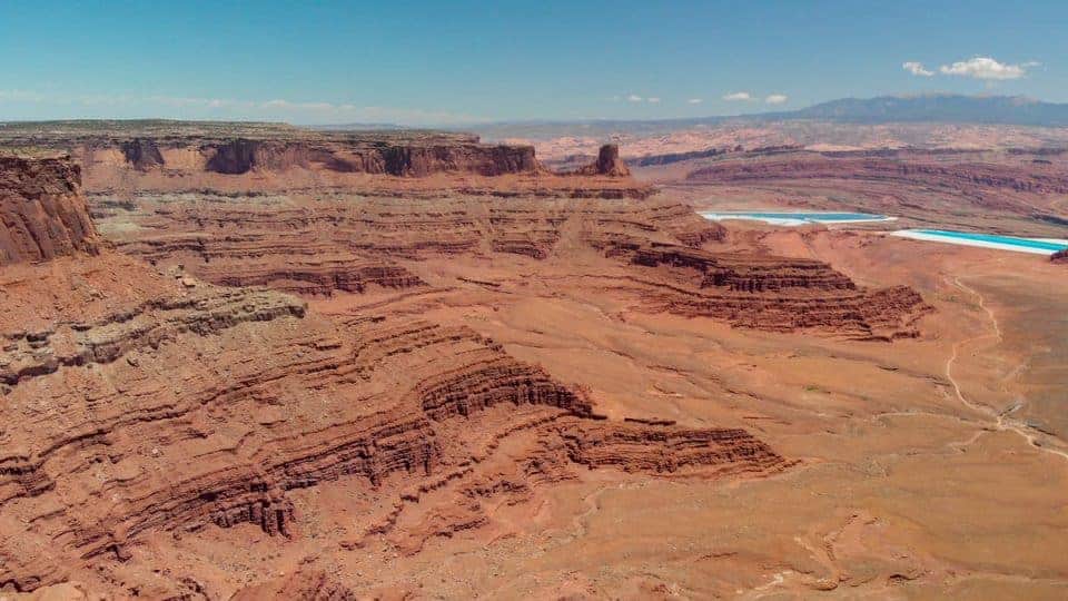
Be sure to read about the bright-colored evaporation ponds at the bottom of the canyon that are used in the mining of salt and potash.
The Colorado River Overlook
- Hike length: 1 mile round trip
- Hike Difficulty: Easy
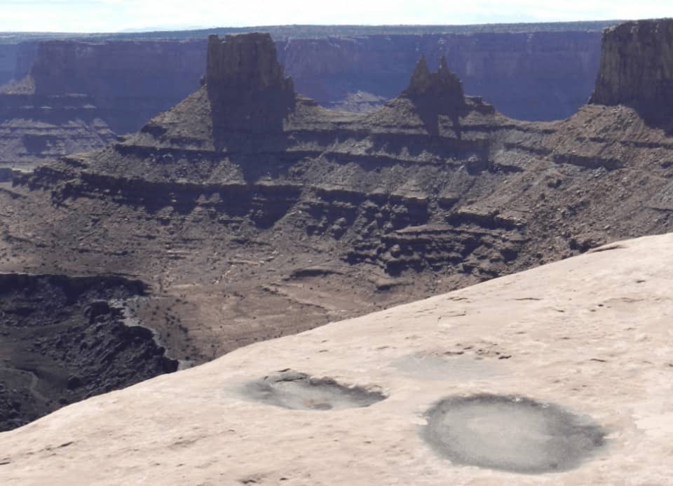
The Colorado River Overlook Trail winds north from the visitor center and leads hikers toward the east rim. You will hike over uneven slickrock, and during wet weather you may see large seasonal pools of water. When going back to the visitor center, all you have to do is retrace your steps.
The East Rim Trail System
- Hike length: 1.5 miles one way
- Hike Difficulty: Easy
The East Rim Trail starts at the visitor center and follows the eastern rim of the mesa to Dead Horse Point for 1.5 miles. It’s a fun alternative to driving the main road.
You’ll see a landscape of beautiful red rocks toward Arches National Park and the La Sal Mountains.
Extend the hike by adding another half-mile to the Basin Overlook spur. The side trail drops about 100 feet where you’ll see more secluded views of the canyon below.
Another way to extend the hike is to add the West Rim Trail for a total of 4-miles (or more). It’s a fun half-day adventure that begins and ends at the visitor center.
The West Rim Trail System
- Hike length: 2.5 to 3.5 miles one way
- Hike Difficulty: Moderate
The West Rim is the longest hike at Dead Horse Point. Start at the visitor center, cross the road, pass briefly through the campground then follow the cliffs along the western boundary of the park.
This trail is more primitive because it’s less traveled than the East Rim. It’s important to follow the cairn-marked routes over exposed sections of sandstone and slick rock.
If you want to add more to the hike, there are spur trails to see different views of the canyon below: Meander, Shafer, and Rim overlook trails.
The Bighorn Overlook Trail
- Hike length: 3 miles round trip
- Hike Difficulty: Easy
The Bighorn Overlook Trail is the longest spur off the West Rim Trail. It branches off to the north near the campground. It’s an isolated spur trail, so you may enjoy the trail all to yourself!
The views here rival those of Dead Horse Point itself, and really should be considered a destination of its own. Look for the eroded fin in the distance resembling a pair of horns, this is the reason for the overlook’s name.
This route also follows cairns across slick rock, along with short sections of moderate cliff exposure. There are no guardrails at the overlook so be careful and watch children.