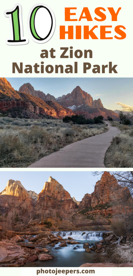
10 Easy Zion National Park Hikes
There are quite a few easy Zion National Park hikes to explore that range from 0.4 miles to 3.5 miles with no more than 100 feet elevation gain. There are even some that are wheelchair accessible!
In this guide we share the important things you need to know about hiking at Zion: what to wear for the hike, what to pack in your day bag, best time of year for hiking, and trail descriptions.

We live a few hours away from Zion so we get to visit often, and know what it’s like to hike during all four seasons. Use our list of easy hiking trails below and this Zion National Park travel guide to plan your daily activities to explore the park.
NOTE: Zion shuttles will run certain times of the year. And hiking permits may be needed for some of the trails. Keep reading for all the information you need before hiking at Zion!
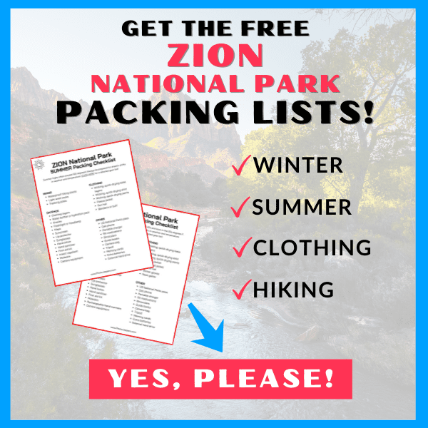
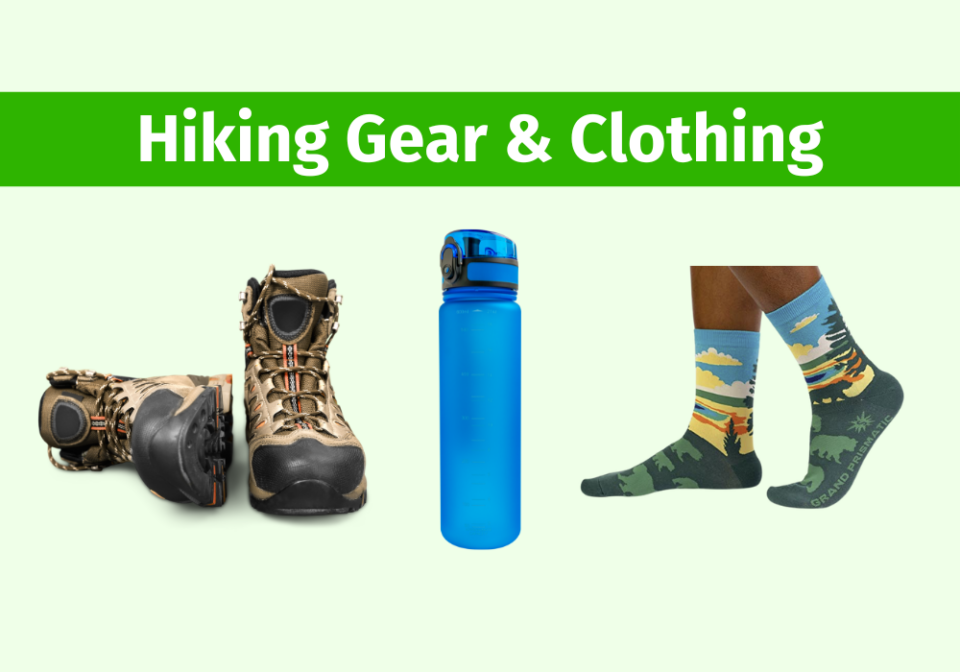
The tips we share here are based on our experience hiking at Zion National Park throughout the years! The first and most important tip is to make sure you have the right clothing and gear for the weather and temperatures when you’ll be visiting! Grab your free printable Zion National Park Packing List by clicking the image below!
What to Pack for Hiking at Zion
- Hiking shoes – waterproof hiking shoes for winter
- Darn Tough hiking socks
- Water – carry a hydration pack or a refillable water bottle in your backpack
- Healthy food that’s portable and filling!
- Columbia fleece jacket – insulated coat in the winter
- Wicking, quick-drying clothing – base layers in the winter
- Lip balm with UV protection – summer and winter
- Sunscreen (even in the winter) and a sunhat
- Hand lotion
- UV sunglasses – summer and winter
- Travel hand sanitizer
- Flashlight or headlamp
- First aid kit
- Insect repellent
- Camera gear – DOWNLOAD the free checklist!
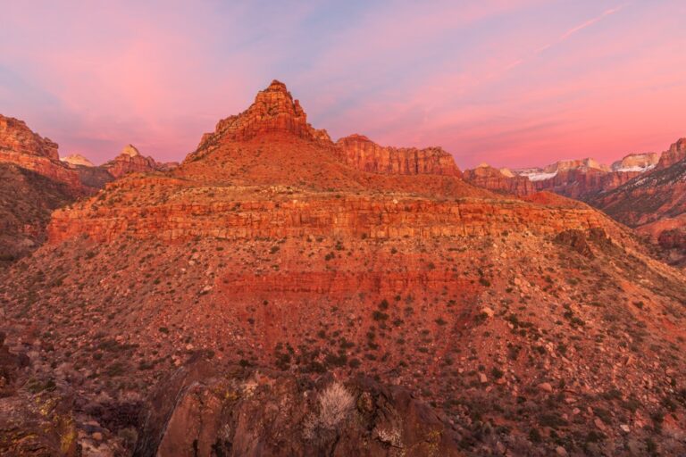
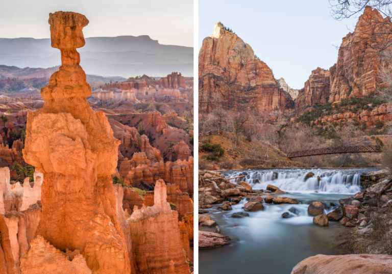
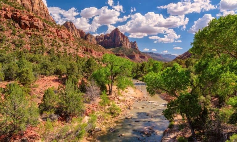
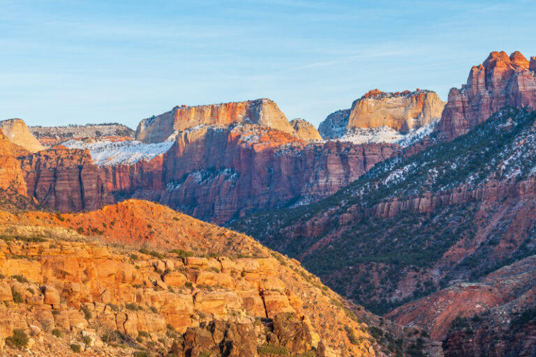
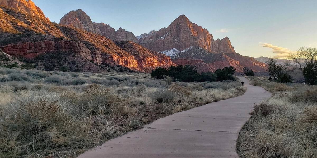
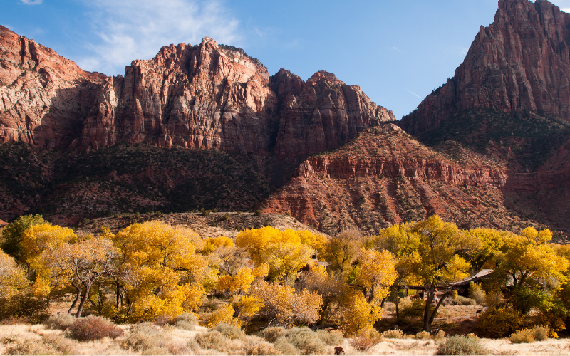
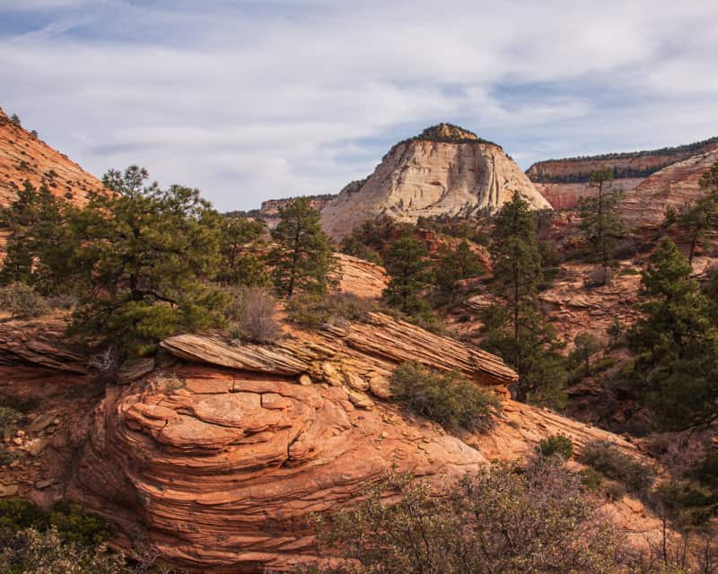
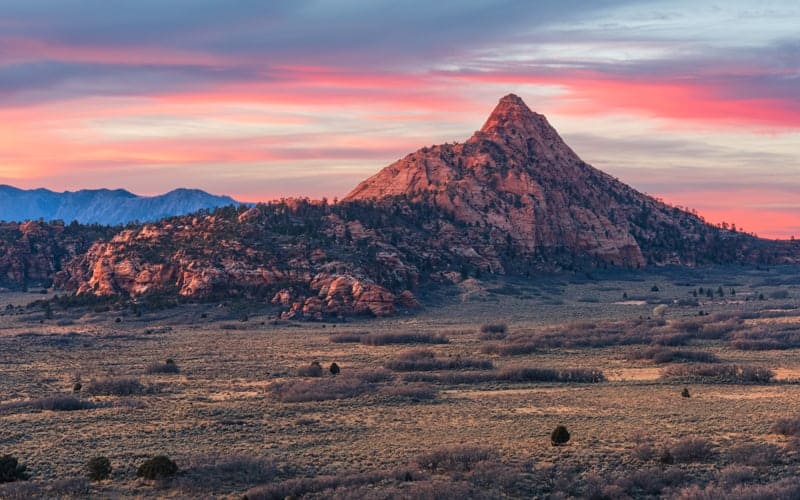
A Photo Tour of Zion National Park
Take a visual tour through Zion National Park to see the stunning landscapes you’ll see when you visit!
Important Things to Know About Hiking at Zion
Zion National Park is the most visited Utah National Park so be prepared for crowds most of the year. We highly recommend you check the Zion NPS website for the most updated information regarding the US National Parks Reservations required for the time you’ll be visiting. For this list of easy hikes, there are no hiking permits needed.
Shuttle and Parking at Zion
From spring to fall (and during the Christmas holiday) most Zion Canyon hikes are accessible only by the Zion National Park Shuttle. Plan ahead to know the shuttle schedule and the shuttle stop near the trailhead.
Be sure to arrive early to find parking at Zion National Park, especially during peak summer season!
There are some fun Zion hikes without the shuttle found near the Visitor Center, along Highway 9, in the Kolob Terrace area, and the Kolob Canyon area.
Zion National Park Trail Conditions
Check current trail conditions at Zion for any trail closures that may be in effect. Zion National Park trails can close due to storm damage, falling rocks, or any other unsafe condition.
Best Time of Year to Hike in Zion
It’s important to know what to expect at Zion during each season so you can determine the best time to visit Zion National Park for YOU!
- Zion National Park in the Spring : weather and temperatures are a perfect time to do some of the best hikes in Zion. But water levels in the canyons may be high which will close some of the hiking trails.
- Zion National Park in the Summer: expect hot temperatures over 100 degrees most of the time. It’s best to hike early morning or late evening.
- Zion National Park in the Fall: best time for Zion National Park hiking. There aren’t many storms, the temperatures aren’t extreme and water levels are low. These conditions make some of the best hikes in Zion safer and more enjoyable. And the fall colors in Zion Canyon are amazing to see in late October.
- Zion National Park in the Winter: weather is cold and often wet. Temperatures can range from highs of 50-60°F during the day to lows well below freezing at night. When it snows, the roads may be plowed, but trails may close due to snow and ice.
Flash Flooding in Zion
Flash floods can be DEADLY! Therefore, learn all you can about flash floods before you explore any of the Zion National park hiking trails.
- Check the weather forecast and stop by the Visitor Center for up to date information
- Watch for changing weather and a buildup of clouds
- Heed warnings
- Be aware of areas that are likely to flood and avoid those areas
- Have a plan in case you encounter a flash flood
- Leave an itinerary with someone and check in when you are done
Leave no Trace at Zion National Park
The #ZionPledge asks visitors to protect yourself and the park by:
- Plan ahead and prepare by reading and following the information in the park newspaper.
- Keep personal food away from all wildlife, and never approach or touch a wild animal.
- Protect the canyon walls, rocks, and trees from graffiti and vandalism.
- Preserve the park scenery by not collecting wildflowers, rocks, or plants.
- Never enter a narrow canyon when there is a potential for flash flooding.
- Be ready to pack out my human waste, toilet paper, and diapers from trails and river corridors.
- Stay on established Zion national Park trails to protect vegetation and fragile cryptobiotic soils.
- Leave rocks as I find them and not stack rock cairns or build river dams.
- Protect the natural sounds of the canyon by talking softly and using headphones for music.
- Recycle what I can and dispose of my trash and food appropriately.
- Park in designated areas and avoid blocking traffic.
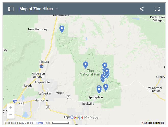
Map of Zion Hikes
Here’s a map of Zion National Park hikes to help you navigate the park. This map includes our favorite Zion National Park hikes that include easy, moderate, and strenuous hiking trails.
List of Easy Zion National Park Hikes
Most of the easy hikes are found in Zion Canyon, but be aware it’s the most crowded part of the park.
The easy Zion National Park trails range from 0.4 miles to 3.5 miles and gain no more than 100 feet in elevation. A few are wheelchair accessible with assistance.
Since these are shorter hikes, they are the best options for those with a limited amount of time who want to see the amazing landscape of Zion.
You’ll find Zion National Park photography opportunities while hiking these easy trails so remember your camera!
1. Pa’rus Trail
- Shuttle Stop: #1 Visitor Center
- Pets: Yes
- Trailhead Location: Access is up the canyon from the Visitor Center and across the bridge adjacent to the South Campground. This trail can also be accessed from the Canyon Junction shuttle stop.
- Distance (roundtrip): 3.5 mi
- Elevation Change: 50 ft
- Estimated Hiking Time: 2 hours
- Accessible: Wheelchairs may need assistance.
- Services: Bathrooms and water filling stations are available at the Visitor Center.
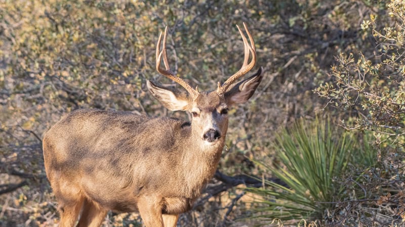
The Pa’rus Trail is one of the best places to watch the red rock glow at sunset. Deer frequent the area as the path follows the Virgin River.
This is the only trail in Zion National Park that allows both pets (on a leash up to 6 feet) and bicycles.
2. Archeology Trail
Shuttle Stop: #1 Visitor Center
Pets: No
Trailhead Location: Behind the Zion Canyon Visitor Center near the entrance to the Visitor Center parking lot.
Distance (roundtrip): 0.4 mi
Elevation Change: 80 ft
Estimated Hiking Time: 30 minutes
Accessible: No.
Services: Bathrooms and water filling stations are available at the Visitor Center.
The Archeology Trail is a short little hike to the top of a hill where you’ll see an old Ancestral Puebloan food storage shelter. It takes about 5 minutes along the sandy trail to reach the top of the hill overlooking the Visitor Center and the Watchman Campground. Look along the north side of the hill to see the foundational remains of the ancient storage shelter. You can see the artifacts from this site at the Zion Human History Museum.
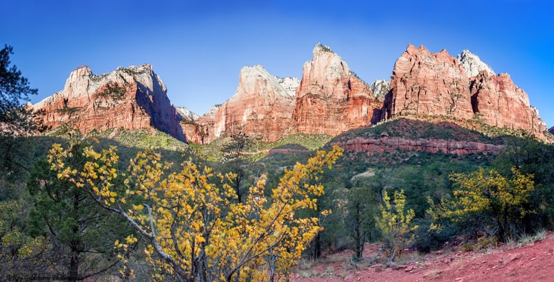
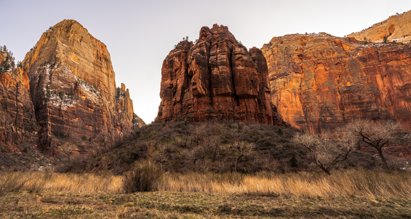
3. Court of the Patriarchs Trails
- Shuttle Stop: #4 Court of the Patriarchs
- Pets: No
- Accessible: No
- Services: No
There are a few ways to explore this area. First, there’s a quick and easy two-minute trail that takes you to a small viewpoint above the trees to see the formations across the canyon that are known as the “Court of the Patriarchs.” There’s an information sign here that points out the three peaks individually named Abraham, Isaac, and Jacob and two others named The Sentinel and Mount Moroni.
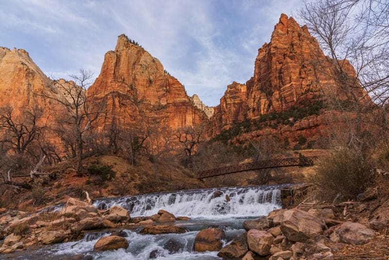
Cross the road to access the Sand Bench Loop horse and foot trail. We don’t recommend you hike this trail, but go as far as the bridge. This is a wonderful Zion National Park photo spot in the morning and evening!
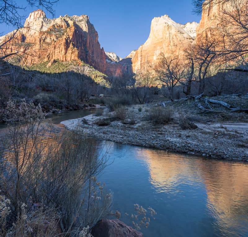
We also like to explore the trails in this area that run along the river to photograph reflections in the water. It’s also a great place to see deer!
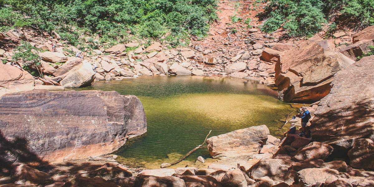
4. Lower Emerald Pool Trail
- Shuttle Stop: #5 Zion Lodge
- Pets: No
- Trailhead Location: Across the road from the Zion Lodge.
- Distance (roundtrip): 1.2 mi
- Elevation Change: 70 ft
- Estimated Hiking Time: 1 hour
- Services: Bathrooms and water filling stations are available at the Zion Lodge.
This Zion National Park trail is officially listed as two: Lower Emerald Pools and Upper Emerald Pools. The hike to the Lower Pools is considered easy while the trek beyond to the Upper Pools is moderate.
Follow the paved trail to the Lower Emerald Pool and waterfalls. Remember that swimming is prohibited in this pool.
5. Grotto Trail
- Shuttle Stop: #5 Zion Lodge or #6 Grotto
- Pets: No
- Trailhead Location: Behind the shuttle stop at the Zion Lodge. This trail can also be accessed from the Grotto if you walk down canyon and behind the historic stone building.
- Distance (roundtrip): 1 mi
- Elevation Change: 35 ft
- Estimated Hiking Time: 30 minutes
- Services: Bathrooms and water filling stations are available at the Zion Lodge. Bathrooms are also available at the Grotto.
The trail runs along the road to connect the Zion Lodge the Grotto. It’s a terrific trail to see wildlife. We also like the trails that run along the river in this area.
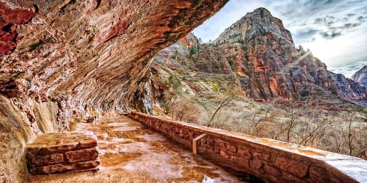
6. Weeping Rock Trail
- Shuttle Stop:#7 Weeping Rock
- Pets: No
- Trailhead Location: Across the bridge adjacent to the parking lot. Follow the signs to the left.
- Distance (roundtrip): .4 mi
- Elevation Change: 98 ft
- Estimated Hiking Time: 30 minutes
- Services: Pit toilets are available at the parking area.
Weeping Rock is a short but steep paved trail with minor drop-offs. It takes you to a rock alcove with dripping springs. There’s a terrific view of Temple of Sinawava.
During the rainy season, water cascades down the rock over the alcove which is a cool thing to see and photograph!
7. Big Bend Trails
After you’ve visited Weeping Rock, cross the road to access all the trails near the river. This is where you’ll see the Great White Throne. We’ve seen deer and wild turkeys while exploring these trails.
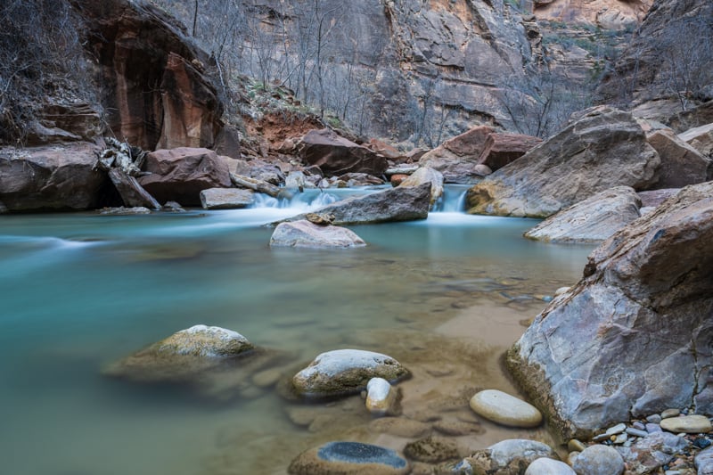
8. Riverside Walk
- Shuttle Stop: #9 Temple of Sinawava
- Pets: No
- Trailhead Location: Adjacent to bathrooms and water refill station.
- Distance (roundtrip): 2.2 mi
- Elevation Change: 57 ft
- Estimated Hiking Time: 1.5 hours
- Accessible: Wheelchairs may need assistance.
The Riverside Walk is a paved Zion National Park trail that follows the Virgin River along the bottom of a narrow canyon. It’s a wonderful place to photograph the river and small waterfalls along the trail.
At the end of this trail, the bottom up Narrows trail begins. The Riverside Walk trail is one of the best easy hikes in Zion National Park so it will be crowded. We recommend you do this in the morning or later in the day.
9. Highway 9 Hikes
There are un-marked hiking trails that let you explore the area along Highway 9. Simply stop at a pullout and see what trails you find. Most of the trails are easy, but you’ll find areas where you can access the river bed and explore mini slot canyon type terrain. And there are places you can scramble over the slickrock to hoodoos. The sky is the limit in this area!
10. Kolob Terrace Hikes
The Kolob Terrace area is home to some pretty famous moderate and strenuous hiking trails. But we find that if you just stop at pullouts and walk along the trails for a bit, you can see some stunning scenery! We definitely recommend the Kolob Terrace area for easy hiking trails!
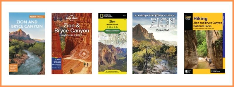
BUY ZION GUIDES & MAPS AT AMAZON
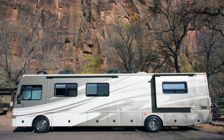
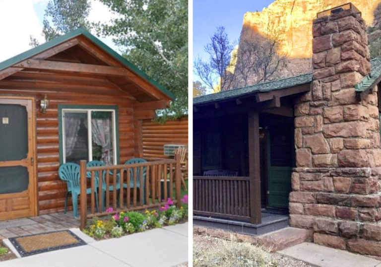
Where to Stay Near Zion National Park
You definitely want to stay in Springdale which borders the entrance to Zion.
- Places to Stay at Zion National Park
- Camping in Zion National Park
- RV Parks near Zion National Park
- Glamping Near Zion National Park
- Cabins Near zion National Park
- Holiday Inn Express – our favorite place to stay with an outdoor pool and amenities you’d find in a high end hotel
- Zion Lodge – we haven’t had a chance to stay here yet, but you can’t go wrong staying right IN the park!
- Under Canvas Zion – if you want to experience a less crowded part of Zion, this is the place! It’s in the Kolob section of the park.
- Vacation Rentals in Springdale – you’ll want to stay in Springdale so you’re close to the park entrance and can walk to shopping and restaurants.