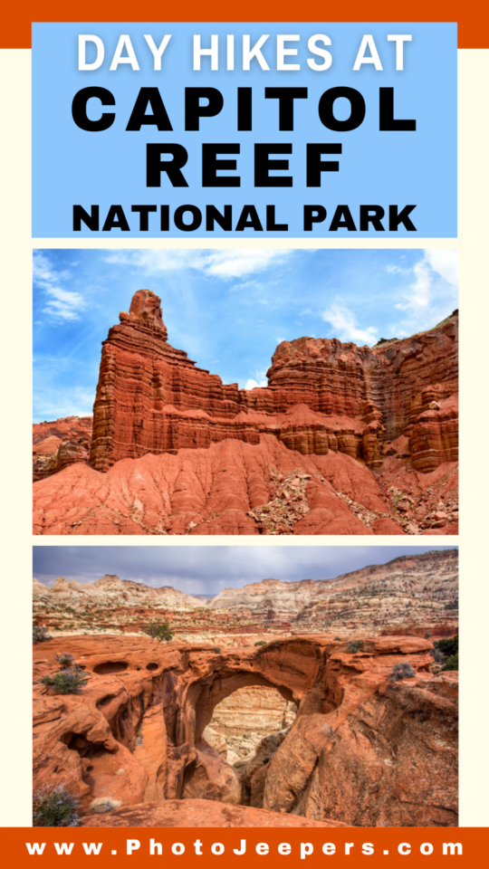
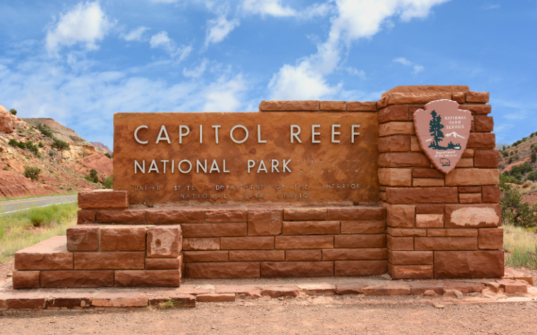
Best Day Hikes in Capitol Reef National Park
Located in southcentral Utah, this Utah National Park offers stunning views and diverse landscape. Exploring the best day hikes at Capitol Reef is terrific way to experience this Utah National Park!
Use this Capitol Reef National Park guide to choose which hikes to add to your itinerary! Come explore the beauty of Capitol Reef this spring and make memories that will last a lifetime!
This list of Capitol Reef day hikes details the distance, time, elevation gain, and important information about what it’s like to hike each trail.
Plus there’s a packing list, travel tips, and ideas of where to stay to plan your Capitol Reef vacation.

This site contains affiliate links which means WE may receive commissions for purchases made through these links. We only provide links to products we actually use and/or wholeheartedly recommend! As an Amazon Associate, we earn from qualifying purchases. Read the full Disclosure Policy.
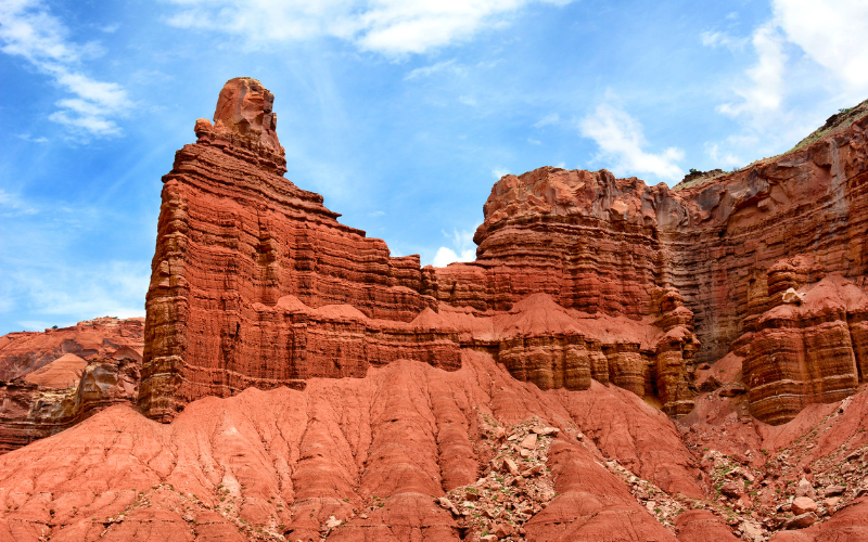
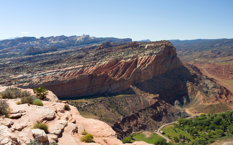
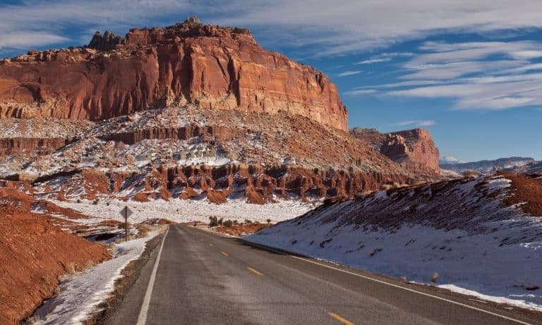
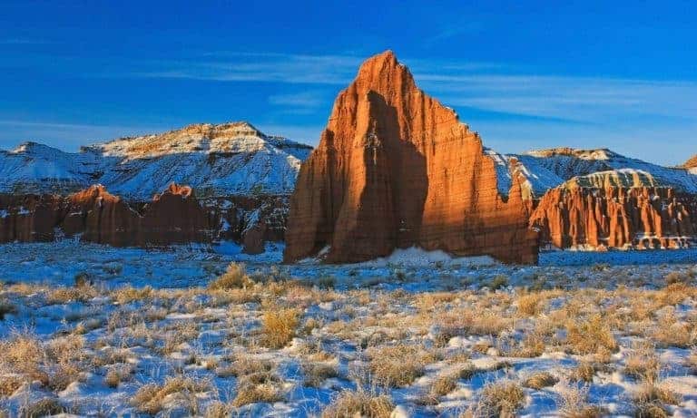
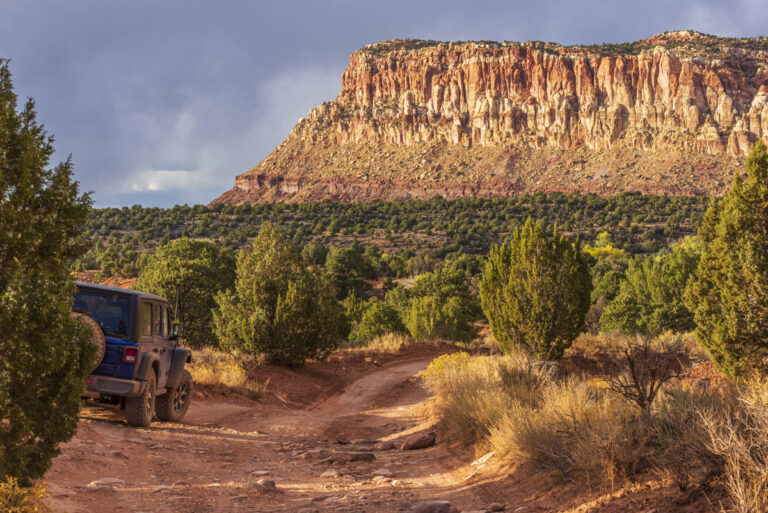
A Photo Tour of Capitol Reef National Park
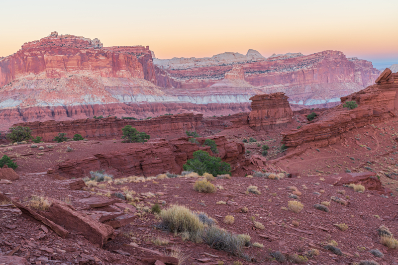
Take a visual tour through Capitol Reef National Park to see the stunning landscape and wildlife you’ll find in the park!
Capitol Reef National Park Hiking Tips
We always recommend you talk to a park ranger to get the most updated information about trail conditions and weather.
Your safety while hiking in Capitol Reef requires good judgment, adequate preparation, and constant awareness. It is your responsibility to know your abilities and limits. Be sure to always carry a Capitol Reef Map when hiking.
Important things to note when hiking at Capitol Reef:
- Stay on the trail.
- Stay back from cliff edges.
- Observe posted warnings.
- Please watch children.
- Avoid narrow canyons when storms are threatening.
Wear hiking boots, not sneakers: Wear hiking boots with good “lug” traction and ankle support. Along with altitude-related illnesses, ankle injuries are one of the park’s top injuries.
Water and sun protection: Carry plenty of water; 1 quart per 2-3 hours of hiking for each person. You’ll want sun protection year-round: lip balm with UV protection, sunscreen, and a sunhat. Also salty and healthy snacks are good in this climate!
Day Hiking Resources
When exploring Capitol Reef hikes, it is especially important that you pack:
- Day Hike Checklist
- What to Bring on a Hike
- Photography Gear for Hiking
- Hiking Gear for Kids & Tips for Hiking with Kids
Best Day Hikes in Capitol Reef National Park
Here’s a list of trails that you can hike in a day’s time. Note the trail difficulty ratings:
- Easy: uneven ground, but fairly level.
- Moderate: a mix of steep grades and level sections.
- Strenuous: steep grades, uneven terrain and long, steady climbs
Remember that many trailheads start at an elevation around 5,000 feet. This can make “easy” trails challenging if you’re not used to the higher elevation.
Easy Day Hikes at Capitol Reef
The trails rated as Easy may have uneven ground in places, but are fairly level for most of the hike.
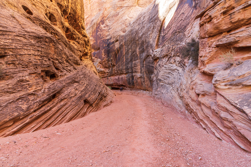
Capitol Gorge, Pioneer Register and The Tanks
- Distance: 2 miles roundtrip
- Time: 1 hour
- Elevation Change: 80 ft
- Trailhead Location: small parking lot at the end of the Capitol Gorge spur trail at the end of the Scenic Drive
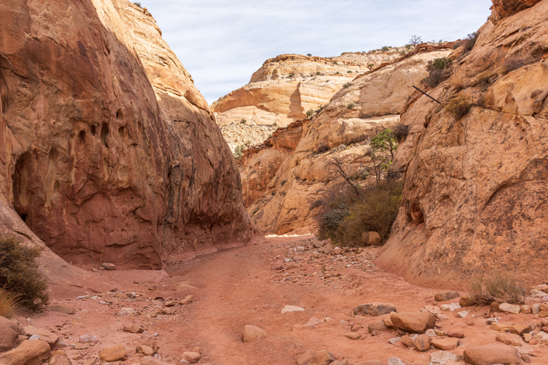
Walking along the Capitol Gorge trail is one of the best easy hikes in the park! There is a trail that runs parallel to the wash, eventually going into the wash.
As you hike, watch for The Pioneer register on the right that is kind of high up on the wall. On the left keep an eye out for the sign pointing out some petroglyphs. Further down on the left there will be more names from the pioneers that first went through the area. You can see evidence of old phone lines going through the gorge as well.

Toward the end of the walled canyon there will be a sign and cairns on the left leading to the Tank Trail. This hike requires a short section of scrambling over rocks as the trails heads up to the top.
The tanks are cool to see, especially when they are filled with water. Enjoy the views of the canyon and keep an eye out for big horned sheep on the rocks in this area.
Here’s a detailed guide about the Capitol Gorge Trail with even more photos!
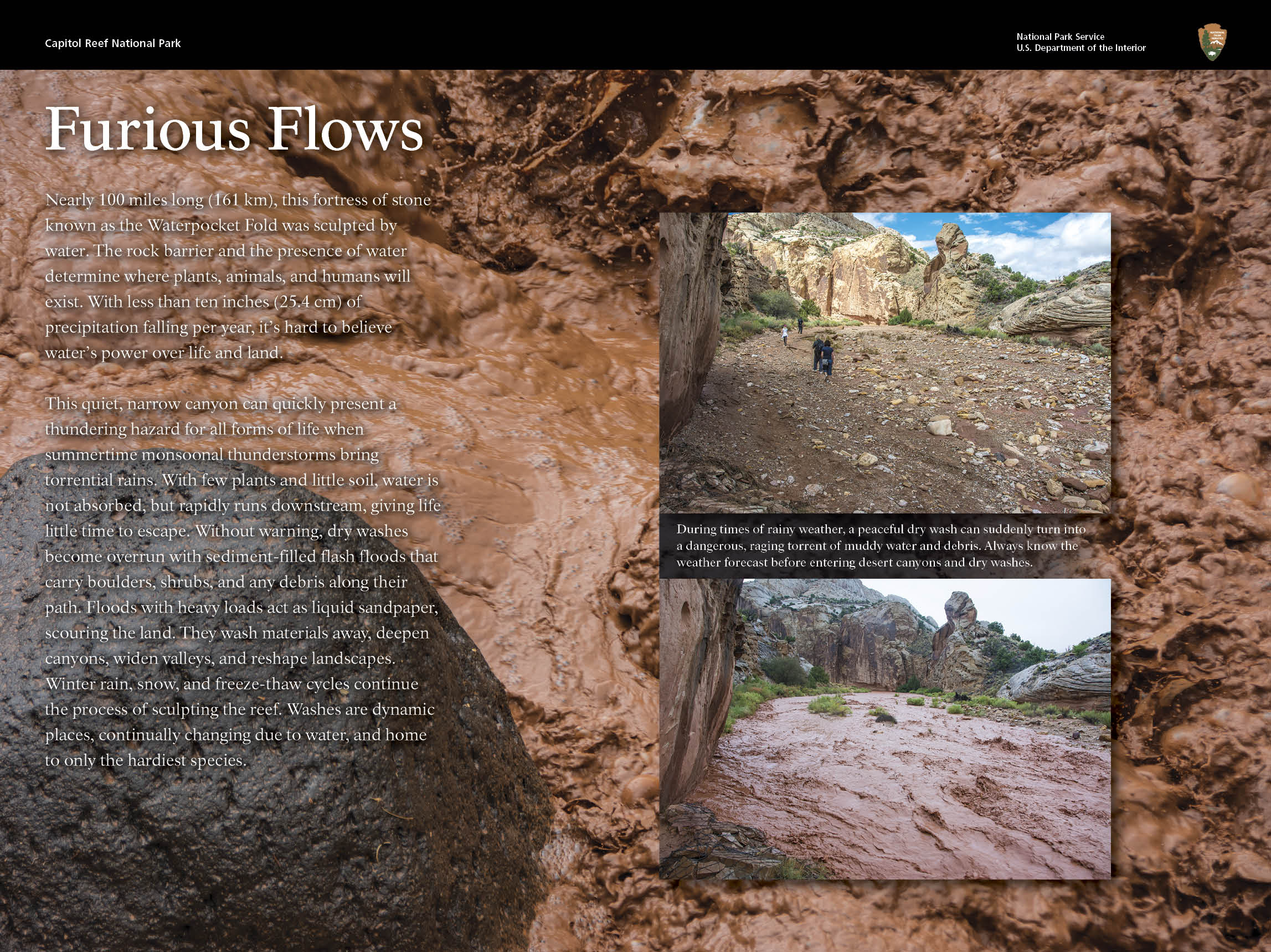
NOTE: Capitol Gorge is a spur dirt road that leads into a narrow, steep-walled canyon that is extremely vulnerable to bad weather conditions. Be aware of monsoon rains and dangerous flash floods, especially in the summer!
Goosenecks Overlook Hike
- Distance: 0.2 miles roundtrip
- Time: 10 minutes
- Elevation Change: less than 50 ft
- Trailhead Location: from Highway 24, turn onto the gravel road for Panorama Point and Sunset Point. Continue down the gravel road to the end and park in the parking lot. This road is suitable for standard cars.
The trail is a short switchback hike with a few rocky steps before hitting the top that overlooks Sulphur Creek Canyon.
Be sure to continue along where the trail dips and leads you to the edge of the canyon, where a metal fence marks the end of the trail.
Sunset Point Hike
- Distance: 0.8 miles roundtrip
- Time: 30 minutes
- Elevation Change: less than 50 ft
- Trailhead Location: same parking lot as Goosenecks hike above
The Sunset Point Trail is the shortest day hike at Capitol Reef. The trail leads to a stunning view of the landscape made up of colorful cliffs and domes.
As the name would suggest, it’s a great spot Capitol Reef National Park photography spot at sunset. We also recommend it as a good sunrise photo spot as well!
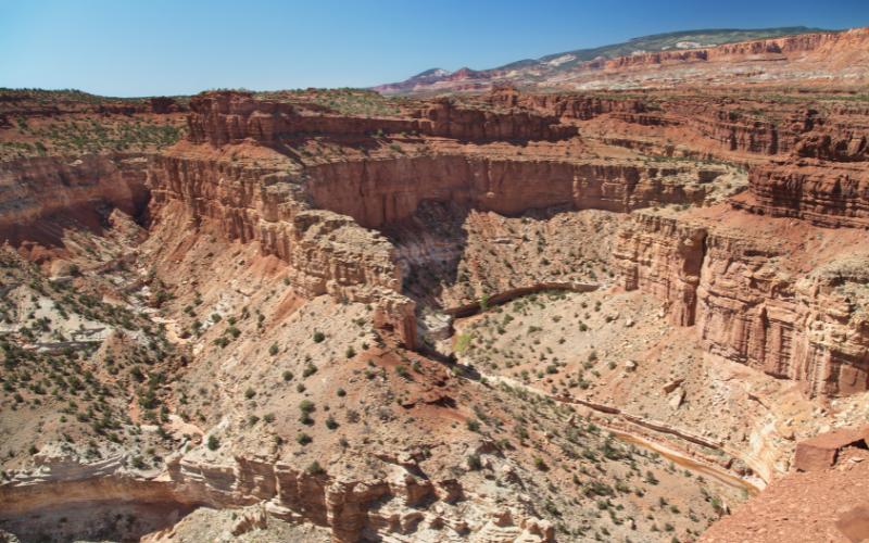
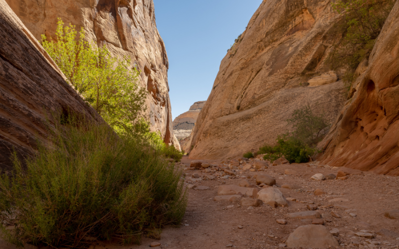
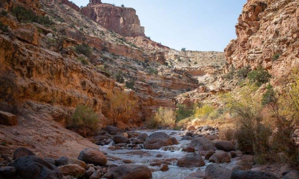
Grand Wash Hike to the Narrows
- Distance: 2-ish miles roundtrip
- Time: 1 hour
- Elevation Change: 200 ft
- Trailhead Location: there are two trailheads: one on Highway 24 and one at the end of Grand Wash Road along the Scenic Drive.
The Grand Wash is a cool slot canyon that doesn’t require walking in water, unlike Sulphur Creek or the Narrows hike at Zion National Park.
We don’t recommend hiking the entire length of this trail. Instead, start the hike at either trailhead and walk until you reach the narrowest section, called The Narrows. This is about one mile in whether you start at the trailhead on Highway 24 or at Grand Wash.
The Narrows is the central section of the Grand Wash, and it is roughly 1 mile from both of these trailheads. So, you can hike to the Narrows from either starting point and it is the same distance.
NOTE: Grand Wash is a spur dirt road that leads into a narrow, steep-walled canyon that is extremely vulnerable to bad weather conditions. Be aware of monsoon rains and dangerous flash floods, especially in the summer!
Moderate Day Hikes at Capitol Reef
You’ll find a mix of steep grades and level sections along the trail for these hikes rated as Moderate.
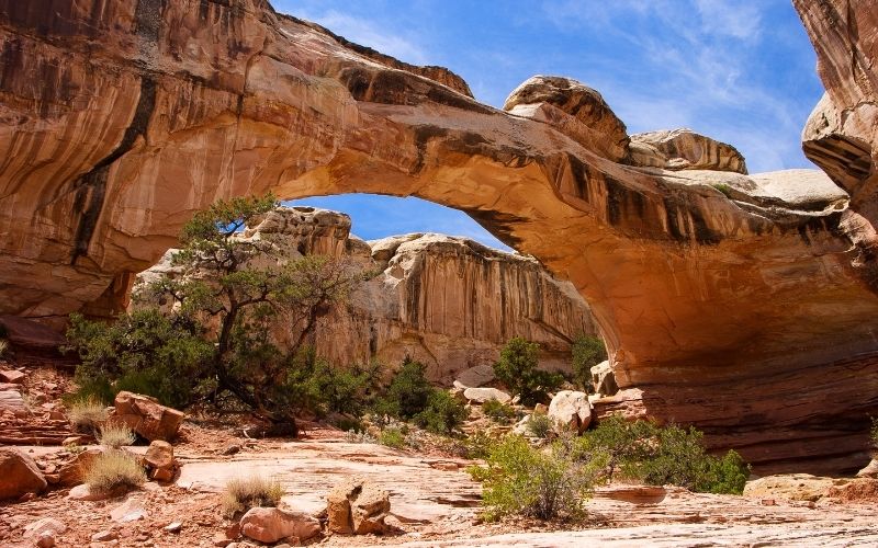
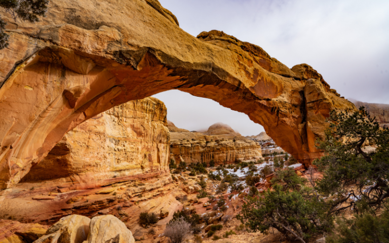
Hickman Bridge Hike
- Distance: 1.8 miles roundtrip
- Time: 2 to 3 hours
- Elevation Change: 400 ft
- Trailhead Location: parking lot along Highway 24 marks the trailhead to the Hickman Bridge Trail
The Hickman Bridge trail is one of the more popular Capitol Reef Hikes. The hike begins with some smaller switchbacks before leveling out a bit. The trail continues along a wash then climbs a little higher with walls starting to tower over you.
At the fork in the trail both will take you to the bridge since it’s a loop, but we prefer taking the trail to the right. Soon you will see the view of the bridge that’s 133 feet tall!
Continue on under the bridge and you’ll be greeted with one of the best views in Capitol Reef that overlooks the canyon below.
Cohab Canyon Hike
- Distance: 3.4 miles roundtrip
- Time: 2 to 3 hours
- Elevation Change: 440 ft
- Trailhead Location: across from the Fruita Barn
If you want to see amazing views of the Fruita area, then the Cohab Canyon Trail is the one you want to do!
Park in the small lot across from the Fruita Barn, then walk a short distance toward the campground to find the start of the trail. The hike is an immediate climb UP!
The trail leads through Cohab Canyon then has one final climb to the top of the mesa where you’ll find a north overlook and a south overlook.
Check out this Cohab Canyon Trail hiking guide that details the hike with awesome photos!
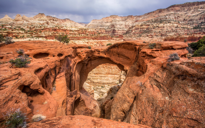
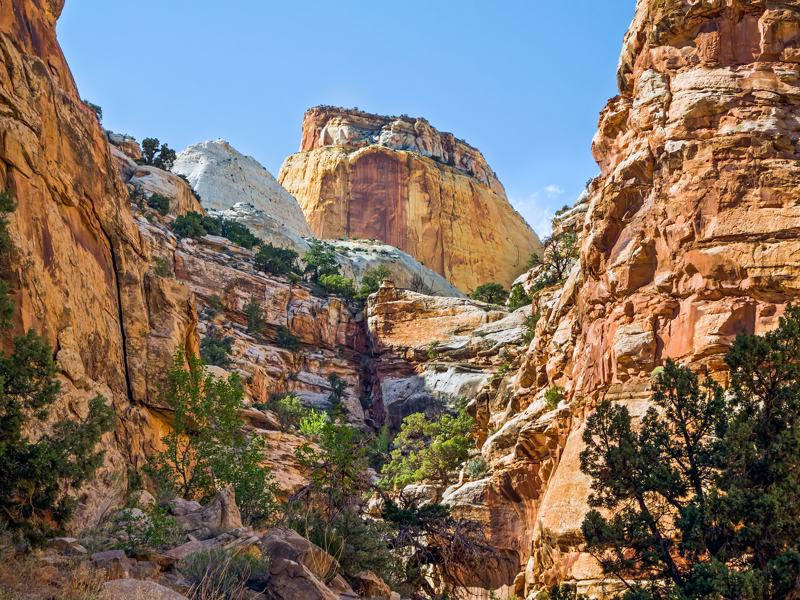
Cassidy Arch Hike
- Distance: 3.4 miles roundtrip
- Time: 2 to 3 hours
- Elevation Change: 845 ft
- Trailhead Location: end of the Grand Wash Road
As you drive down Grand Wash Road, at about 0.75 miles you’ll see the viewpoint for Cassidy Arch. It’s a fun stop to see the arch from below before you do the hike.
This short hike features breathtaking views over the Grand Wash. But the most fun part is the chance to stand on Cassidy Arch and get your picture taken!
This Cassidy Arch hiking guide has all the information you need to know with stunning photos of the hike!
Chimney Rock Loop Hike
- Distance: 3.5 mile loop
- Time: 2 to 4 hours
- Elevation Change: 580 ft
- Trailhead Location: Chimney Rock parking lot along UT 24 near the west entrance to Capitol Reef
The start of the hike is pretty flat, but then transitions to a series of switchbacks until you reach the top of the mesa. Take a breather and enjoy the views!
There’s a second incline taking you to the top where you can view Chimney Rock.
At this point, the trail is all downhill from here as you work your way down the opposite side of the mesa.
Check out this article detailing the Chimney Rock Trail with kids that includes great photos of the trail and scenery.
Strenuous Day Hikes at Capitol Reef
The hikes rated as Strenuous include steep grades, uneven terrain with long, steady climbs.
Sulphur Creek Hike
- Distance: 5.8 miles one-way
- Time: 3 to 5 hours
- Elevation Change: 400 ft
- Trailhead Location: the upper end of the Sulphur Creek route can be accessed from the designated parking lot, 3.3 miles west of the visitor center, which is 0.3 miles west of the Chimney Rock trailhead, on Highway 24. The route ends (or begins) behind the visitor center.
Capitol Reef’s Sulphur Creek trail is similar to the Zion Narrows since you’re following a stream that cuts through a deep canyon. But it’s also very different.
Sulphur Creek is not an official, maintained trail by the National Park Service. Route conditions, including obstacles in canyons, change frequently due to weather, flash floods, rockfall, and other hazards. Route-finding, navigation, and map-reading skills are critical. Do not rely solely on unofficial route markers (rock cairns, etc.); they are not maintained by the NPS.
We recommend you talk to a ranger to get the most current information about this hike before setting out.
The 5.8-mile one-way hike through Sulphur Creek Canyon involves leaving a shuttle vehicle at each end. If you don’t have two vehicles, a 3.3-mile hike along Highway 24 is required to return to your starting point. Vehicle shuttles are not provided or facilitated by the park.
This article details the information you need to hike the Sulphur Creek Trail with photos!
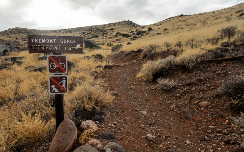
Fremont Gorge Overlook Hike
- Distance: 4.6 miles roundtrip
- Time: 2 to 3 hours
- Elevation Change: 1,090 ft
- Trailhead Location: Blacksmith Shop 0.8 miles from the Visitor Center driving toward the campground
The trail climbs 1,090 feet in 2.3 miles, but that climb is broken up by a flat section across the length of Johnson Mesa.
There’s a stunning view of the gorge and a terrific place to see Capitol Reef’s multicolor cliffs.
Here’s a great detailed article about hiking Fremont Gorge Overlook with photos of the trail as you hike!
Golden Throne Hike
- Distance: 4 miles roundtrip
- Time: 2 to 3 hours
- Elevation Change: 730 ft
- Trailhead Location: parking lot at the end of the Capitol Gorge spur dirt road
The hike begins with a moderate-steep grade for about the first 10 to 15 minutes. The trail then levels a bit and travels in and out of side canyons, but always climbing.
At the end you’re rewarded with views of the Golden Throne, Boulder Mountain, and the Henry Mountains.
If you time it right, the late afternoon and early sunset light casts a golden glow on the Golden Throne and Capitol Gorge!
Check out this detailed article with photos about hiking the Golden Throne Trail.
Rim Overlook Hike
- Distance: 4.6 miles roundtrip
- Time: 2 to 3 hours
- Elevation Change: 430 ft
Navajo Knobs Hike
- Distance: 9.5 miles roundtrip
- Time: 4 to 7 hours
- Elevation Change: 2,725 ft
Trailhead Location for both hikes: parking lot for Hickman Bridge, located on Highway 24.
This parking lot holds about 25 cars and a few RV’s. You’ll also find toilets here.
The hike to Hickman Bridge is an extremely popular hike, so this parking lot tends to fill up early and then stay filled for the remainder of the day. Ideally, get here early to get a space.
From the parking lot, look for the sign marking the Hickman Bridge Trailhead. This is where the hike to the Rim Overlook and Navajo Knobs begins.
This article by Earth Trekkers is one to read if you want to hike the Rim Overlook and Navajo Knobs trails. They included step-by-step details and amazing photographs along the way!
Plan a Capitol Reef Vacation
- Capitol Reef National Park Guide
- Capitol Reef National Park Packing List
- Best Time to Visit Capitol Reef National Park
- Things to Do in Capitol Reef National Park

