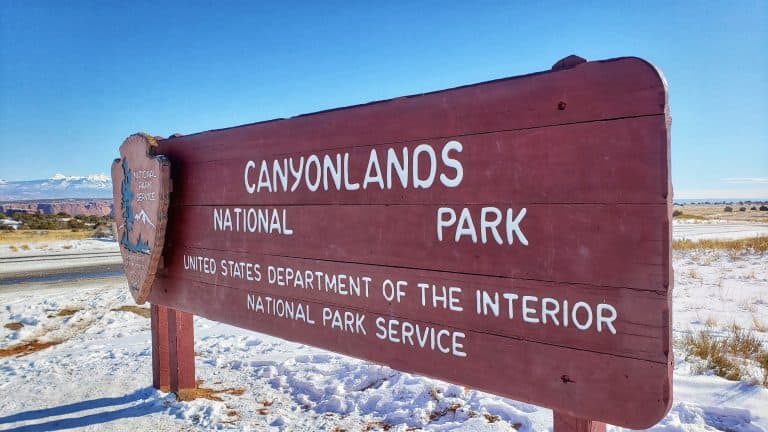
Canyonlands Island in the Sky Hikes
Canyonlands Island in the Sky is a stunning national park located in Utah that is known for its breathtaking views and thrilling hikes. Here’s a list of the best Island in the Sky hikes that include easy, moderate and strenuous trails.
This Canyonlands National Park guide includes: information about each hike, what to pack for a day hike, services available at Island in the Sky, and more!

Whether you’re a beginner or an experienced hiker, there are plenty of Canyonlands Island in the Sky trails to explore. From short hikes to long day trips, there’s something for everyone.
You’ll want to be sure to pack the right clothing and gear so you can enjoy all the outdoor Canyonlands National Park activities any time of year! Click the image below to get your free Canyonlands Packing List!

This site contains affiliate links which means WE may receive commissions for purchases made through these links. We only provide links to products we actually use and/or wholeheartedly recommend! As an Amazon Associate, we earn from qualifying purchases. Read the full Disclosure Policy.
What to Pack for Hiking at Canyonlands
To get the most out of visiting this park, you must be prepared with the right clothing and gear.
Hiking Shoes – Injuries from improper footwear is a common problem that casual visitors and hikers encounter. To make your trip as safe and enjoyable as possible, avoid smooth-soled shoes and only wear sturdy shoes with ample tread.
Hydration and Food – Due to the high desert and altitude in Southeastern Utah, you should drink at least one gallon of water per day, and always carry water with you during all hiking activities. Eat plenty of salty, healthy snacks and food. We use hydration backpacks or carry refillable water bottles in our packs.
Lip Balm and Lotion – Utah’s high elevation and dry air can be hard on your skin. You’ll want to carry lip balm with sunscreen and hydrating lotion to apply as needed when you’re out exploring the trails.
Clothing – Summers in the park mean soaring temperatures, unrelenting sunlight, and low humidity. To keep cool, wear light colored, loose fitting UV protection clothing that does not absorb sunlight. Also avoid sun burn by wearing a wide brimmed hat and by generously applying sunscreen to any parts of your body that are exposed to the sun.
During the winter, wearing the right winter clothing and layers is important to stay dry and warm. Take note that snow and ice can accumulate and make popular trails quite slippery. That’s why trekking poles and traction devices for your shoes are essential. It’s also just as easy to become dehydrated in the cold as it is in the heat. It’s important to carry plenty of water during the winter, and not just during the summer.
National Parks Pass – Before you visit Arches National Park be sure to pack your The America the Beautiful Annual Pass.
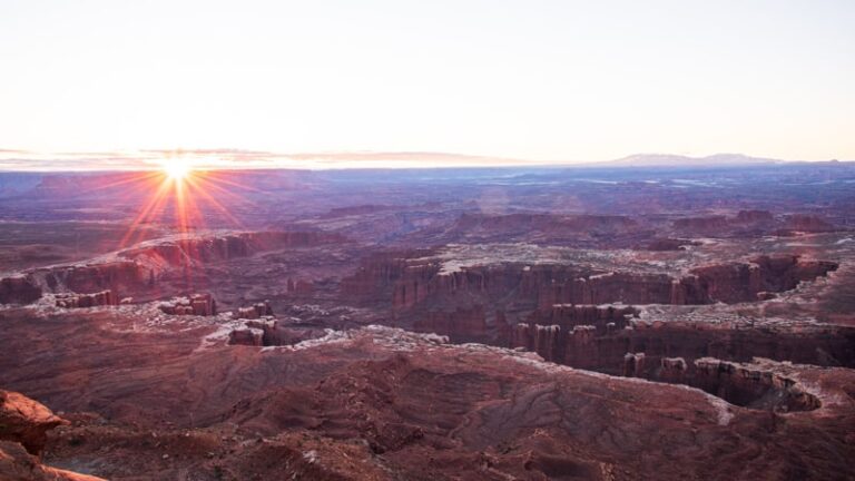
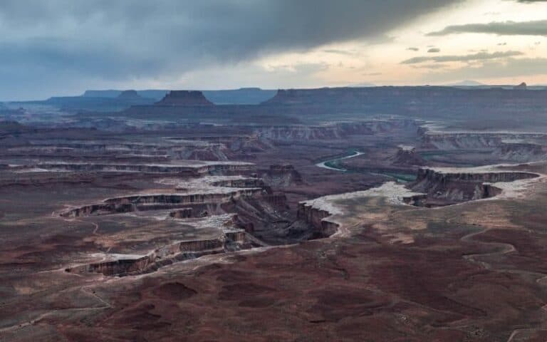
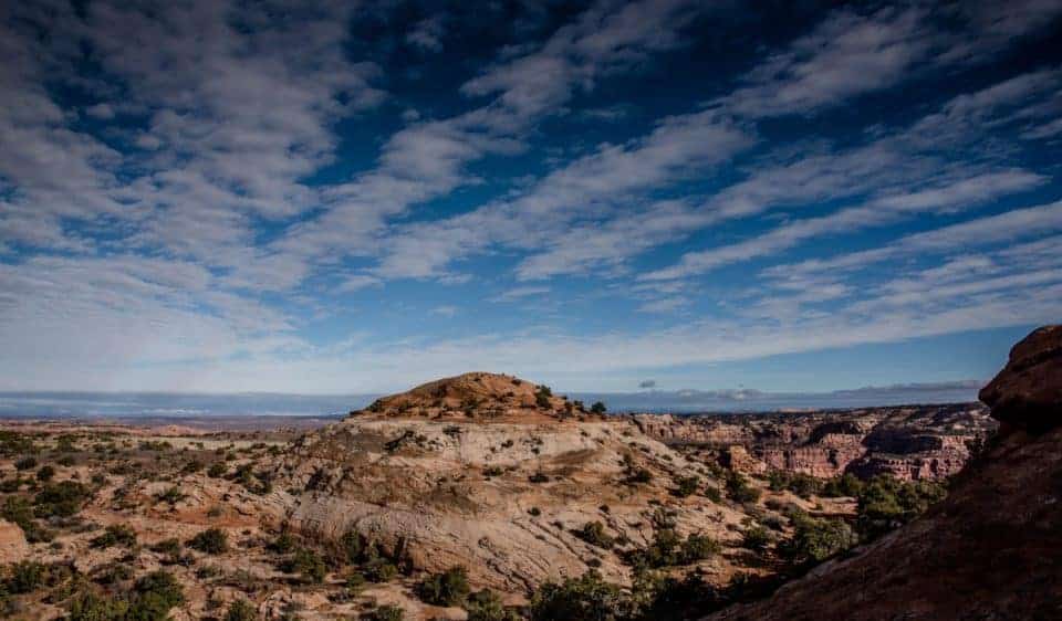
A Photo Tour of Canyonlands National Park
Take a visual tour through Canyonlands National Park (and Dead Horse Point) to see the stunning landscape in the parks!
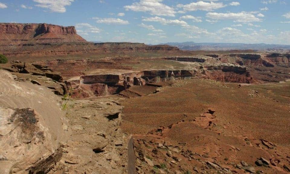
Island in the Sky Hiking Trails
The Canyonlands hikes found at Island in the sky offer breathtaking views of the Colorado River and its canyons. There are many hikes available for all levels of hikers to explore this amazing landscape.
Easy Island in the Sky Hikes
Here’s a list of short trails to explore the Island in the Sky mesa top with minimal elevation change to enjoy canyon views from above.

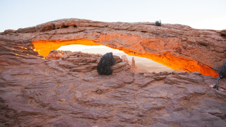
Mesa Arch Hiking Trail
- Distance: 0.5 miles roundtrip
- Hike length: 30 minutes
- Hike difficulty: Easy
Trailhead location: Drive 6.3 miles south of the Island in the Sky Visitor Center and turn left into the Mesa Arch Parking Area.
One of the most photographed hike spots at Island in the Sky is Mesa Arch. It’s considered the best spots for Canyonlands National Park photography at sunrise.
But it’s also one of the most popular areas in the park throughout the day. The small parking lot fills fast so we recommend getting there early to do this hike!
The hike is relatively short. It takes less than an hour to get there, which explains why most visitors love this hike.
Highlights:
- Mesa Arch offers a one-in-a-million view of the sunrise.
- It is perfect for families with children, but watch them near the steep cliff drop off area.
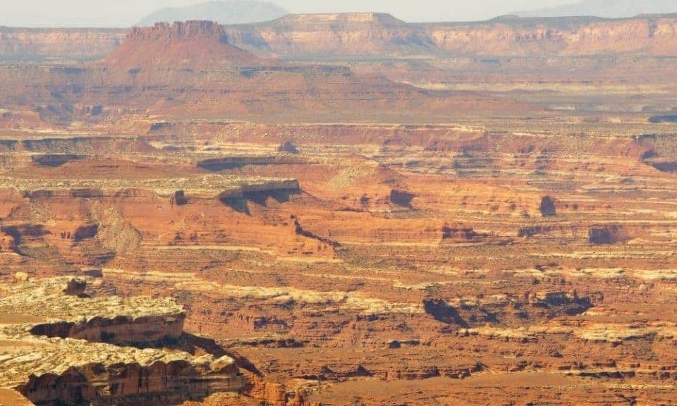
White Rim Overlook Trail
- Distance: 1.8 miles roundtrip
- Hike length: 1.5 hours
- Hike difficulty: Easy
Trailhead location: From the Island in the Sky Visitor Center, drive south for 11 miles toward Grand View Point and turn left into the picnic area. As you drive through the picnic area, the trailhead is on the right.
White Rim Overlook is a short, easy trail with a stunning scenic view at the end.
The overlook gets its name from the layer of white sandstone that forms at the edges of the canyon rim. The contrast of the white rock against the surrounding shades of red-orange cliffs is exquisite.
Highlights:
- Small parking area so hike early morning or late afternoon.
- Stunning 300 degree views!

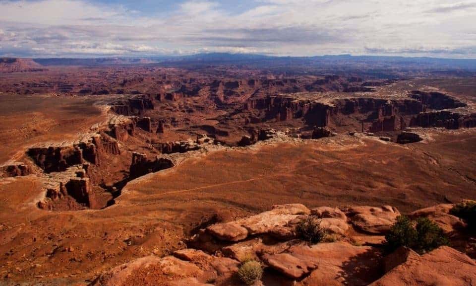
Grand View Point Trail
- Distance: 2 miles roundtrip
- Hike length: 1.5 hours
- Hike difficulty: Easy
Trailhead location: Drive south from the Island in the Sky Visitor Center for 12 miles towards the end of the main road.
As the name implies, Grand View Point is one of the spots with the most attractive views on Island in the Sky. The canyon view carved out by the Colorado River is fantastic, especially at sunrise.
This hike is considered a heavily trafficked out and back trail. We recommend doing it in the morning to avoid the crowds and find a parking spot.
The hike starts out easy and flat then you’ll navigate a section of rugged rock stairs. The rest of the trial follows along the edge of a steep drop-off so watch children here since there are no railings.
The overlook near the parking lot is a paved trail and accessible.
Highlights:
- It is considered to be one of the best views at Island in the Sky.
- One of the best spots for sunrise photography in the park.
Murphy Point Trail
- Distance: 3.6 miles roundtrip
- Hike length: 2 hours
- Hike difficulty: Easy
Trailhead location: From the Island in the Sky Visitor Center, drive south for 8.6 miles and turn right into the parking area for Murphy Point.
The 3.6-mile roundtrip hike to Murphy Point is easy and definitely worth the surreal views at the end! Take time to enjoy and photograph the jaw-dropping panoramic view of Candlestick Tower, the Green River, and the White Rim Road.
Murphy Point is not visited by many tourists so you can enjoy the peace and serenity of this amazing landscape.
Highlights:
- Terrific sunset photography location because of its wide western views.
- Take time to explore the area for even more amazing views!
Moderate Hikes at Island in the Sky
The moderate trails at Island in the Sky include elevation changes usually climbing a sandstone feature or descending partway into a canyon.
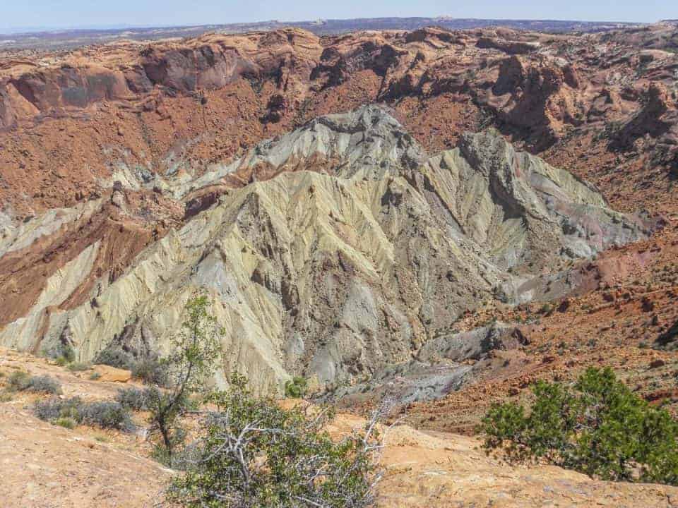
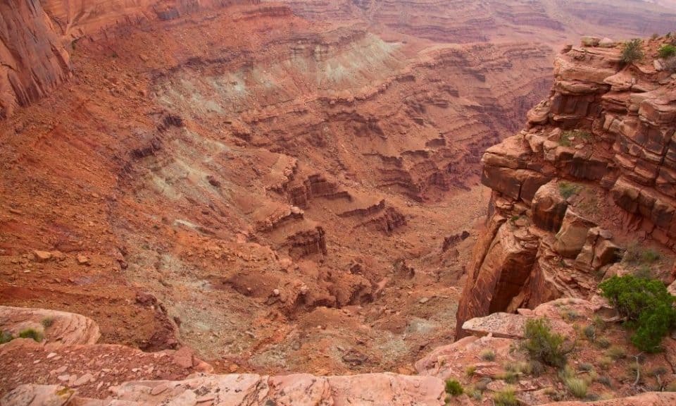
Upheaval Dome Trail
- Distance: 1 mile roundtrip
- Hike length: 30 minutes
- Hike difficulty: Moderate
Trailhead location: Drive 6.5 miles south of the Island in the Sky Visitor Center and turn right onto Upheaval Dome Road. Proceed to another 4.8 miles to the Upheaval Dome Picnic Area. The trailhead is found at the west end of the picnic area.
Upheaval Dome is an amazing feature found at Island in the Sky. There have been many theories about why it looks that way, and you’ll find informational signs about the theories during the hike.
There’s a short path along the Crater View Trail that climbs to the viewpoint to see the unique crater formation.
There is another trail that branches off and continues half mile westwards to a second overlook.
Highlights:
- One of the most unique features in Canyonlands because it’s so unexpected and different from the surrounding landscape.
- There’s an 8 mile Syncline Loop that circles around the crater.
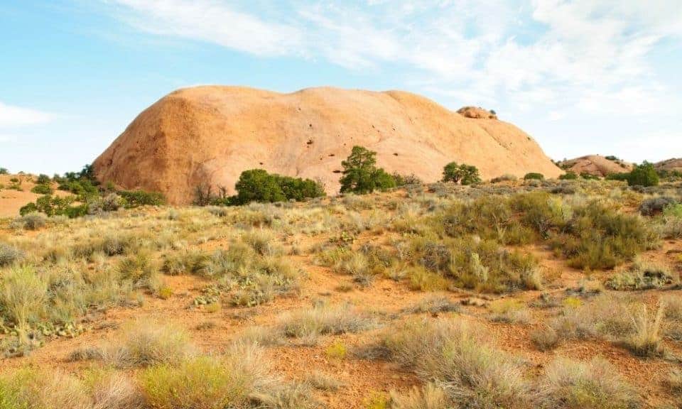
Whale Rock Trail
- Distance: 1 mile roundtrip
- Hike length: 1 hour
- Hike difficulty: Moderate
Trailhead location: From the Visitor Center, drive south for 6.5 miles. Turn right onto Upheaval Dome Road. Drive 4 miles the trailhead parking area for Whale Rock on the right side of the road.
Whale Rock is a natural feature found in the Island in the Sky near Upheaval Dome.
If you’re hiking with kids, the trail is easy as it covers flat sandy ground. They’ll love the idea of crawling around on a giant whale!
There is no shade so be prepared with sun protection. Also note that shoes with a good grip will help when climbing up the slickrock, especially the more steep sections. There are handrails along the trail to help through this section as well.
Highlights:
- Atop the whale you’ll enjoy amazing views!
- Watch children because the drop offs are steep!
Aztec Butte Trail
- Distance: 2 miles roundtrip
- Hike length: 1.5 hours
- Hike difficulty: Moderate
Trailhead location: Drive 6.5 miles south of the Visitor Center then turn west onto Upheaval Dome Road. Proceed to another 0.8 mile and turn north into the Aztec Butte Parking Area.
The main Aztec Butte trail follows a sandy wash as it crosses level grasslands toward the butte. The 360 view from the top is fantastic!
NOTE: the last part of the trail is steep and becomes more difficult as you walk along ledges toward the top of the butte. Right before the top you will need to scramble up a very steep slickrock section with a tall ledge (some may need a boost up here). Be sure you are comfortable doing down this section before you go up! Due to the exposure here, it’s definitely not a trail for people with a fear of heights.
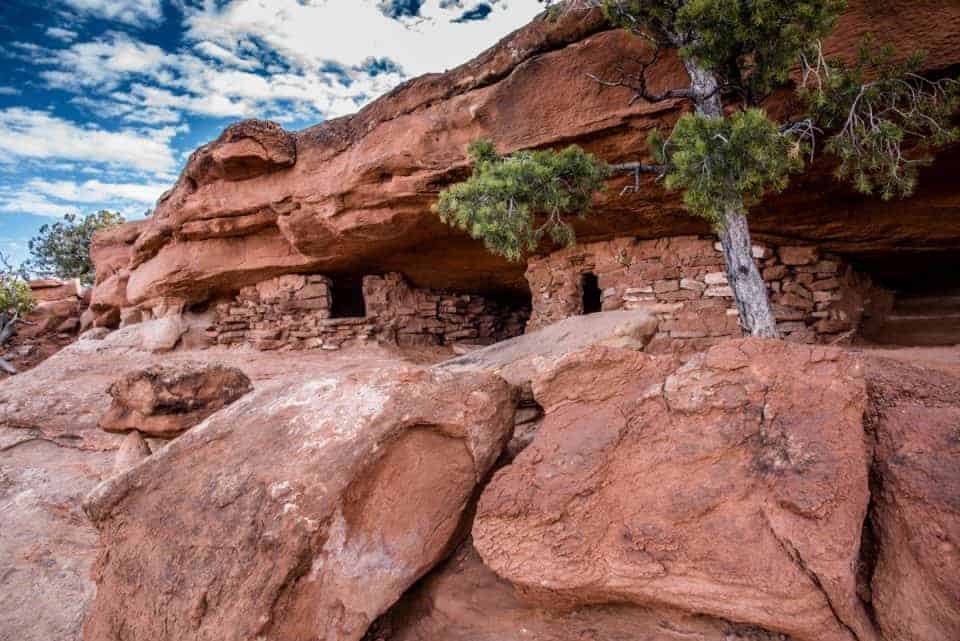
There is an Aztec Butte spur trail that leads to two ancestral Puebloan structures. This is considered an easy trail if you want to skip the harder one we detailed above!
Highlights:
- Do not to enter, touch, or climb archaeological sites!
- Both trails require scrambling up to slickrock and ledges.
Neck Spring Trail
- Distance: 5.8 miles roundtrip
- Hike length: 3-4 hours
- Hike difficulty: Moderate
Trailhead location: The Neck Spring trailhead is at the Shafer Canyon Overlook parking lot, located 0.8 mile south of the visitor center.
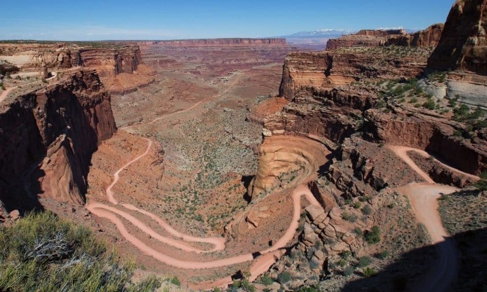
Neck Spring is a loop trail that circles the rim of Taylor Canyon. You’ll pass ranching relics and two springs where cowboys would water their cattle.
NOTE: You’ll encounter a steep climb around mile 3.3. Young children and anyone with a fear of heights might have a hard time. Also there are some points along the mesa top where the trail comes close to the edge which might be hard for anyone fearful of heights.
Highlights:
- Spectacular views of the canyons with the La Sal Mountains in the distance.
- Watch for jeeps or mountain bikes making their way down the steep switchbacks of the Shafer Canyon Road below.
Strenuous Hikes at Island in the Sky
The strenuous trails at Island in the Sky begin on the mesa top and descend via switchbacks to the White Rim bench, or beyond to one of the rivers. They have an elevation change of 1,000-2,000 feet and require negotiating steep slopes of loose rock as well as sections of deep sand.
Gooseberry Canyon Trail
- Distance: 5.4 miles roundtrip
- Hike length: 4-6 hours
- Hike difficulty: Strenuous
Trailhead location: From Island in the Sky Visitor Center, drive 11 miles south to the picnic area on the left side of the road. The trailhead is shared by Gooseberry Trail and White Rim Overlook Trail.
Famous for being the steepest in Canyonlands National Park, Gooseberry Canyon’s trail descends over a thousand feet in just a mile. It starts by going down with more than a thousand steps and requires hikers to back up at the hike’s end.
Gooseberry Canyon is a strenuous hike with rough switchbacks that cross sheer cliffs and scree slopes. This is not a good trail for anyone with a fear of heights! Also, know your physical capabilities for hiking down and back up a steep trail in the desert!
Highlights:
- Enjoy the views as you hike, and take time to catch your breath!
- The trail ends at the White Rim looking into Gooseberry Canyon.

Syncline Loop Trail
- Distance: 8.3 miles roundtrip
- Hike length: 5-7 hours
- Hike difficulty: Strenuous
Trailhead location: Drive 6.5 miles south of the Island in the Sky Visitor Center and turn right onto Upheaval Dome Road. Proceed to another 4.8 miles to the Upheaval Dome Picnic Area. The trailhead is at the west end.
Syncline Loop trail follows the canyons around Upheaval Dome. It is recommended mostly for expert hikers due to its primitive nature. You’ll be navigating steep switchbacks, climbing and scrambling through boulder fields, with a 1,300-foot elevation change. This trail has the most park rescues because hikers underestimate what’s required to hike it!
Most hikers suggest taking the trail clockwise so there’s more afternoon shade. Also, this way you hike the steep descent into the canyon and enjoy a slow and steady climb back to the rim.
Highlights:
- This hike is not for the faint of heart – carefully consider your strengths and weaknesses as a hiker before tackling this hike!
Murphy Loop Trail
- Distance: 10.8 miles roundtrip
- Hike length: 5-7 hours
- Hike difficulty: Strenuous
Trailhead location: Drive 8.6 miles south from the Island in the Sky Visitor Center and park at the Murphy Trailhead pullout.
The Murphy Loop is a lollipop trail instead of an out-and-back route. The nice flat mile-long walk on White Rim Road connects the Murphy Hogback Trail to the Murphy Wash Trail to complete the loop.
It’s best to do the route counterclockwise, which allows you to walk down instead of up a hill on White Rim Road.
It’s a long, difficult day hike or overnighter from the Island in the Sky to the White Rim Road and back.
Highlights:
- Remember this hike requires a strenuous climb back to the mesa rim!
- Trail descends 1,400-feet as you walk through a boulder field slope, cross a small bridge and enjoy the views along the way!
Alcove Spring Trail
- Distance: 11.2 miles roundtrip
- Hike length: 6-7 hours
- Hike difficulty: Strenuous
Trailhead location: Drive 6.5 miles south of the Island in the Sky Visitor Center and turn right onto Upheaval Dome Road. Proceed another 3.3 miles to the Alcove Spring Parking Area at the trailhead sign on the road’s right side.
The first 1.5 miles of the Alcove Spring trail is a steep 1000 foot descent along a sometimes hard-to-follow route. The trail flattens out and you’ll meet up with the Moses & Zeus Trail.
The Alcove Spring trail ends near the Taylor Campground (complete with a bathroom). At this point, you can either turn back or take the short and well-worth it Moses & Zeus Trail, which offers amazing views of the spires.
Highlights:
- Great trail for backpacking and camping – be sure to get your Canyonlands backcountry permit in advance!
Wilhite Trail
- Distance: 12.2 miles roundtrip
- Hike length: 6-8 hours
- Hike difficulty: Strenuous
Trailhead location: From the Visitor Center, drive 6.5 miles south and turn right onto Upheaval Dome Road. After 2.1 miles, you’ll find the sign for Wilhite Trail on the left side.
The Wilhite trail starts atop the mesa then drops about 1,600 feet. Spectacular landscape with towering canyon walls with distant views of False Kiva, Cleopatra’s Throne and Candlestick Tower.
Highlights:
- Backcountry trail that requires advanced preparation to complete safely.
Lathrop to White Rim Road Trail
- Distance: 13.6 miles roundtrip
- Hike length: 5-7 hours
- Hike difficulty: Strenuous
Trailhead location: From the visitor center it’s about 2 miles on the left.
The Lathrop Trail starts out flat then descends several benches as it traverses the cliffs below the Lathrop overlook. There are many switchbacks as the trail works its way down the rock fall to the desert floor.
At the bottom the trail continues for another 1.5 miles to the White Rim Road. There is an option to continue the hike another 4 miles down to a day use area on the Colorado River.
Highlights:
- Stay clear of the mines and tailing piles to avoid kicking up radioactive dust that could get in your lungs!

BUY AT AMAZON: Arches and Canyonlands Guides and Maps
Where to Stay Near Canyonlands
There are no lodging facilities in the park, but there are campgrounds:
- Island in the Sky Campgrounds
- Needles Canyonlands Camping
- Where to Stay Near Canyonlands
- Hotels Near Canyonlands National Park
- Holiday Inn Express Hotel & Suites Moab – we enjoyed our stay and highly recommend this hotel due to its location close to Canyonlands.
- Purple Sage – our all-time favorite place to stay in Moab – walking distance to shopping, full kitchen, and only 8 units so you don’t feel lost in a large hotel.
- Red Cliffs Lodge – rooms up to 6 people – located 17 miles from Moab, this lodge is known for its beautiful location, winery and activities like horseback riding, fishing and more!
- Townhomes south of Moab – we really like the townhomes in Spanish Valley with kitchen, washer and dryer in the unit and a swimming pool/hot tub (just a 5 minute drive south of Moab).