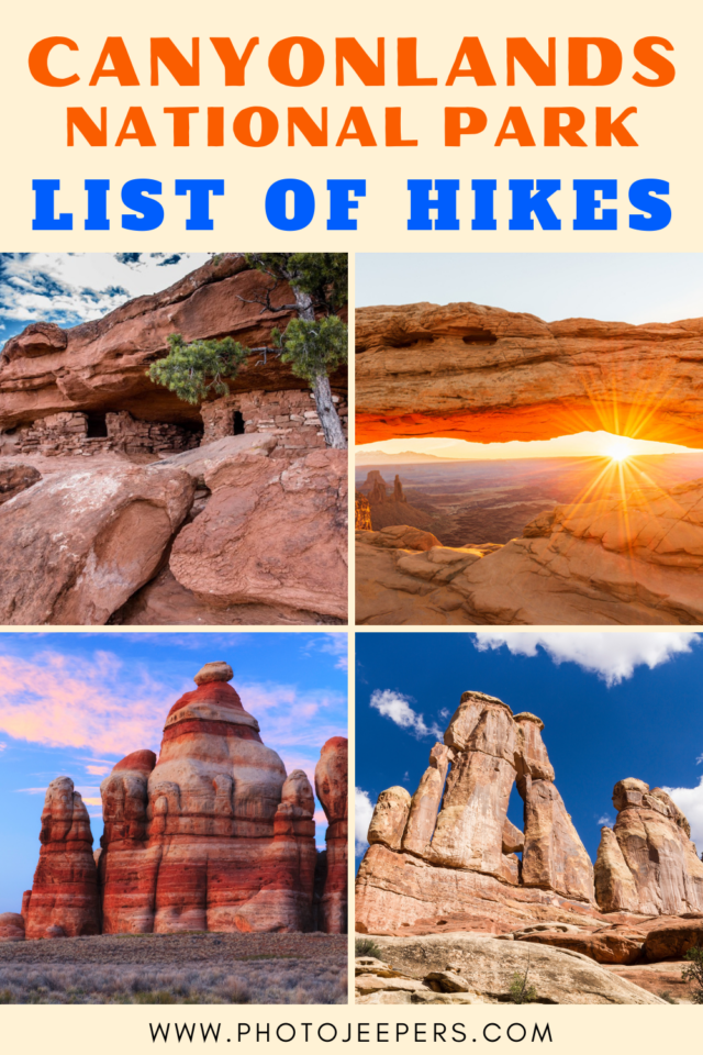
Canyonlands Hikes at Island in the Sky and Needles
Here’s a list of the best Canyonlands hikes found at the Island in the Sky district and the Needles district.
Use this Canyonlands National Park guide to plan your vacation itinerary: hiking trails, what to pack, where to stay, and more travel tips.
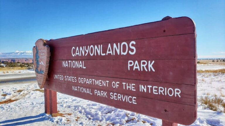
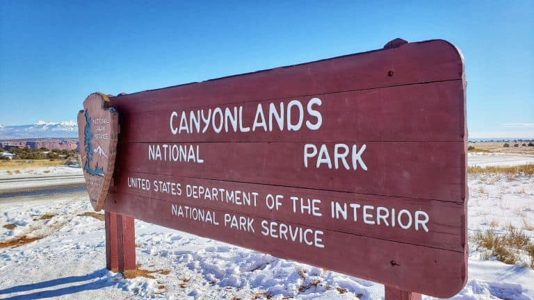
Canyonlands National Park is 527 square miles of beautiful, rugged landscape that has been transformed into a multitude of canyons, mesas, buttes, and arches by the erosion of the Green and Colorado rivers.
Hiking is one of the best ways to explore this amazing national park. There are Canyonlands hiking trails for all levels: easy, moderate and strenuous.

This site contains affiliate links which means WE may receive commissions for purchases made through these links. We only provide links to products we actually use and/or wholeheartedly recommend! As an Amazon Associate, we earn from qualifying purchases. Read the full Disclosure Policy.
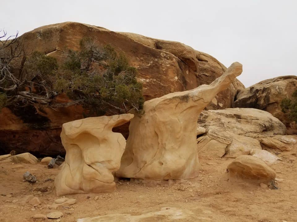
A Photo Tour of Canyonlands National Park
Take a visual tour through Canyonlands National Park (and Dead Horse Point) to see the stunning landscape in the parks!
About Canyonlands National Park
Canyonlands is subdivided along the Green and Colorado Rivers into four unique districts, that are known as The Needles, Island in the Sky, The Maze and The Rivers.
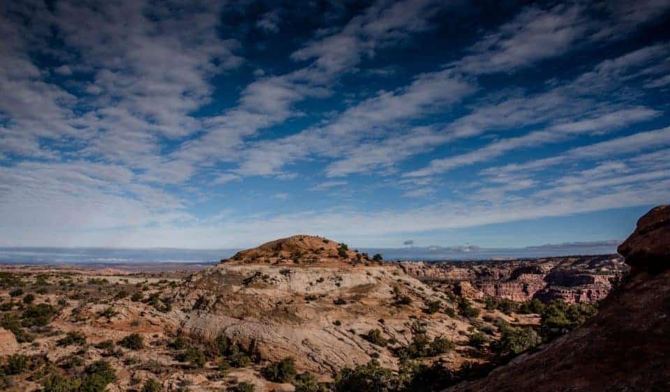
Canyonlands National Park Island in the Sky is the most accessible district. It also offers fantastic, panoramic views of the park along the Island in the Sky scenic drive!
Take a short side trip to visit Dead Horse Point State Park near the entrance to Island in the Sky. It is a must-see location!
In contrast, when you visit Needles Canyonlands, you’ll experience a remote, backcountry experience with an assortment of natural geologic formations that can only be reached by using one of the many Canyonlands hiking trails or four-wheel driving trails.
Check out our article explaining Canyonlands Island in the Sky vs Needles!
Tips For Hiking at Canyonlands National Park
One of the best things to do at Canyonlands National Park is hiking. But due to the remote location of Canyonlands, always be prepared with water, food and proper clothing so you can be self-reliant.
Carry a hydration pack or a refillable water bottle in your backpack. We also like to have healthy protein snacks while we hike. Since most of the trails are fully exposed to the sun you’ll need sunscreen, even in the winter.
Trails are usually marked with cairns (small rock piles) and have signs at intersections. Many remote trails do not receive regular maintenance and may not be adequately marked. All backcountry hikers should carry a topographic map.
In the winter the trails may be covered in snow or ice that may require traction devices for hiking.
- What to Bring on a Day Hike
- Hiking Gear and Tips for Kids
- Tips for Hiking with Kids
- Winter Clothing for Hiking
- Winter Hiking Gear List
- Photography Gear for Hiking
Best Time for Hiking at Canyonlands
It’s important to know what the Canyonlands National Park weather is like to hike during the different seasons of the year to help you decide.
- Canyonlands National Park in the Spring
- Canyonlands National Park in the Summer
- Canyonlands National Park in the Fall
- Canyonlands National Park in the Winter
Canyonlands in the summer is HOT so mornings and evenings are the best times to be outside. During the winter, hiking may be a bit more limited due to cold or snowy conditions!
Canyonlands Hikes at Island in the Sky
Canyonlands Island in the Sky has something for everyone. There are hundreds of miles of scenic trails to explore. Here are the best Island in the Sky hikes:
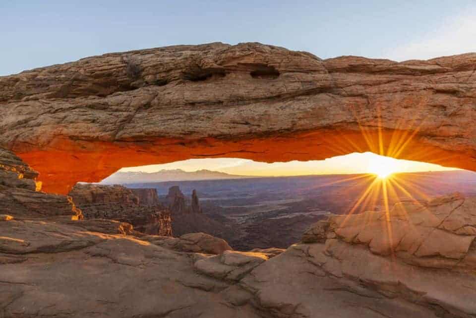
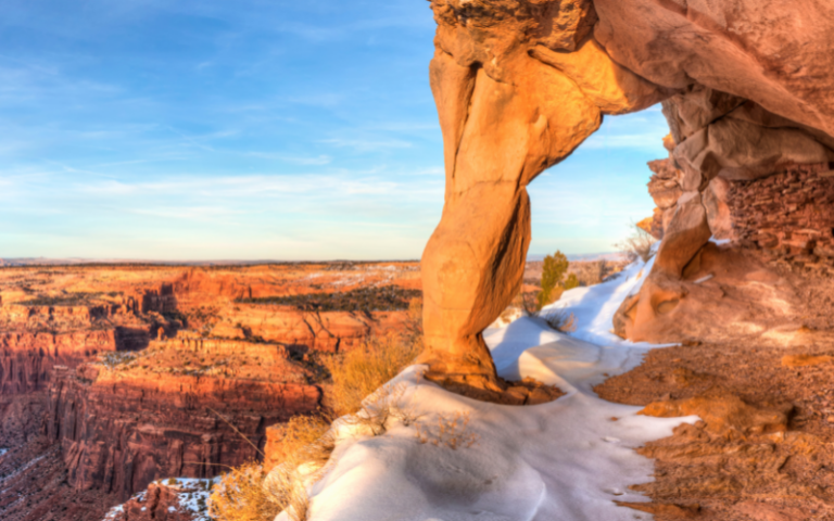
Mesa Arch, 0.5 miles, Easy
One of the most iconic landmarks of the Canyonlands, this short beginner hike will take you about thirty minutes and leads to the spectacular cliff-edge Mesa Arch.
Especially popular among photographer’s, the Mesa Arch trail is a .7-mile loop to the famous sunrise spot offering a stunning view of a scenic canyon vista and daytime views toward the La Sal Mountains.

Grand View Point, 2 miles, Easy
Canyonlands National Park’s Grand View Point showcases some of the best panoramic views. The views here encompass miles of the Green and Colorado river canyons; red rock cliffs, ravines, and mountain ranges can be seen on the distant horizon.
The Grand View Point trail is an easy in-and-out hike that follows the canyon edge of Island in the Sky mesa and takes about an hour and a half. At the viewpoint, an outdoor exhibit highlights the features of The Needles, the La Sal and Abajo Mountains, Mountain Basin, and White Rim Road. NOTE: The cliff edges do not have rails to watch children!
White Rim Overlook, 1.8 miles, Easy
Near the south end of the Canyonlands Island in the Sky district sits the White Rim Overlook. This trail takes about an hour and a half and is best viewed in the late afternoon.
The overlook gets its name from the layer of white sandstone that forms at the edges of the canyon rim. The contrast of the white rock against the surrounding shades of red-orange cliffs is exquisite. There is extremely limited trailhead parking here but it’s worth it for the spectacular panoramic view from the overlook.
Murphy Point, 3.6 miles, Easy
A much longer hike, Murphy Point provides excellent wide views off the western end of Island in the Sky. Downhill most of the way, this Islands in the Sky hike leads you past a historic corral on the mesa top.
You’ll enjoy panoramic views of the Green River, Candlestick Tower, and the White Rim Road.
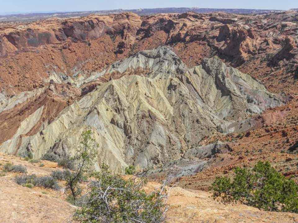
Upheaval Dome, 1 mile to 1st overlook, Moderate
The total trail is 1.7 miles but it’s a short, steep, under a mile hike to the first overlook; the second overlook adds a mile. The Upheaval Dome Trail is thought to be the most unique geological feature in Utah.
A 3-mile-wide area with a 1000-foot-deep crater with rocks pushed together in the center to make a dome-shaped structure. To truly appreciate it, this is one you’ll have to see in person. You can learn all about the dome at the exhibits at the end of the trail.
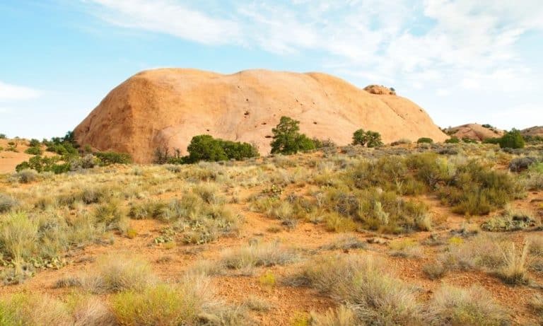
Whale Rock, 1 mile, Moderate
The Whale Rock hike leads you up the side of a large, rounded sandstone rock that some would say resembles a whale.
This trail is a fun one to climb and the handrails make it easier to navigate. The Whale Rock Trail rewards you with broad views of the Canyonlands Island in the Sky.
Aztec Butte, 2 miles, Moderate/Difficult
One of the most interesting hikes in the Island in the Sky district, the Aztec Butte trail is short but challenging at times. You’ll be required to hike up ledges and slickrock which can be difficult. Grasslands will lead you to a loop around the top that provides spectacular views into Taylor Canyon.
Early on, the trail splits with Aztec Butte to the right and another smaller butte to the left before dropping below the rim to see two Puebloan structures called granaries. These are a unique find and both have been well-preserved. The hike is 1.8 miles if you continue to the second butte, 1.3 miles if you skip it. View structures from a distance; entering, touch and climbing on the sites is prohibited.
Syncline Loop, 8.3 miles, Difficult
The difficult Syncline Loop Trail follows the canyons around Upheaval Dome and is one of the premier Canyonlands Island in the Sky hikes. Highly trafficked but challenging, most of the park’s rescues occur on this trail.
With a steep 1,300-foot elevation change, Syncline Loop requires experienced hikers to navigate sharp ledges, massive boulders, and steep slickrock. Rewarding in the end, this hike is not for the inexperienced.
This trail is perfect for those wanting to do an overnight but works well for a long day hike, too. Make sure to carry plenty of water, a flashlight, and a map. To keep the sun at your back hike this trail clockwise.
Alcove Spring, 11.2 miles, Difficult
About a half-mile from the trailhead a spring sits under a large cove where Alcove Spring got its name. Accented by towering sandstone walls, Alcove Spring Trail passes through two-large alcoves before taking you to the Zeus and Moses spires.
Of all the difficult trails leading off the mesa Alcove Spring is considered the most moderate but is still strenuous and challenging. Allow yourself a full day to tackle this trail.
Gooseberry Canyon 5.4 miles, Difficult
Canyonlands National Park’s steepest trail, Gooseberry Canyon descends an incredible 1500 vertical feet. Your destination is visible right away and may not be ideal for those who fear heights, but you can turn around on this out-and-back trail at any point. The views and scenery here are stunning but it will challenge your hiking abilities, only experienced hikers in great shape should tackle this trail.
Remember, if you go down, you’ll have to venture back up. The Gooseberry Canyon trail is unique because it lets you hike among the Canyonlands, below the level of the mesa, instead of viewing from overlooks above; you get a vastly different experience and perspective. When you descend don’t forget to look up, you’ll be amazed at how far you’ve come.
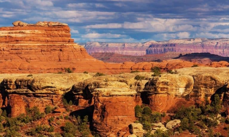
Canyonlands Hikes at The Needles
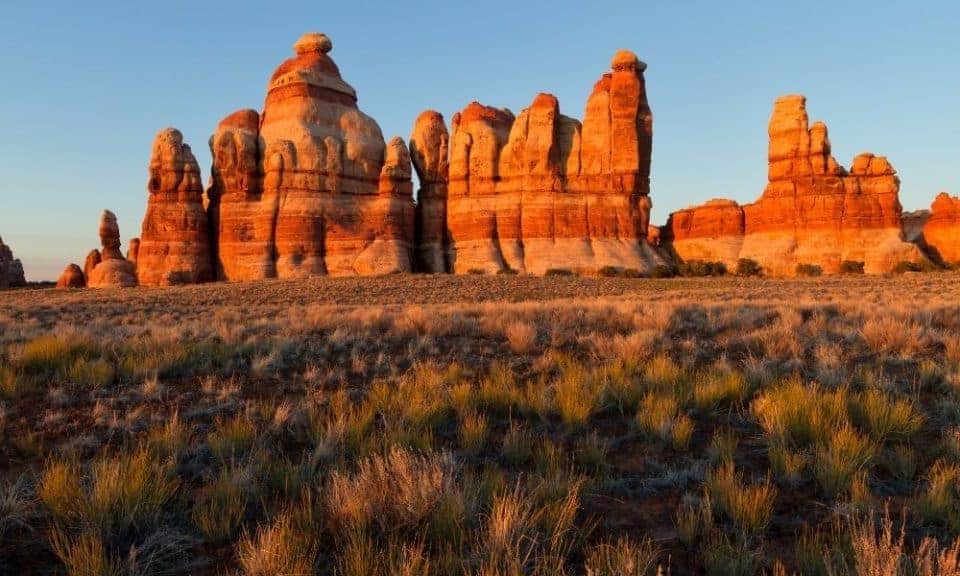
The Needles Canyonlands district makes up the southeast corner of Canyonlands National Park and gets its name from the hundreds of colorful spires that dominate the area.
The Canyonlands Needles are home to a multitude of arches, canyons, and cliffs all surrounded by a rough, rugged landscape. Strong hikers can tackle most of the Needles hikes in a day but combined with others on the loop make for a much longer trip. There are camping areas in the Needles district for those who want to stay overnight and spend more time exploring the Needles trails. Check out this great resource about backpacking for beginners!
Here’s a list of the awesome Canyonlands Needles hikes:
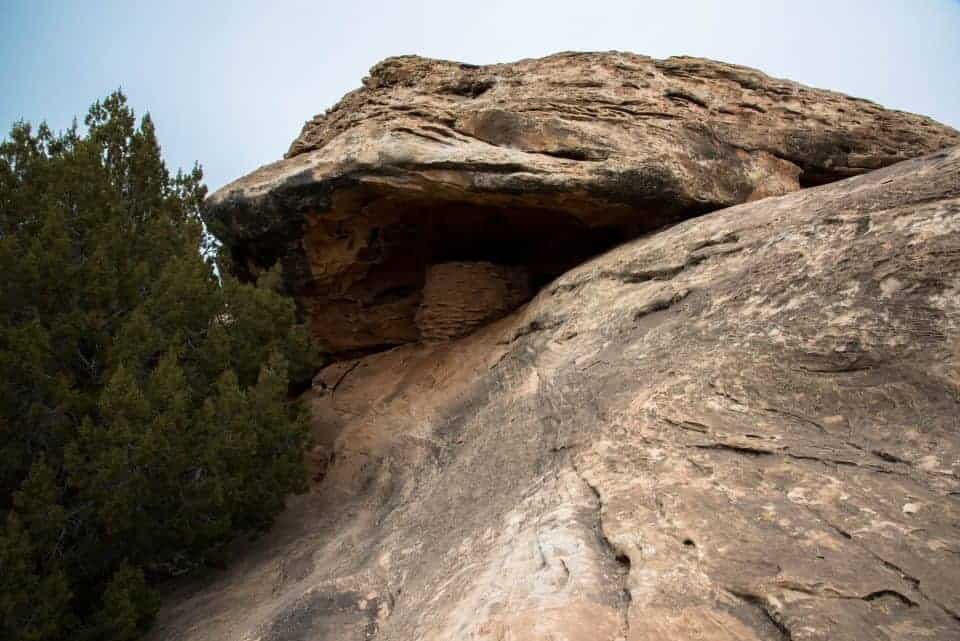
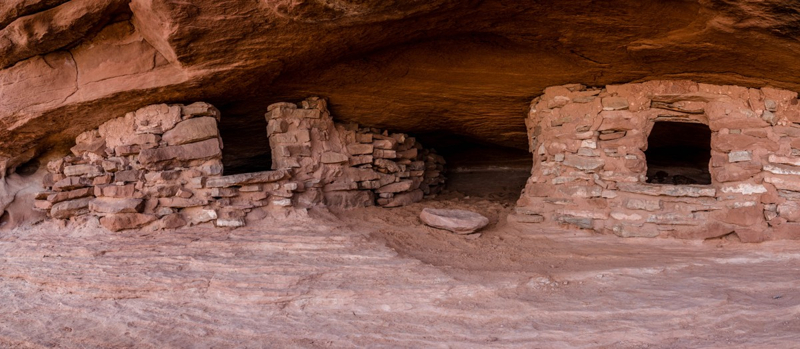
Roadside Ruin, 0.3 miles, Easy
This easy, kid-friendly trail is short with only a few stone steps to navigate. The Roadside Ruin trail is highly trafficked but in good condition. Here you’ll get to see a Puebloan-era storage structure that was once used to store food.
The Roadside Ruin trail guide explains the ruins and points out the native plants you’ll see along the way.
Pothole Point, 0.6 miles, Easy/Moderate
Although short, this trail is uphill and has uneven footing so might be considered moderate for some. Pothole Point is a short loop trail that crosses communities of sandstones with natural depressions called potholes. The potholes have tiny, sensitive ecosystems that come to life as water collects within the pothole. There are days when you might see tadpoles, snails, beetles etc.
To preserve these delicate potholes, it’s important to walk around them and avoid putting anything in them, even when they are dry. There are no trail guides, but small rock piles (cairns) show the way. Panoramic views from the trail are memorable and this trail offers one of the best viewpoints of the Needles.
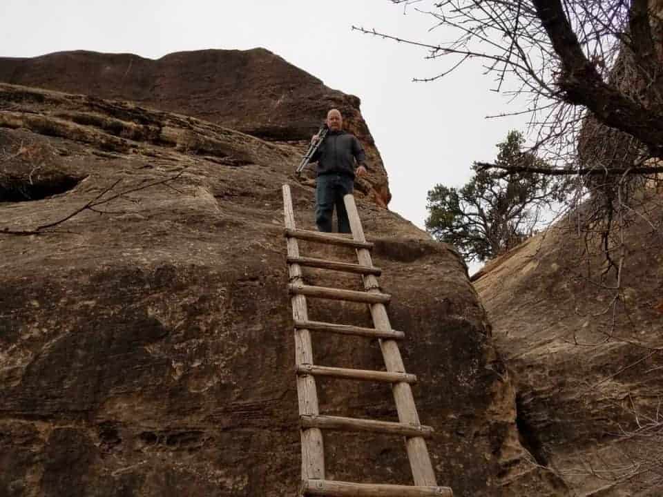
Cave Spring, 0.6 miles, Easy/Moderate
A short loop that winds around a white and red sandstone mesa, there’s a lot to see on this trail. Here you’ll pass Cave Spring, prehistoric rock paintings, well-preserved pictographs, and a historic cowboy camp with many original artifacts on display.
You will climb two wooden ladders on the Cave Spring trail, one of which that takes you to a 360-degree panoramic view of the Needles district. This trail is easy for those who have no problem climbing the two ladders and the sandstone rock but might be challenging for children or the elderly. It is recommended that you take the trail clockwise so you’re climbing up instead of down the ladders.
Slickrock Foot Trail, 2.4 miles, Moderate
A moderate trail with most of the hike on the hard slickrock surface that gives the trail its name. This trail offers stunning views of the canyons and the Needles. Grab a brochure at the trailhead to help you identify the landmarks along the way.
You’ll appreciate the spurs to the 4 great overlooks with amazing views. This is a good beginner hike with lots of potential for exploring, the strategically placed cairns make it easy to pick the trail back up. I recommend this trail in the morning or evening as you are exposed to the open sun and heat on this trail.
Chesler Park Loop Trail, 10.4 miles, Moderate/Difficult
This moderate trail is fun and popular because of its diversity in the landscape. The Needles Chesler Loop Trail has you climbing up and down over rock formations, through sand and various rock terrain, slit canyons, and grasslands.
This is a beautiful trail with lots to explore and stunning panoramic views of the Needles. Please keep in mind that a four-wheel-drive vehicle is required to get to the trailhead.
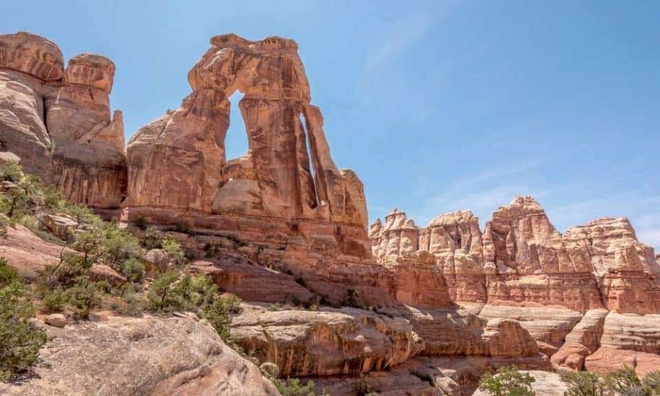
Druid Arch, 11 miles, Difficult
A favorite of the Canyonlands Needles hikes, Druid Arch is located about 5 ½ miles from the Elephant Hill Trailhead and offers one of the most spectacular views in the Needles district. The Druid Arch trail will have you scrambling through high desert, canyons, a maze of needles, up a steep ladder and a rock wall to get to the arch. The scrambles keep you on your toes but are fun and well worth it in the end.
The uniquely shaped Druid Arch is named for its resemblance to the large rocks of Stonehenge and is notable for both its height and sharp angular shape. A high bench near the end of Elephant Canyon offers a spectacular view of the arch but don’t forget to stop and take in the beautiful scenery at Elephant Canyon.
Confluence Overlook Trail, 10 miles, Moderate/Difficult
Crossing through Big Spring Canyon, the Confluence Overlook Trail takes you through miles of open desert, areas of slickrock and deep packed sand, and ends at a dramatic cliff overlook with magnificent panoramic views of the Colorado and Green River confluence.
These two rivers define the three districts of Canyonlands National Park. At the overlook you can see the two rivers 1,000 feet below for a grand view. Make sure to check out the colored sandstone spires and a huge red butte along the trail.
Squaw Canyon to Lost Canyon Loop, 8.7 miles, Moderate
The Squaw Canyon / Lost Canyon loop trail is combined for a pleasant hike that’ll take you over sandstone hills and slickrock, through a creek crossing, up a ladder, and through some challenging sections as you navigate between the two canyons.
You’ll see spectacular views and diversity along the trail. Slickrock, grasslands, tree-lined canyons, mesas, buttes, and mountains can all be seen from this scenic trail. Backcountry campsites are available at both Lost Canyon and Squaw Canyon, but a permit is required.
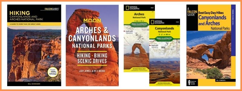
BUY AT AMAZON: Arches and Canyonlands Guides and Maps
More Hiking Trails Near Moab
- Arches National Park Hiking Trails
- Canyonlands Hikes
- Canyonlands Island in the Sky Hikes
- Dead Horse Point State Park Hiking Trails
Where to Stay Near Canyonlands
There are no lodging facilities in the park, but there are campgrounds:
- Island in the Sky Campgrounds
- Needles Canyonlands Camping
- Where to Stay Near Canyonlands
- Hotels Near Canyonlands National Park
- Holiday Inn Express Hotel & Suites Moab – we enjoyed our stay and highly recommend this hotel due to its location close to Canyonlands.
- Purple Sage – our all-time favorite place to stay in Moab – walking distance to shopping, full kitchen, and only 8 units so you don’t feel lost in a large hotel.
- Red Cliffs Lodge – rooms up to 6 people – located 17 miles from Moab, this lodge is known for its beautiful location, winery and activities like horseback riding, fishing and more!
- Townhomes south of Moab – we really like the townhomes in Spanish Valley with kitchen, washer and dryer in the unit and a swimming pool/hot tub (just a 5 minute drive south of Moab).