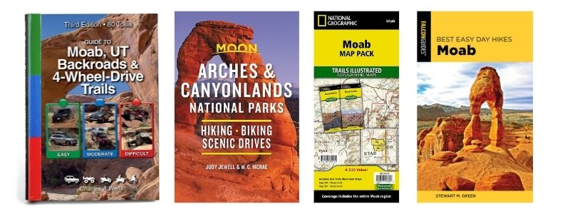
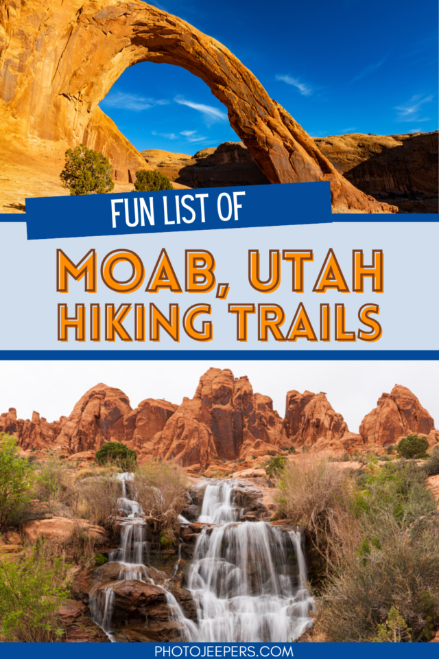
List of Moab Utah Hiking Trails
Moab, Utah is a hiker’s paradise. Located in the heart of red rock country, this desert town offers some of the most spectacular and varied hiking trails in the United States.
Exploring the many Moab Utah hiking trails is one of the best ways to see the stunning landscape in the area.
Use this Moab Utah Vacation Guide that details the most popular hikes: distance, time, elevation gain, and important information about what it’s like to hike each trail.
The entire Moab area is one big playground, especially for hiking. It’s a terrific way to see and photograph this scenic area filled with sandstone arches, pinnacles, petroglyphs and even dinosaur prints!
Use our Moab, Utah packing list to make sure you have the right clothing and gear for hiking any time of year! Grab your free printable packing checklist by clicking the image below!

This site contains affiliate links which means WE may receive commissions for purchases made through these links. We only provide links to products we actually use and/or wholeheartedly recommend! As an Amazon Associate, we earn from qualifying purchases. Read the full Disclosure Policy.
What To Pack for Hiking in Moab
- Hiking shoes
- Darn Tough hiking socks
- WATER: Hydration packs or carry refillable water bottles in your backpack.
- Healthy snacks – there may be NO services on the trails you’ll hike or drive.
- Lip balm with sunscreen and hydrating lotion – Utah’s high elevation and dry air can be hard on your skin.
- Summer – High temperatures, unrelenting sunlight, and low humidity. To keep cool, wear light colored, loose fitting UV protection clothing that does not absorb sunlight. Also avoid sun burn by wearing a sunhat and by generously applying sunscreen to any parts of your body that are exposed to the sun.
- Winter – Pack winter clothing to stay dry and warm.
- Fleece jacket
- Buff headbands
- Hand sanitizer
- Flashlight or headlamp
- First aid kit
- DOWNLOAD – Camera gear checklist
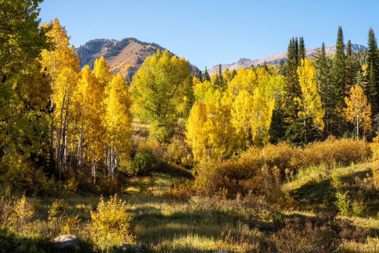
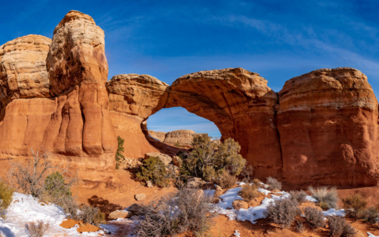
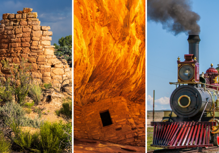
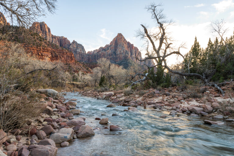
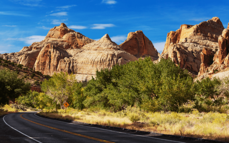
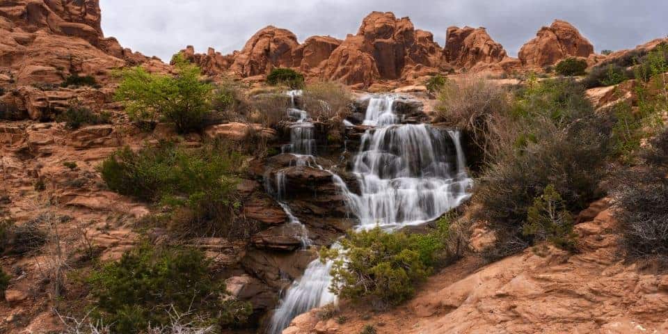
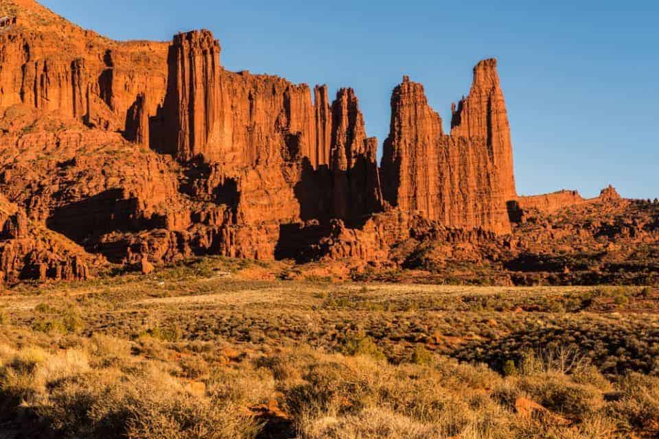
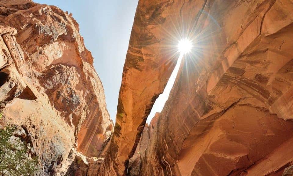
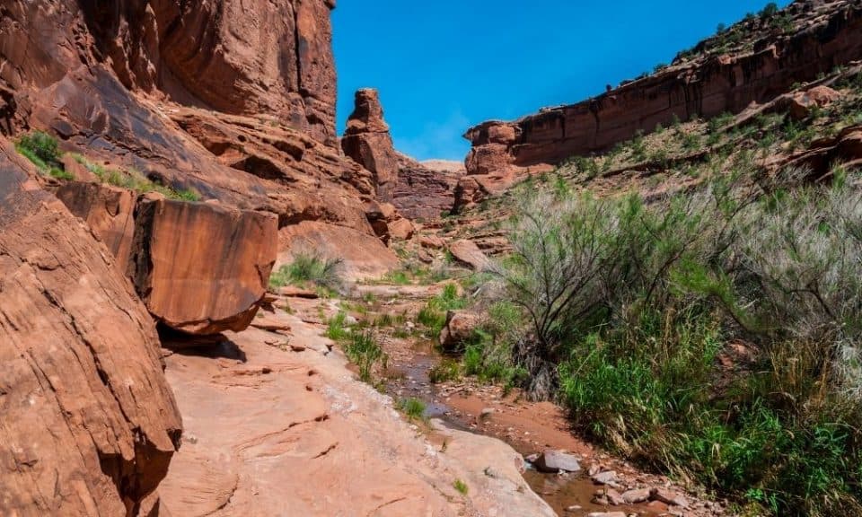
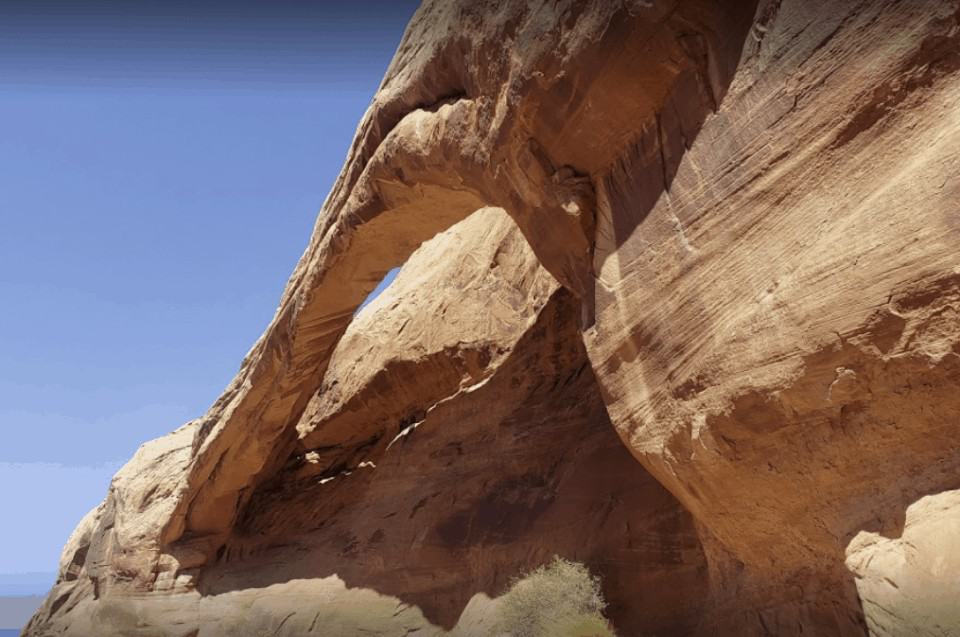
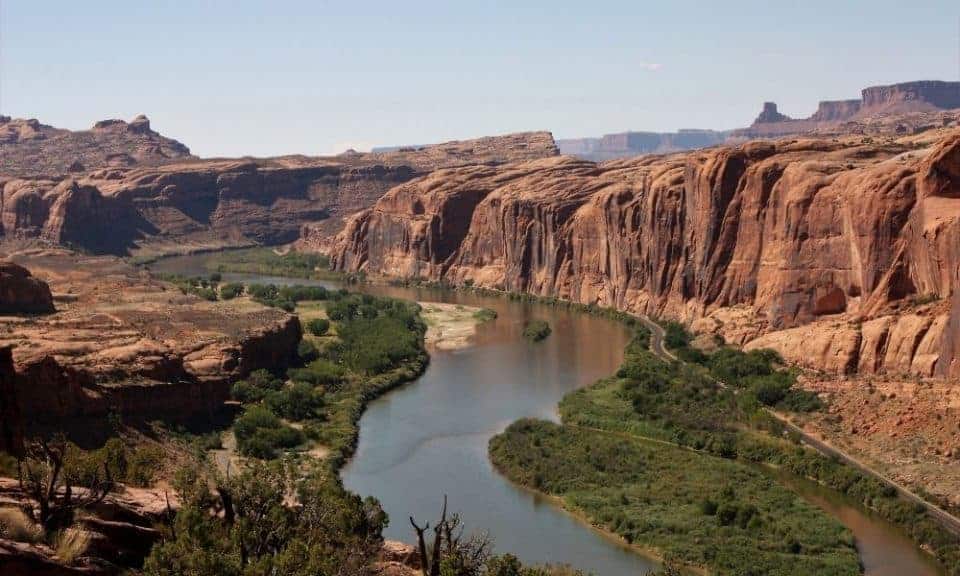
A Photo Tour of Moab, Utah
Take a visual tour through the Moab, Utah area to see the stunning landscapes you’ll see when you visit!
List of Moab Utah Hiking Trails
Sometimes the Moab hikes get overshadowed by the trails in the national parks in the area. Of course, we like to explore those trails, and you should add them to your itinerary:
But the Moab hiking trails are just as fun and rewarding, and don’t require an entrance fee like you’ll need at the National and State Parks.
Hiking in Moab can be done any time of year, but if you’re wondering what it’s like to visit Moab during the various seasons and months, check out our article: Best time to visit Moab.
If you enjoy taking pictures on your adventures, check out our photography gear for hiking!
Here’s a list of our favorite trails in Moab in alphabetical order.
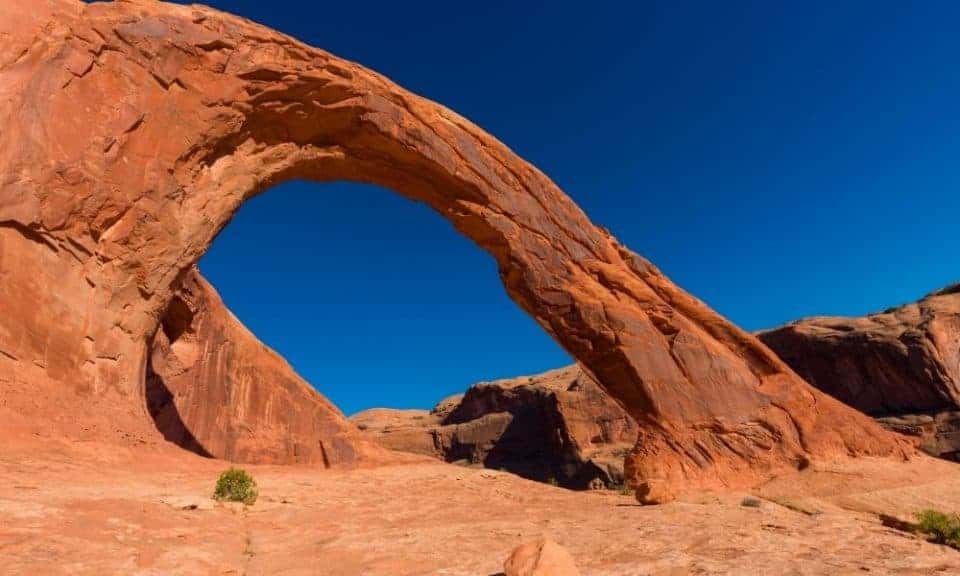
Corona Arch Trail
- Hike length: 3 miles round trip
- Time required: 2 hours
- Hike difficulty: Moderate
- Trailhead Location: from Moab, take US-191 North for 4 miles. Turn left onto UT-279 South. Follow UT-279 for 10 miles. Parking and the trailhead are located on the north-side (right-side) of the highway.
The Corona Arch Trail is one of the most popular and unique trails in Utah. It offers stunning views along the way and the reward at the end is the 140-feet wide and 150-feet high Corona Arch.
Combine the hike to include seeing Bowtie Arch while you’re here!
Corona Arch Trail is considered moderate due to a few areas where you’ll need to use cables to get up and down the slickrock slopes. There is no shade along this trail so it’s best to hike during the early mornings or early evening hours. Leashed pets are allowed on the trail.
Dellenbaugh Tunnel Trail
- Hike length: 3.6 miles round trip
- Time required: 2 hours
- Hike difficulty: Moderate
- Trailhead Location: take Highway 313 for 8 miles. Turn right on the Dubinky Well Road and go north for approximately five miles. Turn left at the Spring Canyon Point Road (just before the Dubinky windmill). Go west on this road for about one mile to the base of the large Tombstone (Needle) Rock monolith. Turn left on a dirt road at this monolith and it is less than a mile to a parking area.
The best term to describe Dellenbaugh Tunnel is an “oddity in nature.” Start near the Tombstone Butte and follow the trail as it leads to the Spring Canyon’s upper end. From there, you will notice a natural tunnel arch.
At the end of the tunnel, the canyon side opens up to breathtaking views! The Dellenbaugh Tunnel is a less-trafficked hiking trail in Moab to enjoy a moment of seclusion and peace.
Faux Falls Trail
- Hike length: 200 feet
- Time required: 15 minutes
- Hike difficulty: Easy
- Trailhead Location: reaching the falls by vehicle requires high clearance for a couple of rough spots, but the road can be easily walked.
Directions to the Faux Falls Trailhead:
- Go south out of Moab on highway 191 about 7.5 miles to mile marker 117.9.
- Turn left here, on the signed Kens Lake road. Reset your odometer.
- Follow this road 0.55 miles to a junction. Go right, toward the signed Mountain Loop Road. Reset your odometer again.
- 0.6 miles – Stay left.
- 1.4 miles – 4-way junction. Go left toward Kens Lake and reset your odometer.
- Continue straight at mile 0.6, instead of turning left into Ken’s Lake.
- 1.0 miles – Turn Left Into Campground
The trailhead has parking for several vehicles and contains an information kiosk. The last 1/2 mile of dirt road before the trailhead can become rough at times and some might want to park and walk it.
The Faux Falls Trail earned it’s name because the trail takes you to a waterfall created by the piping diverting water from Mill Creek to fill the reservoir, Ken’s Lake.
In the spring the waterfall is full and rushing due to the spring rains and snow runoff from the nearby mountains. In the hotter months, there’s still water flowing, but it’s not the same as spring. In the summer expect crowds since the cool water is a nice reprieve from the heat!
If you plan to hike with the whole family, including your children, keep an eye on them since these waterfalls and pools are steep.
Fisher Towers Trail
- Hike length: 5.2 miles round trip
- Time required: 2 to 3 hours
- Hike difficulty: Easy
- Trailhead Location: Head north out of Moab a couple of miles to State Highway 128 (just before the Colorado River). Follow highway 128 about 21 miles to a signed turn off on the right. Follow the good dirt road 2.2 miles to it’s end at a small campground and parking lot.
The Fisher Towers are scenic rock formations eroded into bizarre yet exciting shapes. The color, texture, and structure of these formations are incredibly photogenic, especially at sunset. The Fisher Towers Trail winds around the bizarre formations of pinnacles, spires, and gargoyles. There is no shade on the trail so use sun protection and carry plenty of water.
Grandstaff Canyon Trail
- Hike length: 2 miles to Morning Glory
- Time required: 4 hours round trip
- Hike difficulty: Moderate
- Trailhead Location: The Grandstaff Canyon Trail is located three miles east of the junction with U.S. 191, Utah Scenic Byway 128.
The Grandstaff Canyon Trail is named after William Grandstaff, an African-American prospector in the 19th century. This trail is one of Moab’s most famous trails that offers a fun and exciting day adventure.
From the parking area next to Hwy 128, follow the trail up the left side of the stream. Keep going upstream for about 1.5 miles. At the fork in the road, follow the trail to the right, cross the stream, and walk up the steep slope. Morning Glory Bridge is located at the end of the trail about 0.5 miles up the canyon from the stream.
NOTE: Do not touch the poison ivy that grows below the pool under the bridge! Poison ivy plants have dark green, shiny leaves with serrated edges in clusters of three.
Hidden Valley Trail
- Hike length: 4 miles
- Time required: 2 to 3 hours
- Hike difficulty: Moderate
- Trailhead Location: Drive 3 miles south from Moab on U.S. 191 and turn right onto Angel Rock Road. After two blocks, turn right onto Rimrock Road and drive to parking area.
The Hidden Valley Trail starts off challenging with a steep climb on rough and rocky switchbacks. As you continue to follow the trail, the endpoint is the most satisfying part. It will give you a broad glimpse of the Moab area, along with panoramic views of Behind the Rocks. By following the Moab Rim four-wheel drive trail, you can extend your hike down to the Colorado River.
Hunter Canyon Trail
- Hike length: 2 miles one-way; 3.2 miles round trip
- Time required: 1 to 2 hours
- Hike difficulty: Easy
- Trailhead Location: from Main Street on Moab’s south side turn west on Kane Creek Boulevard. Drive west to a Y-junction. Stay left on Kane Springs Road. Drive west, then turn south along the Colorado River. From there, you will notice a cattle guard. Continue going south until you see the signed Hunter Canyon Trailhead.
The Hunter Canyon Trail is an out-and-back trail that offers impressive views featuring a canyon with sandstone cliffs. Besides the beautiful view noted on this trail, dense vegetation, and poison ivy, is also present. This trail is also home to nine BLM campsites, making it ideal for more than a day hike. You can hike with your dogs on this trail as long as they are appropriately leashed.
Juniper Trail
- Hike length: 1.9 miles round trip
- Time required: 45 minutes to 1 hour
- Hike difficulty: Easy
- Trailhead Location: located in the Sand Flats Recreation Area (fee to enter). Drive 6.3 miles from the entrance station and you’ll see a parking area.
The Juniper Trail is a well-maintained and easy-to-follow trail. It offers panoramic views of the Grandstaff, Mill Creek Canyons, Moab Rim, Porcupine Rim, La Sal Mountain range, and Colorado River channel make this hike a must-do, especially in the last afternoon and around sunset.
A great family-friendly hike, but note there are no pit toilets. And there is no shade along this trail so avoid hot, sunny days! Dogs are also able to use this trail but must be kept on leash.
Longbow Arch Trail
- Hike length: 2.4 miles round trip
- Time required: 1 to 2 hours
- Hike difficulty: Easy
- Trailhead Location: the trail begins at the Poison Spider parking area, 5.9 miles from Hwy 191 on Hwy 279. Trailhead is near restroom.
The Longbow Arch Trail follows a rocky and gradual elevation for a short distance on slickrock from the parking lot. As the trail passes through the four-wheel-drive route, a broad canyon will be there to serve as the impressive welcoming structure.
Upon reaching the nearby end of the said canyon, the Longbow Arch Trail passes through a narrow side canyon. From there, you will notice the existence of a primitive trail. This trail combines rock art panels, dinosaur prints, and arches. With these exciting diversities, the Longbow Arch Trail is one of the most trafficked trails in Moab.
The Longbow Arch Trail is best visited during cooler months. For hotter days, an early morning or early evening hike is recommended. It offers staggering views of Behind the Rocks, La Sal Mountains, Rock art panels, and the 60-feet Longbow Arch.
Moab Rim Trail
- Hike length: 6-10 miles roundtrip
- Time required: 4 to 5 hours
- Hike difficulty: Strenuous
- Trailhead Location: On Kane Creek Boulevard, 2.6 miles northwest of its intersection with U.S. Highway 191 in Moab (0.1 mile beyond the first cattleguard).
The Moab Rim Trail is a popular route of hiking, biking and off-roading. From the parking area, follow the 4-wheel-drive vehicle route up the slickrock ledge-ramps of sandstone. Moab Rim trail is slickrock all the way to the top with brutal stair-step features made worse by the steep angle. The hard work and effort are rewarded with grand views of the Colorado River, the Moab Valley, and the Behind the Rocks area.
Poison Spider Bench Trail
- Hike length: 2.5 miles roundtrip
- Time required: 2 hours
- Hike difficulty: Easy
- Trailhead Location: 5.9 miles from Highway 191 on Highway 279. The trailhead begins on the Poison Spider Jeep Trail, about 0.25 miles from the parking lot.
The Poison Spider Bench Trail follows an old road that has been closed to motorized vehicles. The trail is mostly level with one short climb. Enjoy terrific views toward Moab and the LaSal Mountains as you hike. Near the end of the trail look for an arch on the rim to your right (northeast).
Portal Overlook Trail
- Hike length: 3.2 miles roundtrip
- Time required: 2 to 3 hours
- Hike difficulty: Moderate
- Trailhead Location: JayCee Park Recreation Site, Utah Scenic Byway 279. The trailhead is located 4.2 miles west of Utah 279/ U.S. 191 junction.
The Portal Overlook Trail is a hiking and biking only trail that follows a slickrock bench up from the Colorado River to an expansive view of the Moab Valley and the surrounding landscape. The trail consists of several switchbacks climbing up “ramps” of sandstone to the overlook. Be cautious at the top viewpoint because there are no safety fences.
Stairmaster Trail
- Hike length: 1.8 miles roundtrip
- Time required: 2 hours
- Hike difficulty: Moderate
- Trailhead Location: Moab Rim parking area on Kane Creek Road, 2.6 miles from the Hwy 191 junction
The Stairmaster Trail is a short but rewarding hike that leads to an amazing overlook of the Moab valley and LaSal Mountains. This hike is only 1 mile to the overlook at the top, but you’ll earn it since the elevation gain is 820 feet in that short distance.
You’ll quickly see why it’s called the Stairmaster Trail! There is no shade on this trail so it gets really hot in the summer. Be careful hiking with dogs because the slickrock will get too hot for their paws.