Visiting Grand Staircase-Escalante National Monument
Located in the heart of southern Utah, you’ll enjoy breathtaking views and remote wilderness areas when visiting Grand Staircase-Escalante National Monument.
Grand Staircase is an incredible place to visit in Utah that encompasses nearly 1.9 million acres of stunning terrain, including canyons, mesas, buttes, cliffs and plateaus that have been carved by eons of erosion.
Grand Staircase-Escalante features a wide variety of outdoor activities such as scenic drives, horseback riding, hiking, and camping.
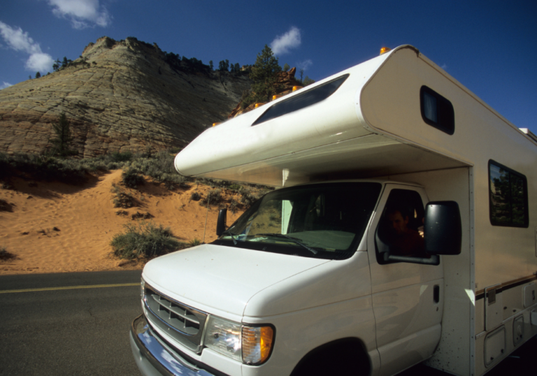
Despite its remote location and dramatic landscape, the monument is very accessible and offers a variety of services such as lodging, restaurants, gas stations and more.
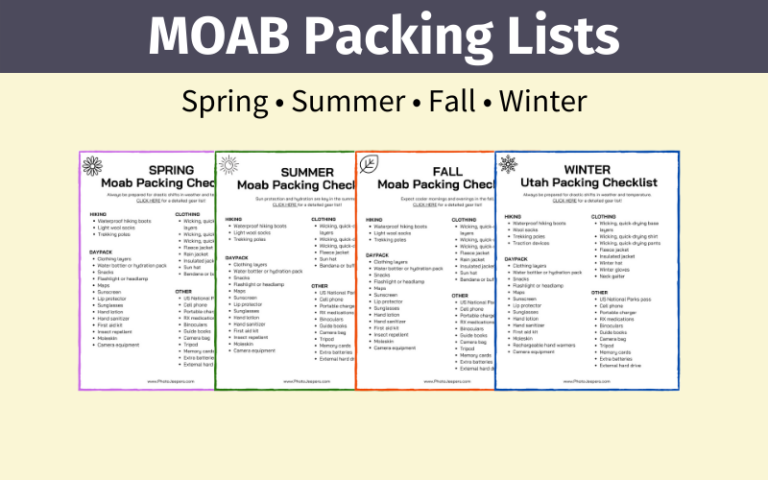
Use our Utah Packing Lists to make sure you have the right clothing and gear for visiting any time of year! Grab your free printable packing checklist by clicking the image below!

This site contains affiliate links which means WE may receive commissions for purchases made through these links. We only provide links to products we actually use and/or wholeheartedly recommend! As an Amazon Associate, we earn from qualifying purchases. Read the full Disclosure Policy.
Visiting Grand Staircase-Escalante National Monument
The Grand Staircase-Escalante National Monument is a large protected area in southern Utah. Here’s some basic information about the area:
Entrance and Permit Fees: Grand Staircase-Escalante National Monument does not charge entrance fees. However, there may be fees for camping, backcountry permits, and other activities within the park.
Operating Hours: The monument is open 24 hours a day, year-round. Some roads and facilities might be closed in the winter because of snow. The best way to get the most up-to-date information is to check the park’s website or call ahead.
Weather: Grand Staircase-Escalante National Monument has dry, desert-like weather, with hot summers and cold winters. Visitors should be prepared for extreme temperature changes, especially if traveling between higher and lower elevations.
Many of the dirt roads in the monument are impassable when wet, snowy or muddy. We highly recommend checking with Rangers for current conditions!
Wildlife: There are desert bighorn sheep, coyotes, bobcats, and many bird species in the monument. Visitors should be respectful of nature and avoid approaching or feeding them.
Can You Drive Through the Grand Staircase?
Experience the rugged beauty of Utah’s stunning landscapes as you travel along the Scenic Byway 12, stretching across 120 miles.
Meandering through the Grand Staircase-Escalante National Monument, this iconic route is one of the two paved highways in the area. It offers a captivating journey through diverse terrain that will leave you spellbound.
Is It Worth Visiting the Grand Staircase?
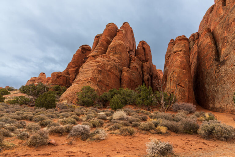
If you love the great outdoors, visiting this Utah National Monument is a must. The rugged and vast landscape is home to unique geological formations, diverse wilderness, and fascinating biodiversity. You will be in awe of the monument’s breathtaking slot canyons and majestic waterfalls.
Are Dogs Allowed in the Grand Staircase?
Most trails allow dogs, but it is important to note that dry slot canyons along the Hole in the Rock Road are an exception due to the confined spaces.
Following the hike guidelines is important since some hikes require dogs to be leashed, and others allow them to roam free. Make sure you clean up after your furry friend so the area’s natural beauty stays pristine.
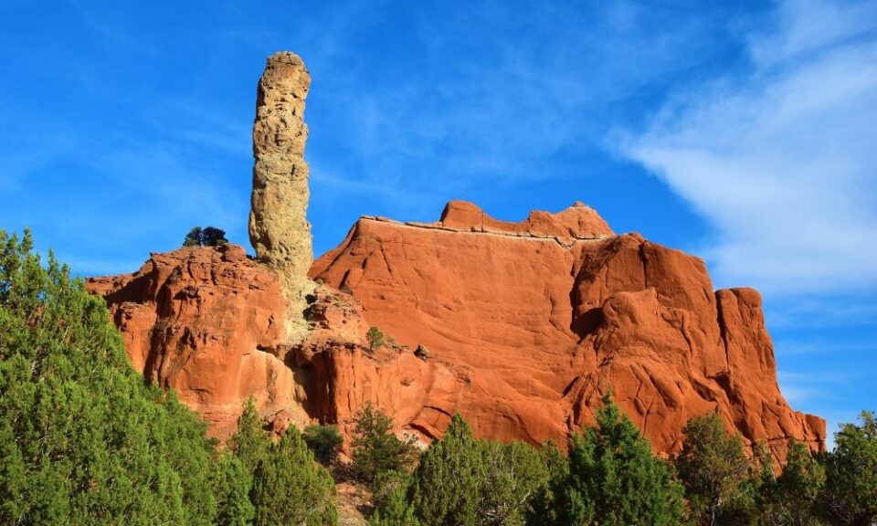
Why Do They Call It Grand Staircase?
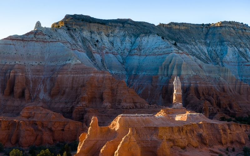
The name “Grand Staircase” refers to a series of colorful cliffs and plateaus that run along the western edge of the monument.
“Grand Staircase” was first coined by geologist Clarence Dutton in the late 19th century to describe the cliffs and plateaus in the region. As he saw the rocks, he saw a series of steps going up to higher elevations, each composed of a different rock.
Their colors reflect different mineral compositions and weathering patterns and range in age from around 270 million years old to 50 million years old.
Three Units of Grand Staircase-Escalante National Monument
The monument is divided into three distinct regions: Grand Staircase, Kaiparowits Plateau, and Canyons of the Escalante.
The Grand Staircase: This area can be seen from the rim of the Bryce Canyon amphitheater. This region of the monument features a series of massive, colorful cliffs. Sedimentary rock layers comprise the Grand Staircase, each representing a different period of Earth’s history.
The Kaiparowits Plateau: This region is a remote, high-altitude desert plateau home to a wide variety of plant and animal species. Aside from its geology, it’s also known for its Late Cretaceous rock formations.
The Canyons of the Escalante: This region is characterized by deep, narrow canyons carved by the Escalante River and its tributaries. Native American ruins and rock art can be found in the canyons and various wildlife and plant species.
Each park region offers impressive hiking, camping, and exploring opportunities.
Things To Do at Grand Staircase-Escalante National Monument
Here are some of the top things to do at Grand Staircase:
Day Hiking at Grand Staircase-Escalante
The monument has miles and miles of day hiking trails that take you through some of the region’s most breathtaking scenery.
The popular day hikes at Grand Staircase:
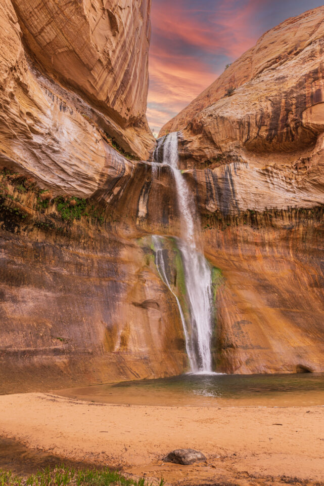
Lower Calf Creek Falls – The easy trail is just under 6 miles round trip. A small fee is required to park in the day use area and is payable at the information kiosk.
Arrive EARLY to escape the crowds, avoid the summer heat and find a parking spot at the Calf Creek Falls trailhead.
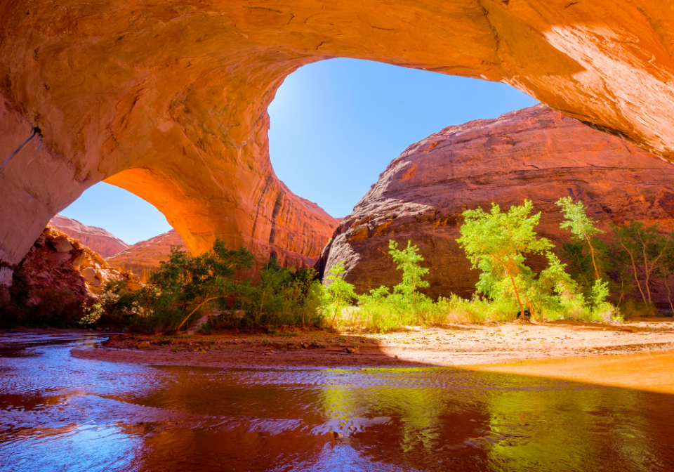
Escalante Natural Bridge – This easy family-friendly hike takes you to the 130 foot high stone bridge! From the parking area you’ll follow the trail up stream and cross the stream a handful of times before reaching the bridge on the left side.
In early spring the Escalante river might be flowing too high to cross. Winter in a nice time of year to hike, but you’ll still need to cross the river a handful of times.
Zebra Slot Canyon – Named for it’s striking orange-striped walls, you don’t need a guide to explore this one-of-a-kind slot canyon! BUT reaching the beautiful striped canyon walls is no easy task. You’ll need to drive 8 miles down a dirt road, and hike 5 miles round trip.
Parts of Zebra Slot Canyon are filled with anywhere from a few inches to a few feet of water! It requires wading through murky water, squeezing through very narrow canyon walls and a bit of climbing/scrambling to maneuver through the tightest sections.
Backpacking at Grand Staircase-Escalante
Grand Staircase-Escalante National Monument has over 1.9 million acres of wilderness to explore. Tips for backpacking in Grand Staircase:
- Carry a Map: Always carry a good Grand Staircase Escalante map, Escalante’s winding canyons can be confusing.
- Check the Weather: Check the weather frequently in all surrounding areas, slot canyons are very dangerous during the summer monsoon season when there’s a high chance of flash flooding.
- Carry Lots of Water: Though there are water sources in many places, you never want to be caught short on water while hiking in the desert.
- Tell or Bring a Friend: Tell someone your route and stick to it. In the event something does go wrong, this will make it much easier for someone to find you.
- Permits: If you are spending more than a day in the area, get a permit from the BLM office in Escalante or at trailhead register boxes.
The best backpacking hikes in Grand Staircase:
Escalante River Backpacking – the most common itineraries for backpacking the Escalante River are typically 2 to 5 days and 20 to 40 miles. You could start from both the Escalante River Trailhead (Highway 12 bridge crossing) or Escalante Town Trailhead (in the town of Escalante).
Death Hollow Backpacking – the only way to see the majority of the canyon is to backpack it, which would typically take three days. Death Hollow is remote, so do not expect help from any other hikers. Poison ivy is abundant in the canyon, so make sure you are able to identify the plant without walking into it. And as always, make sure the weather looks clear before going into Death Hollow.
Coyote Gulch Backpacking – this is a great backpacking trip for beginners due to the fairly level terrain, water availability, and the fact that you can hike it in 1-2 nights. Coyote Gulch is also a very popular trail, so you should avoid the peak of Spring Break and right after school gets out if you are hoping for any solitude.
Scenic Drives at Grand Staircase-Escalante
Driving through the monument is an excellent way to see natural beauty. Scenic Byway 12 is one of the most scenic drives in the country. This Utah Scenic Drive connects Bryce Canyon with Capitol Reef National Parks! It’s also the only fully paved road in the monument.
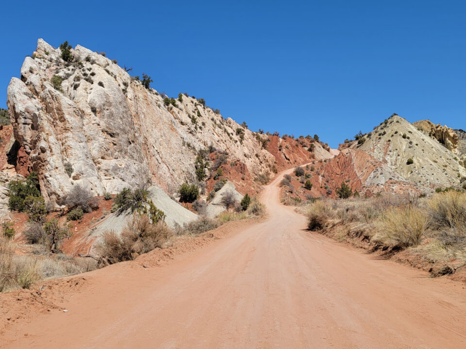
There are other scenic dirt roads that range from graded to unmaintained, rocky, or sandy doubletracks.
Most of the Grand Staircase roads can be accessed by 2WD cars in dry weather. It’s usually recommended to use a 4WD vehicle when driving off the pavement in Southern Utah.
Many of the dirt roads become impassable when wet! Spring and summer rains and winter snows can sometimes leave roads slick, muddy, washed out, and impassable to the best high-clearance four-wheel drive vehicle.
We recommend you check with the Visitor Center or local BLM office before hitting any road during the rainy season!
Burr Trail Loop-the-Fold Drive – this 124-mile loop drive begins near Boulder and ends near the Capitol Reef Waterpocket District. Most passenger cars, pickups, and vans can usually negotiate the roads without difficulty. Many of the roads are unpaved, and are often rough, sandy, and corrugated.
Cottonwood Canyon Scenic Drive – this 47-mile drive one way connects Scenic Byway 12 on the north, near Kodachrome Basin State Park, to Highway 89 on the south, east of Kanab. Be sure to stop at Grosvenor Arch!
Hole-in-the-Rock Scenic Drive – this 62-mile drive one way ends at the river pioneer crossing that is now Lake Powell. Most people drive 11 miles to Devil’s Garden or 26 miles to Peek-a-boo and Spooky Gulch trailheads.
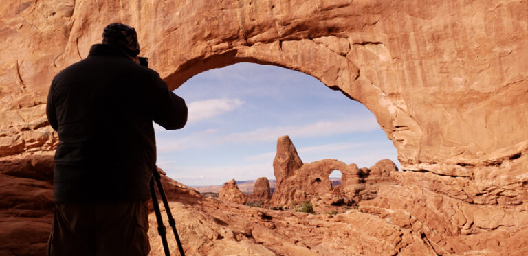
Photography at Grand Staircase-Escalante
Definitely pack your camera gear to capture the beauty of this national monument. It’s a desert environment so we recommend using a camera backpack to help mitigate dust, and carry a camera cleaning kit to wipe dust off your lens as needed!
Here are some of our favorite photo spots in Kanab and the Grand Staircase area:
Peekaboo Slot Canyon (near Kanab) – about 7 miles north of Kanab off Highway 89 you access the road to the slot. Then it’s 3.5 miles driving in very deep sand to get the the entrance. We booked a tour with Dreamland Safari for our photography group. Tripods are allowed here and you can photograph the canyon at your own pace.
Johnson Canyon Road – about 11 miles east of Kanab along Highway 89 you can access Johnson Canyon Road. As you drive north stop at pullouts to photograph the colorful cliffs found in this region of Grand Staircase. The old Gunsmoke film set is about five miles from the turnoff at Highway 89, but note it’s on private land. At the end of the paved road, you’ll find Skutumpah Road – a dirt road that is accessible for passenger vehicles except when wet!
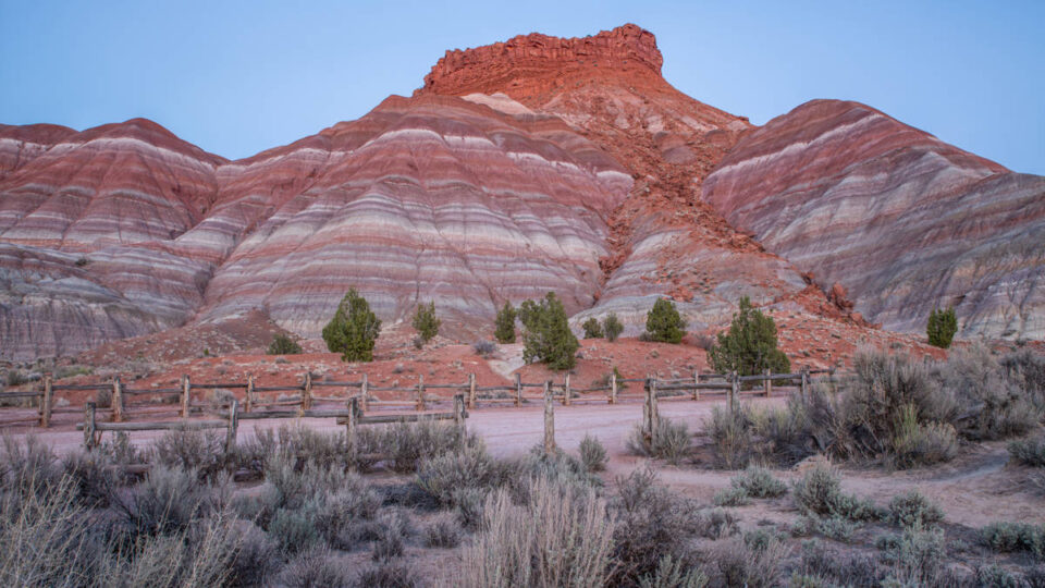
Old Pariah – around milepost 31 east of Kanab is the Pariah River Valley Road. This dirt road is 6 miles long, with a steep section near the end. We have seen passenger cars on this road, but we recommend you at least have an SUV. Don’t drive this road when it’s wet! The colorful striped cliffs here are best photographed at sunset with the golden light! Once the sun goes down the even blue hour light is nice as well.
The Toadstools – the trailhead is located off Highway 89 about 45 miles east of Kanab. There are no fees, the trail is open year-round, and it’s dog-friendly. Hike less than a mile along the easy trail to reach the hoodoo formations. You’ll find the main red Toadstool and other mushroom-like rocks in the area to explore. We recommend sunset and night photography at The Toadstools. Remember to have your headlamp to hike back the way you came in the dark!
Camping at Grand Staircase-Escalante
Within the monument itself, there are three established campgrounds operating on a first-come first-served basis.
- Whitehouse Campground – 45 miles east of Kanab has 5 sites
- Calf Creek Campground – 16 miles northeast of Escalante has 14 sites
- Deer Creek Campground – 6 miles southeast of Boulder has 7 sites
Other campgrounds in the area include:
- Kodachrome Basin State Park – 23 basic sites, 10 full-hookup sites, 2 group sites
- Escalante Petrified Forest State Park – 14 basic sites, 8 partial-hookup sites, 1 group site
Primitive camping is allowed in Grand Staircase. Look for sites identified as “Primitive Camping Location” or sites showing signs of prior use.
Do not camp at any trailhead or within 300 feet of corrals, springs, seeps, or streams.
Overnight permits are required for all overnight car camping. Permits are free of charge and may be obtained at visitor centers or at developed trailheads.
Utah Bucket List
To help make your trip planning easier, we’ve compiled this comprehensive list of must-do activities that belong on every Utah Bucket List: things to see, do and taste all around the state! Grab the free download by clicking the graphic below!