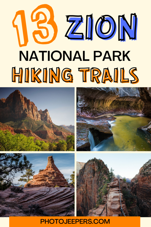
List of Zion National Park Hikes
Zion National Park, located in southwestern Utah, offers some of the most spectacular hiking experiences in the United States. Zion National Park hikes cater to all skill levels and interests. This guide details the best easy, moderate and strenuous hikes at Zion!
Use our Zion National Park travel guide to plan your trip. We share what to pack, where to stay and other things to do in addition to these world-famous hiking trails!

We live a few hours away from Zion so we get to visit often, and know what it’s like to hike during all four seasons. Due to the desert environment here, it’s important to stay hydrated, use sun protection, and get the latest weather information before hitting the trails any time of year.
NOTE: Zion shuttles will run certain times of the year. And hiking permits may be needed for some of the trails. Keep reading for all the information you need before hiking at Zion!
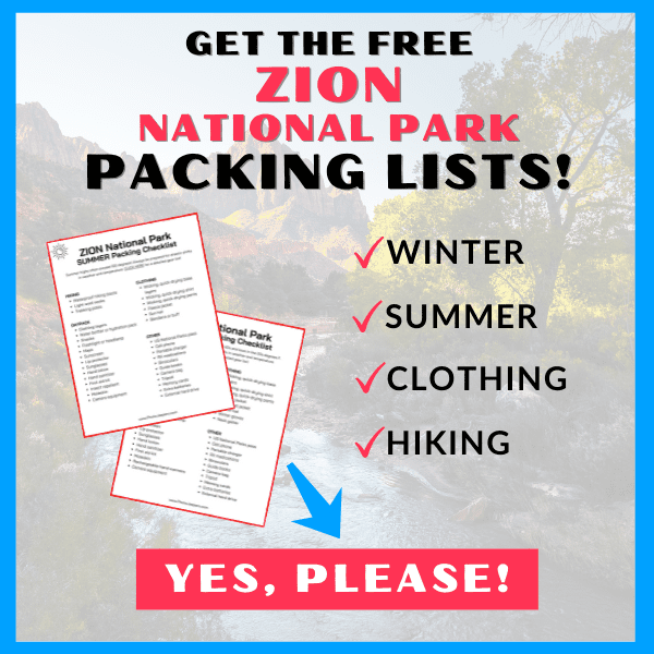
The tips we share here are based on our experience hiking at Zion National Park throughout the years! The first and most important tip is to make sure you have the right clothing and gear for the weather and temperatures when you’ll be visiting! Grab your free printable Zion National Park Packing List by clicking the image below!
This site contains affiliate links which means WE may receive commissions for purchases made through these links. We only provide links to products we actually use and/or wholeheartedly recommend! As an Amazon Associate, we earn from qualifying purchases. Read the full Disclosure Policy.
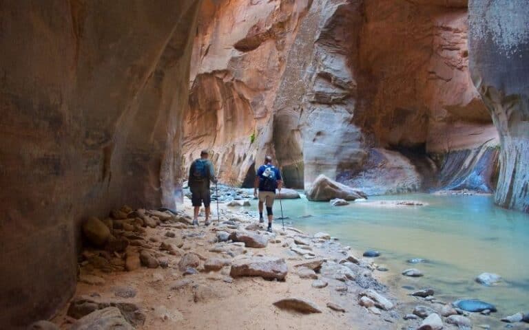
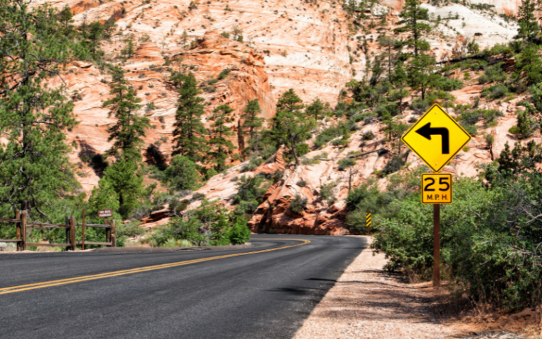
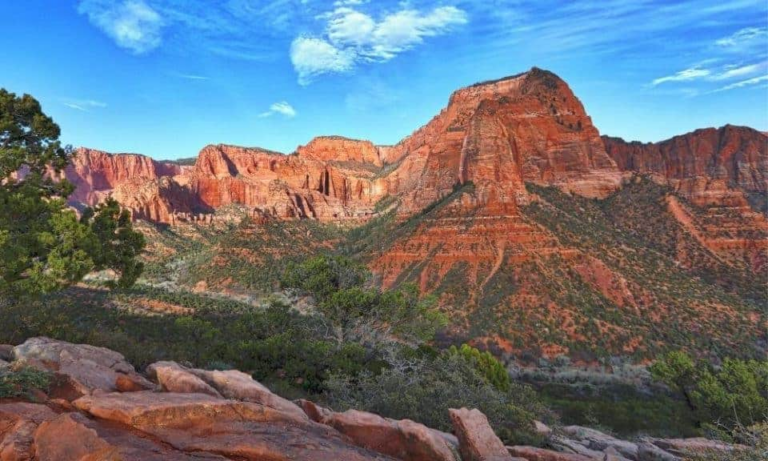
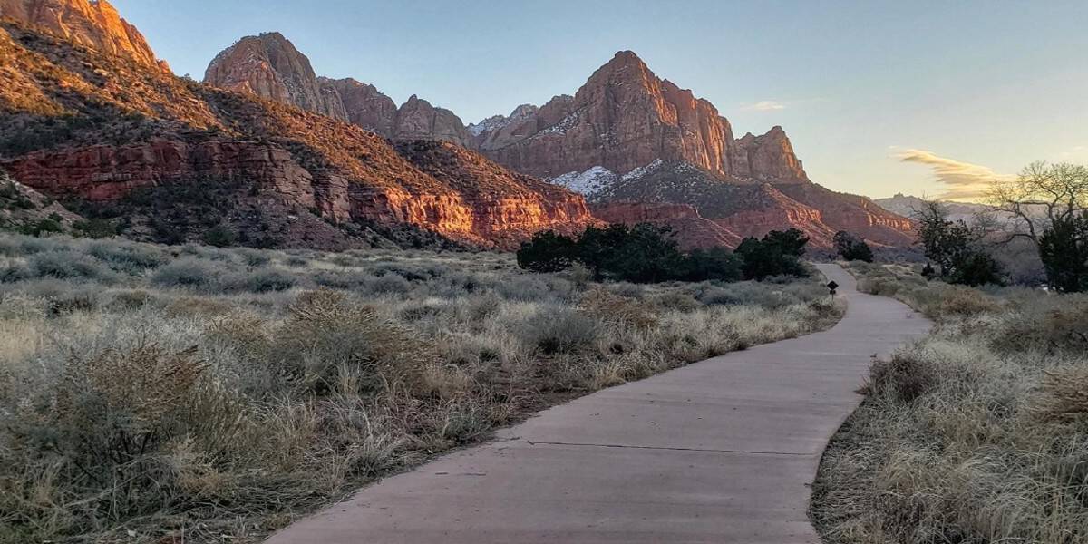
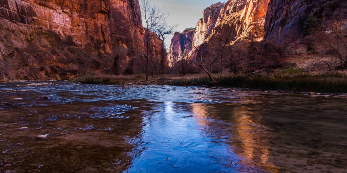
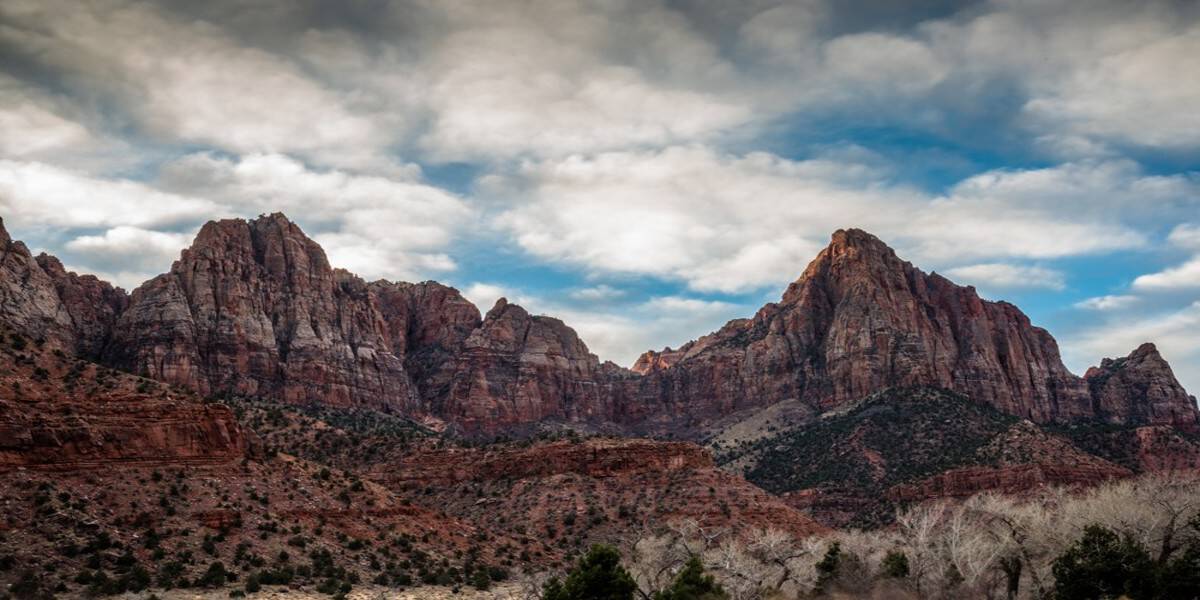
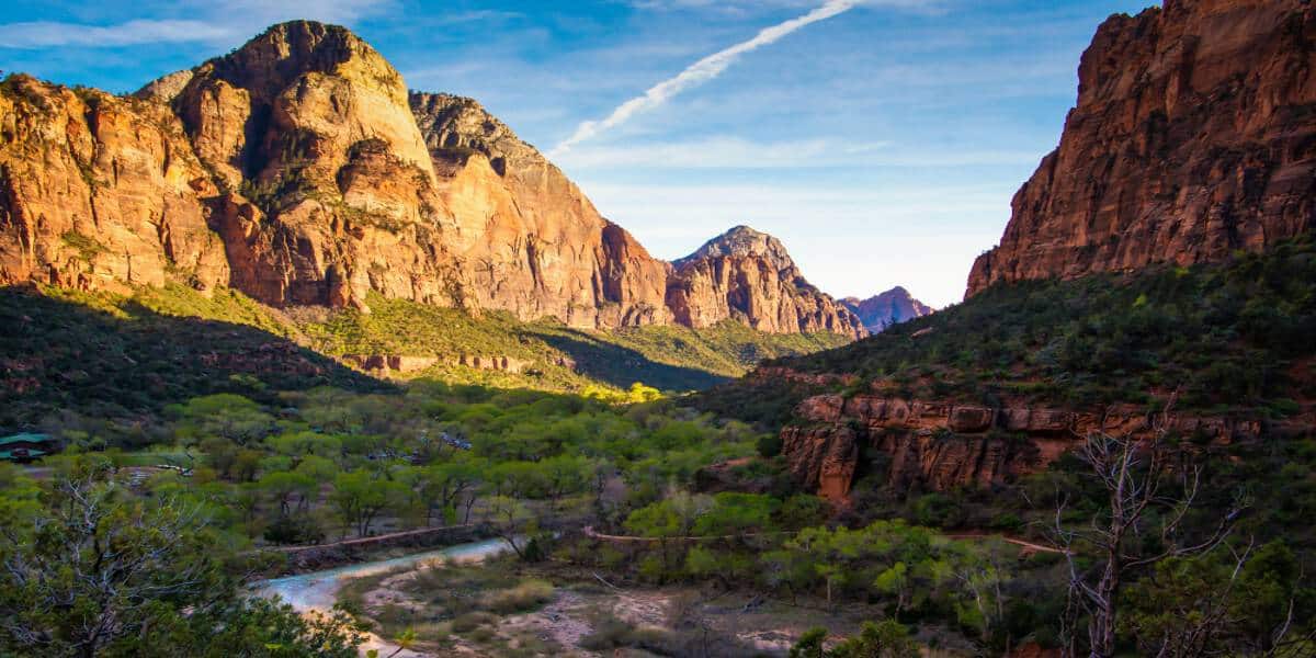
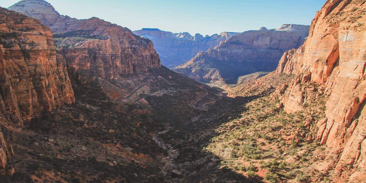
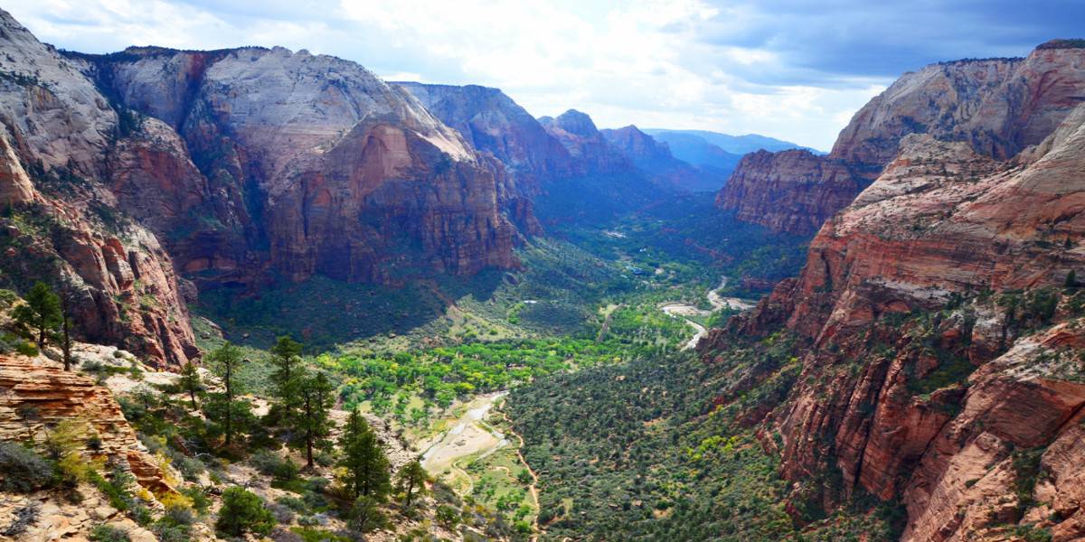
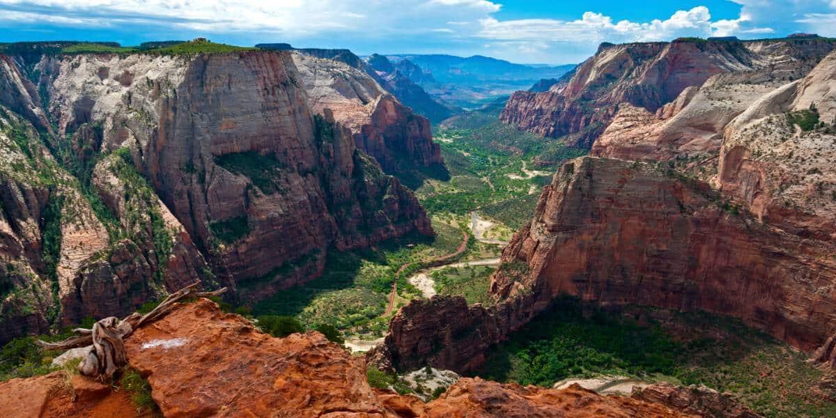
A Photo Tour of Zion National Park
Take a visual tour through Zion National Park to see the stunning landscapes you’ll see when you visit!
Important Things to Know About Zion National Park Hikes
Zion National Park hikes are some of the best in the entire world. It’s no surprise that this national park is the most visited Utah National Park since visitors cannot wait to explore all the magnificent hiking trails that Zion National Park has to offer.
If you’re looking for Zion national park vacation ideas, check out these world-famous hiking trails! With so many day hikes in Zion National Park to choose from, park guests can enjoy a multitude of one-of-a-kind experiences like sloshing through the Virgin River in the Narrows or braving exposed cliffs on Angel’s Landing. But every Zion National Park hiking trail offers amazing views of the red rock landscape that the park is known for.
Zion Hiking Permits
We highly recommend you check the Zion NPS website for the most updated information regarding the US National Parks Reservations required for the time you’ll be visiting. You will need permits to hike one of three trails in the park: Angels Landing, the Subway, and from the Narrows top-down. We’ll detail this more later in the article about hiking these specific trails.
Shuttle and Parking at Zion
From spring to fall (and during the Christmas holiday) most Zion Canyon hikes are accessible only by the park shuttle. Plan ahead to know the Zion National Park shuttle schedule and the shuttle stop near the trailhead.
Be sure to arrive early to find parking at Zion National Park, especially during peak summer season!
There are some fun Zion hikes without the shuttle found near the Visitor Center, along Highway 9, in the Kolob Terrace area, and the Kolob Canyon area.
Zion National Park Trail Conditions
Check current trail conditions at Zion for any trail closures that may be in effect. Zion National Park trails can close due to storm damage, falling rocks, or any other unsafe condition.
Best Time of Year to Hike in Zion
Hiking the trails of Zion National Park is amazing, but the area can be harsh and unforgiving when it comes to weather.
Zion National Park in the Spring: March, April and May at Zion: Springtime weather and temperatures are a perfect time to do some of the best hikes in Zion. But water levels in the canyons may be high which will close some of the hiking trails.
Zion National Park in the Summer: June, July and August at Zion: Summer is hot with temperatures over 100 degrees most of the time. It’s best to hike early morning or late evening.
Zion National Park in the Fall: September, October and November at Zion: Fall is the best time for Zion National Park hiking. There aren’t many storms, the temperatures aren’t extreme and water levels are low. These conditions make some of the best hikes in Zion safer and more enjoyable. And the fall colors in Zion Canyon are amazing to see in late October.
Zion National Park in the Winter: December, January and February at Zion: Winters in Zion National Park are cold and often wet. Temperatures can range from highs of 50-60°F during the day to lows well below freezing at night. When it snows, the roads may be plowed, but trails may close due to snow and ice.
Flash Flooding in Zion
Flash floods can be DEADLY! Therefore, learn all you can about flash floods before you explore any of the Zion National park hiking trails.
- Check the weather forecast and stop by the Visitor Center for up to date information
- Watch for changing weather and a buildup of clouds
- Heed warnings
- Be aware of areas that are likely to flood and avoid those areas
- Have a plan in case you encounter a flash flood
- Leave an itinerary with someone and check in when you are done
Leave no Trace
The #ZionPledge asks visitors to protect yourself and the park by:
- Plan ahead and prepare by reading and following the information in the park newspaper.
- Keep personal food away from all wildlife, and never approach or touch a wild animal.
- Protect the canyon walls, rocks, and trees from graffiti and vandalism.
- Preserve the park scenery by not collecting wildflowers, rocks, or plants.
- Never enter a narrow canyon when there is a potential for flash flooding.
- Be ready to pack out my human waste, toilet paper, and diapers from trails and river corridors.
- Stay on established Zion national Park trails to protect vegetation and fragile cryptobiotic soils.
- Leave rocks as I find them and not stack rock cairns or build river dams.
- Protect the natural sounds of the canyon by talking softly and using headphones for music.
- Recycle what I can and dispose of my trash and food appropriately.
- Park in designated areas and avoid blocking traffic.
Do your part to enjoy nature responsibly when enjoying any of the Zion National Park hiking trails.
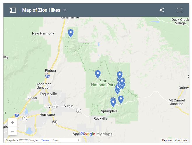
Map of Zion Hikes
Use this Map of Zion Hikes to navigate around the park.
List of Zion National Park Hikes
Zion National Park has easy, moderate, and strenuous hikes. Many of the hikes are found in Zion Canyon, but it’s the most crowded part of the park. There are many hiking trails outside Zion Canyon where you can find a bit more solitude.
Easy Hiking Trails at Zion National Park
Easy Zion National Park hikes trails range from 0.4 miles to 3.5 miles and gain no more than 100 feet in elevation. A few are wheelchair accessible with assistance. Since these are shorter hikes, they are the best options for those with a limited amount of time who want to see the amazing landscape of Zion.
- Pa’rus Trail
- Emerald Pools Trail
- Weeping Rock Trail
- Riverside Walk
Pa’rus Trail
- Shuttle Stop: #1 Visitor Center
- Pets: Yes
- Trailhead Location: Access is up the canyon from the Visitor Center and across the bridge adjacent to the South Campground. This trail can also be accessed from the Canyon Junction shuttle stop.
- Distance (roundtrip): 3.5 mi
- Elevation Change: 50 ft
- Estimated Hiking Time: 2 hours
- Accessible: Wheelchairs may need assistance.
- Services: Bathrooms and water filling stations are available at the Visitor Center.
The Pa’rus Trail is one of the best places to watch the red rock glow at sunset. Deer frequent the area as the path follows the Virgin River.
This is the only trail in Zion National Park that allows both pets (on a leash up to 6 feet) and bicycles.
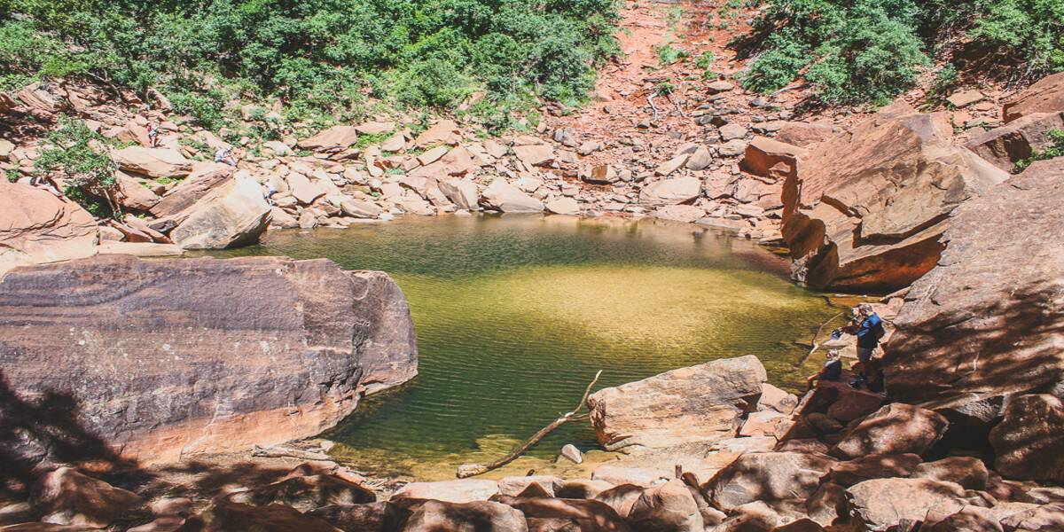
Emerald Pools Trail
- Shuttle Stop: #5 Zion Lodge
- Pets: No
- Trailhead Location: Across the road from the Zion Lodge.
- Distance (roundtrip): 1.2 mi
- Elevation Change: 69 ft
- Estimated Hiking Time: 1 hour
- Services: Bathrooms and water filling stations are available at the Zion Lodge.
This Zion National Park trail is officially listed as two: Lower Emerald Pools and Upper Emerald Pools, but it can easily be done as one leaving from Zion Lodge. This is a nice hike and a good way to fill a couple extra hours. It’s a pretty laid back trail and only has 269 feet of elevation gain between the two trails.
It’s a sandy trail leading to a few small pools of water that are, you guessed it, emerald in color. The upper pool is the coolest, and biggest, so definitely go to that one if you only have time for one.
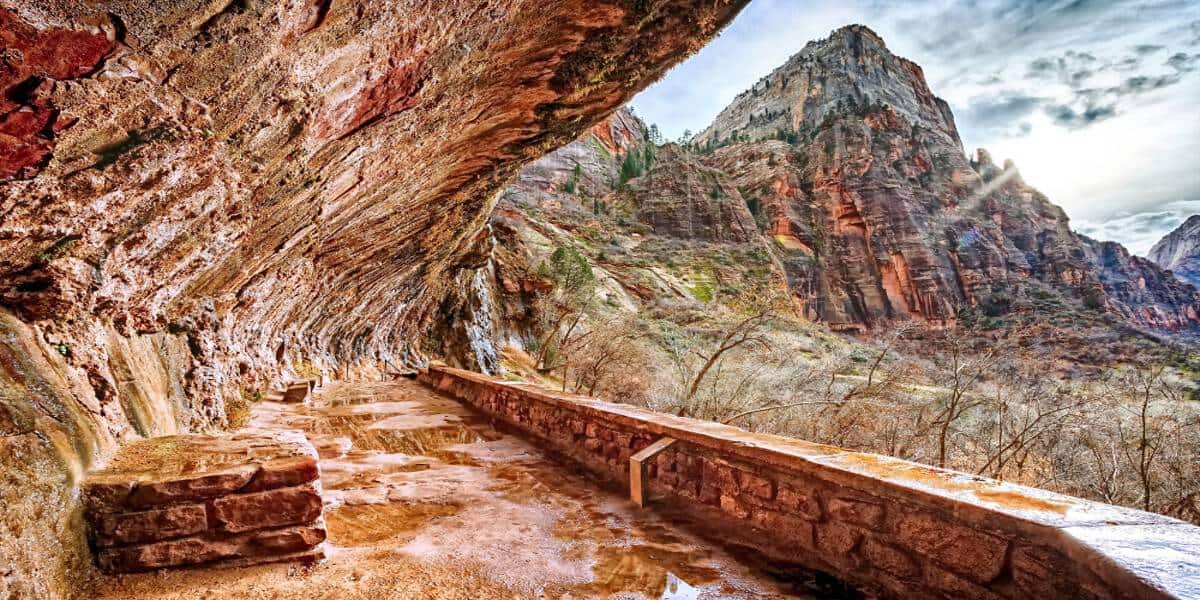
Weeping Rock Trail
- Shuttle Stop:#7 Weeping Rock
- Pets: No
- Trailhead Location: Across the bridge adjacent to the parking lot. Follow the signs to the left.
- Distance (roundtrip): .4 mi
- Elevation Change: 98 ft
- Estimated Hiking Time: 30 minutes
- Services: Pit toilets are available at the parking area.
Weeping Rock is a short but steep paved trail with minor drop-offs. It takes you to a rock alcove with dripping springs. There’s a terrific view of Temple of Sinawava.
During the rainy season, water cascades down the rock over the alcove which is a cool thing to see and photograph!
Riverside Walk
- Shuttle Stop: #9 Temple of Sinawava
- Pets: No
- Trailhead Location: Adjacent to bathrooms and water refill station.
- Distance (roundtrip): 2.2 mi
- Elevation Change: 57 ft
- Estimated Hiking Time: 1.5 hours
- Accessible: wheelchairs may need assistance.
The Riverside Walk is a paved Zion National Park trail that follows the Virgin River along the bottom of a narrow canyon. It’s a wonderful place to photograph the river and small waterfalls along the trail.
At the end of this trail, the bottom up Narrows trail begins. The Riverside Walk trail is one of the best hikes in Zion national Park. Therefore, it gets crowded so it’s best to do this in the morning or later in the day.
Moderate Hiking Trails at Zion National Park
These moderate day hikes at Zion National Park range from 1 mile to 7.6 miles and have larger elevation gains. Many of these trails offer magnificent views of Zion Canyon.
This list of moderate hikes requires extra planning:
- wear proper footwear
- carry enough water
- know the physical abilities necessary to successfully complete the hike
Watchman Trail
- Shuttle Stop: #1 Visitor Center
- Pets: No
- Trailhead Location: Up the canyon and across the road. Stay along the river to begin the trail.
- Distance (roundtrip): 3.3 mi
- Elevation Change: 368 ft
- Estimated Hiking Time: 2 hours
- Services: Bathrooms and water filling stations are available at the Visitor Center.
The Watchman trails has moderate drop-offs and ends where you can see the Towers of the Virgin, lower Zion Canyon, Watchman Peak, and Springdale. Read this Watchman Trail guide from The Modern Hiker for more details about this hike.
Kayenta Trail
- Shuttle Stop: #6 The Grotto
- Pets: No
- Trailhead Location: Across the street from the shuttle stop and then across the footbridge.
- Distance (roundtrip): 2.0 mi
- Elevation Change: 150 ft
- Estimated Hiking Time: 1.5 hours
- Services: Bathrooms and water filling stations are available at the Grotto.
The Kayenta Trail is an unpaved hike from the Grotto to the Emerald Pools with moderate drop-offs. The Modern Hiker has a good hiking guide for the Kayenta Trail. Be sure to take photos of the Zion Canyon as you hike along this trail.
Canyon Overlook Trail
- NOT accessible by shuttle
- Pets: No
- Trailhead Location: Located near the east entrance of the Zion-Mount Carmel Tunnel.
- Distance (roundtrip): 1.0 mi
- Elevation Change: 163 ft
- Estimated Hiking Time: 1 hour
- Services: Pit toilets are available in the parking area.
Canyon Overlook trail is short, a little challenging, has a great view at the end, and you might see bighorn sheep.
On the east side of the tunnel, right before the tunnel entrance, is the trailhead and parking for Canyon Overlook. There is a bit of a climb of elevation (163 feet total), but it’s nothing crazy and doesn’t last long. You’ll be making your way up into the canyon and eventually come to a little bridge leading to “the cave” before making the push to the final overlook.
The trail is pretty straightforward with very minimal rock scrambling. At the end, you have a fabulous view overlooking Echo Canyon, where you just (most likely) drove up from. You can also see the window holes from the tunnel off to the left.
To enter or exit the parking area just east of the tunnel, you must turn right. Parking is extremely limited, so do this early morning or be prepared to circle around many times to grab a spot.
The best time to hike the Canyon Overlook trail is before sunrise so you avoid the crowds and can take amazing photos of the sun lighting the distant mountain peaks!
Strenuous Hiking Trails at Zion National Park
The strenuous Zion National Park trails range from 2.5 miles to 9.4 miles and have elevation gains of up to 2,148 ft. These trails are physically challenging, and some can be even be mentally challenging as you must walk along steep cliffs holding onto chains for safety.
Strenuous trails require preparation and planning. During the summer you battle extreme heat, thunderstorms, and rain which can bring flash floods. Always check the current weather conditions and plan accordingly. Your safety is your responsibility.
Angel’s Landing
- Shuttle Stop: #6 The Grotto
- Pets: No
- Trailhead Location: Across the road from the shuttle stop and then across the footbridge.
- Distance (roundtrip): 5.4 mi
- Elevation Change: 1,488 ft
- Estimated Hiking Time: 4 hours
- Services: Bathrooms and water filling stations are available at the Zion Lodge.
If there’s one hike everyone knows about in Zion, it’s Angels Landing. One of the best hikes in Zion National Park starts off at The Grotto and follows the Virgin River before climbing the side of the cliff via 21 switchbacks known as Walter’s Wiggles.
Hiking permits for Angel’s Landing are required year-round for the chains section – you can hike to Scouts Landing and back without a permit.
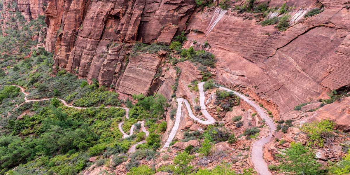
At the top of the switchbacks, you’ll end up at Scout’s Landing, which can be a good stopping point if you have a strong fear of heights. From there to the top, you follow a narrow ridge with steep drop-offs on either side. There is a chain to hold onto on the way up.
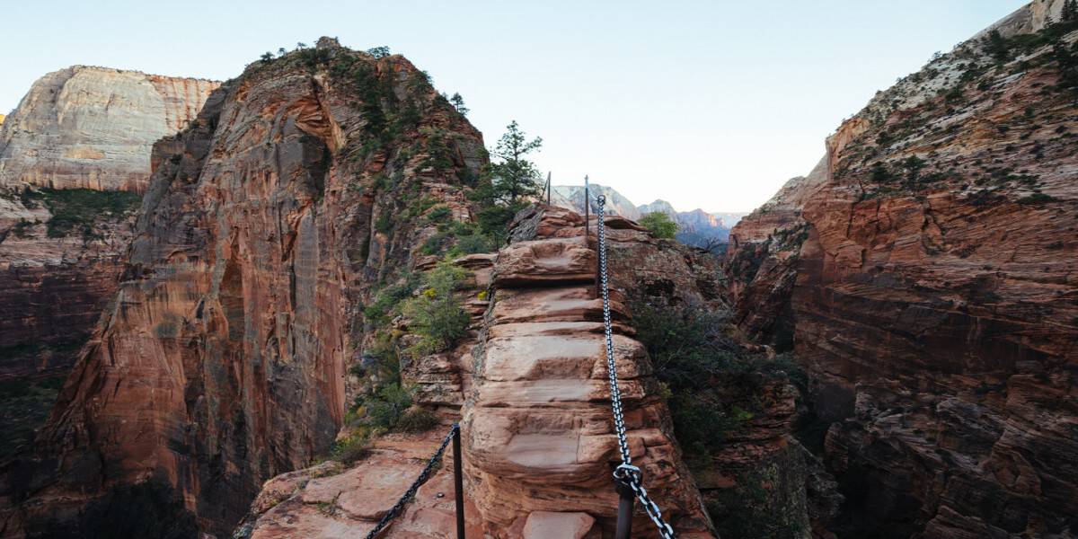
There isn’t much room on the final part of this trail, so if you’re very nervous, have terrible balance, or just hate heights, you may want to reconsider the push to the top. The views are still pretty stellar from Scout’s Landing.
Hidden Canyon
- Shuttle Stop: #7 Weeping Rock
- Pets: No
- Trailhead Location: Access the East Rim Trail from across the footbridge adjacent to the parking lot. The Hidden Canyon Trail turns right from the East Rim Trail at the sign.
- Distance (roundtrip): 2.5 mi
- Elevation Change: 850 ft
- Estimated Hiking Time: 2.5 hours
- Services: Pit toilets are available at the parking area.
The Hidden Canyon trail starts at Weeping Rock, along with Observation Point. You climb the same steep switchbacks before making your way around the outside of the cliff and into the canyon itself. If you’re looking for crazy views, skip this one as it’s more of a cozy canyon that you end up in.
There are some exposed cliffs on one side as you make your way around the cliff, but there are chains most of the way around. The trail can get a little slippery with loose sand on the rock, so be careful of that. Once you get around the cliff, the maintained trail ends, but you can continue a little more.
You have to do a little scrambling over rocks and boulders. None of it is terribly difficult, but remember, it can be harder to get back down, so if you don’t feel comfortable climbing up, don’t force yourself to.
After the first boulder scramble, the canyon almost has the feel of a slot canyon, but is more open. There are some open sandy areas and other areas covered in moss.
About halfway through this Zion National Park trail, there is an arch off to the right marked with a few little cairns. The trail ends shortly after that and you just have to turn back around.
Observation Point
- Shuttle Stop: #7 Weeping Rock
- Pets: No
- Trailhead Location: Access the East Rim Trail from across the footbridge adjacent to the parking lot. The Observation Point Trail branches off of the East Rim Trail after approximately 2.5 miles.
- Distance (roundtrip): 8.0 mi / 12.9 km
- Elevation Change: 2,148 ft / 655 m
- Estimated Hiking Time: 6 hours
- Services: Pit toilets are available at the parking area.
The view at the end of the Observation Point trail rivals the view at Angel’s Landing. It actually overlooks Angel’s Landing.
This Zion National Park trail starts at the Weeping Rock stop and takes you up some steep switchbacks.
The entire trail can be quite tough, but it is paved. If you don’t like heights, but don’t mind a longer hike, this is a good alternative to Angel’s Landing because it doesn’t have the same exposed cliffs.
The last mile on the rim of the canyon is mostly flat, offering relief from the steep climb up. The hike back down is the same way you came from. It can be tough on knees, so take your time getting back down. I would definitely do this one if you have a full day, are in relatively good shape, and like stellar views.
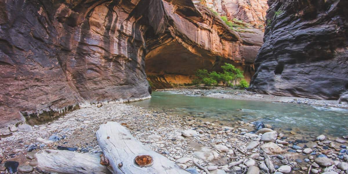
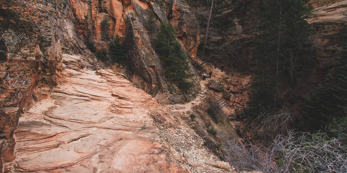
The Narrows
- Shuttle Stop: #9 Temple of Sinawava
- Pets: No
- Trailhead Location: Adjacent to shuttle stop and restrooms.
- Distance (roundtrip): 16 mi
- Elevation Change: 334 ft
- Estimated Hiking Time: 8 hours
The Narrows is the other trail everyone knows when you mention Zion National Park hikes. This trail starts at the end of the Riverside Walk and takes you into the Virgin River with canyon walls towering above you on both sides.
Narrows hiking permits are required if you want to travel the full 16-mile trail. Most people only hike in a couple of miles before turning around. This is a one-of-a-kind hike that you should definitely do, at least part of if you have a chance.
This trail gets pretty packed during the day in the summer, so we recommend going early in the morning or going in mid-day and heading out in the evening when it empties out.
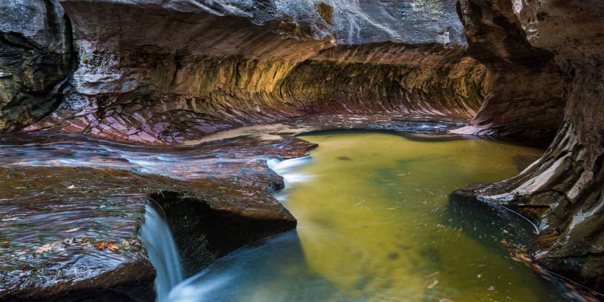
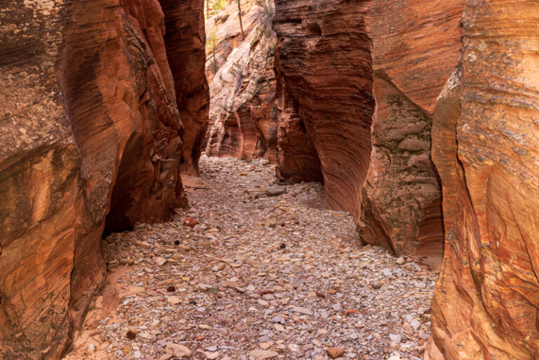
The Subway
- Distance: 9-9.5 miles
- Time: Full day
The Subway is another top Zion hike, but can only be done if you land one of the few permits available. A Subway hiking permit is required if you want to do the Left Fork North Creek section. There is a lottery in advance as well as a last minute lottery so this one can take some planning to do.
Located on Kolob Terrace Road, you can either hike this bottom-up or top-down. The top-down route requires ropes and rappelling experience, while bottom-up does not, but it is very difficult.
Either way, you’ll need extensive route finding skills. You’ll also need to cross creeks, swim through cold, debris-filled pools, and scramble over boulders. This is another one of a kind hike and can be compared to the Narrows, but more intense. The highlight is a tunnel-like area reminiscent of a subway tunnel, giving the tits it’s name.
You will also need two cars or a shuttle for this since the beginning and end of the trail are far apart.
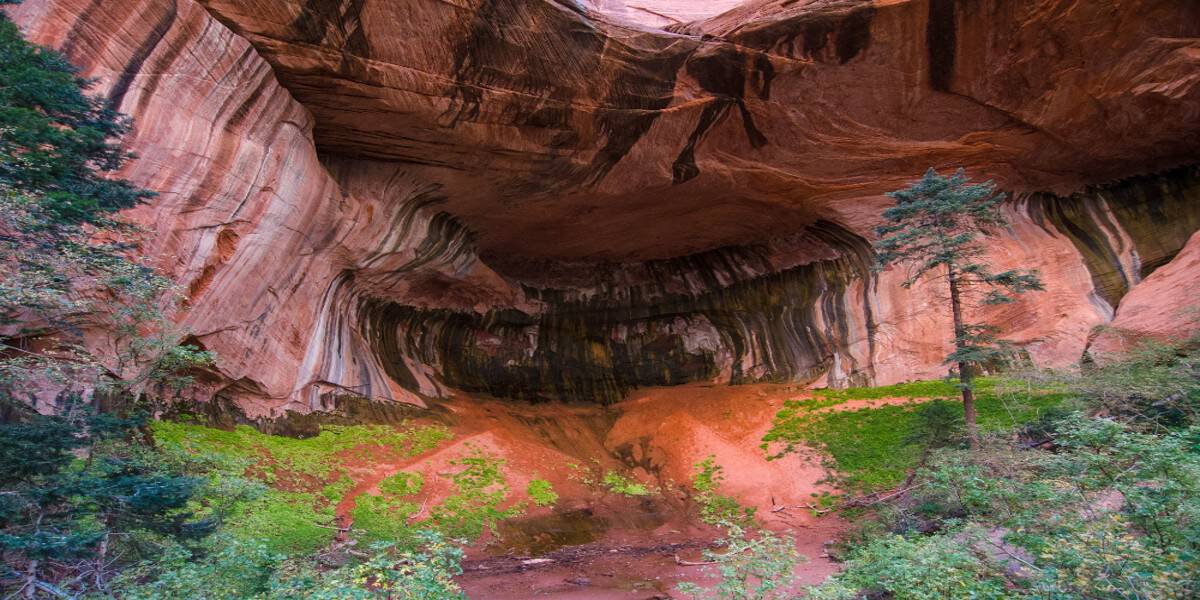
Kolob Canyon Taylor Creek Trail
The hiking trails at the Kolob Canyon section of Zion are a great way to escape the crowds you find near Springdale.
- Average Hiking Time: 4 hours roundtrip
- Roundtrip Distance: 5.0 miles
- Elevation Change: 450 feet
- Group Size Limit: 12 people or less*
- Services: Restrooms at the trailhead
The Taylor Creek trail is accessed in the Kolob Canyons section of Zion. It takes about 45 minutes to drive here from the main canyon section of Zion.
This hike is the only one outside Zion Canyon that doesn’t require a permit. The Zion Wilderness in Kolob Canyons is a totally different experience and landscape from the rest of the park. This is easily one of my favorite hikes in the park now.
The trailhead is on the left, not too far from the entrance. It’s a nice, leisurely hike walking along and crossing over Taylor Creek. It starts out pretty open and eventually, leads you into the canyon. There are two little cabins along the trail that could make good stopping points if you didn’t have time for the whole trail. The maintained trail ends at the Double Arch Alcove which is the highlight of this Zion hike.
*Large groups result in larger impacts. All groups traveling in the Zion Wilderness must follow the group size limit for that area. Group size limits are strictly enforced. Permits will be denied and violators will be cited if limits are exceeded.
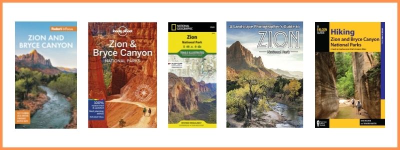
BUY ZION GUIDES & MAPS AT AMAZON
Where to Stay Near Zion National Park
You definitely want to stay in Springdale which borders the entrance to Zion.
- Places to Stay at Zion National Park
- Camping in Zion National Park
- RV Parks near Zion National Park
- Glamping Near Zion National Park
- Cabins Near zion National Park
- Holiday Inn Express – our favorite place to stay with an outdoor pool and amenities you’d find in a high end hotel
- Zion Lodge – we haven’t had a chance to stay here yet, but you can’t go wrong staying right IN the park!
- Under Canvas Zion – if you want to experience a less crowded part of Zion, this is the place! It’s in the Kolob section of the park.
- Vacation Rentals in Springdale – you’ll want to stay in Springdale so you’re close to the park entrance and can walk to shopping and restaurants.