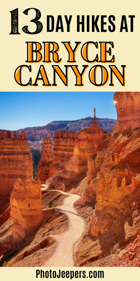
Best Day Hikes at Bryce Canyon National Park
Bryce Canyon encompasses over 35,000 acres of picturesque expansive views! Exploring the day hikes at Bryce Canyon is the best way to experience this National Park in Utah!
Most day hikes and their trailheads are found in the Bryce Amphitheater area. You’ll find that many Bryce Canyon hikes connect to create longer combinations of hiking trails.

This Use this Bryce Canyon travel guide includes what to wear for the hike, what to pack in your day bag, best time of year for hiking, and trail descriptions.
We live a few hours away from Bryce Canyon so we get to visit often, and know what it’s like to hike during all four seasons. It’s important to stay hydrated, use sun protection, and get the latest weather information before hitting the trails any time of year.
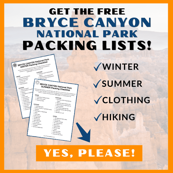
The tips we share here are based on our experience hiking at Bryce Canyon National Park throughout the years! The first and most important tip is to make sure you have the right clothing and gear for the weather and temperatures when you’ll be visiting! Grab your free printable Bryce Canyon Packing List by clicking the image below!
This site contains affiliate links which means WE may receive commissions for purchases made through these links. We only provide links to products we actually use and/or wholeheartedly recommend! As an Amazon Associate, we earn from qualifying purchases. Read the full Disclosure Policy.
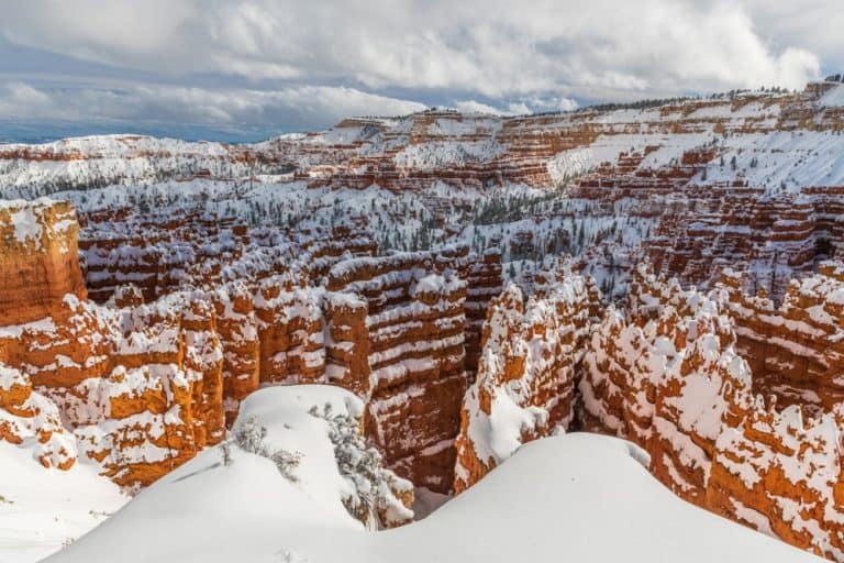
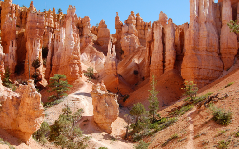
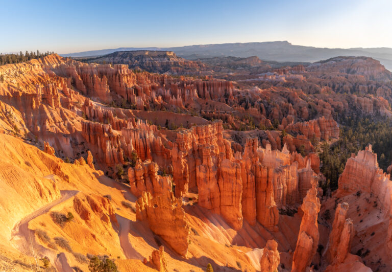
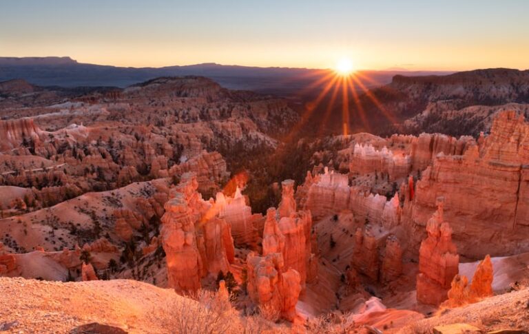
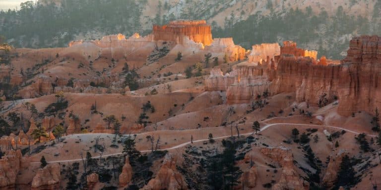
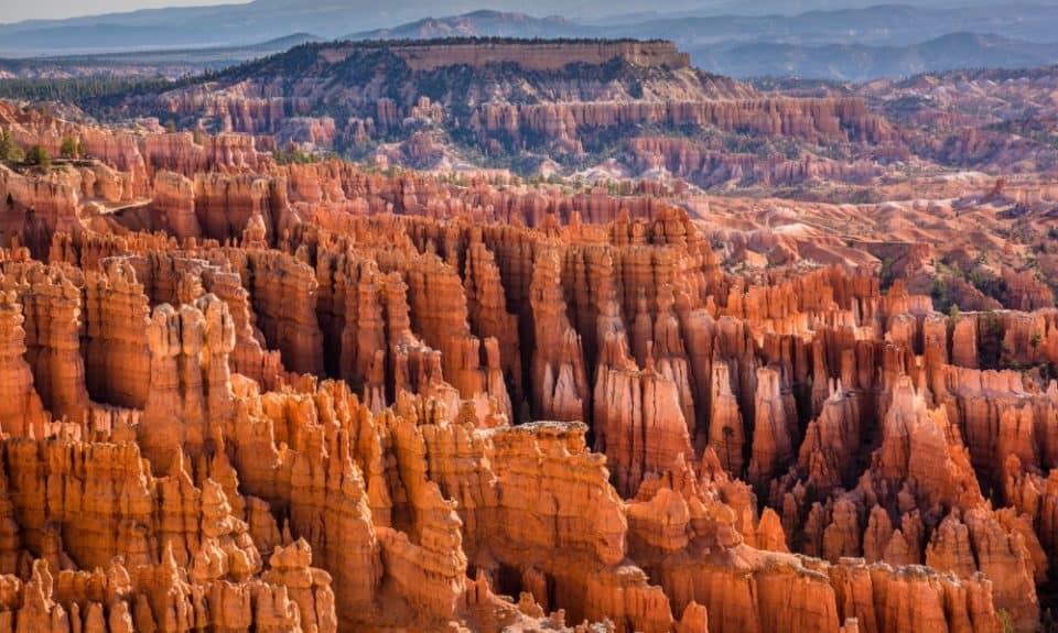
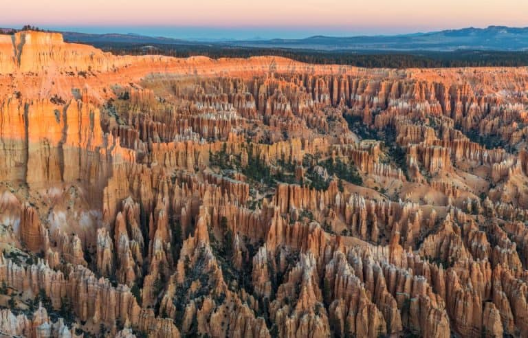
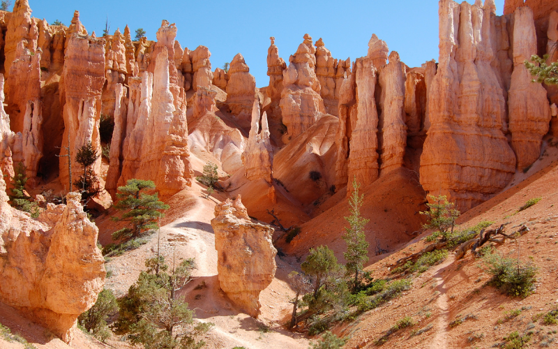
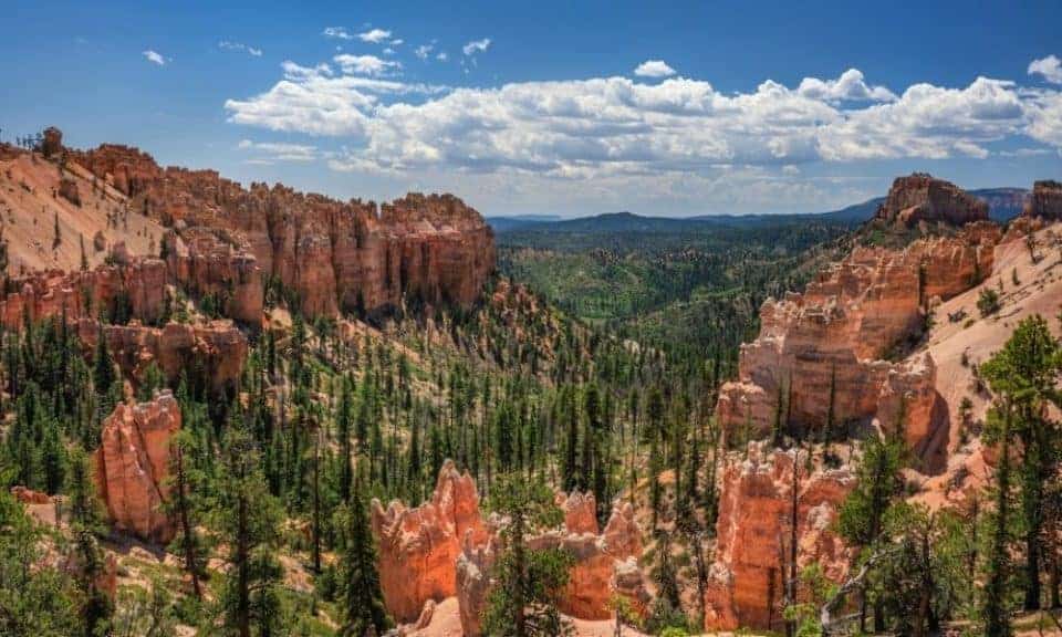
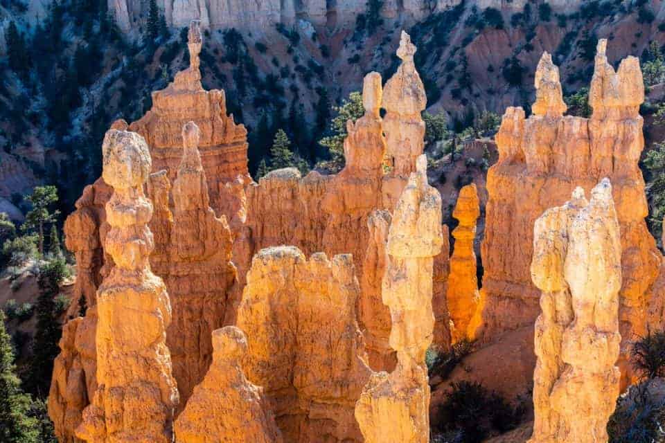
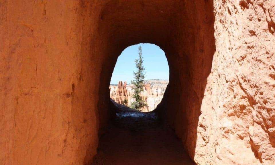
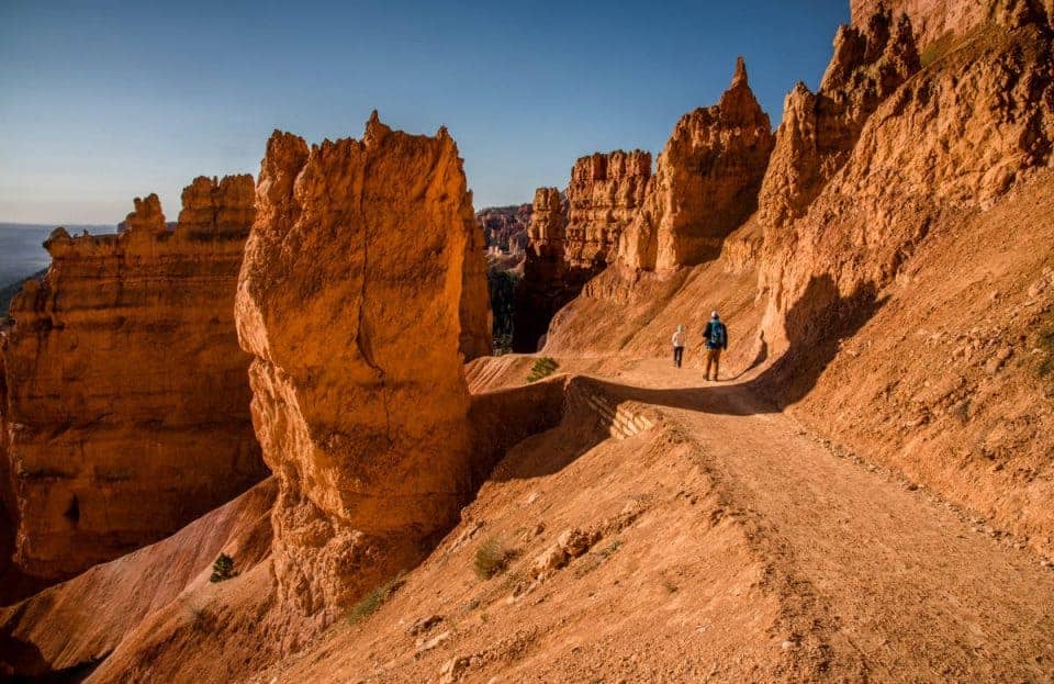
A Photo Tour of Bryce Canyon National Park
Take a visual tour through Bryce Canyon National Park to see the stunning landscapes you’ll see when you visit!
Hiking at Bryce Canyon: Know Before You Go
One of the most popular Bryce Canyon activities is hiking. It’s important to know what to expect before hitting the trail.
We always recommend you talk to a park ranger to get the most updated information about trail conditions and weather.
Bryce Canyon elevation: You’ll be over 9,000 feet in the park. Many visitors can feel light-headed and nauseated with just mild exertion. Keep in mind that most hikes at Bryce Canyon begin by going DOWN and end with a climb back UP. Leave yourself enough energy for your return trip.
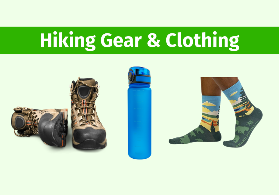
Wear hiking boots, not sneakers: Trust us, you want to wear hiking boots with good “lug” traction and ankle support. Along with altitude-related illnesses, ankle injuries are the park’s number one injury. When visiting Bryce Canyon in the winter, you’ll want traction devices and ski poles for extra grip and support.
Water and sun protection: Carry plenty of water; 1 quart per 2-3 hours of hiking for each person. You’ll want sun protection year-round: lip balm with UV protection, sunscreen, and a sunhat.
Stay on maintained trails: Do not use “social” trails or climb on hoodoos. These social trails contribute to plant death, aggressive erosion, and visitor/wildlife confrontations including rattlesnakes. It’s always best to obey Leave No Trace principles.
Hiking with pets: Pets at Bryce Canyon are only allowed on paved trails and viewpoints, roads, campsites, and picnic areas. The 0.5 mi section of Rim Trail between Sunset and Sunrise Points and the Shared-Use Bike Path are the only paved trails at Bryce Canyon. Pets must be leashed at all times and you are required to clean up after your pet. Dog owners looking for hoodoos and dog-friendly trails should consider visiting nearby Red Canyon, which is managed by the U.S. Forest Service.
Bryce Canyon weather: Lightning at Bryce Canyon is a year-round danger, especially during the summer monsoon season. If you can hear thunder, lightning is within 10 miles and you need to seek the shelter of a building or your vehicle immediately. Bryce Canyon National Park weather varies from season to season, and even month to month.
- Bryce Canyon in the Spring
- Bryce Canyon in the Summer
- Bryce Canyon in the Fall
- Bryce Canyon in the Winter
Bryce Canyon winter hiking: Before visiting Bryce Canyon National Park, you’ll need to review the road conditions, closures, and weather for the time you’ll be at the park. Your packing list should definitely include winter gear for hiking in the snow at Bryce Canyon.
Traction devices are recommended for all Bryce Canyon winter hikes. They can be rented in Bryce City if you don’t bring your own. We also recommend you talk to a park ranger to get the most updated information about trail conditions and weather. Some trails close in the winter due to unsafe conditions.
Day hiking resources: Check out this list of resources for day hikes, hiking with kids, and camera gear to carry along!
Bryce Canyon Hike the Hoodoos
The Hike the Hoodoos program at Bryce Canyon is a fun way to explore the hiking trails in the park. You must hike at least 3 miles on designated trails to find benchmark survey markers.
To prove you hiked the trails, you can obtain rubbings of the benchmarks or take a selfie with the benchmark. Present the rubbings or photos to the Visitor Center ranger to receive a special reward!
There are nine Hike the Hoodoos benchmarks found along eight day hiking trails at Bryce Canyon:
- Mossy Cave
- Bristlecone Loop
- Queen’s Garden
- Navajo Loop
- Tower Bridge
- Swamp Canyon Loop
- Peekaboo Loop
- Fairyland Loop
Best Day Hikes at Bryce Canyon National Park
Bryce Canyon has several day-hiking trails to meet all abilities. You’ll find easy, moderate, and strenuous Bryce Canyon hikes.
Many of the basic trails at Bryce Canyon can be connected to create a combination of two or more of these basic trails. The popular Navajo Loop Queen’s Garden Trail is an example of connecting the Navajo Loop trail with the Queen’s Garden Trail to create a longer combined hike.
Most day hikes and their trailheads are found in the Bryce Amphitheater area.
Sunset to Sunrise Trail
- Distance: 1.0 mile roundtrip
- Hike length: 1 hour
- Hike difficulty: Easy
- Trailhead Location: Sunset Point Parking Lot
The Sunset to Sunrise Rim Hike is one of the best 3asy hikes at Bryce Canyon National Park. You can also hike it in reverse from Sunrise to Sunset Point.
From the trail you’ll see staggering Bryce Canyon views along the amphitheater rim.
- The Sunset to Sunrise trail is wheelchair and stroller accessible.
- It is suitable for adults and children in all fitness levels.
- This is the only trail at Bryce Canyon where dogs are permitted.
Rim Trail
- Distance: 5.5 miles one way – shorter options available
- Hike length: 1 to 7.5 hours
- Hike difficulty: Easy
- Trailhead Location: Fairyland Point Parking Lot
The Rim Trail at Bryce Canyon National Park is a great trail for anyone who can’t hike DOWN and back UP the canyon. You can start from Fairyland Point hiking to Bryce Point, or the other way around.
Bryce Point is our favorite Bryce Canyon sunrise photography spot. Start your day taking photos then hike to Fairyland Point!
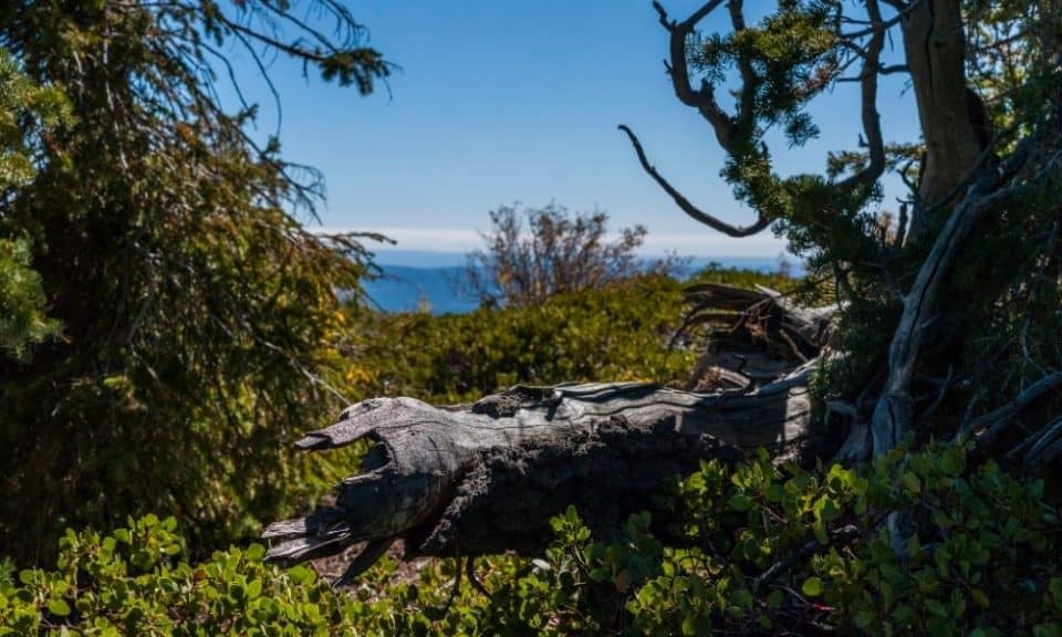
Bristlecone Loop Trail
- Distance: 1.3 miles roundtrip
- Hike length: 1 hour
- Hike difficulty: Easy
- Trailhead Location: Rainbow Point Parking Lot
At the end of the Bryce Canyon scenic drive, you will find the Bristlecone Loop. This trail is easy and smooth and suitable for children and adults at all fitness levels.
The views of Bryce Canyon along Bristlecone Loop trail are amazing. You’ll enjoy being surrounded by the Bristlecone Pine trees with shade and fresh air!
Highlights:
- A century-old Bristlecone Pine tree is found on this trail.
- The parking lot for Rainbow Point and the Bristlecone Loop is small and does fill up. But many only stay long enough to look at the viewpoint so spots will open up regularly.
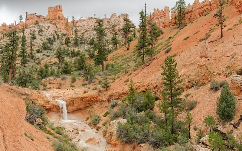
Mossy Cave Trail
- Distance: 0.8 miles roundtrip
- Hike length: 1 hour
- Hike difficulty: Easy
- Trailhead Location: From the Visitor Center, drive 4 miles north on UT 63 (main park road) to SR 12. Turn right and drive 3.5 miles east. Parking will be on the right hand side. Do not park along the shoulder of SR 12. If the parking lot is full, return to hike at another time.
Being one of the most accessible trails, the Mossy Cave Trail is often one of the most visited so arrive early or later in the day to avoid the crowds. During the winter, Mossy Cave may have large ice formations.
This easy and fun short hike at Bryce Canyon follows the river and you’ll see the Tropic Ditch waterfall. Visitors are permitted in the water, but only enter and exit at bridge crossings to reduce social trails elsewhere.
Mossy Cave is a fee area, like the rest of the park. Keep your park pass or proof of admission with your vehicle for rangers to inspect.
Queen’s Garden Trail
- Distance: 1.8 miles roundtrip
- Hike length: 1 to 2 hours
- Hike difficulty: Moderate
- Trailhead Location: Sunrise Point Parking Lot
The Queen’s Garden Loop is a short, steep trail that starts at Sunrise Point. Remember the trail going down the canyon may not seem too difficult, but don’t forget you’ll need to hike back up this same trail!
This trail earned its name because of the iconic Queen Victoria hoodoo. The resemblance of the spire to a carved-out Queen is visibly apparent.
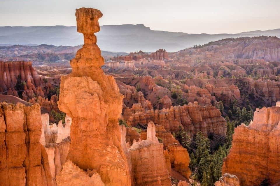
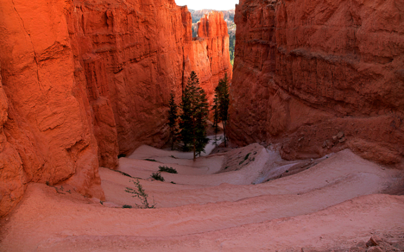
Navajo Loop Trail
- Distance: 1.3 miles roundtrip
- Hike length: 1 to 2 hours
- Hike difficulty: Moderate
- Trailhead Location: Sunset Point Parking Lot
Along the Navajo Loop Trail you’ll see three famous formations: Thor’s Hammer, Wall Street, and Two Bridges.
We HIGHLY recommend taking this trail down to at least Thor’s Hammer so you can experience seeing the hoodoos and windows up close. That way, the climb back up isn’t as long compared to going down to the canyon floor.
The slot canyon-style narrowness of Wall Street is a famous attraction in the park, but it’s usually closed until summer when the trail is no longer dangerous due to falling rock.
Navajo Queen’s Garden Combination Trail
- Distance: 2.9 mile point to point
- Hike length: 2 to 3 hours
- Hike difficulty: Moderate
- Trailhead Location: Sunrise/Sunset Point Parking Lot
The combination Navajo Loop Queen’s Garden trail is a popular day hike at Bryce Canyon. This is one must-do hike we love! We like to start at Sunset Point where the steep descent is easier going down. The ascent back up the canyon at Sunrise Point isn’t as steep. You can start and end at either point.
Highlights:
- The trail is home to a famous 400-year-old Douglas Fir in the Wall Street portion of the trail.
- Look for geological formations called windows and fins can be found along the trail.
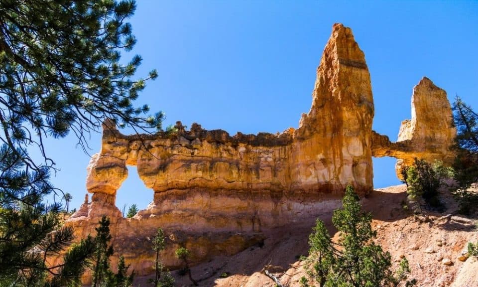
Tower Bridge Trail
- Distance: 3.0 miles round trip
- Hike length: 2 to 3 hours
- Hike difficulty: Moderate
- Trailhead Location: Sunrise Point Parking Lot
Along the Tower Bridge trail at Bryce Canyon you’ll see panoramic views of arches, hoodoos, and red rocks.
Starting at Sunrise Point the trail drops in elevation from the rim down to Tower Bridge. You can return the way you came back to Sunrise Point or continue along the Fairyland Loop Trail (8 miles total).
Highlights:
- Some of the views you can see include the China Wall and the Sinking Ship.
- Climbing up to the bridges is strictly prohibited. If you want to enjoy views from multiple perspectives, please stay on the trail.
Sheep Creek / Swamp Canyon Loop Trail
- Distance: 4.0 mile loop
- Hike length: 3 to 4 hours
- Hike difficulty: Moderate
- Trailhead Location: Drive south along the Bryce Canyon scenic drive. The Sheep Creek or Swap Canyon trailhead is located on your left side.
The Sheep Creek or Swamp Canyon trail was formerly used for moving sheep around to different grazing areas. You’ll hike through a lush meadow area surrounded by Ponderosa pines.
This loop trail is less popular than others in the park so it’s a great way to escape the crowds.
Fairyland Loop Trail
- Distance: 8.0 miles point to point
- Hike length: 4 to 5 hours
- Hike difficulty: Strenuous
- Trailhead Location: Fairyland Point Parking Lot
The Fairyland Loop is considered strenuous for most hikers due to its length, complicated trail, and intensity of elevation changes. Located at the northern portion of Bryce Canyon, it’s a great way to escape the crowds.
You’ll enjoy views of the China Wall, Tower Bridge, and an extensive collection of hoodoos along with other unique geological features in the park.
Peekaboo Loop Trail
- Distance: 5.5 miles
- Hike length: 3 to 4 hours
- Hike difficulty: Strenuous
- Trailhead Location: Bryce Point Parking Lot
The Peekaboo Loop is a strenuous hike due to its length and steep and roller coaster-like ups and downs along the trail.
The views along the trail are amazing where you’ll see up close Bryce’s hoodoos, The Cathedral, Fairy Castle, and Wall of Windows. The Peekaboo Loop earned its name from the windows (natural arches) formed in the rocks found in the area.
NOTE: Please be courteous when meeting horse/mule riders on the trail and give them right-of-way.
Navajo/Peekaboo Combination Loop Trail
- Distance: 4.9 mile loop
- Hike length: 3 to 4 hours
- Hike difficulty: Strenuous
- Trailhead Location: Sunset Point Parking Lot. Head straight down into the canyon and take the sign labeled as “Wall Street” to start the Navajo Loop.
Starting at Sunset Point, the Navajo/Peekaboo Combination Loop is a strenuous hike with a series of steep switchbacks and elevation changes.
The Figure 8 Combination
- Distance: 6.4 miles loop
- Hike length: 4 to 5 hours
- Hike difficulty: Strenuous
- Trailhead Location: Sunset Point Parking Lot
The Figure 8 Combination Trail combines Queen’s Garden, Peekaboo Loop, and Navajo Loop. The steep grades and multiple elevation changes make the Figure 8 Combination Trail a strenuous one.
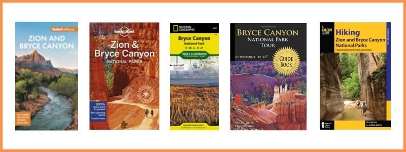
Check Amazon for: Bryce Canyon Guides and Maps
Bryce Canyon Itineraries
We’ve put together our favorite Bryce Canyon National Park Itineraries for 1, 2, or 3 days in the park! Grab a free copy by clicking the graphic below. Click on the links to read the detailed itinerary for Bryce Canyon based on the time you have to spend at the park!
- Bryce Canyon National Park One Day Itinerary
- Two days in Bryce Canyon National Park
- Three Days in Bryce Canyon National Park