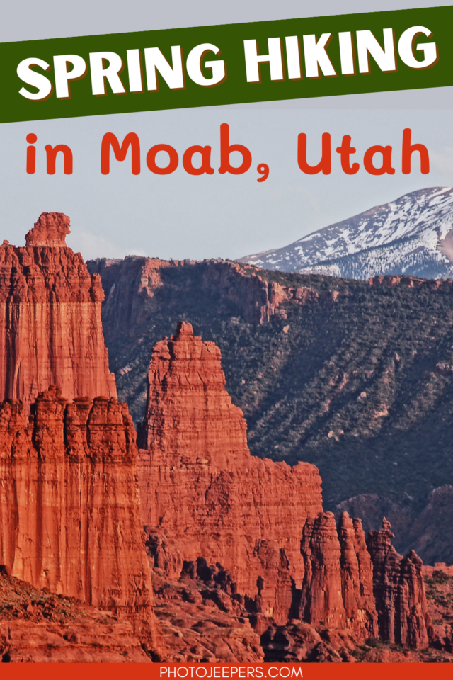
Moab Spring Hikes + Travel Tips
Visiting Moab in the spring is a great way to experience the beauty of this stunning desert oasis. There are amazing Moab spring hikes to explore the hiking trails in two National Parks, one State Park, and on BLM land.
Use this Moab Utah Vacation Guide to plan your spring trip: hiking trails, weather, what to pack, where to stay and more!
Hiking in Moab is a terrific way to see and photograph this scenic area filled with sandstone arches, pinnacles, petroglyphs and even dinosaur prints!
This list of Moab spring hikes details the distance, time, elevation gain, and important information about what it’s like to hike each trail.
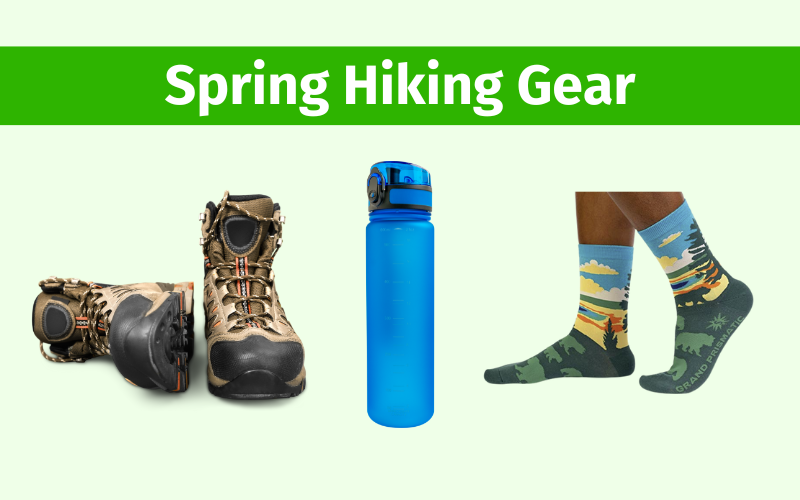
Use our Moab, Utah packing list to make sure you have the right clothing and gear for hiking in the spring! Grab your free printable packing checklist by clicking the image below!

This site contains affiliate links which means WE may receive commissions for purchases made through these links. We only provide links to products we actually use and/or wholeheartedly recommend! As an Amazon Associate, we earn from qualifying purchases. Read the full Disclosure Policy.
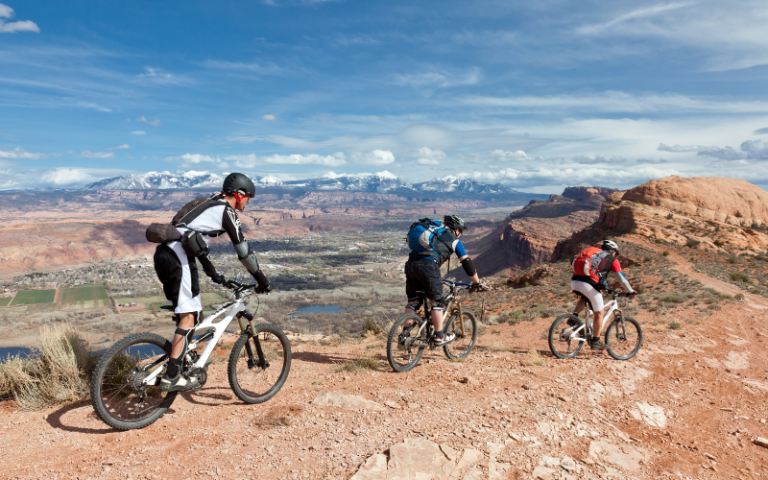
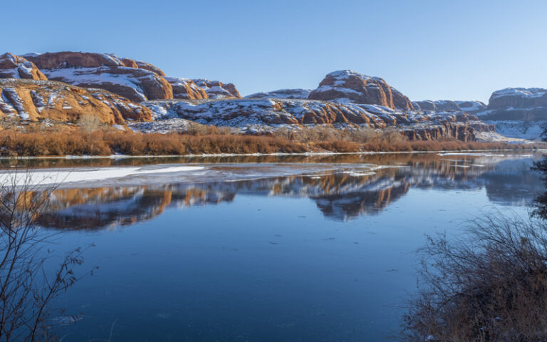
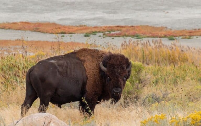
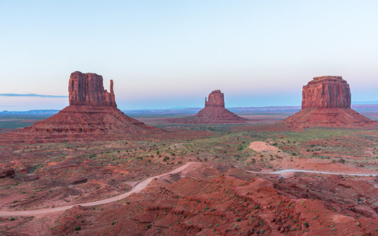
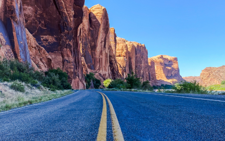
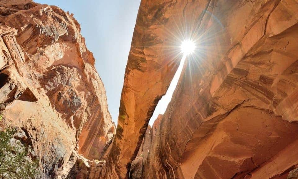
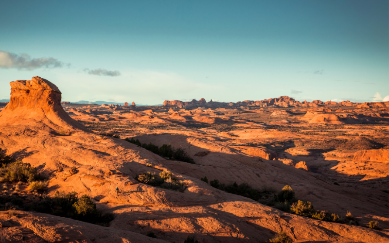
A Photo Tour of Moab, Utah
Take a visual tour through the Moab, Utah area to see the stunning landscapes you’ll see when you visit!
Tips for Spring Hiking in Moab
Planning a trip to Moab in the spring is a great time to enjoy moderate weather, but it’s also a busy time of year!
Before heading out on any hiking trail in Moab, we recommend you check current trail conditions with the Visitor Center at the National or State Parks, or the Moab BLM office.
Moab Spring Weather
Springtime in Moab varies quite a bit from month to month. It’s important to pack for all types of weather because you never know when the weather will change.
- Moab in March: Highs 64 | Lows 35 degrees F
- Moab in April: Highs 71 | Lows 42 degrees F
- Moab in May: Highs 82 | Lows 51 degrees F
It is not unusual to get rain or even snowfall in March. We recommend you watch the weather and pack a winter coat, winter hat, and winter gloves when going to Moab in early spring. A fleece jacket, hat, and gloves should be fine later in the spring.
One of the best Moab spring activities is hiking. It’s important to be prepared with the right clothing and gear for spring hikes.
Moab Spring Hikes
You’ll find a Moab hiking trail to suit any level of hiker. We recommend taking along your photography gear for hiking to capture the arches, rock features, and landscape you’ll find in the area!
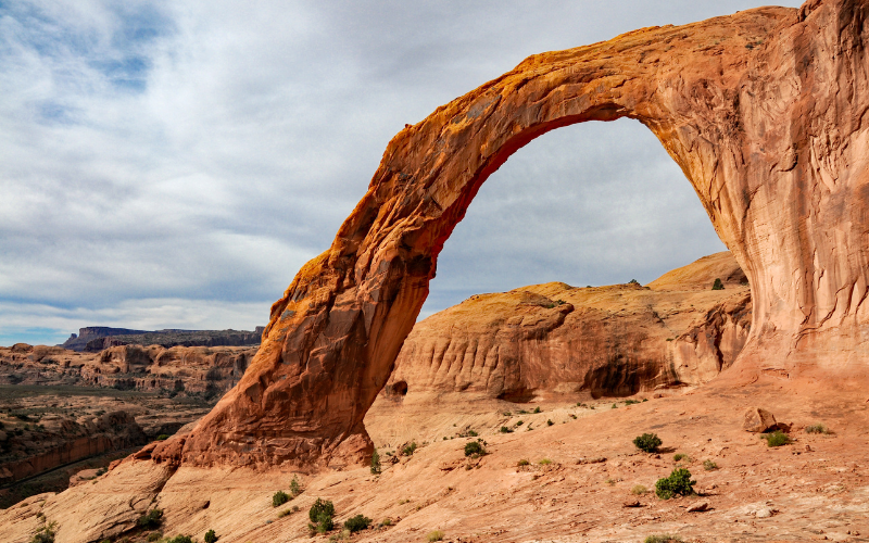
Corona Arch Spring Hike
- Hike length: 3 miles round trip
- Time required: 2 hours
- Hike difficulty: Moderate
- Trailhead Location: from Moab, take US-191 North for 4 miles. Turn left onto UT-279 South. Follow UT-279 for 10 miles. Parking and the trailhead are located on the north-side (right-side) of the highway.
The most popular Moab trail is the Corona Arch Hike. It offers stunning views along the way and the reward at the end is the 140-feet wide and 150-feet high Corona Arch. Combine the hike to include seeing Bowtie Arch while you’re here!
Corona Arch Trail is considered moderate due to a few areas where you’ll need to use cables to get up and down the slickrock slopes. This part of the hike could be slick during the winter.
Leashed pets are allowed on the trail.
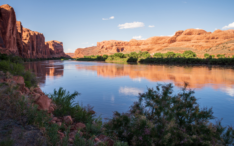
Be sure to give yourself time to see all the sites along the Potash-Lower Colorado River Scenic Byway after the hike! We really like this drive in the late afternoon when the red rocks along the river glow in the reflection of the water!
Faux Falls Spring Hike
- Hike length: 200 feet
- Time required: 15 minutes
- Hike difficulty: Easy
Directions to the trailhead:
- Go south out of Moab on highway 191 about 7.5 miles to mile marker 117.9.
- Turn left here, on the signed Kens Lake road. Reset your odometer.
- Follow this road 0.55 miles to a junction. Go right, toward the signed Mountain Loop Road. Reset your odometer again.
- 0.6 miles – Stay left.
- 1.4 miles – 4-way junction. Go left toward Kens Lake and reset your odometer.
- Continue straight at mile 0.6, instead of turning left into Ken’s Lake.
- 1.0 miles – Turn Left Into Campground
The trailhead has parking for several vehicles and contains an information kiosk. The last 1/2 mile of dirt road before the trailhead can become rough at times and some might want to park and walk it.
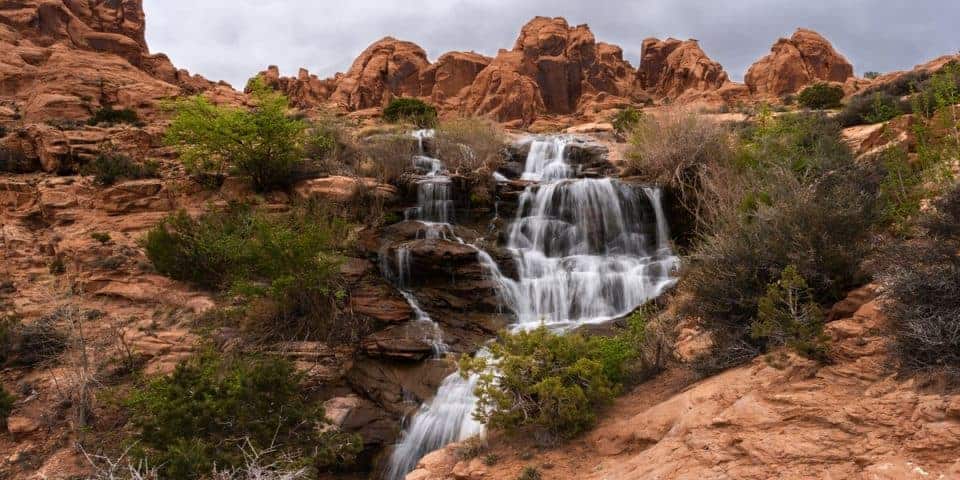
The Faux Falls Trail earned it’s name because the trail takes you to a waterfall created by the piping diverting water from Mill Creek to fill the reservoir, Ken’s Lake.
In the spring the waterfall is full and rushing due to the spring rains and snow runoff from the nearby mountains.
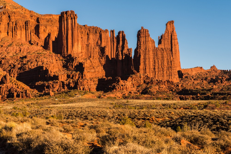
Fisher Towers Spring Hike
- Hike length: 5.2 miles round trip
- Time required: 2 to 3 hours
- Hike difficulty: Easy
- Trailhead Location: Head north out of Moab a couple of miles to State Highway 128 (just before the Colorado River). Follow highway 128 about 21 miles to a signed turn off on the right. Follow the good dirt road 2.2 miles to it’s end at a small campground and parking lot.
The Fisher Towers Trail begins in the parking lot and descends a small set of steps to a ridge of Slickrock. This strenuous trail continues down into the ravine, where it narrows as it follows the cairns on the ridge.
As soon as the trail leaves the ravine, it climbs quickly and begins to wind directly beneath the Fisher Towers. The trail starts by traveling around the base of the largest tower in the park, The Titan. It then ascends upward to a ridge that provides an excellent view of Fisher Valley, the Colorado River, and the desert towers of Castle Valley.
Fisher Towers is a terrific sunset Moab photography spot!!
Grandstaff Canyon Spring Hike
- Hike length: 2 miles to Morning Glory
- Time required: 4 hours round trip
- Hike difficulty: Moderate
- Trailhead Location: The Grandstaff Canyon Trail is located three miles east of the junction with U.S. 191, Utah Scenic Byway 128.
The Grandstaff Canyon Trail is named after William Grandstaff, an African-American prospector in the 19th century. This trail is one of Moab’s most famous trails that offers a fun and exciting day adventure.
From the parking area next to Hwy 128, follow the trail up the left side of the stream. Snow and ice may be present during the winter months on this Moab hike.
Keep going upstream for about 1.5 miles. At the fork in the road, follow the trail to the right, cross the stream, and walk up the steep slope. Morning Glory Bridge is located at the end of the trail about 0.5 miles up the canyon from the stream.
Juniper Trail Spring Hike
- Hike length: 1.9 miles round trip
- Time required: 45 minutes to 1 hour
- Hike difficulty: Easy
- Trailhead Location: located in the Sand Flats Recreation Area (fee to enter). Drive 6.3 miles from the entrance station and you’ll see a parking area.
The Juniper Trail is a well-maintained and easy-to-follow trail. It offers panoramic views of the Grandstaff, Mill Creek Canyons, Moab Rim, Porcupine Rim, La Sal Mountain range, and Colorado River channel.
Dogs are also able to use this trail but must be kept on leash.
Spring Hikes at Arches National Park
One of the best Arches National Park spring activities is hiking. Check with the Visitor Center about trail conditions, especially in early spring.
Here’s a list of our favorite Arches National Park spring hikes:
- Park Avenue
- Balanced Rock
- The Windows and Turret Arch
- Double Arch
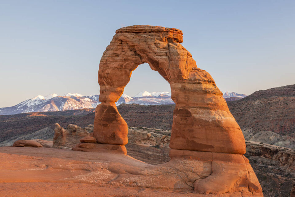
- Delicate Arch
- Sand Dune Arch and Broken Arch
- Skyline Arch
- Landscape Arch
Spring Hikes at Canyonlands National Park
Before setting out on any Canyonlands National Park spring hike, check with the Visitor Center about trail conditions, especially in early spring.
One of the best Canyonlands National Park spring activities is hiking. Due to the remote location of Canyonlands, always be prepared with water, food and proper clothing so you can be self-reliant. Remember there is no gas, food or lodging at Canyonlands National Park Island in the Sky or Needles Canyonlands.
Here’s a list of spring Island in the Sky hikes:
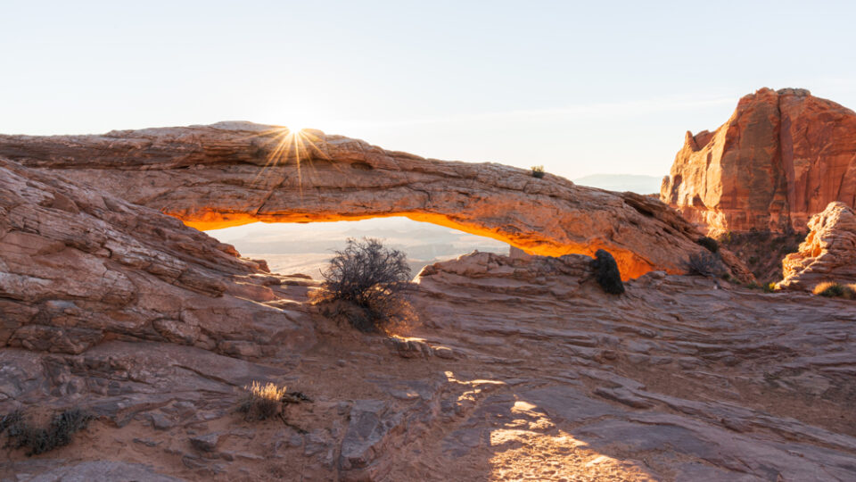
- Mesa Arch
- Grand View Point
- White Rim Overlook
- Murphy Point
- Upheaval Dome
- Whale Rock
- Aztec Butte
Check out the spring Canyonlands Needles hikes:
- Roadside Ruin
- Pothole Point
- Cave Spring
- Chesler Park Loop
- Druid Arch
- Confluence Overlook
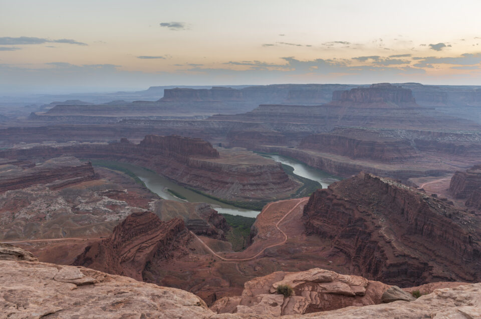
Dead Horse Point Spring Hikes
This Utah State Park is located near the entrance to Canyonlands National Park Island in the Sky.
The Dead Horse Point State Park hiking trails run along the top of the mesa and connect to each other. Dogs are allowed on hiking trails, but must be kept on a leash at all times.
Here’s a list of spring hikes at Dead Horse Point:
- Dead Horse Point Overlook Trail
- Visitor Center Nature Trail
- The Colorado River Overlook
- East Rim Trail System
- West Rim Trail System