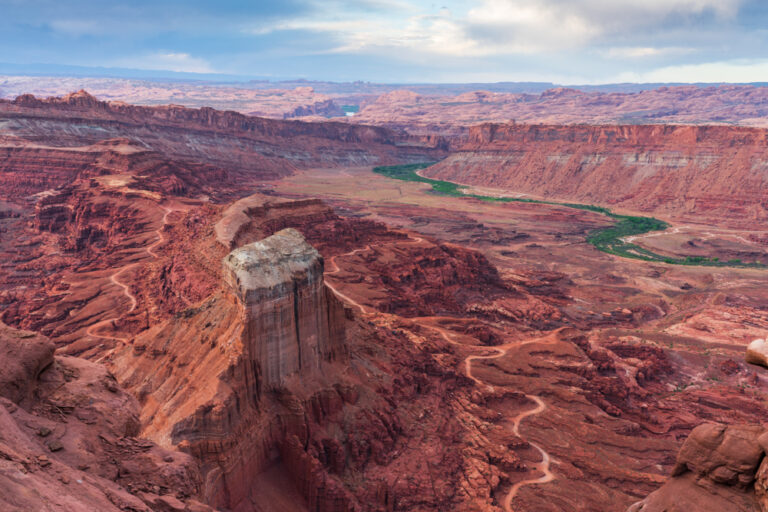
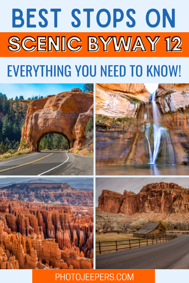
Best Stops Along Scenic Byway 12 in Utah
With Bryce Canyon at one end, Capitol Reef at the other, here’s a list of the best stops along Scenic Byway 12 in Utah. Add this stunning 124 mile drive to your list of places to visit in Utah!
It won’t take long to see why it’s noted as one of the most scenic highways in America.
Along this All American Road located in south-central Utah, you’ll be amazed by the wonder and beauty of this area.
This guide starts at Red Canyon near Bryce Canyon National Park, and ends in Torrey near Capitol Reef National Park.
This site contains affiliate links which means WE may receive commissions for purchases made through these links. We only provide links to products we actually use and/or wholeheartedly recommend! As an Amazon Associate, we earn from qualifying purchases. Read the full Disclosure Policy.
Utah Highway 12: Know Before You Go
Travel Planning: Scenic Byway 12 is a winding, country road 124 miles long. Plan an average speed of 40 miles per hour as you estimate your drive time.
Food and Water: We recommend you pack the water and food you’ll need for this drive. There are small grocery stores in Panguitch and Torrey. The smaller towns along the route do offer lodging and food, but it can be hit-or-miss when or if they are open!
Cellular Service: Highway 12 runs through remote and rugged landscape. Cell phones do not work along much of the drive. Plan to make calls when stopped at locations that do have service.
GPS Navigation Systems: Beware of GPS navigation systems in this area!! Units programmed to provide the most direct route may lead you into the backcountry where the roads aren’t paved, and there are no services.
Backcountry Roads: Many of these scenic backways are very rough and remote. High-clearance and/or four-wheel drive vehicles are needed to travel some sections of these roads, many of which are seasonally maintained and impassible when wet. All are far from emergency road service so be prepared for anything.
Road Safety: Use the pullouts along the byway to read interpretive sign panels. Never block the road by stopping in the traffic lanes to take photographs – pull off the road where it is safe to do so.
Share the Road: Many segments of Scenic Byway 12 have sharp curves and narrow to no paved shoulders. Give cyclists and school buses space and pass only when it is legal and safe.
Open Range: You may encounter livestock or wildlife on or near the roadway. Slow down or stop as required and proceed only when it is safe to do so.
Flash Flooding: Even small rain storms can cause dangerous flash floods in streams, drainages and canyons along Scenic Byway 12. Be aware while hiking. Do not attempt to walk or drive through flood waters. You or your vehicle can be swept away causing injury or death. Inquire about current weather conditions at one of the area visitor centers.
Best Stops Along Scenic Byway 12
We will detail the stops starting at Red Canyon to Torrey. You can drive it the opposite way as well. Approximately 7 miles from Panguitch, Utah on Highway 89, turn east onto Highway 12.
Here’s what you can see, do, and photograph at all the best stops on Scenic Byway 12!
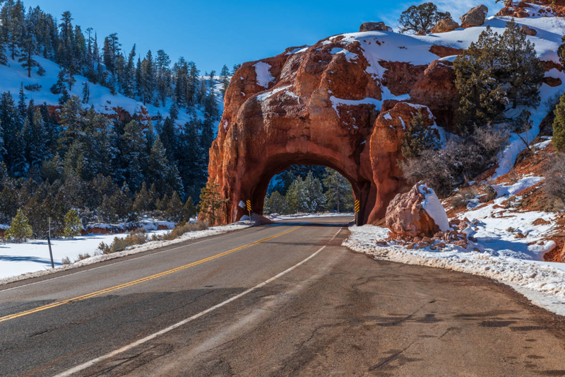
Red Canyon
Magnificent views of red colored rock formations and Ponderosa pines is what you will see, and can photograph, at Red Canyon.
The Red Canyon Trail System includes well maintained hiking trails. There paved trails for biking, trails for mountain biking, and miles of ATV trails. Stop by the Visitor Center to pick up a map and guidelines as to the type of traffic each trail allows.
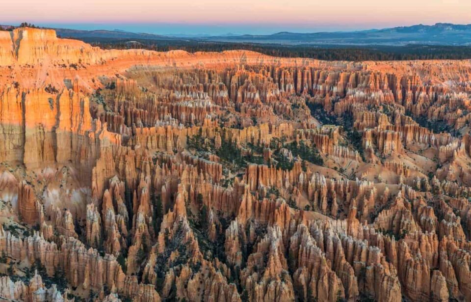
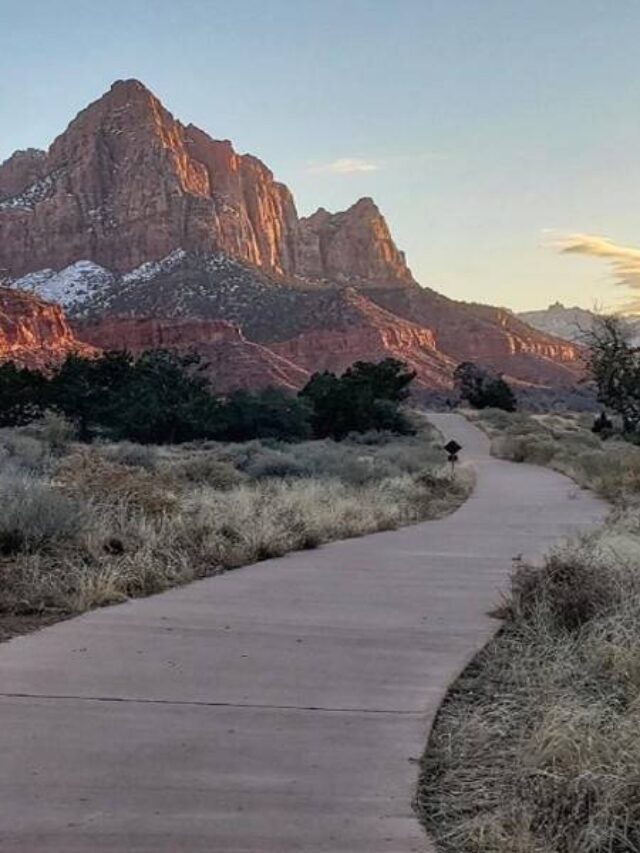
Bryce Canyon National Park
The uniqueness of the hoodoos, canyon, cliffs, and jaw-dropping views will have you snapping picture after picture when visiting Bryce Canyon National Park
Here’s a list of fun things to do at Bryce Canyon:
- Bryce Canyon Scenic Drive
- Best day hikes at Bryce Canyon National Park
- Bryce Canyon Photo Spots
- Bryce Canyon Activities
- Bryce Canyon National Park Camping

Grand Staircase Escalante Visitor Center
In Cannonville you’ll find the Grand Staircase-Escalante National Monument Visitor Center. It’s open seasonally with interpretive displays, maps, books, and souvenirs.
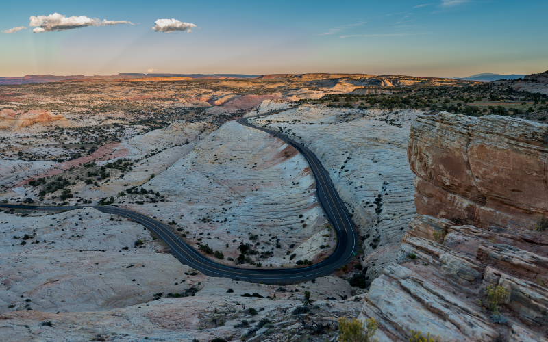
Grand Staircase Escalante was named a National Monument in 1996. As you drive along Scenic Byway 12, you’ll see a landscape of colorful sandstone cliffs, canyons, and slickrock that makes up the Grand Staircase Escalante.
But to really explore the area, you’ll need to drive the backroads off the main road. These backroads provide access to trailheads and scenic drives! This area is remote with less services than national parks, so be prepared to keep yourself safe!
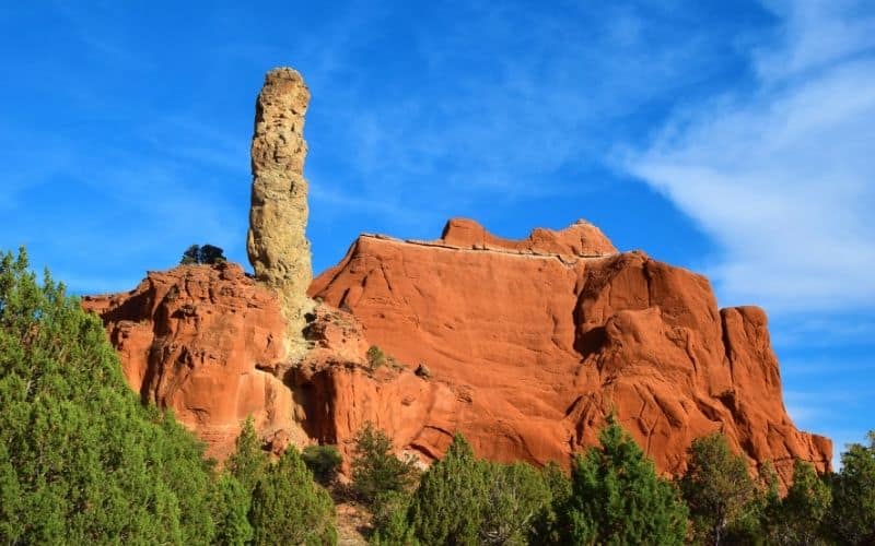
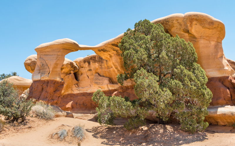
Kodachrome Basin State Park
You’ll find a lot of things to do at Kodachrome Basin State Park in Utah. It’s a small park, but due to it’s unique landscape, it’s worth the stop even if you just drive through.
You can hike among hoodoos, explore trails by horseback, and practice your photography skills in a place with no shortage of incredible scenes!
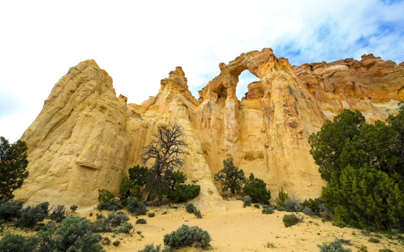
Cottonwood Canyon Scenic Byway and Grosvenor Arch
This Scenic Backway runs for 46 miles heading south through Grand Staircase-Escalante National Monument from Cannonville to Highway 89 near Kanab.
The road is paved for 9 miles between Cannonville and the turnoff to Kodachrome Basin State Park. Thereafter, the road is graded dirt with an underlying clay base making it impassable when wet.
About 11 miles south of Kodachrome Basin State Park you’ll find Grosvenor Arch. If you’ve got an extra hour, and the right vehicle, we recommend this detour to see this unique towering arch!
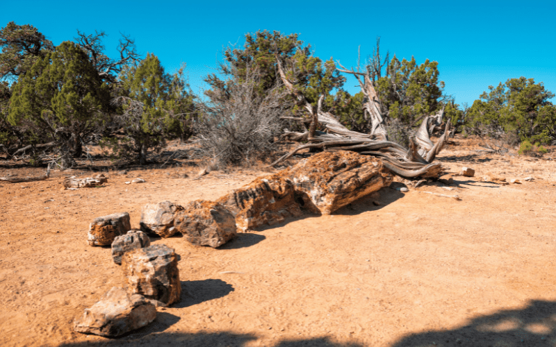
Escalante Petrified Forest State Park
Petrified is the term used for wood that is fossilized from millions of years ago. It may look like rock, but when you get close you can see that it was wood at one time.
This stop along Highway 12 will be a short one. Escalante Petrified Forest State Park is full of history and unique geological features. Keep in mind, it is illegal to remove any petrified wood from the forest.
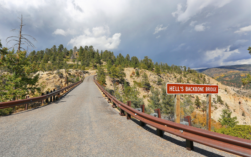
Hell’s Backbone Scenic Byway
Built by the CCC workers during the Great Depression era, this 44 mile road starts in Escalante and ends in Boulder. The byway runs through juniper desert, passes Posey Lake, continues up into the pine and aspen forest then returns down to the desert. This road is closed in the winter.
Be sure to stop where the road crossed the old historic wooden Hell’s Backbone Bridge. The views of the rugged canyons here are stunning!
If you take this road, it does bypass a few cool stops along Highway 12 between Escalante and Boulder.
Hole-in-the-Rock Scenic Backway
Starting 5 miles east of Escalante off Scenic Byway 12 you’ll find Hole-in-the-Rock Road. It’s a dirt and gravel road that runs 57 miles one way to the end of the road.
This backway accesses recreational and historic sites in both Grand Staircase-Escalante National Monument and Glen Canyon National Recreation Area. Devil’s Garden and the Dry Fork slot canyons are popular recreational destinations. Visitors interested in pioneer history should see Dance Hall Rock and Hole-in the-Rock at the end of the road.
One of the many popular hiking destinations in this area is Coyote Gulch. It’s a 13-mile side canyon where you can see and photograph sandstone natural bridges, arches, as well as a sandy, shallow streambed. Check at the Escalante Interagency Visitor Center for information, current conditions, and permits for this backcountry experience.
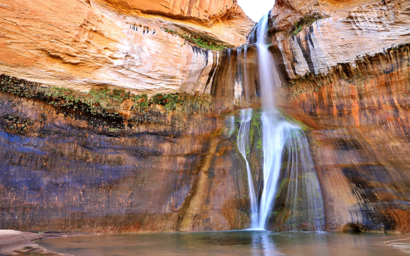
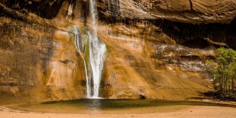
Calf Creek Falls
Calf Creek Recreation Area offers a 13-site campground, a day-use picnic area, and trailhead. – a great stop after a day of driving or hiking and seeing all the sites along Byway 12.
Lower Calf Creek Falls hike is the main attraction here. It’s a 6-mile moderately strenuous round-trip hike. But the stunning 126-foot waterfall is worth the effort!
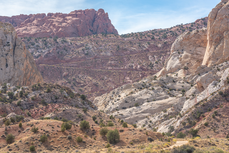
Burr Trail Scenic Backway
From the town of Boulder, the Burr Trail runs through Grand Staircase-Escalante National Monument where you’ll see Deer Creek Campground, Long Canyon, and the Circle Cliffs.
The road continues into Capitol Reef National Park down the Burr Trail Switchbacks that drop nearly 800 feet in about a mile while zigging and zagging down the Waterpocket Fold.
At the junction of the Notom Road, you can head north to Capitol Reef, or south to Bullfrog in the Glen Canyon National Recreation Area.
Traveling along the Burr Trail can be done from spring to fall during dry conditions. If you travel after a storm you may find yourself stuck due to the high clay consistency. Check weather before venturing down this trail.
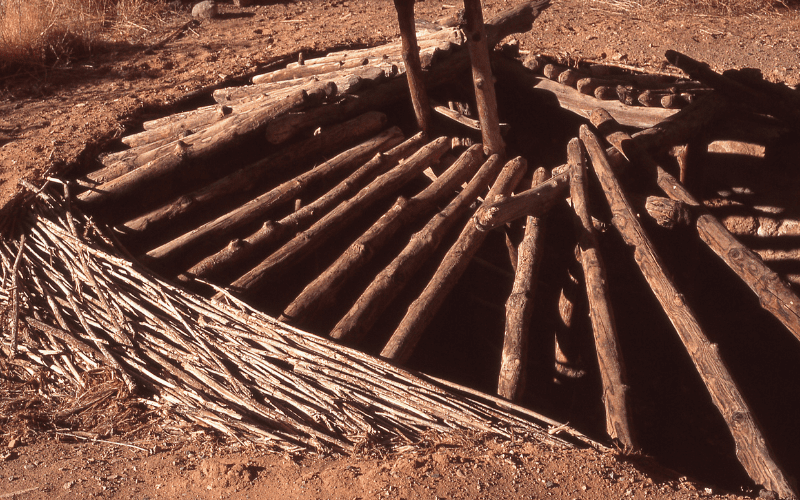
Anasazi State Park Museum
The area around Anasazi State Park was once occupied by the Ancestral Puebloans between 1050 and 1175 A.D. It’s now used for important archeological excavation.
Anasazi State Park offers an exciting glimpse into the past and is well worth a visit if you’re in the area. Over a thousand years ago, this spot was home to one of the largest known populations of the ancestral Pueblo people – and now, it’s a spot where you can learn all about how these Native Americans lived.
Boulder Mountain
Scenic Byway 12 climbs to an altitude of more than 9,000 feet where you can enjoy breathtaking views of the rugged, rainbow-hued landscape stretching out below.
The highway is a landscape of aspen, pine, spruce, and fir. It’s a beautiful drive in the fall to see the autumn colors on the trees!
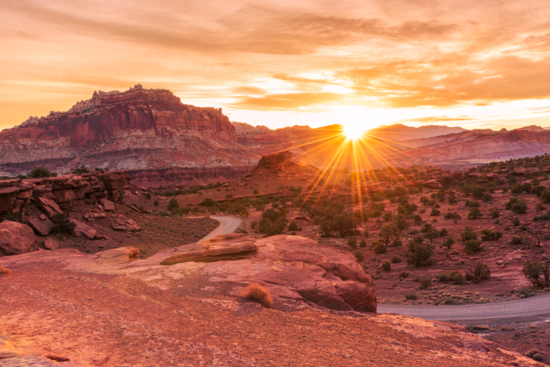
Capitol Reef National Park
With beautiful red canyons this is a great place to spend a couple days if you are into hiking, off-roading, fishing, camping, and photography.
Here’s a list of things to do in Capitol Reef National Park:
Lodging Along Highway 12 in Utah
The best lodging options will be near Bryce Canyon and Capitol Reef National Parks. You will find places to stay in the smaller towns of Tropic, Escalante, and Boulder
Where to Stay Near Bryce Canyon:
- Bryce Canyon Places to Stay
- Bryce Canyon Hotels
- Bryce Canyon Winter Lodging
- Bryce Canyon National Park Camping
- Bryce Canyon National Park RV Vacation
- Vacation Rentals Near Bryce Canyon
- Best Western Ruby’s Inn – easy access right outside the park
- Best Western Plus – also right outside the park
Places to Stay Near Capitol Reef
- Places to Stay at Capitol Reef National Park
- Capitol Reef National Park Camping
- Hotels near Capitol Reef National Park
- RV Parks Near Capitol Reef National Park
- Capitol Reef Resort – this is where we stay! Make it a unique experience and stay in a teepee or covered wagon!
- Austin’s Chuckwagon Motel – basic rooms and cabins with a deli and store right on the property which is so convenient!
- Vacation Rentals Near Capitol Reef – we like finding a place with a kitchen so we can prepare our own food.