Capitol Reef Burr Trail Loop Scenic Drive
Enjoy captivating scenery along the Capitol Reef Burr Trail Loop scenic drive. It’s a jaw-dropping off-road experience through the Waterpocket District of this Utah National Park.
Use this Capitol Reef National Park guide to see unique geologic formations aptly named “waterpockets” that show off the powerful forces of nature and time. The Waterpocket District of the park is a hidden gem to enjoy solitude and backcountry exploration.
The Burr Trail Loop-the-Fold driving tour is 123.7 miles starting and ending at the Capitol Reef Visitor Center. There are both paved and unpaved sections of this route that travels through Capitol Reef and Grand Staircase-Escalante National Monument.
In dry weather the Burr Trail is easily accessible to passenger cars, but wet weather may make the road impassable even for 4-wheel drive vehicles. Be sure to check weather and road conditions before setting out!
Living only a few hours away, we’ve had the opportunity to explore the Burr Trail scenic drive loop many times. The tips we share are based on our experiences visiting the area throughout the years!
The Waterpocket District of Capitol Reef is a remote part of the park with no services (gas or food). Be sure you pack all necessary supplies, food, and water for a day trip driving the scenic loop of the Burr Trail.
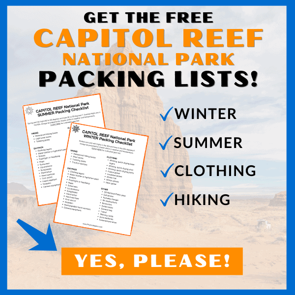
Check out our Capitol Reef National Park packing list so you have the right clothing and gear for visiting any time of year! Grab your free printable packing checklist by clicking the image below!
This site contains affiliate links which means WE may receive commissions for purchases made through these links. We only provide links to products we actually use and/or wholeheartedly recommend! As an Amazon Associate, we earn from qualifying purchases. Read the full Disclosure Policy.
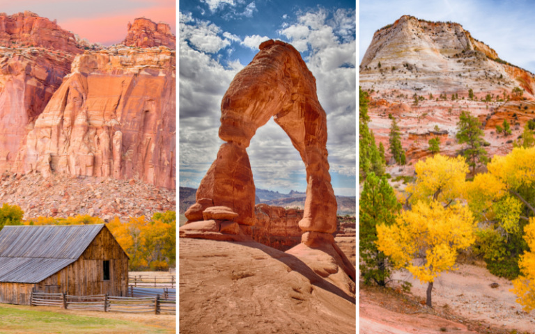
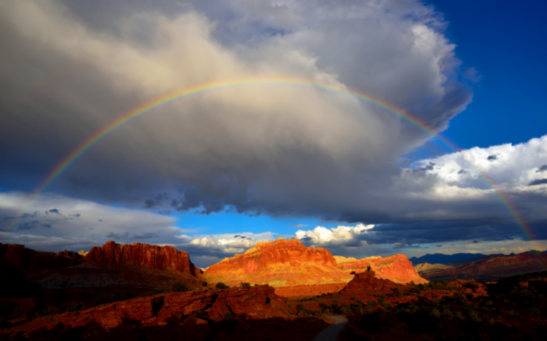
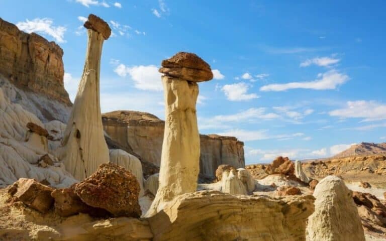
A Photo Tour of Capitol Reef National Park
Take a visual tour through Capitol Reef National Park to see the stunning landscape and wildlife you’ll find in the park!
Things to Know Before Driving the Burr Trail Loop
The Capitol Reef Burr Trail is a bit off the beaten path, but trust us, the loop drive is worth all the effort to see the amazing landscapes you’ll find here!
Location: The Burr Trail Scenic Drive is in south-central Utah starting at Boulder along Scenic Byway 12 and ending at the eastern end of Capitol Reef National Park.
Distance: The Capitol Reef Loop the Fold covers 123.7 miles. You will begin and end at the Visitor Center. The scenic drive can be rive clockwise or counterclockwise.
Time: Driving the entire loop without additional stops or hikes takes 6 to 8 hours to complete. For exploring detours, visiting overlooks, or embarking on short hikes, you must allocate one full day to enjoy the whole Loop the Fold route.
Directions: Generally, it is best to drive the Cathedral Valley Loop clockwise. This allows you to tackle the river crossing at the beginning of the drive. Remember, the water level in the Fremont River may be too high to safely cross in a vehicle at times. If that’s the case, modifications to the loop may be necessary. Check the river conditions before starting the drive to avoid any inconvenience at the end of the loop.
Vehicle Requirement: The Burr Trail Loop can be driven year-round. Most of the time, passenger cars, pickups, and vans can usually drive .with no issue. Spring and summer rains and winter snows can leave sections of the Burr Trail Road slick, muddy, washed out, and impassable, even for high-clearance, four-wheel-drive vehicles. Always check the weather forecast and ask the rangers at the Visitor Center for current conditions.
Weather and Seasons: The Capitol Reef weather can vary significantly depending on the season. Summers tend to be hot, with temperatures 90 to 100°F, while winters can bring cold temperatures and occasional snowfall. Spring and fall offer milder weather and are popular times to visit.
Services: Services and facilities along the Burr Trail Scenic Drive are limited. The town of Boulder, located at the starting point, offers amenities such as fuel, lodging, and dining options. However, once on the drive, no potable water or services are available until you reach the Visitor Center in Capitol Reef National Park. There is a pit toilet at the Deer Creek and Cedar Mesa campgrounds. Cell phone reception is usually poor to nonexistent.
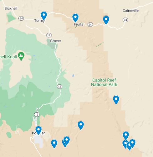
Map of the Best Stops Along the Burr Trail Loop
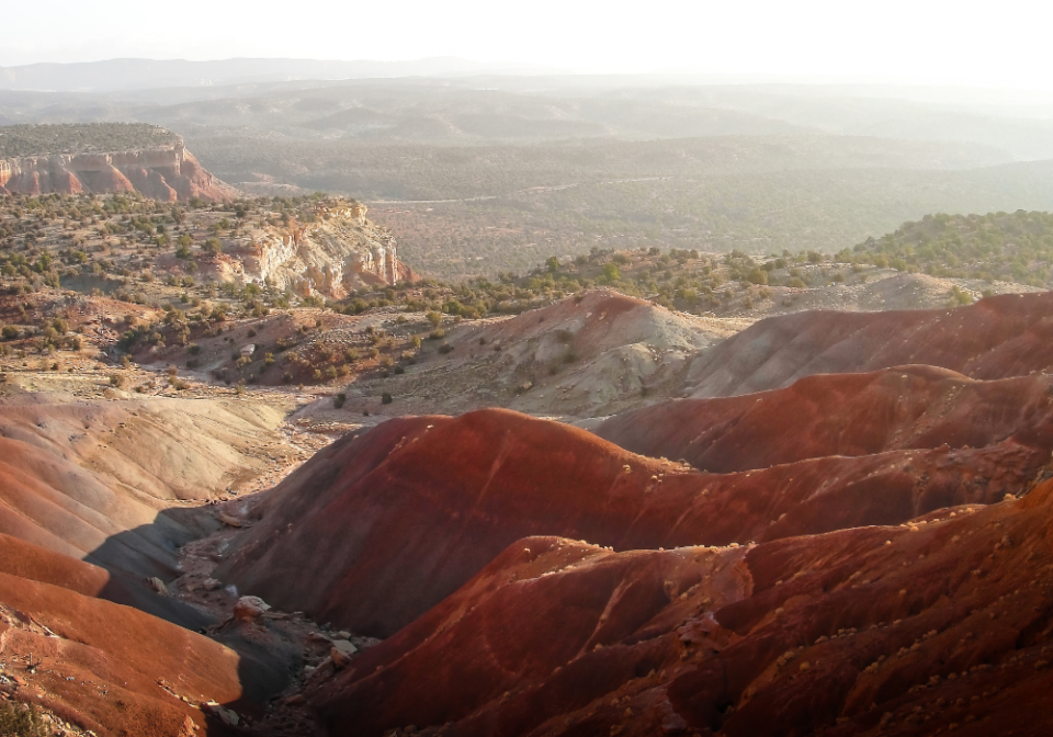
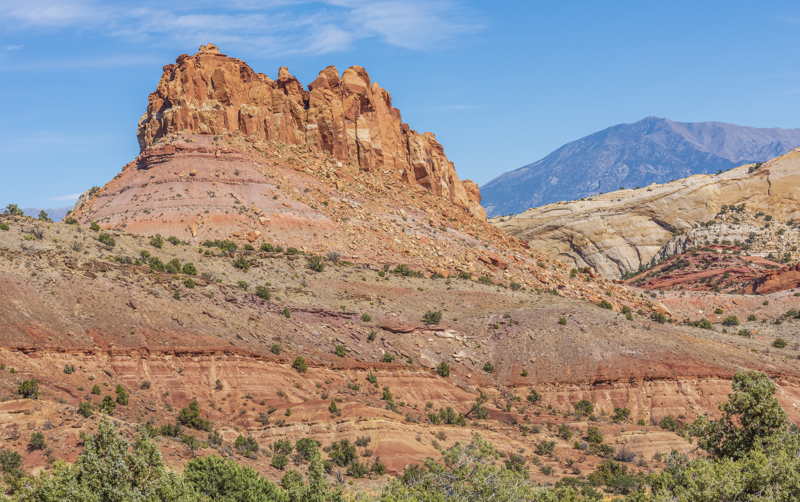
Check out the map of the Burr Trail Loop-the-Fold Points of Interest that include stunning natural features and viewpoints. You’ll get to see the Waterpocket Fold, a unique geological formation that stretches for nearly 100 miles and is characterized by colorful sandstone layers.
Capitol Reef Burr Trail Loop Scenic Drive Route Description
The Burr Trail Loop is one of the best Utah Scenic Drives! Here’s the route description, distances, and stops for driving the loop road counterclockwise starting at the Capitol Reef Visitor Center.
Visitor Center to Highway 12/24 Junction: 9.8 miles
We recommend you fill your tank with gas and grab any food, snacks, and water you’ll need for the day. There “may” be services in Boulder, but it’s a small town and we’ve experienced times driving through when nothing was open.
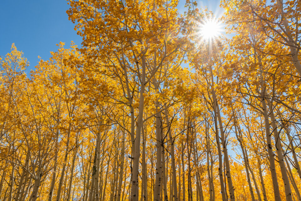
This junction is the beginning of Scenic Byway 12 that ends near Bryce Canyon. Enjoy beautiful views as you summit Boulder Mountain! Fall is an amazing time to see yellow aspen as you make the drive from Torrey to Boulder.
Hwy 12/24 Junction to Boulder: 46 miles
Boulder is the starting point of the Burr Trail and home to the fascinating Anasazi State Park where you can immerse yourself in the rich history of the Ancestral Puebloan people.
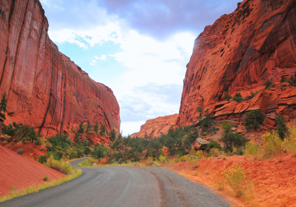
As you venture onto the Burr Trail, be prepared to immerse yourself in the mesmerizing red rock scenery that characterizes the Grand Staircase-Escalante National Monument. Towering cliffs, colorful rock formations, and expansive vistas will greet you along the way, showcasing the natural beauty of southern Utah.
From Boulder, this part of the Burr Trail is paved for about 35 miles.
Boulder to Deer Creek Campground – 6.8 miles
The Deer Creek Campground offers a pit toilet, but no other services, including potable water.
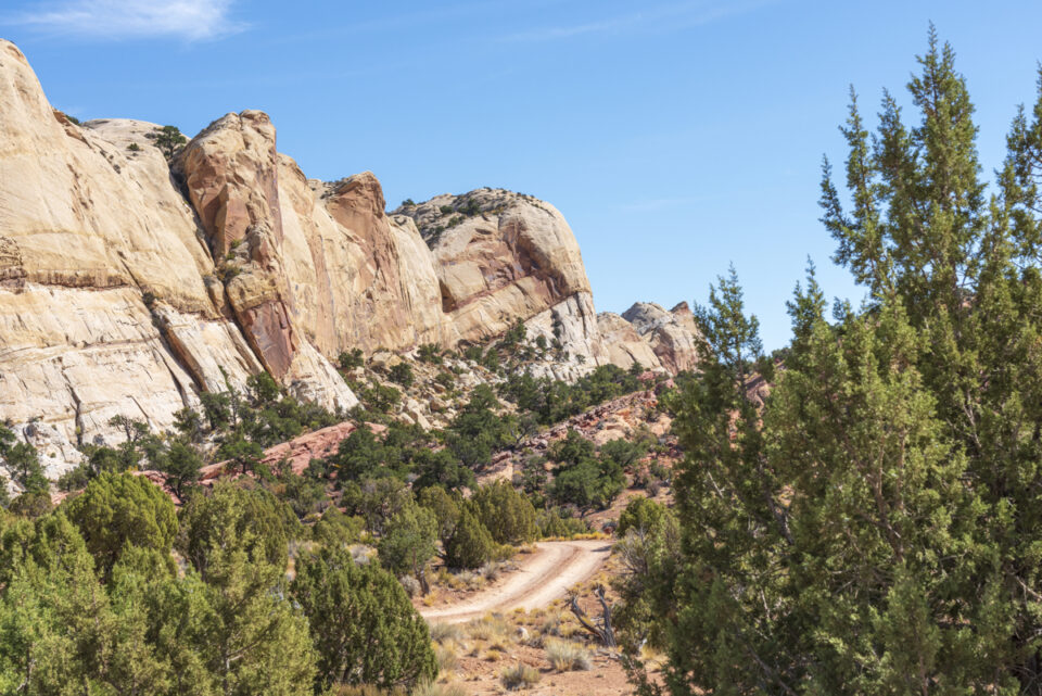
Deer Creek Campground to Long Canyon (Singing Canyon): 4.4 miles
One of the early highlights of the drive is Long Canyon. This stretch features towering sandstone walls that create a narrow corridor, providing a dramatic, awe-inspiring driving experience. Take your time to appreciate the sheer beauty of this unique geological formation.
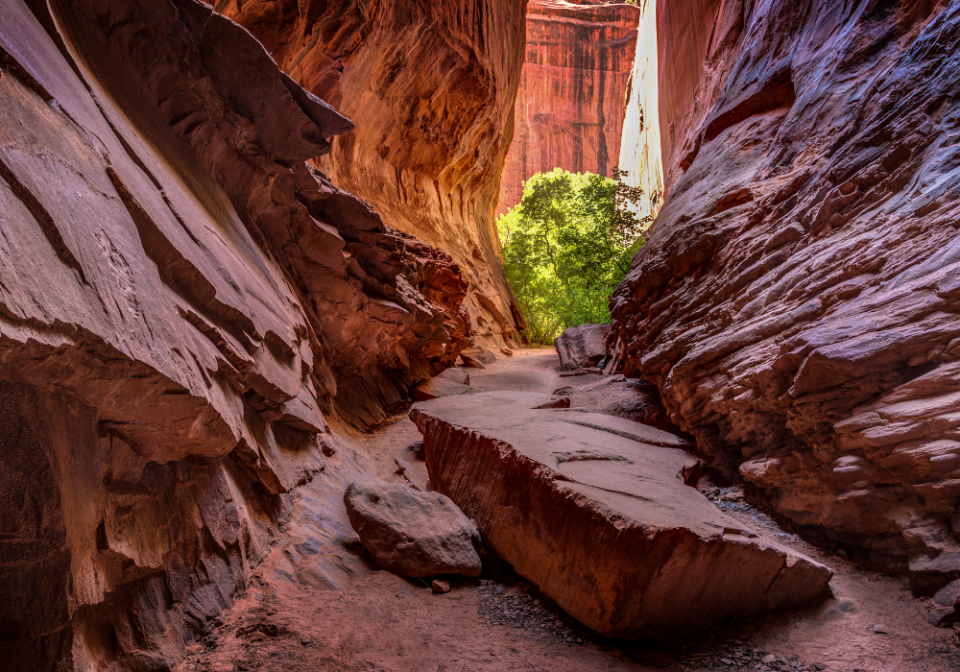
After the descent down into the canyon, about 1.4 miles past the U-turn look for an unmarked pullout that’s the trailhead to Singing Canyon. It’s a short narrow slot canyon, but does require a bit of scrambling over a few boulders to reach the end of the trail.
Wonder why it’s called Singing Canyon? Sing a few notes or shout a few words and you’ll find out!
Singing Canyon to Long Canyon Overlook – 5.3 miles
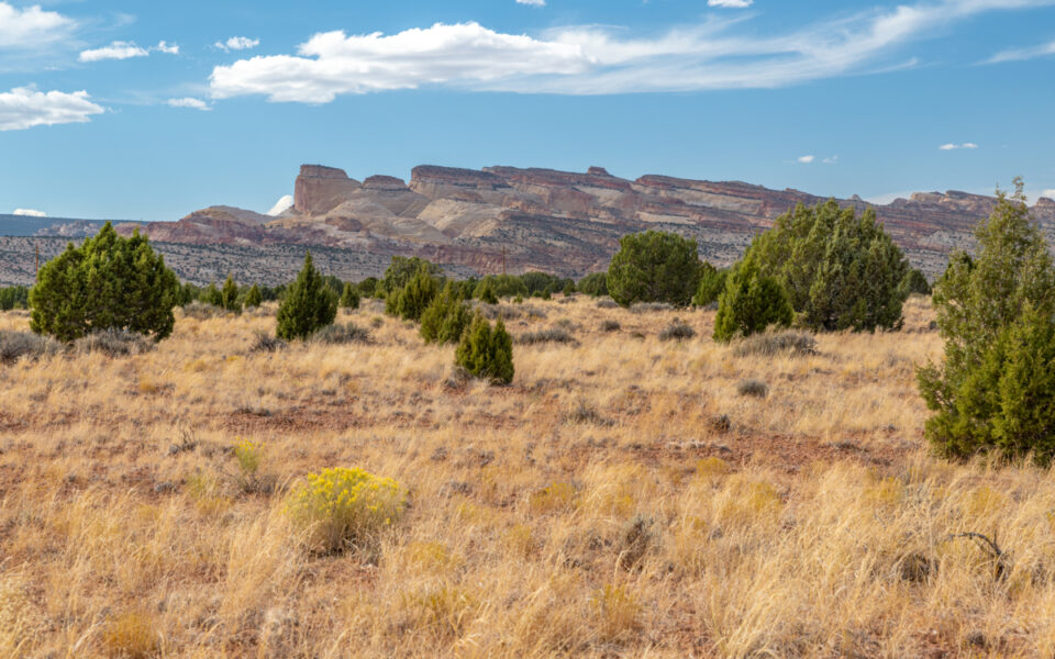
Be sure to stop at the pullout on the right at the top of the hill to see views of the Circle Cliffs, Henry Mountains, and Chinle Formation hills.
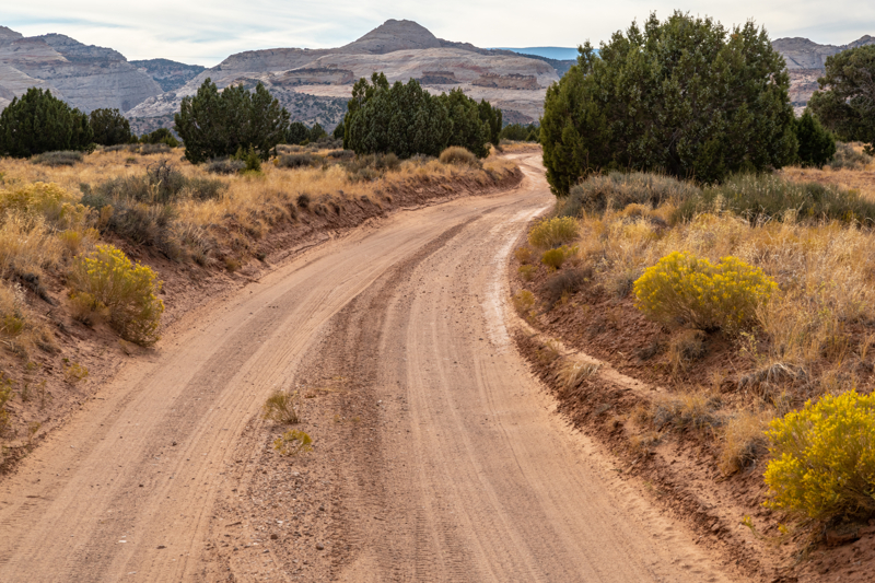
Not far from this point, the Burr Trail Road becomes a dirt road. If the weather or road conditions are bad, this is the best spot to turn around and return the way you came!
Long Canyon Overlook to Upper Muley Twist Canyon Road – 16 miles
DETOUR to Strike Valley Overlook – This detour adds 6 miles of driving and about one hour onto the full Looping the Fold. You’ll need a high-clearance 4WD vehicle to drive the extremely rough road 2.9 miles one way.
If you don’t have a 4WD vehicle you’ll need to park in the area near the side road and walk about 2.5 miles one way to reach the trailhead.
From the trailhead it’s a half-mile walk to the Strike Valley Overlook viewpoint!
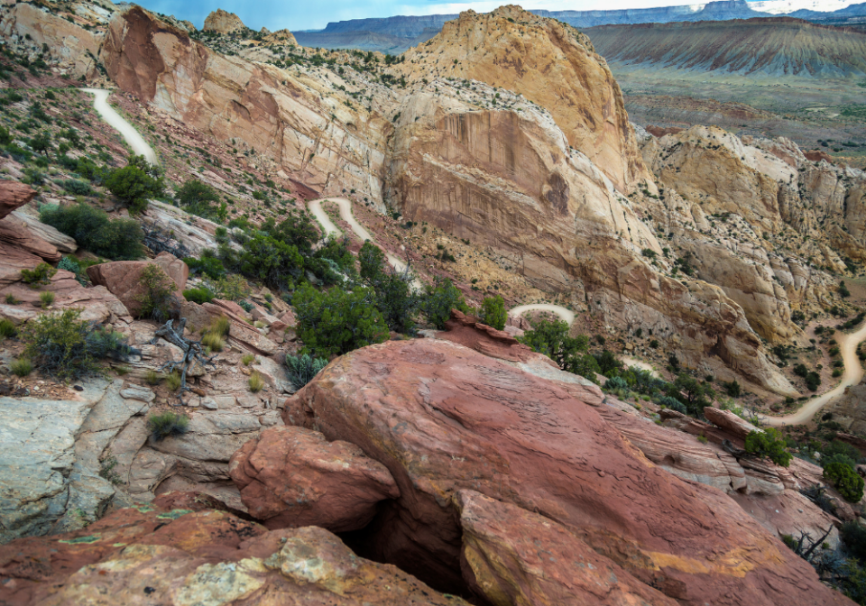
Upper Muley Twist Canyon Road to Top of Burr Trail Switchbacks – 1.2 miles
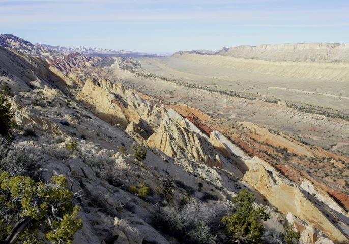
From the top of the Burr Trail Switchbacks there are a few places to pull over and park so you can walk around the area to see the view of Strike Valley and the road you’ll soon drive down! This road was constructed in the late 1800’s in order to move cattle over the Waterpocket Fold!
Continue the drive down the Burr Trail Switchbacks for 2 miles until you reach the Notom-Bullfrog Road Junction. You’ll turn left to head back toward Capitol Reef National Park. If you take the road to the right, it eventually ends near the Bullfrog Marina of Lake Powell.
Notom-Bullfrog Road Junction to Cedar Mesa Campground – 11.4 miles
This part of the drive gives you the best ground-level views of the striking Waterpocket Fold. This immense geological feature is a fold in the Earth’s crust that spans approximately 100 miles.
The Cedar Mesa Campground offers a pit toilet, but no other services.
Cedar Mesa Campground to Highway 24 – 21.3 miles
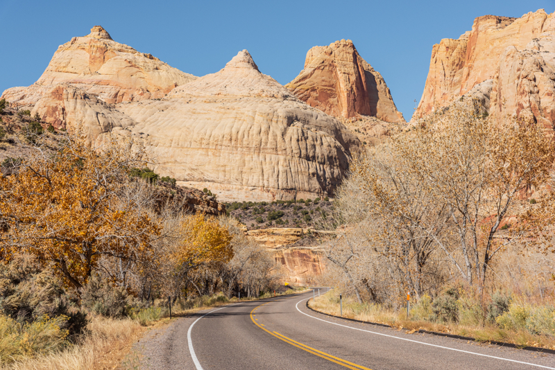
As you drive this stretch of road, that eventually becomes paved, look to your left to see views of Capitol Reef’s stone features.
Highway 24 to Capitol Reef Visitor Center – 9 miles
At this junction you’ll turn left to return back to the Visitor Center. Turning right takes you to the start of the Cathedral Valley Scenic Drive, another must-do day trip if you have a 4WD vehicle.
Driving along Highway 24 back toward Fruita, you’ll pass the Behunin Cabin, Grand Wash Trailhead, Hickman Bridge Trailhead, Petroglyphs, and the Fruita Schoolhouse.
Burr Trail Packing List
When planning a trip to drive the Burr Trail Loop, it is vital to pack the right gear and supplies since part of the drive is through a remote area with no services. Here are some things you should consider including in your packing list:
Vehicle Essentials:
- Spare tire and tools: Carry a spare tire and the tools required to change it, as well as a tire pressure gauge and air compressor.
- Emergency kit: Pack a basic emergency kit with flashlight, extra batteries, jumper cables, and a roadside assistance kit.
- Maps and navigation tools: Bring a detailed Capitol Reef map or GPS device to navigate the loop and find specific points of interest.
Outdoor Gear:
- Water: Since no potable water is available, it is crucial to bring an adequate amount of water for hydration. Plan to carry more water than you think you will need, especially considering the dry climate and potential for dehydration.
- Snacks and Food: Pack enough non-perishable food and snacks to sustain you throughout the trip.
- Sun Protection: The desert sun can be intense, so pack sunscreen with a high SPF rating to protect your skin from harmful UV rays. Bring sunglasses, a wide-brimmed hat, and lightweight, breathable UV clothing that covers your arms and legs.
- Proper Footwear: Choose sturdy and comfortable hiking boots or hiking shoes for walking on uneven desert terrain. Closed-toe shoes are recommended to protect your feet from rocks, cacti, and other potential hazards.
- First Aid Kit: It’s always wise to have a basic first aid kit on hand. Include band-aids, antiseptic ointment, pain relievers, blister pads, and any personal medication you may require.
- Camera Gear: Capture the area’s beauty by packing your camera gear – pack extra batteries or a portable charger to ensure you take advantage of all photo opportunities.
Hiking Trails Along the Burr Trail Scenic Drive
The Burr Trail Scenic Drive offers access to several Waterpocket District hiking trails that showcase the area’s stunning natural beauty.
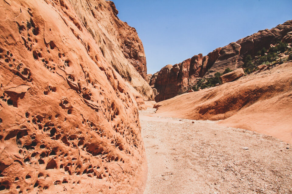
There are short-distance hikes into Red, Surprise, and Headquarters Canyons that cut through multiple sedimentary rock layers.
Burro Wash, Cottonwood Wash, Sheets Gulch are fun slot canyon hikes. It’s important to use caution in narrow canyons, particularly during the flash flood season (typically July-September). Always check the weather forecast before your visit.
Upper and Lower Muley Twist Canyons and Halls Creek Narrows are popular overnight destinations. Free backcountry permits are required for all overnight trips and can be obtained at the visitor center.
Camping Along the Burr Trail Scenic Drive
There is one Capitol Reef National Park camping option along the Burr Trail route:
Cedar Mesa Campground: Located off Notom-Bullfrog Road, approximately 23 miles south of Highway 24, this campground features five primitive sites. It is a smaller, more secluded option, ideal for those seeking a quieter camping experience. It operates on a first-come, first-served basis.
There are two campgrounds within a reasonable distance from the Loop the Fold drive:
Cathedral Valley Campground: Located at mile marker 30.4 on Cathedral Road, the Cathedral Valley Campground offers six campsites. This is the only designated campground along the Cathedral Valley loop, providing basic facilities such as picnic tables and vault toilets. Keep in mind that sites are available on a first-come, first-served basis. The campground also tends to have stronger cellular service than other areas along the loop.
Fruita Campground: Situated in the Fruita District, this campground provides a range of facilities, including campsites with picnic tables, fire rings, and access to restrooms. It offers a serene setting surrounded by orchards and scenic views. Reservations are recommended.
You’ll also find RV Parks Near Capitol Reef National Park in Torrey and Hanksville that are close to the start and end points of the Burr Trail loop road on Highway 24.
Capitol Reef Cathedral Valley Tours
If you want to explore this remote part of Capitol Reef and don’t have the right vehicle, you can book a variety of Cathedral Valley Tours. There are half day tours that take you to the Temples of the Sun and Moon. Or there are full day tours to see the full loop!
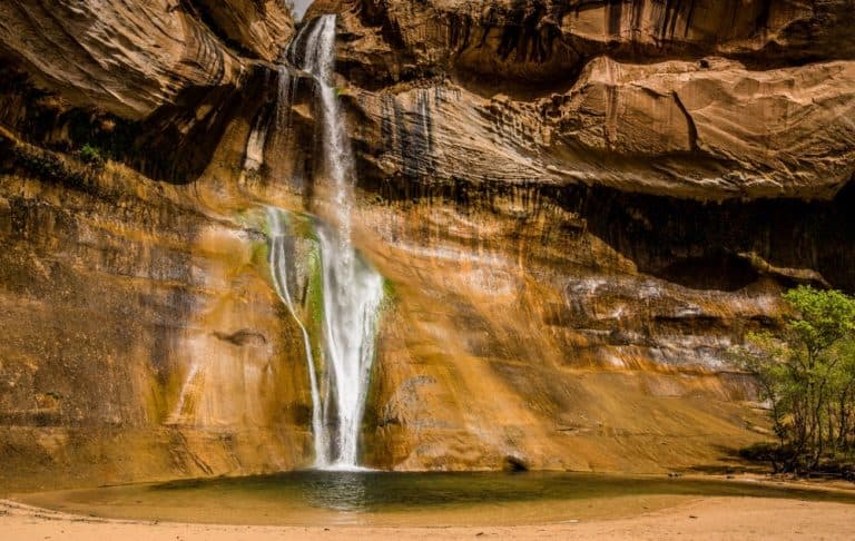
Things To Do Near Capitol Reef
- Capitol Reef National Park Activities
- Lower Calf Creek Falls
- Bryce Canyon National Park Activities
- Goblin Valley State Park
- Moab, Utah Vacation Guide
Capitol Reef Itinerary
Check out these done-for-you itineraries for Capitol Reef based on the time you have to spend exploring the park! Click the graphic below to grab a free copy of the travel bundle with printable itineraries!