Three Days in Capitol Reef National Park: Itinerary and Guide
Spending three days in Capitol Reef National Park allows you time to really explore this beautiful national park in Utah: scenic drives, off-roading, hiking, biking, and more!
Use this Capitol Reef National Park guide to plan your 3-day trip: things to see and do, best time to visit, what to pack, and where to stay.
We’ve got other itineraries as well if you don’t have three days:
And grab our travel bundle with printable 1, 2 and 3-day itineraries to print and use to plan your vacation!
This site contains affiliate links which means WE may receive commissions for purchases made through these links. We only provide links to products we actually use and/or wholeheartedly recommend! As an Amazon Associate, we earn from qualifying purchases. Read the full Disclosure Policy.
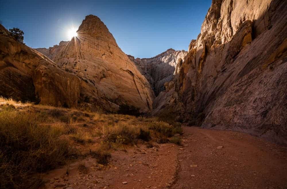
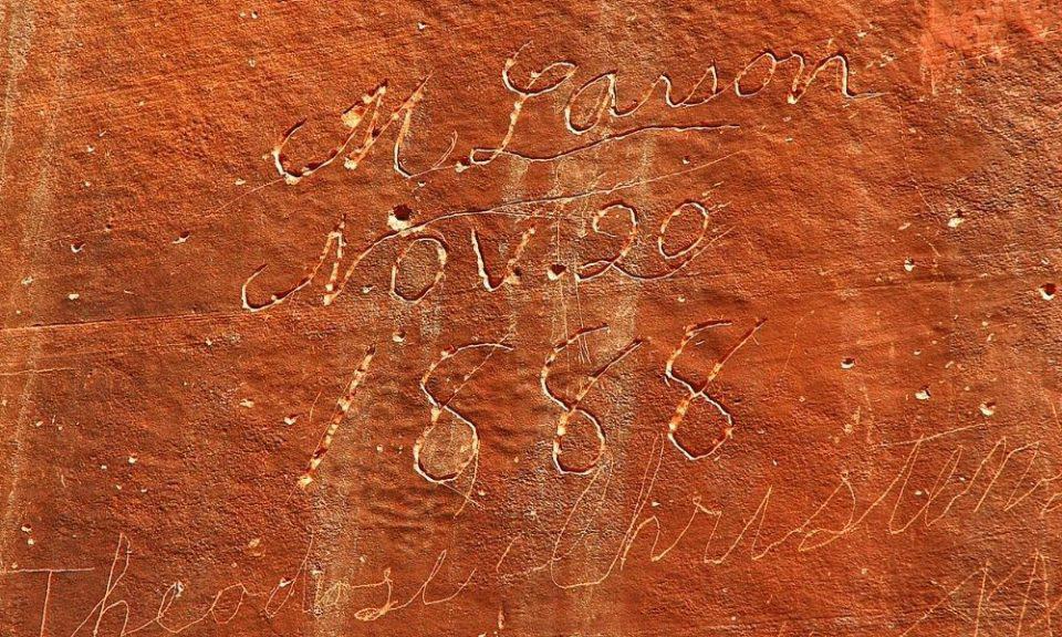
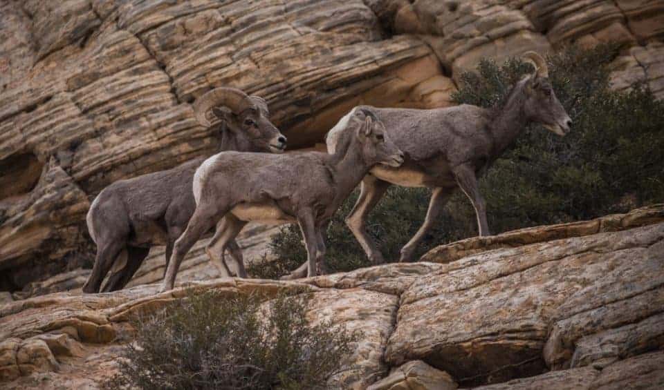
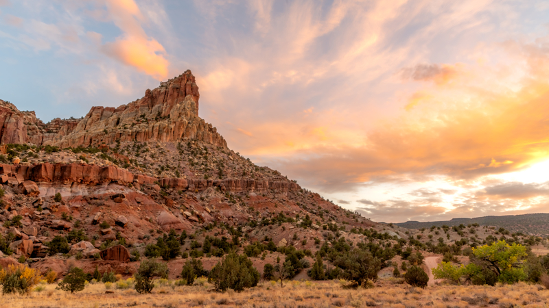
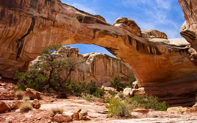
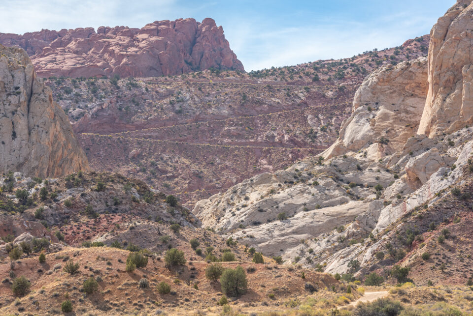
A Photo Tour of Capitol Reef National Park
Take a visual tour through Capitol Reef National Park to see the stunning landscape and wildlife you’ll find in the park!
What to Expect When Visiting Capitol Reef
When you visit Capitol Reef National Park you’ll see stunning landscapes with cliffs, canyons, domes, and bridges.
The park is located in south-central Utah between Arches and Canyonlands National Parks and Bryce Canyon and Zion National Parks where
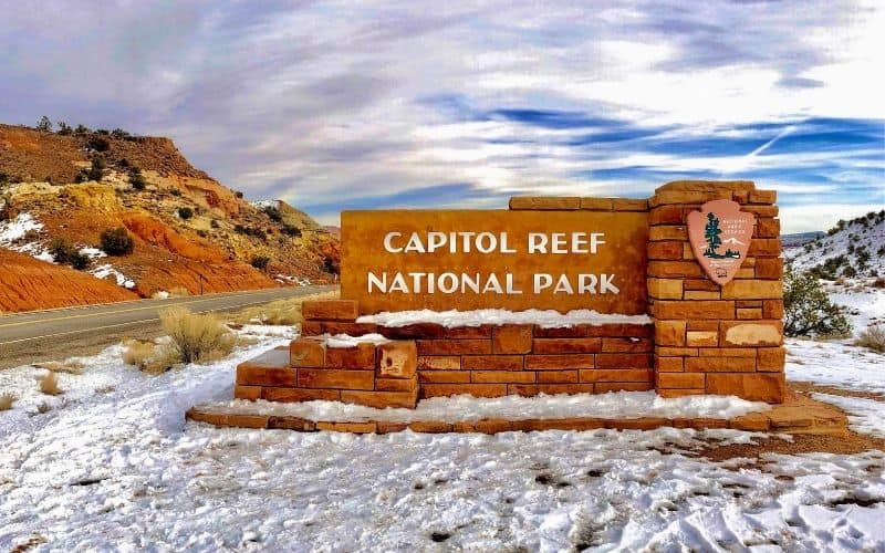
Capitol Reef National Park is open 24 hours a day, every day of the year, even on holidays! Be sure to check the Capitol Reef website for the most updated information for the visitor center hours and closures when you plan to visit.
A Capitol Reef entrance fee is charged only for the main scenic drive in the park. The self-pay entrance station is located just south of the campground. There is no entrance fee for anyone with the US National Parks pass.
When you visit it will feel uncrowded compared to the other 4 Utah National Parks which is really nice!
Best Time of Year to Visit Capitol Reef National Park
Determining the best time to visit Capitol Reef National Park depends on what you want to see and do, and the type of weather you prefer.
Most of the year you’ll enjoy fun outdoor things to do in Capitol Reef National Park like scenic drives, hiking, and biking. During the winter, the activities might be a bit more limited due to the cold and snow! If you’re prepared with the right winter clothing and traction devices for hiking, it’s a wonderful time of year to visit!
Capitol Reef National Park Weather
It’s important to know what the Capitol Reef National Park weather is like during all four seasons to help you decide the best time to plan your vacation.
Spring Weather at Capitol Reef – varies quite a bit from month to month. It’s important to pack for all types of weather because you never know when the weather will change.
- Capitol Reef in March: Highs 55 | Lows 31 degrees F
- Capitol Reef in April: Highs 64 | Lows 37 degrees F
- Capitol Reef in May: Highs 73 | Lows 46 degrees F
It is not unusual to get snowfall in March or even April. We recommend you watch the weather and pack a winter coat, winter hat, and winter gloves when going to Capitol Reef in early spring.
Summer Weather at Capitol Reef – temperatures will be hot! Plan your outdoor activities for the cooler mornings and evenings!
- Capitol Reef in June: Highs 85 | Lows 56 degrees F
- Capitol Reef in July: Highs 90 | Lows 62 degrees F
- Capitol Reef in August: Highs 87 | Lows 60 degrees F
With the hot summer temperatures, you’ll want to protect yourself from the sun by wearing a sun hat, sunscreen and sunglasses. It’s important to stay hydrated and carry a hydration pack or a refillable water bottle in your backpack.
Fall Weather at Capitol Reef – great time to explore the park because it will be cool in the mornings and evenings, and the daytime temperatures aren’t too hot compared to the summer.
- Capitol Reef in September: Highs 80 | Lows 50 degrees F
- Capitol Reef in October: Highs 65 | Lows 40 degrees F
- Capitol Reef in November: Highs 50 | Lows 30 degrees F
With the cooler temperatures at night, you will definitely want to bring a fleece jacket, warm hat and gloves for the nights and early mornings.
Winter Weather at Capitol Reef – temperatures really drop during this offseason time of year.
- Capitol Reef in December: Highs 39 | Lows 19 degrees F
- Capitol Reef in January: Highs 39 | Lows 18 degrees F
- Capitol Reef February: Highs 45 | Lows 23 degrees F
During the winter it is especially important to dress in layers. We recommend an insulted winter jacket, fleece jacket, warm hat and gloves if you’ll be doing any outside activities. Here’s the full list of the outdoor winter clothing we use!
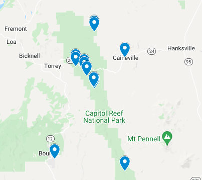
Map of Capitol Reef Points of Interest
Use this Google map of the Capitol Reef photograph spots we love to navigate through the park.

Itinerary for Three Days in Capitol Reef National Park
The next three days will be spent taking sunrise and sunset photos, exploring the Capitol Reef scenic drives, and hiking trails.
When hiking in Capitol Reef, your safety depends on your good judgment, adequate preparation, and constant awareness. Your safety is your responsibility. Carry a Capitol Reef Map when hiking.
Important things to note when hiking at Capitol Reef:
- Stay on the trail.
- Stay back from cliff edges.
- Observe posted warnings.
- Please watch children.
- Avoid narrow canyons when storms are threatening.
Before you set out on any Capitol Reef Hikes, be sure you pack the proper gear, plenty of water and healthy snacks.
- Day Hike Checklist
- What to Bring on a Hike
- Photography Gear for Hiking
- Hiking Gear for Kids & Tips for Hiking with Kids
Day 1 at Capitol Reef National Park
Here’s what we recommend for visiting Capitol Reef the first day of your vacation.
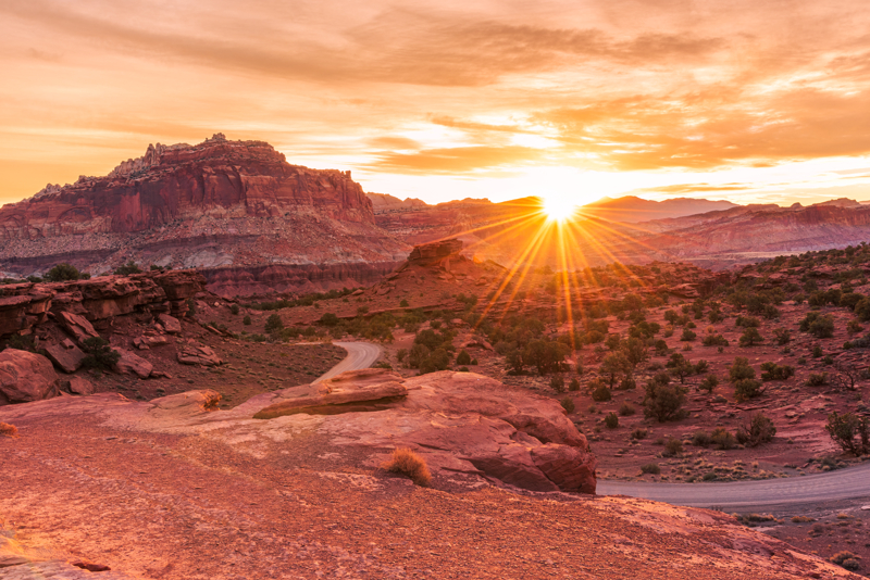
Sunrise at Panorama Point
Panorama Point is found along Highway 24 between Torrey and Fruita, where you’ll find the Capitol Reef Visitor Center. There is no fee to access all points of interest along Highway 24.
It’s a short walk up a small incline for a stunning view of the Capitol Reef landscape. We love this Capitol Reef National Park photography spot to capture the sun rising over the horizon!
Landscape photography tips:
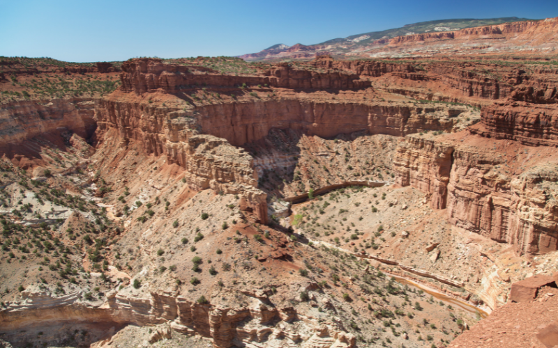
Goosenecks and Sunset Point Trails
From Panorama Point, drive to the Goosenecks along the 1-mile dirt road to the end. The dirt road is suitable for 2WD vehicles in dry conditions.
Follow the short 0.2 mile roundtrip hike to the Goosenecks Overlook to see the stunning view down to Sulphur Creek.
You’ll also see the trail to Sunset Point in this same parking lot. It’s a great spot for sunset, but we’ll be in another part of the park at this time. If you’re up to it, we suggest you do this short 0.8 mile roundtrip hike now to see an amazing panoramic views of Capitol Reef.
Capitol Reef Visitor Center
The Visitor Center is the best place to get the most up-to-date information for road and trail conditions in Capitol Reef as well as camping and ranger-led programs.
The park is open all day, every day. The visitor center is open daily, but check the Capitol Reef website for holiday closure dates and operation times. You can get a copy of the Capitol Reef Park Map there too.
Capitol Reef Scenic Drive
The Capitol Reef scenic drive accessed through Fruita is the best way to experience this park. Yes, you can stop at the various pullouts, and even access some hikes along Highway 24 that don’t require paying the park entrance fee. But we highly recommend taking the time for the scenic drive!
It will take about a 2 hours roundtrip to explore the scenic drive, including the two dirt spur roads (Grand Wash and Capitol Gorge). If you plan to do any of the hikes along the scenic drive (Cassidy Arch Trail, Grand Wash Trail, or Capitol Gorge Trail), be sure to add more time to your itinerary.
The 7.9 mile paved main road is suitable for passenger vehicles. The two dirt spur roads enter canyons with narrow sections, and are usually suitable for passenger cars and RVs up to 27 feet in length. The Scenic Drive, Grand Wash, and Capitol Gorge roads can be closed due to snow, ice, mud, and flash floods so always be aware or weather and road conditions!
You will need a National Park pass to enter the scenic drive beyond the Fruita campground at Capitol Reef. The annual park pass can be purchased online or at the Capitol Reef visitor center. If you purchase a digital pass be sure to print or save it on your mobile device since connectivity is limited in the park.
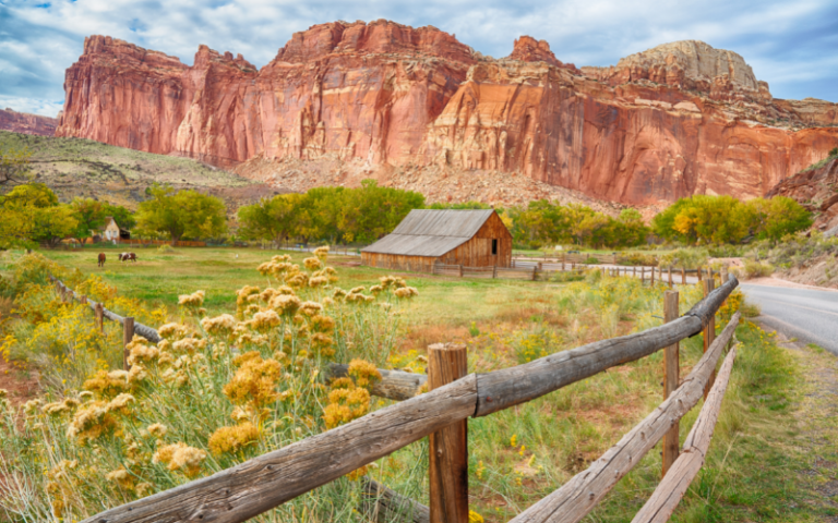
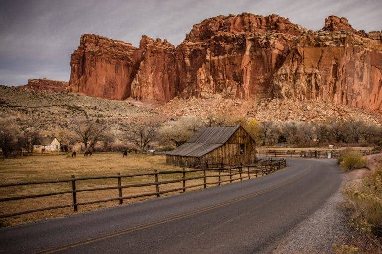
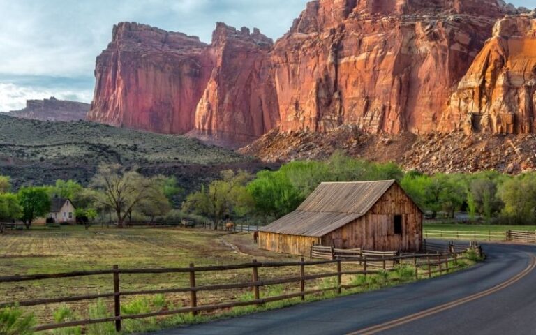
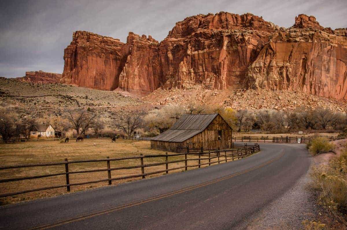
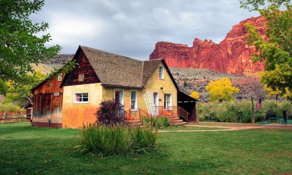
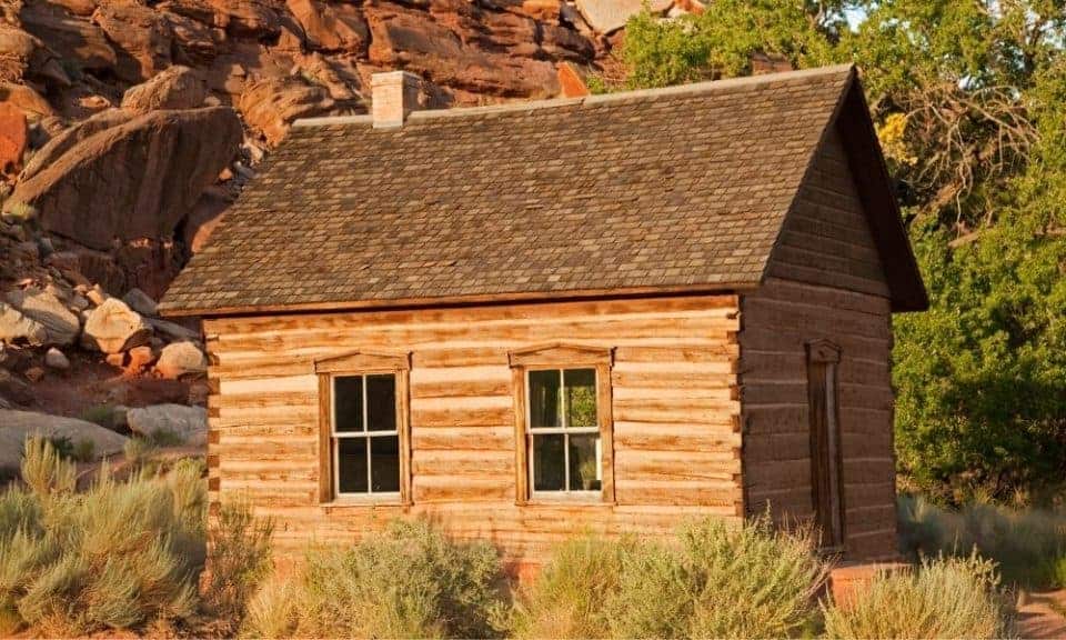
Capitol Reef Fruita Area
The scenic drive begins at the Capitol Reef Fruita Historic District. Here you’ll find most of the Capitol Reef services like the Visitor Center, ranger programs, restrooms, and large picnic area near the river and the campground.
Fun things to see, do, and photograph in Fruita:
- Fruita barn
- Blacksmith shop
- Fruita schoolhouse
- Gifford House (museum and yummy food)
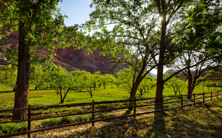
- Fruit orchards (pick fresh fruit in season)
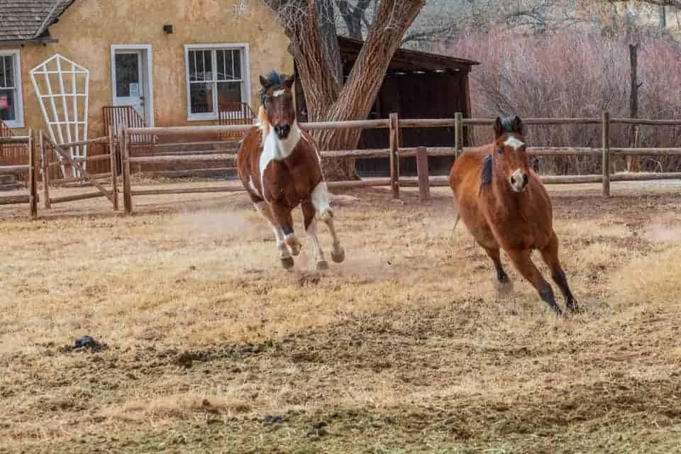
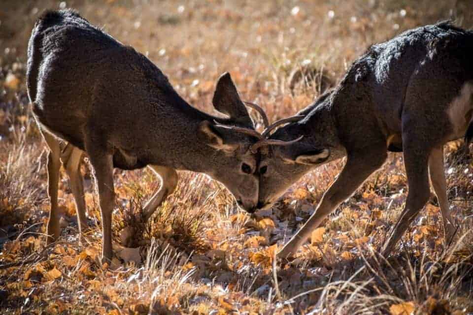
The Fruita district is the best place to photograph animals! The horses at the Gifford Barn are fun to watch. And deer frequent the orchards and picnic areas as well.
Just past the Fruita campground, you’ll find a self-pay station to purchase your pass to drive the scenic road, or be sure to display your park pass at this point.
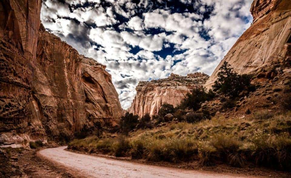
Grand Wash Road
The Capitol Reef Grand Wash is a spur dirt road that leads into a narrow, steep-walled canyon that is extremely vulnerable to bad weather conditions.
PAY ATTENTION to the weather because you don’t want to get caught in the narrow canyon during a flash flood!
At the end of the road is the small parking lot for the Grand Wash trail. Here you’ll turn around and return the way you came back to the paved scenic drive road.
Capitol Gorge Road
At the end of the scenic drive you’ll find the unpaved road to Capitol Gorge. There’s a large parking area with picnic tables and pit toilets here. Eph Hanks Tower seen from the parking lot is a terrific location for sunset and night photography.
This is also where the dirt road spur trail begins to take you to the Capitol Gorge trail. The drive down the spur road is worth it if you have the time, even if you won’t do the hike.
Pioneer Register and The Tanks Hikes
There is a trail that runs parallel to the wash, eventually going into the wash. On the right, you’ll see a few names carved on the wall. The Pioneer register is up kind of high, so watch out for it.

Toward the end of the walled canyon there will be a sign and cairns on the left leading to the tanks. The tanks are cool to see, especially when they are filled with water. The views are pretty good up there. Keep an eye out for big horned sheep on the rocks in this area.
PAY ATTENTION to the weather because you don’t want to get caught in the narrow canyon during a flash flood!
Sunset at Capitol Reef
There are a few sunset photo spots we recommend for Day 1. You won’t see the sun actually setting, but you’ll capture the golden light on the rock formations and walls at these locations:
- Eph Hanks Tower
- Scenic Drive Road
- Fruita Barn
Check out these resources for taking sunset photos:

Day 2 at Capitol Reef National Park
On Day 2 at Capitol Reef, you have time to do a short day hike in addition to driving the Burr Trail Loop.
Capitol Reef Day Hikes
Here’s a list of the best day hikes found in Capitol Reef National Park.
- Distance: 1.8 miles roundtrip
- Elevation Gain: 400 ft
- Difficulty: Moderate
- Trailhead: Hickman Bridge Trail Parking Lot along Highway 24 (no NP fee) – it’s a small parking area so do this hike early!
- Distance: 3.6 miles roundtrip
- Elevation Gain: 590 ft
- Difficulty: Moderate
- Trailhead: Chimney Rock Trail Parking Lot along Highway 24 (no NP fee) – terrific spot for sunset!
- Distance: 3.4 miles roundtrip
- Elevation Gain: 440 ft
- Difficulty: Moderate
- Trailhead: Near Fruita Barn 1 mile SE of the Visitor Center (no NP fee)
- Distance: 3.4 miles roundtrip
- Elevation Gain: 670 ft
- Difficulty: Strenuous
- Trailhead: Grand Wash (NP fee)
Drive the Burr Trail / Notom Road Loop
The Burr Trail / Notom Road Loop is also called the Loop-the-Fold Driving Tour. It’s a 124-mile loop that takes 4-6 hours.
In dry weather the Burr Trail / Notom Road Loop is easily accessible to passenger cars. Wet weather may make the road impassable even for 4-wheel drive vehicles. Always check with rangers for weather and road conditions before driving this road.
- Pack plenty of water and the supplies you’ll need for the trip. Pack out what you pack in. Carry out all trash and food scraps.
- The drive is fairly remote and access to cell phone service is unlikely. Leave your trip itinerary with someone so you can be located in case of car trouble or other mishaps.
- There are no fees to drive on the Burr Trail Scenic Backway.
- Most areas and trails along the backway require your dog to be on-leash.
- Flash floods happen in an instant here. A storm can appear out of nowhere, sending water flooding into a canyon. If you see or hear a threat of rain or storms, DO NOT RISK your safety for the scenery. Never enter washes or narrow canyons when it is raining or threatening to rain.
From Capitol Reef, access the Scenic Byway 12 heading to Bryce Canyon. The Burr Trail Scenic Backway begins in Boulder and is paved to the west boundary of Capitol Reef.
You’ll drive 18 miles to a scenic turnoff above switchbacks. The road turns to dirt and gravel here. You can turn around and head back the way you came, or continue on to make the loop back to Capitol Reef.
If you keep going, you’ll reach the Burr Trail Switchbacks with amazing views of the Waterpocket Fold. The road here descends down a series of tight switchback turns several hundred feet to the valley below.
A short distance past the bottom of the Switchbacks is a junction. This is where the Notom Road and Burr Trail meet. Turn left to follow the Notom Road that runs north from the junction parallel with the Waterpocket Fold passing through the small town of Notom where it connects a short distance later to SR-24 east of Capitol Reef.
Day 3 at Capitol Reef National Park
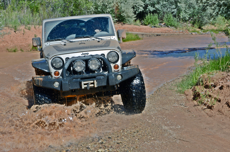
Exploring the Cathedral Valley is the activity for the third day at Capitol Reef. You have the option to drive this road with your own 4WD vehicle, or to take a guided tour.
Drive the Cathedral Valley Loop (Option 1)
Capitol Reef National Park includes the Cathedral Valley Loop. This is a remote and rugged area of the park.
Vehicles with high ground clearance, even those without four-wheel drive, can usually negotiate the roads without difficulty. However, road conditions can vary greatly depending on recent weather conditions. Spring and summer rains and winter snows can leave the roads muddy, washed out, and impassable to the best high-clearance four-wheel drive vehicle, so check at the visitor center for current road conditions.
- Carry plenty of water, food, gas, adequate clothing, a shovel, and emergency supplies.
- No potable water is available in Cathedral Valley.
- Cell phone reception is usually poor to nonexistent. Leave your trip itinerary with someone so you can be located in case of car trouble or other mishaps.
- There are no fees to drive the Cathedral Valley Loop road.
This driving loop is 57.6 miles and takes about 6-8 hours to complete. It requires fording the Fremont River (there is no bridge over the river). Do not attempt to cross the river during floods or other periods of high water. Ask at the visitor center about river ford conditions or call 435-425-3791. The ford has a hard packed, rocky bottom and water levels are normally a foot or less deep.
We recommend you start the Cathedral Valley drive clockwise at Hartnet Road, 11.7 miles east of the visitor center on Highway 24. This way if the river is too high to cross safely, you don’t need to drive all the way back.
Continue on that road for 27.8 miles to Hartnet Junction. Turn right (north) onto Cathedral Road and drive 29.9 miles back to Highway 24 to complete the loop.
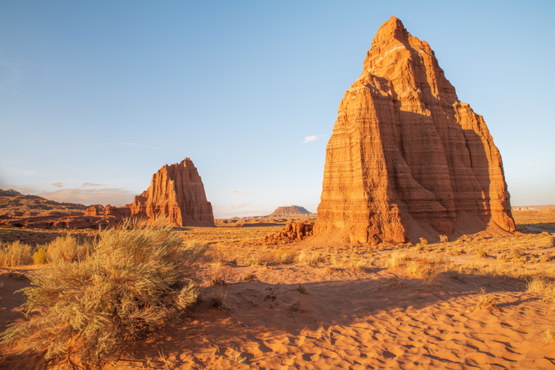
If the river is too high, then we recommend you start on Cathedral Road from Highway 24. Drive to see Temples of the Sun and Moon then return back the way you came.
Cathedral Valley Guided Tour (Option 2)
If you don’t have a 4-wheel drive vehicle and still want to see the Cathedral Valley, then book a guided tour!
- Enjoy a Cathedral Valley private tour in a comfortable 4WD vehicle
- Explore Capitol Reef National Park’s hidden gems with a guide
- See landmarks like the Temples of the Sun and Moon
- Munch on snacks while learning about the geography of Cathedral Valley
Things to Do Near Capitol Reef
- Visiting Goblin Valley State Park
- Best Stops Along Scenic Byway 12
- Anasazi State Park
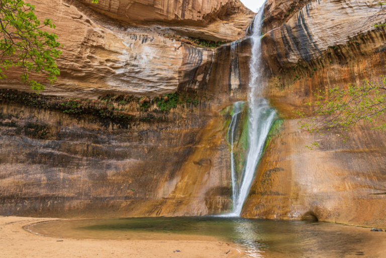
- Lower Calf Creek Falls Hiking Guide
- Escalante Petrified Forest State Park
- Kodachrome Basin State Park
- Bryce Canyon Travel Guide
Plan a Capitol Reef Vacation
- Capitol Reef National Park Guide
- Capitol Reef National Park Packing List
- Best Time to Visit Capitol Reef National Park
- Things to Do in Capitol Reef National Park