Capitol Reef Cathedral Valley Loop Scenic Drive
Situated in the remote district of Capitol Reef National Park, the Cathedral Valley Loop Scenic Drive offers a rugged and captivating experience for those seeking to venture off the beaten path.
Use this Capitol Reef National Park guide to see sandstone monoliths, vibrant Bentonite hills, and expansive desert vistas in the Cathedral Valley district. This hidden gem appeals to those who appreciate solitude and backcountry exploration.
The Cathedral Valley Loop, a 58-mile scenic drive, presents an incredible opportunity to immerse yourself in this remarkable landscape. The absence of paved roads adds to the allure of this drive as you venture into the heart of the wilderness, far away from the crowds.
Living only a few hours away, we’ve had the opportunity to explore the Cathedral Valley scenic drive many times. The tips we share are based on our experiences visiting the area throughout the years!
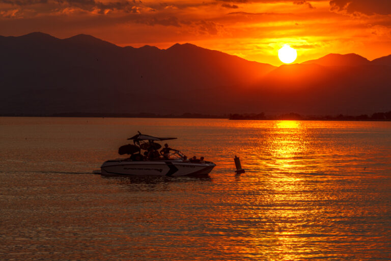
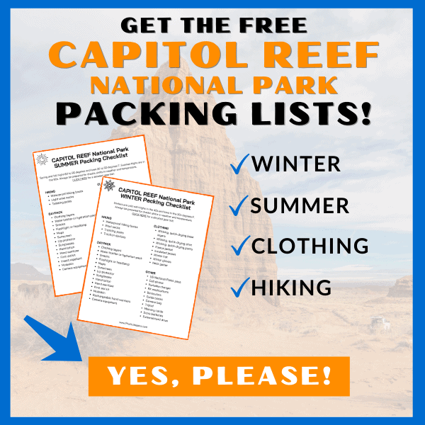
Check out our Capitol Reef National Park packing list so you have the right clothing and gear for visiting any time of year! Grab your free printable packing checklist by clicking the image below!
This site contains affiliate links which means WE may receive commissions for purchases made through these links. We only provide links to products we actually use and/or wholeheartedly recommend! As an Amazon Associate, we earn from qualifying purchases. Read the full Disclosure Policy.
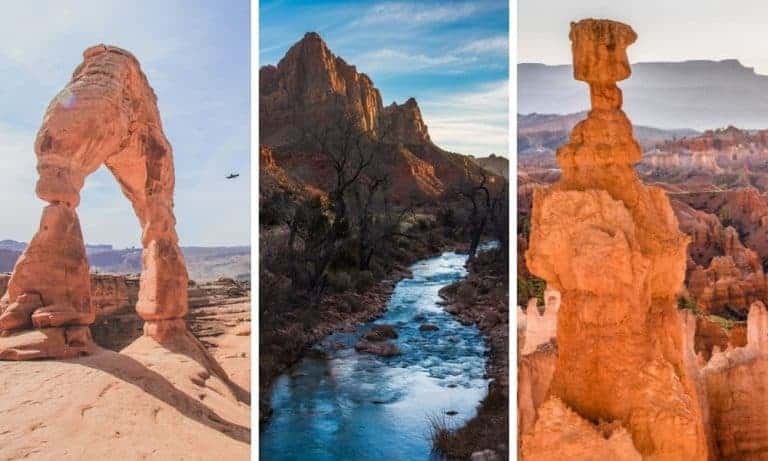
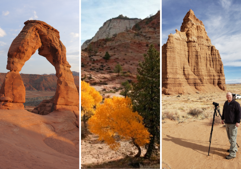
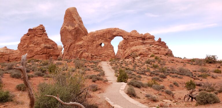
A Photo Tour of Capitol Reef National Park
Take a visual tour through Capitol Reef National Park to see the stunning landscape and wildlife you’ll find in the park!
Things to Know Before Visiting Cathedral Valley
Cathedral Valley is a bit off the beaten path, but trust us, the loop drive is worth all the effort to see the amazing landscapes you’ll find here!
Location: The loop consists of two primary roads: Hartnet Road and Cathedral Road. Starting from Highway 24, you will drive northwest on Hartnet Road, through Cathedral Valley, then return to Highway 24 via Cathedral Road. You will drive a short stretch of Highway 24 to complete the loop.
Distance: The main loop itself covers a distance of 58 miles. If you explore all the short detours and viewpoints mentioned during the drive below, the total distance will be approximately 72.6 miles.
Time: Driving the entire loop without additional stops or hikes takes 6 to 8 hours to complete. For exploring detours, visiting overlooks, or embarking on short hikes, you must allocate one full day to enjoy the whole Cathedral Valley Loop experience.
Directions: Generally, it is best to drive the Cathedral Valley Loop clockwise. This allows you to tackle the river crossing at the beginning of the drive. Remember, the water level in the Fremont River may be too high to safely cross in a vehicle at times. If that’s the case, modifications to the loop may be necessary. Check the river conditions before starting the drive to avoid any inconvenience at the end of the loop.
Vehicle Requirement: Both Hartnet Road and Cathedral Road are gravel roads with some sections containing thick sand and small obstacles. Thus, a high-clearance vehicle is essential to traverse these terrains safely. While a 4×4 vehicle is not mandatory according to the National Park Service, it is strongly advised. Renting a 4×4 Jeep or booking a Cathedral Valley tour are options if you can’t access such a vehicle.
Remember all vehicles can navigate the Capitol Reef Scenic Drive from Fruita to Capitol Gorge!
Road Conditions: Approximately 95% of the road is well-maintained and relatively easy to drive. However, there are a few sections where 4WD may be necessary, particularly in sandy areas or when encountering obstacles. Having a 4×4 vehicle provides an added level of confidence and capability in handling these situations.
Weather and Seasons: The weather in Cathedral Valley can vary significantly depending on the season. Summers tend to be hot, with temperatures 90 to 100°F, while winters can bring cold temperatures and occasional snowfall. Spring and fall offer milder weather and are popular times to visit.
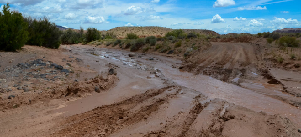
The Cathedral Valley Loop can be driven year-round. However, it’s important to note that spring and summer rains and winter snow can leave roads muddy, washed out, and impassable, even for 4×4 vehicles. ALWAYS check with the Capitol Reef Visitor Center for current road conditions.
Services: There is no potable water in the area. There is a pit toilet at the Cathedral Valley primitive campground. Due to the remote location it’s essential to pack all necessary supplies for your trip. Cell phone reception is usually poor to nonexistent.
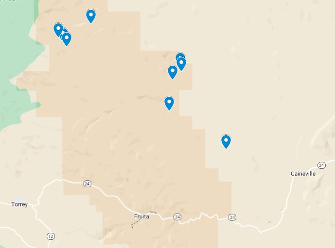
Map of the Best Stops Along the Cathedral Valley Loop
Check out the map of the Cathedral Valley Loop Points of Interest. Before we share the full loop description, here’s a quick look at the must-see sights as you begin the drive from Hartnet Road:
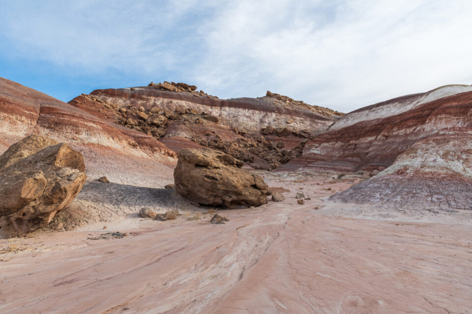
Bentonite Hills: As you navigate the Cathedral Valley Loop, take advantage of the opportunity to drive through the Bentonite Hills. These colorful hills add another layer of visual interest to your journey.
Lower South Desert Overlook & Jailhouse Rock: This overlook offers a different perspective of the South Desert area, with views of Jailhouse Rock, an intriguing rock formation resembling a prison cell.
Lower Cathedral Valley Overlook: Enjoy a 2-mile round-trip hike to the Lower Cathedral Valley Overlook. From this viewpoint, you can marvel at the Temples of the Sun and Moon from a bird’s eye perspective, offering a different view than the Upper Cathedral Valley Overlook.
Upper South Desert Overlook: From this vantage point, you can witness the beauty of the South Desert region, with its expansive desert scenery and distant mesas.
Upper Cathedral Valley Overlook: This overlook provides a stunning panoramic view of the Cathedral Valley, allowing you to appreciate the vastness and grandeur of the landscape fully.
Morrell Cabin: A short and easy 0.5-mile round-trip walk leads to the cabin. It was used from 1930 to 1970 as a resting place for cowboys moving their livestock between the rangelands and mountain pastures.
Gypsum Sinkhole: Take a quick visit to the Gypsum Sinkhole, a unique geological feature that showcases the power of erosion and the beauty of nature’s creations.
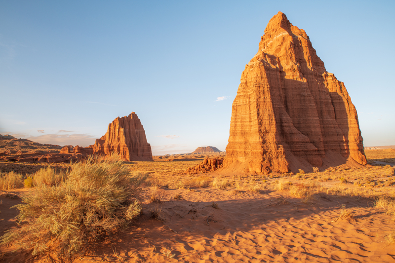
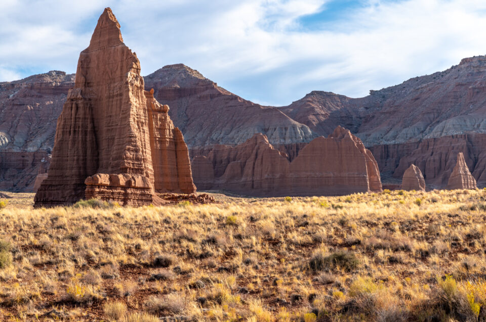
Temples of the Sun & Moon: These iconic sandstone monoliths are the highlights of Cathedral Valley. Their towering presence and unique formations make them a photographer’s dream and a sight to behold.
Cathedrals Trail: Embark on the Cathedrals Trail, a hiking adventure that takes you closer to the Temples of the Sun and Moon. This trail provides a more intimate encounter with the magnificent monoliths.
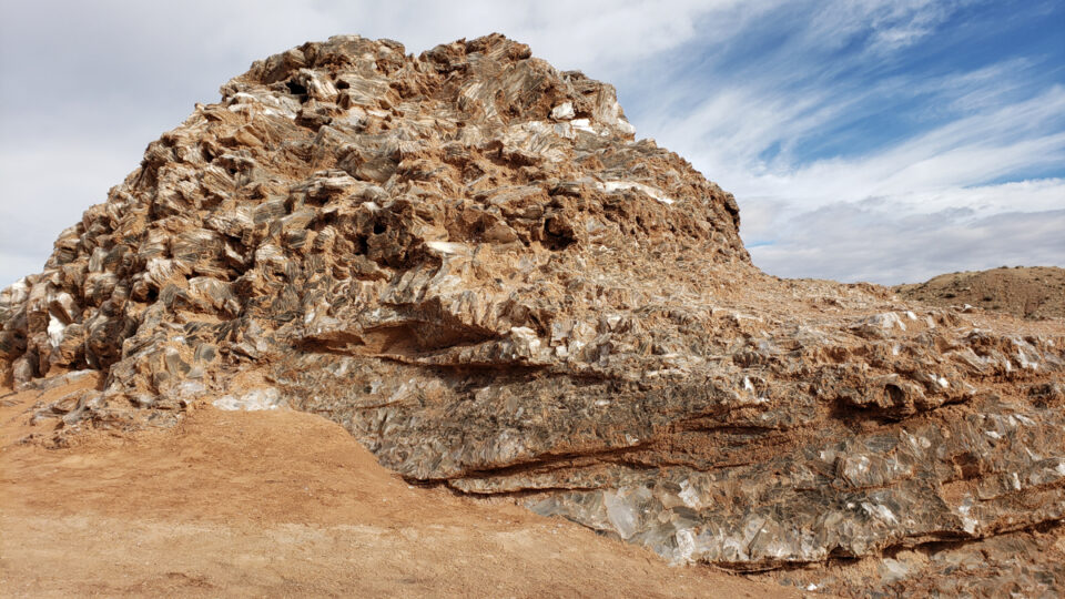
Glass Mountain: Be sure to take a look at this large, exposed mound of selenite crystals, a variety of gypsum in the form of glassy crystals. Remember that collecting anything is prohibited in all national parks!
Cathedral Valley Loop Route Description
The Cathedral Valley Loop is one of the best Utah Scenic Drives! We recommend you drive it clockwise, starting at the junction of Hartnet Road and Highway 24.
Starting at the Fremont River avoids the disappointment of driving the full loop counter-clockwise then finding the river crossing impassable, requiring the return drive along the full loop back to Highway 24 and Cathedral Road.
Always prioritize your safety and beware of changing water levels before attempting to cross the river.
IF the Fremont River is impassable, we recommend you start at Highway 24 and take the Cathedral Road to the Upper Cathedral Valley Overlook then turn around and go back the way you came. This route let’s you see many of the best points of interest in Cathedral Valley!
Here’s the route description, distances, and stops for driving the loop road:
Hartnet Road
Reset your odometer at mile marker 91 on Highway 24 and turn onto Hartnet Road. After driving for 0.5 miles, take the second left to the Fremont River crossing. See the map for this section of the drive and the river ford.
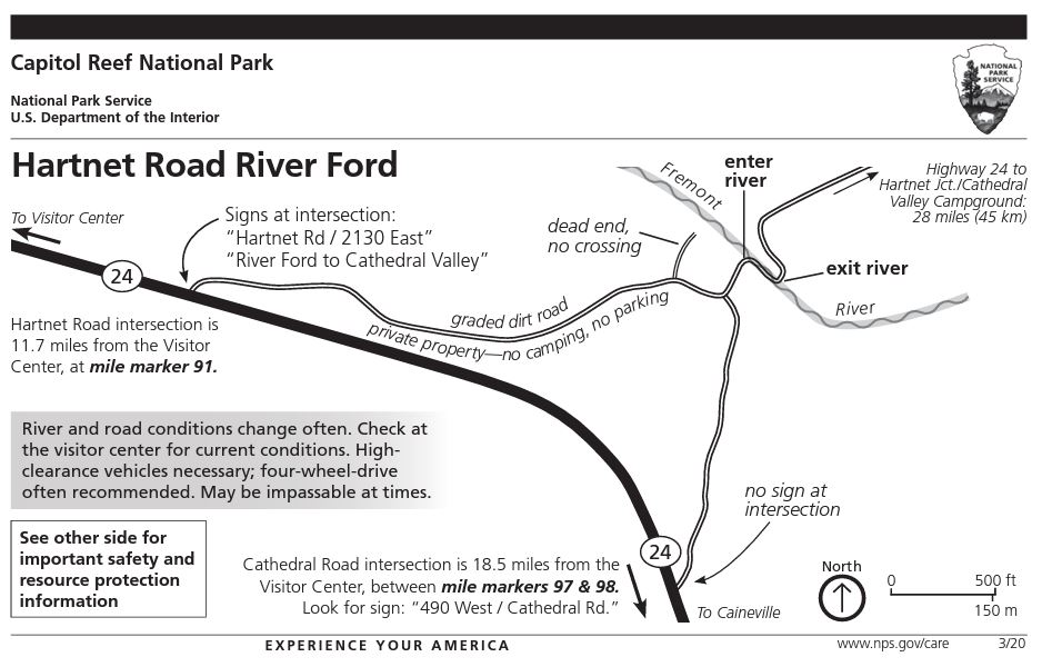
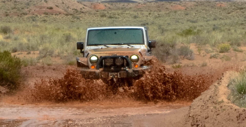
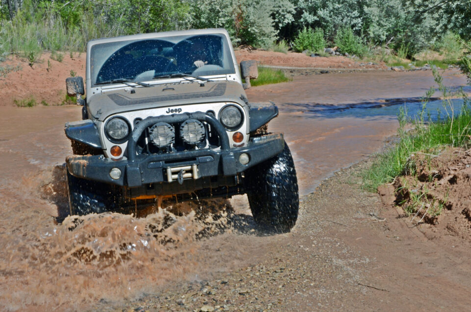
Crossing the Fremont River (River Ford)
To cross the Fremont River, enter the river and immediately turn right, following the downstream path for approximately 100 feet. Then make a sharp left to climb onto the opposite river bank. Remember that the water level varies, typically between 8 and 16 inches. However, the water level can rise after storms or snowfalls, making the crossing unsafe.
Please respect the posted no trespassing signs along the road near the ford by not parking off-road or camping in the vicinity.
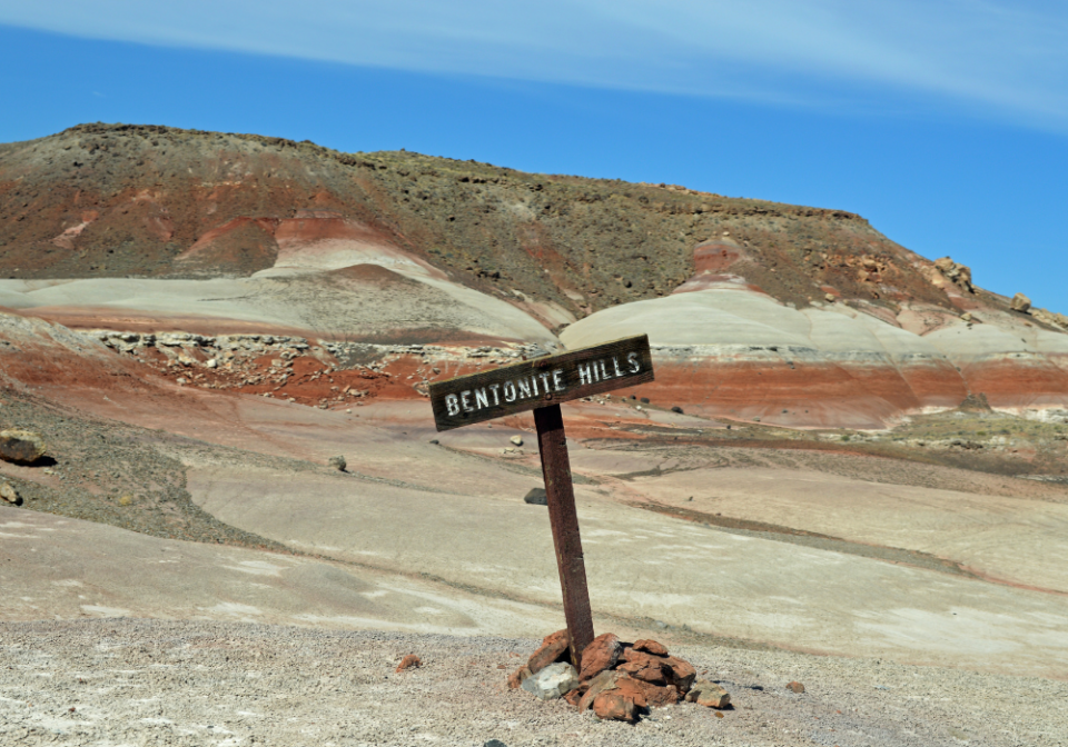
Bentonite Hills
Witness the vibrant Bentonite Hills, which are composed of clay and volcanic ash. These hills grace the landscape as you pass along. After rainfall, this area may be impassable due to the clay roads in the area.
Lower South Desert Overlook & Jailhouse Rock
Take a left onto the spur road and drive 1.2 miles to reach the endpoint. Park your vehicle in the small parking lot. Embark on a 0.25-mile walk (0.5 miles round trip) to get to the breathtaking overlook. This viewpoint is one of our personal favorites throughout the entire drive. For those seeking more adventure, you can continue hiking from here, following the trail past Jailhouse Rock to Temple Rock. This 4.5-mile out-and-back hike takes approximately 2 hours.
Capitol Reef Park Boundary
As you reach this point, you transition from Bureau of Land Management (BLM) lands and officially enter Capitol Reef National Park.
Lower Cathedral Valley Overlook
To witness a bird’s eye view of the Temple of the Sun and the Temple of the Moon, embark on a 1.8-mile round-trip hike to the overlook. Most of the trail is flat and quick-paced. Once you reach the viewpoint, a short but moderately challenging hike up the saddle awaits you to get even higher vantage points.
Upper South Desert Overlook
For a breathtaking view of the South Desert and the Water Pocket Fold, go on a 0.5-mile round-trip hike to this viewpoint. The trail ascends mostly uphill from the parking lot, demanding some effort. However, your reward is an outcropping of rock offering panoramic vistas of the South Desert.
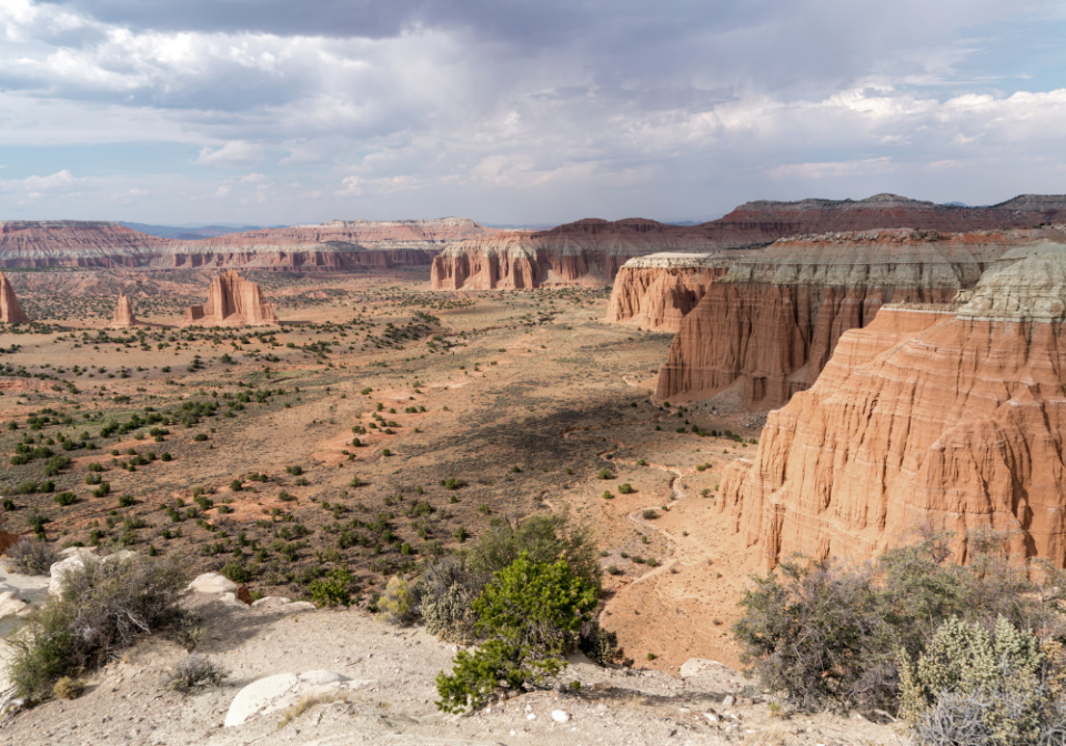
Upper Cathedral Valley Overlook
Turn right onto the spur road and drive 0.4 miles until you reach the end. Take a short walk (about a quarter of a mile round-trip) to another stunning viewpoint. This time, yo will look northeast, gazing upon Cathedral Valley and its magnificent Entrada Sandstone monoliths and rock formations. This overlook is the cover photo for this post.
Hartnett Junction
At this junction, make a right onto Cathedral Road to continue the loop. If you continue straight, you’ll exit Capitol Reef National Park and enter Fishlake National Forest.
Cathedral Valley Campground
A spur road leads to a six-site campground. This is the only place where you will find a pit toilet along the loop. Additionally, this area provides the strongest cellular service.
Beyond the campground, Cathedral Road descends into the valley. The road features several switchbacks and narrow sections, so exercise caution and watch out for oncoming vehicles!
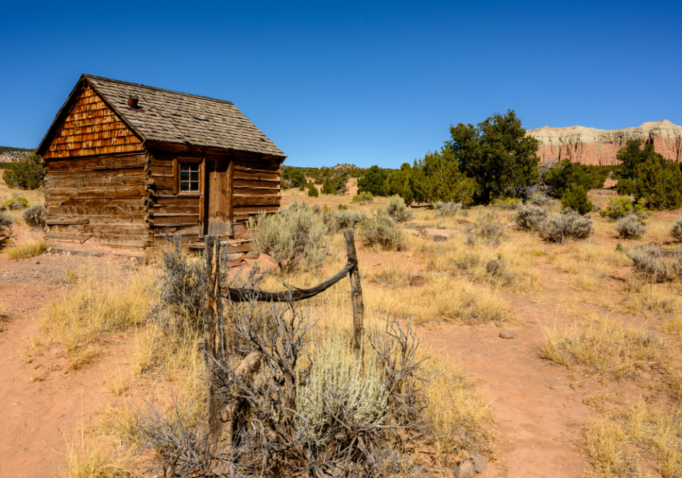
Morrell Cabin
This is a fun easy 0.5-mile round-trip walk to see the cabin used by cowboys from 1930 to 1970.
Cathedral’s Trail
Distance: 2.5 miles | Difficulty: Easy | Total Ascent: 400 feet | Time: 40-60 minutes
The Cathedral’s Trail offers a delightful hike with excellent views of the monoliths in Cathedral Valley. The first half of the trail, where you walk alongside the chain of sandstone formations, is particularly enchanting. The trail culminates atop a hill, rewarding you with panoramic vistas of Cathedral Valley.
Cathedral Valley Junction
At this junction, Baker Ranch Road leads north through the remote wilderness known as Last Chance Desert before reaching Interstate 70. To continue the Cathedral Valley Loop, stay straight on the road.
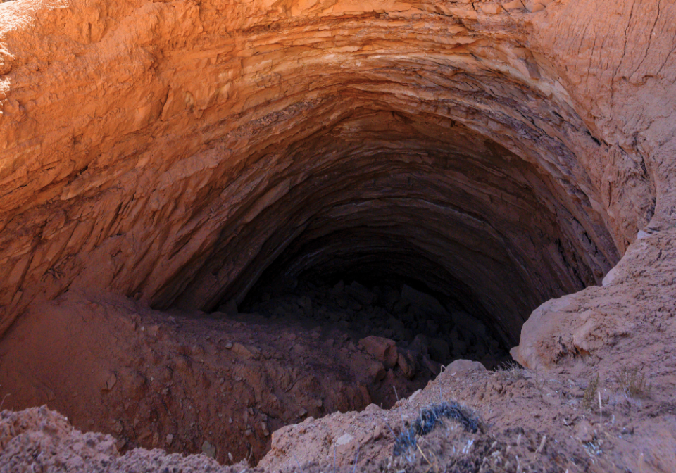
Gypsum Sinkhole
Take a right turn and drive along the 1-mile spur road until you reach the end. From there, it is a short walk to the impressive Gypsum Sinkhole. The dissolution and drainage of a gypsum dome formed this giant hole.
Exit Capitol Reef National Park
At this point, you exit Capitol Reef National Park and re-enter the Bureau of Land Management (BLM) lands. A road junction leads to the more remote Last Chance Wilderness.
Junction for the Temples of the Sun and Moon
Make a right turn onto the spur road that leads to the Temples of the Sun and Moon. This road spans 1 mile and will take you back into Capitol Reef National Park.
Glass Mountain
Take the spur road that leads to Glass Mountain. This unique rock formation is characterized by selenite crystals, also known as moonstones. From this point, you will also enjoy a fine view of the Temples of the Sun and Moon.
Temples of the Sun and Moon
The Temple of the Sun and the Temple of the Moon are iconic formations within Cathedral Valley. Composed of Entrada Sandstone, these structures are gradually eroding. The Temple of the Sun is the larger of the two formations.
The road concludes near the Temple of the Moon, where you can explore while being mindful to avoid walking on the delicate biological soil crust. The sandy area behind the Temple of the Moon offers an excellent photography spot.
Morrison Formation
As you drive back along Cathedral Road, you will exit Capitol Reef National Park again and enter BLM lands. This stretch between the Temples of the Sun and Moon and Highway 24 doesn’t have any unique viewpoints or hiking trails.
This area may become impassable during wet or rainy conditions. We’ve encountered deep sand and water-filled washes along this stretch of road! So happy we had our Jeep!!
2.5 miles from Highway 24, the road name changes to Caineville Wash Road at the junction with W Factory Road, which leads to Factory Butte.
Highway 24
Here, the dirt road transitions to asphalt. Turn right to complete the full loop and return to Capitol Reef National Park. To reach Caineville, Hanksville, or Moab, turn left.
If you complete the entire loop, driving back to the junction with Hartnet Road on Highway 24, the total distance covered is 72.6 miles.
Cathedral Valley Packing List
When planning a trip to explore the Cathedral Valley, it is vital to pack the right gear and supplies to ensure a comfortable and safe experience. Here are some things you should consider including in your packing list:
Vehicle Essentials:
- High clearance vehicle: Ensure you have a car with adequate ground clearance to navigate the gravel roads and potential obstacles along the loop.
- 4×4 (strongly recommended): A 4-wheel drive vehicle will provide added traction and capability, especially in sandy sections or challenging terrain.
- Spare tire and tools: Carry a spare tire and the tools required to change it, as well as a tire pressure gauge and air compressor.
- Emergency kit: Pack a basic emergency kit with flashlight, extra batteries, jumper cables, and a roadside assistance kit.
- Maps and navigation tools: Bring a detailed Capitol Reef map or GPS device to navigate the loop and find specific points of interest.
Outdoor Gear:
- Water: Since no potable water is available, it is crucial to bring an adequate amount of water for hydration. Plan to carry more water than you think you will need, especially considering the dry climate and potential for dehydration.
- Snacks and Food: Pack enough non-perishable food and snacks to sustain you throughout the trip.
- Sun Protection: The desert sun can be intense, so pack sunscreen with a high SPF rating to protect your skin from harmful UV rays. Bring sunglasses, a wide-brimmed hat, and lightweight, breathable UV clothing that covers your arms and legs.
- Proper Footwear: Choose sturdy and comfortable hiking boots or hiking shoes for walking on uneven desert terrain. Closed-toe shoes are recommended to protect your feet from rocks, cacti, and other potential hazards.
- First Aid Kit: It’s always wise to have a basic first aid kit on hand. Include band-aids, antiseptic ointment, pain relievers, blister pads, and any personal medication you may require.
- Camera Gear: Capture the area’s beauty by packing your camera gear – pack extra batteries or a portable charger to ensure you take advantage of all photo opportunities.
Camping Near Cathedral Valley
While there are limited camping options within the Cathedral Valley Loop, there are a few nearby locations where you can set up camp and enjoy the surrounding natural beauty.
Here are some Capitol Reef National Park camping options in the vicinity of the Cathedral Valley Loop:
Cathedral Valley Campground: Located at mile marker 30.4 on Cathedral Road, the Cathedral Valley Campground offers six campsites. This is the only designated campground along the loop, providing basic facilities such as picnic tables and vault toilets. Keep in mind that sites are available on a first-come, first-served basis. The campground also tends to have stronger cellular service than other areas along the loop.
Capitol Reef National Park Campgrounds: There are two campgrounds within a reasonable distance from the loop:
- Fruita Campground: Situated in the Fruita District, this campground provides a range of facilities, including campsites with picnic tables, fire rings, and access to restrooms. It offers a serene setting surrounded by orchards and scenic views. Reservations are recommended.
- Cedar Mesa Campground: Located off Notom-Bullfrog Road, approximately 23 miles south of Highway 24, this campground features five primitive sites. It is a smaller, more secluded option, ideal for those seeking a quieter camping experience. It operates on a first-come, first-served basis.
You’ll also find RV Parks Near Capitol Reef National Park in Hanksville that are close to the start and end points of the loop road on Highway 24.
Dispersed Camping: If you prefer a more remote camping experience, dispersed camping is allowed on Bureau of Land Management (BLM) lands surrounding Cathedral Valley. However, you must practice Leave No Trace principles and follow BLM regulations regarding camping duration and site selection. Be prepared with water and waste disposal solutions, as amenities may be limited.
Remember to check for any campground closures or restrictions before your trip, and be mindful of fire regulations in the area. Respect the natural environment and leave your campsite as you found it to preserve the beauty of the Cathedral Valley and surrounding lands.
Cathedral Valley Tours
You’ll find quite a few options for Cathedral Valley Tours. This is a terrific way to visit the area if you don’t have the right vehicle to get there yourself!
There are half day tours that take you to the Temples of the Sun and Moon. Or there are full day tours to see the full loop!
Things To Do Near Cathedral Valley
- Capitol Reef National Park Activities
- Goblin Valley State Park
- Scenic Byway 12
- Moab, Utah Vacation Guide
Capitol Reef Itineraries
Check out these done-for-you itineraries for Capitol Reef based on the time you have to spend exploring the park! Click the graphic below to grab a free copy of the travel bundle with printable itineraries!
- Capitol Reef National Park in One Day
- Two days in Capitol Reef National Park
- Three days in Capitol Reef National Park