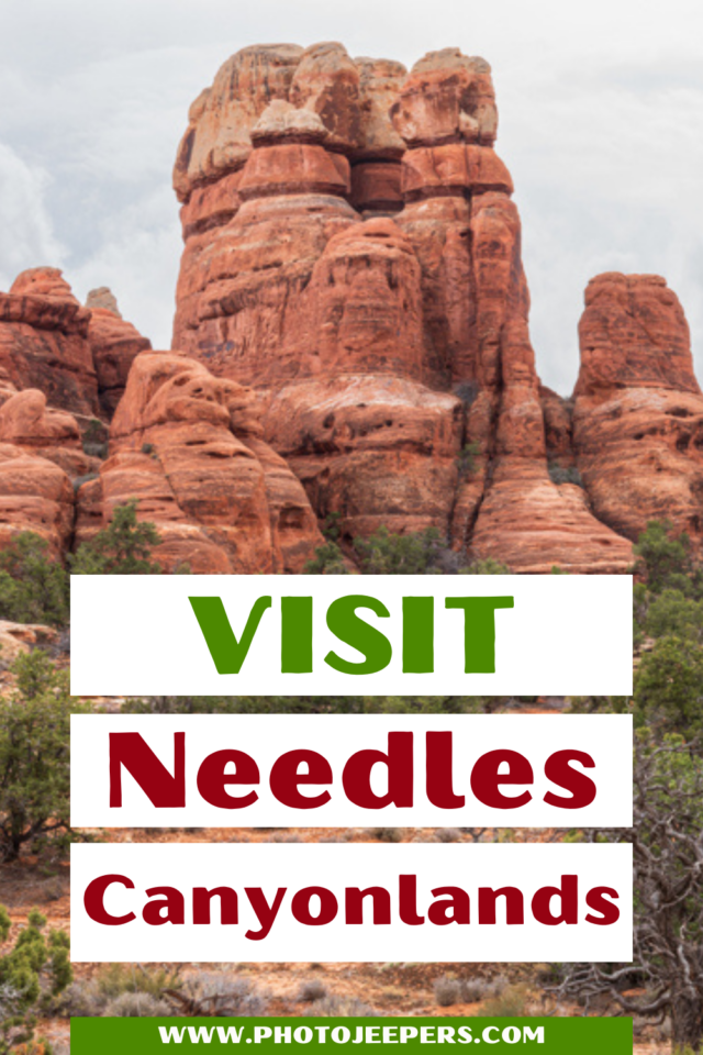
Travel Guide to Visit Needles Canyonlands National Park
From its towering sandstone spires to its colorful desert vistas, Needles Canyonlands offers visitors an unforgettable experience. Needles is one of the four districts (or areas) you’ll find at this national park in southeast Utah.
Use this jam-packed Canyonlands National Park guide to help you get ready to take a vacation to Needles Canyonlands: services available, weather, what to pack, where to stay, things to do, and more!
Whether you are looking for a peaceful escape or an exciting adventure, Needles Canyonlands has something for everyone.
Check out these Canyonlands itineraries:
- Canyonlands National Park One Day Itinerary
- One Day at Needles Canyonlands National Park
- Two Days at Canyonlands National Park
- Three Days at Canyonlands National Park

This site contains affiliate links which means WE may receive commissions for purchases made through these links. We only provide links to products we actually use and/or wholeheartedly recommend! As an Amazon Associate, we earn from qualifying purchases. Read the full Disclosure Policy.
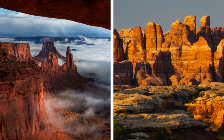
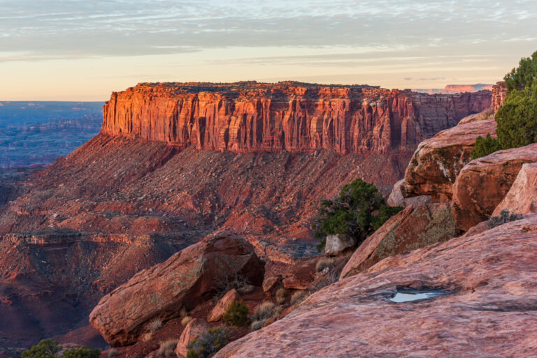
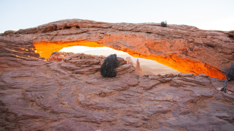
A Photo Tour of Canyonlands National Park
Take a visual tour through Canyonlands National Park (and Dead Horse Point) to see the stunning landscape in the parks!
The Needles Canyonlands Travel Tips
When visiting Canyonlands National Park, keep in mind The Needles District is in a remote part of the park that features extensive hiking trails, amazing geology, and relatively few people, making this a fantastic area to explore.
Check out our article explaining Canyonlands Island in the Sky vs Needles!
To better prepare for your visit to this amazing place, we suggest visiting the National Park Service website to get the most current information.
We also recommend stopping by the Needles Visitor Center, which is open daily between early spring and late fall, to learn about current park conditions, purchase essential maps and books, obtain necessary backcountry permits, watch an orientation video about the park, stock up on water, and get an introduction to ranger led programs that occur during most nights throughout the spring and fall.
TRAVEL TIP: Needles Canyonlands is a remote area with few services. There is no food, lodging (only camping), or gas available in the park. Pack everything you’ll need during your time in Needles Canyonlands. Water is available at the visitor center year-round. Electric outlets are not available.
Needles Canyonlands Weather
The Needles is located in Southeast Utah, part of the Colorado Plateau “high desert”. Canyonlands National Park weather has large temperature fluctuations, sometimes up to 40 degrees in a single day!
The best time to visit Canyonlands National Park is during the most temperate seasons in the spring (April through May) and fall (mid-September through October). The spring and fall daytime highs average 60º to 80ºF and lows average 30º to 50ºF .
- Canyonlands National Park in the Spring
- Canyonlands National Park in the Summer
- Canyonlands National Park in the Fall
- Canyonlands National Park in the Winter
Summer temperatures often exceed 100ºF! Outdoor activities should be limited to the cooler morning and evenings. Late summer monsoon season brings violent storm cells which often cause flash floods that affect Needles Canyonlands.
Winters temperature highs average 30º to 50ºF and lows average 0º to 20ºF. So it’s cold! Large amounts of snow in the park are uncommon, but even small amounts of snow or ice can make the park trails and roads impassable. Be prepared with the right winter clothing and gear!
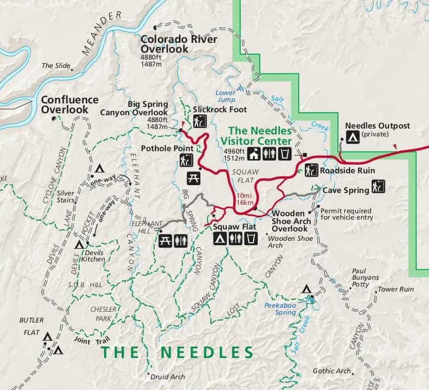
Map of Needles Canyonlands
Canyonlands Needles maps can be printed to help you navigate to the various points of interest around the park.
How to Get to Needles Canyonlands
Located just 15 miles south of Canyonlands National Park Island in the Sky, the Needles Canyonlands area occupies the entire Southeast corner of Canyonlands National Park. And while the Needles is adjacent to the Island in the Sky region, the geography of the natural landscape means that it is actually a 137 miles drive to visit Needles Canyonlands.
This section of Canyonlands National Park is 40 miles south of Moab and 15 miles north of Monticello, then another 35 miles to the west, in the state of Utah in the USA.
When visiting Needles from either city, drive along US 191 until you reach UT 211. This is the only road into and out of this section of the park.
TRAVEL TIP: When navigating to this part of the park, always use a Canyonlands National Park map since GPS units routinely lead visitors in the wrong direction.
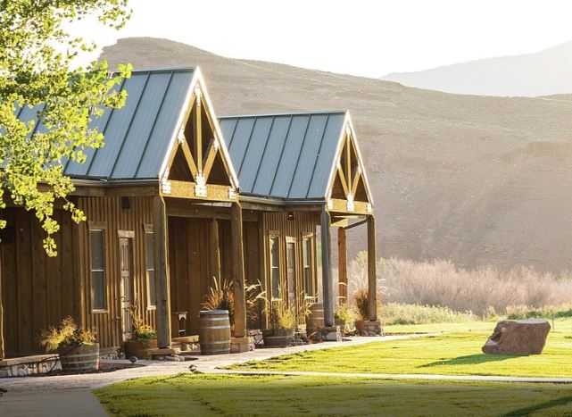
Where to Stay Near Needles Canyonlands
There are all types of lodging in and near Moab, as well as a variety of restaurants and places to shop. The town of Monticello is a bit closer to Needles, but the lodging, food and shopping options aren’t as good. It’s a much smaller town than Moab.
Camping in Canyonlands Needles
Needles Canyonlands Camping: The Needles Campground has 26 individual sites, plus 3 group sites in different locations around The Needles district. You can reserve some individual sites in spring and fall. Other times of the year, individual sites are first-come, first-served. Sites fill quickly in spring and fall.
You can also reserve group sites for nights between mid-March and mid-November. There are toilets, picnic tables, and fire rings in the campground.
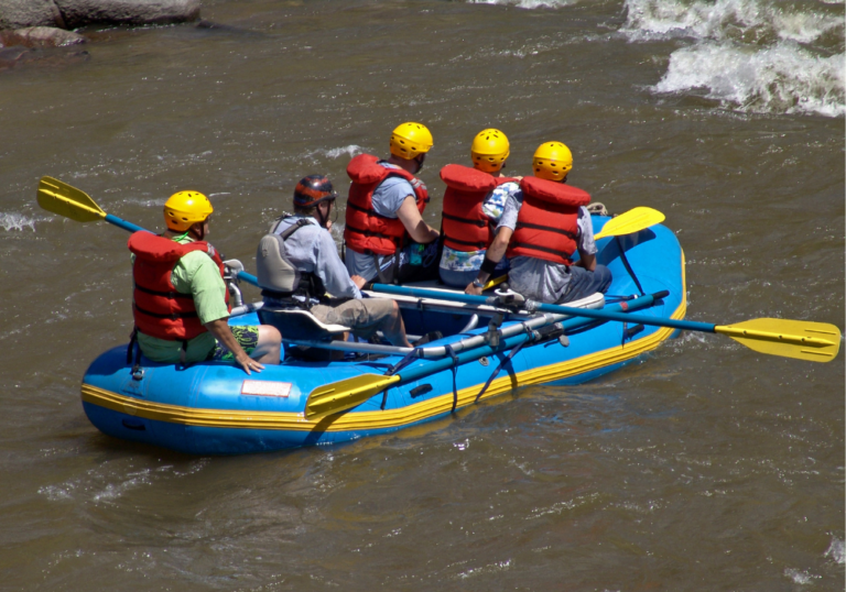
Canyonlands has an extensive backcountry where people enjoy backpacking, four-wheel driving, bicycling, and more. Visit the Canyonlands backcountry travel planning page to learn more.
Things to Do at Canyonlands Needles
Visitors will find many different things to do in Needles Canyonlands like walk short trails to granaries, hike through the needles rock formations, and even drive along four-wheel-drive roads that overlook the majestic Colorado River.
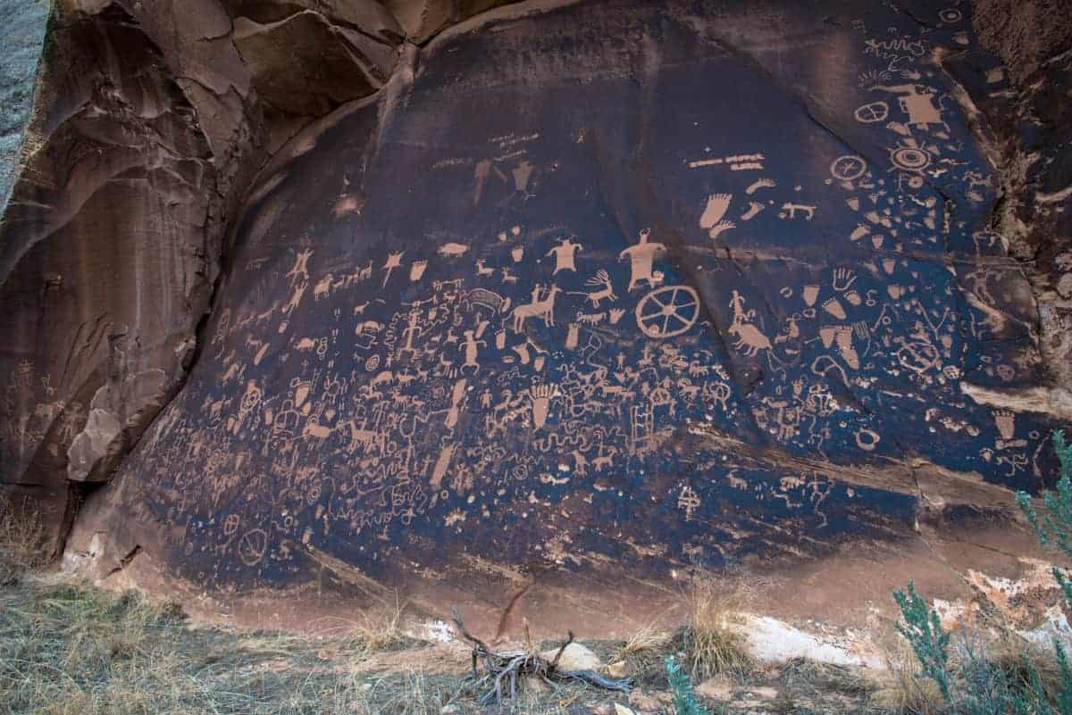
Newspaper Rock – Utah State Historic Monument
Newspaper Rock isn’t part of the Canyonlands National Park. It is a Utah State Historic Monument you pass as you drive the road toward the entrance of the Needles District.
TRAVEL TIP: Make sure you stop here to see the rock panel carved with one of the largest known collections of petroglyphs dating back 2,000 years!
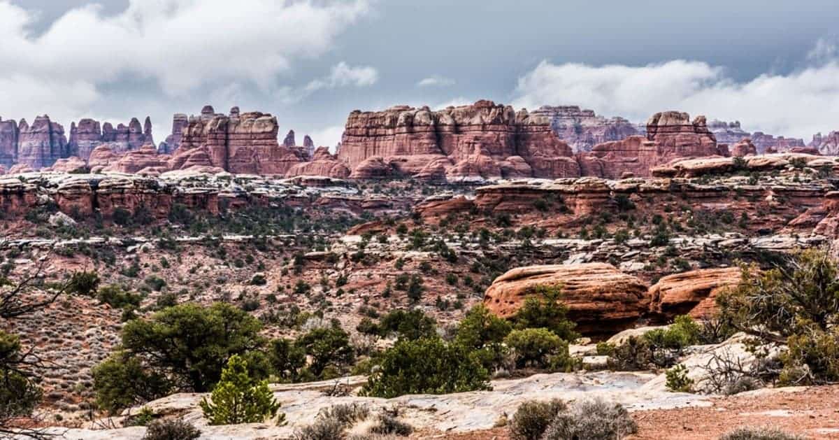
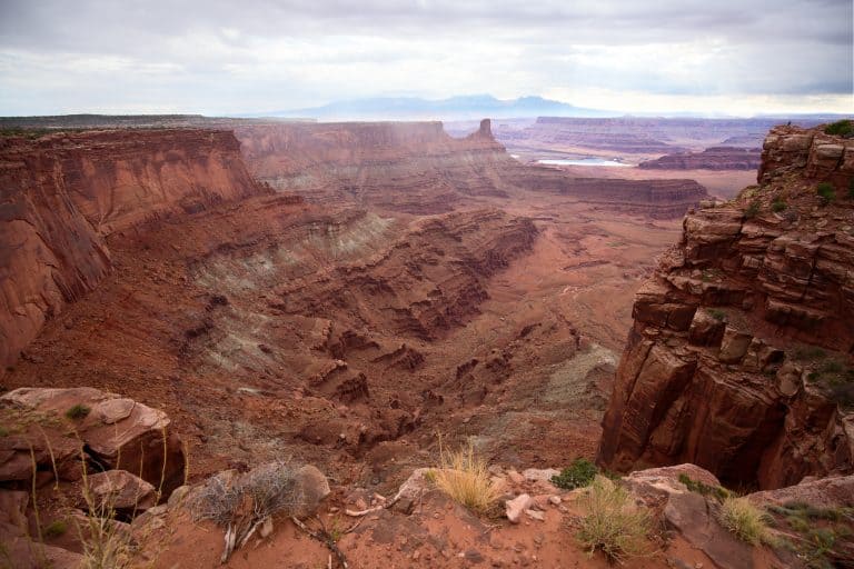
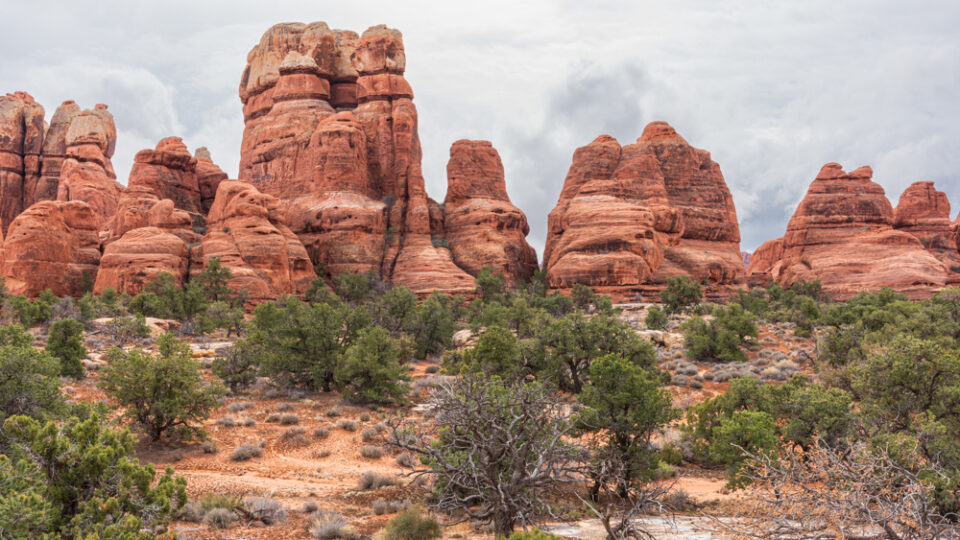
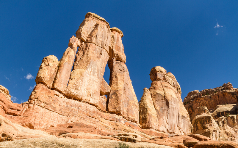
View of the Needles Formations
To get a good view of the needles formations in Canyonlands, drive along Elephant Hill road. At the top of the hill you will get a spectacular, panoramic view of the needles.
Stop and enjoy the 360 degree view and the geologic processes that lead to the formation of this amazing landscape.
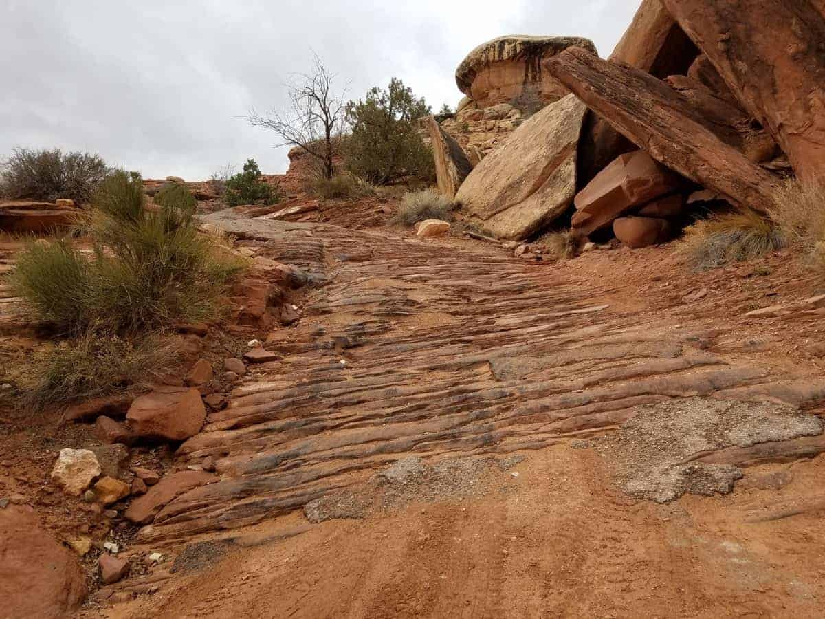
Hiking Trails at Needles Canyonlands
Canyonlands hikes range from easy to strenuous, so there’s something for everyone! There are over 60 miles of interconnecting trails at the Needles. There are short, self-guided trails and primitive backcountry trails.
Surfaces along the hiking trails at Needles Canyonlands can be uneven. Trail guides are available at the visitor center and at the trailheads.
- What to Bring on a Day Hike
- Hiking Gear and Tips for Kids
- Winter Clothing for Hiking
- Photography Gear for Hiking
- Best Cameras for Hiking
Here’s a list of Canyonlands Needles hikes:
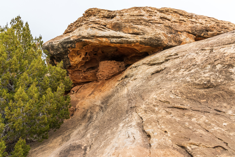
Roadside Ruin Trail – An easy, 0.25 mile long loop trail that uses trail markers to distinguish the species of flora that indigenous people typically used throughout their daily lives. Along this Canyonlands Park hike, which should take you roughly 45 minutes, you’ll find a typical, Pueblan-era granary, estimated to be around 800 years old, that is tucked beneath a charming rock overhang.
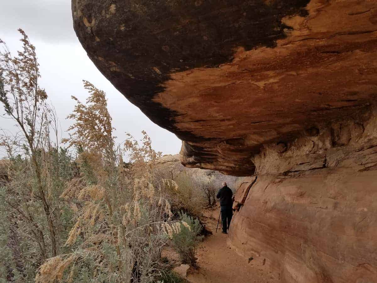
Cave Spring Trail – This short and easy loop trail will take you between 30 and 90 minutes to complete. The first point of interest is the Cowboy Camp that dates back to the early 1900’s. Throughout this camp you’ll find remnants of the past like a simple stove, wooden tables, storage chests, assorted kitchen tools, and frying pans. It really is fun to go back in time and see what a cowboy’s life was like during the early part of the last century.
Continue along the trail and you’ll see several alcoves in which the cowboys used to sleep. In the final alcove, you’ll find the Cave Spring. Look for some handprints and simple pictographs at the back of the alcove. They were placed here by Indians who arrived long before the cowboys ever did. As you continue you’ll encounter two wooden ladders where the trail continues up and onto a slickrock plateau above the alcoves.
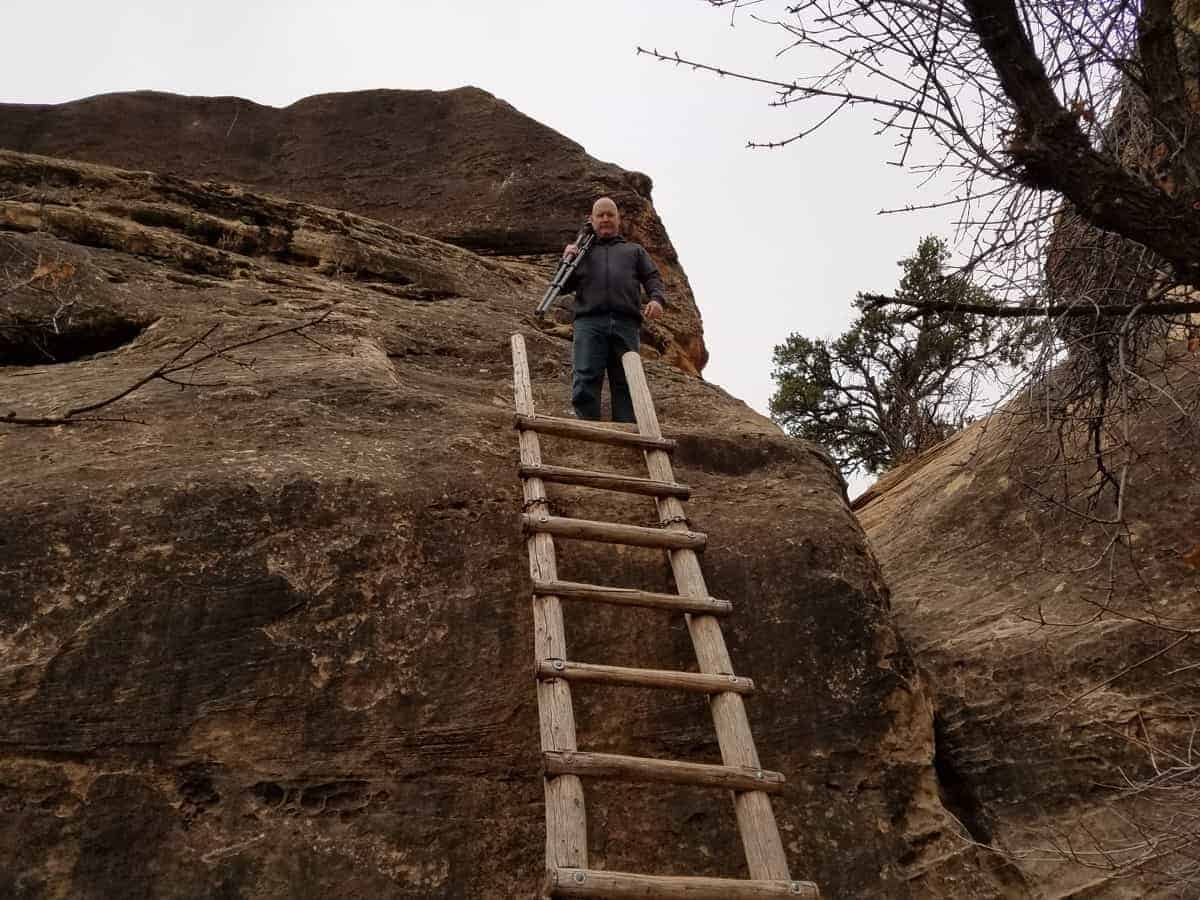
Small children and anyone with a fear of heights may not want to continue along the trail. You can return at this point back to the parking lot. Enjoy the breathtaking scenery of the Canyonlands Needles District atop the sandstone plateau. The trail will then drop down and rejoin the original trail back to the trailhead.
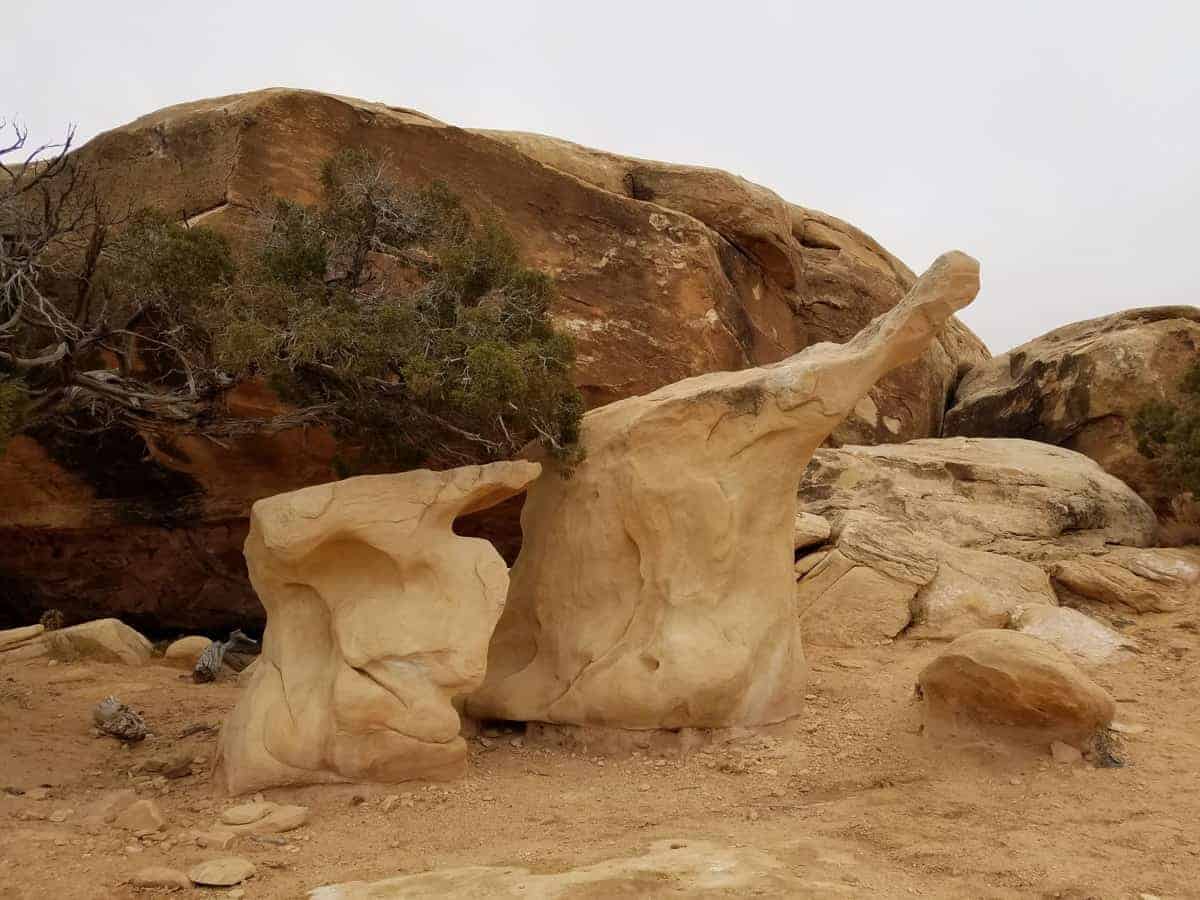
Pothole Point Trail – This is a short, 0.6 mile loop that will take anywhere between 30 and 60 minute to complete. Hike along uneven slickrock and explore diverse pothole communities with views of majestic Needles formations in the background..
To be honest though, this trail was a bit disappointing compared to the rest of the park. The sign indicates you could see pothole puddles teeming with life. It had been raining, and there were puddles, but we saw nothing alive in the pools.
The best part of this trail were the interesting rock formations in one area. If you don’t have a lot of time to spend at Needles Canyonlands, this is definitely one trail you can skip.
Slickrock Trail – This trail is 2.4 miles long, takes approximately 2 hours, and crosses uneven surfaces. However, the effort is worth it since you get great panoramic views from this trail.
Big Spring to Squaw Canyon – This trail is 7.5 miles long, takes between 3 and 4 hours to complete, and has steep grades as well as exposure to heights. It is a great introduction to the areas beautiful landscape and has 2 backpacking sites as well as water availability seasonally.
Squaw Canyon to Lost Canyon – This trail is 8.6 miles long, takes between 4 and 6 hours to complete, and travel deep in the canyon, with 3 backpacking sites that have water available seasonally.
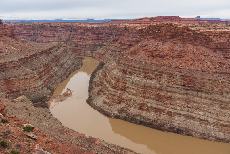
Confluence Overlook – This trail is 10 miles long, takes between 5 and 6 hours to complete, and crosses open country to a cliff that overlooks the joining of the Green and Colorado Rivers. Only at-large camping is available.
Peekaboo – This trail is 10 miles long, takes between 5 and 6 hours to complete, and has two ladders that must be climbed. But, completing this strenuous hike means that you’ll be rewarded with fantastic views of the natural landscape. One 4 wheel drive campsite is at the end of the trail, with water available seasonally.
Chester Park/Joint Trail – This trail is 11 miles long, takes between 5 and 7 hours to complete, traverses deep, narrow fractures, has 5 backpacking sites (no water), and provides exquisite views of the desert grasses and the colorful sandstone spires.
Druid Arch – This trail is 11 miles long, takes between 5 and 7 hours to complete, goes through canyon bottoms with deep sand and loose rock, has one ladder with a steep climb that involves some scrambling, and has 3 backpacking sites with water available seasonally.
Lower Red Lake Canyon – This trail is a multi-day, 18.8 mile long hike that involves a strenuous hike in and out of the Grabens, as well as a steep descent into the river. Only at large camping is available here.
Salt Creek Canyon – This hike is a multi-day, 22.5 mile long hike that begins at Cathedral Butte and follows drainage that can be obscured by vegetation. You’ll see many arches and archeological sites along the way as well as 4 designated campsites in the upper section. Only at large camping can be found in the lower section.

4×4 Trails at Canyonlands Needles
Before you attempt any 4×4 trails through Needles Canyonlands, be aware that all these roads require high-clearance, four-wheel-drive vehicles.
These trials should not be attempted by inexperienced drivers since there is a high risk of vehicle damage that could lead to towing costs in excess of $1,000.
4X4 OFFROAD GUIDELINES AT NEEDLES:
- keep all vehicles on designated roads
- only licensed drivers may operate vehicles
- ATVs, UTVs, and OHVs are strictly prohibited
- pets are not allowed on trails or in vehicles
- closely monitor weather conditions since flooding can make roads impassable
Additionally, all drivers must obtain a permit for either day or overnight use of any 4×4 trails. These permits are in high demand throughout the spring and fall so be sure to make permit reservations well in advance.
Here’s a list of fun off-road trails at Canyonlands Needles!
Elephant Hill 4×4 Trail – Many consider Elephant Hill in Needles Canyonlands one of the most technical four-wheel-drive roads in Utah. Drivers are challenged with steep grades, loose rock, stair-step drops, tight turns and tricky backing.
Once over the initial hill of the trail, equally challenging roads lead to various other geologic features as well as BLM lands in the south of the park.
It’s worth tackling all of these driving obstacles to see some of the most amazing scenery in the Needles Canyonlands area.
TRAVEL TIP: Plan ahead since only 24 Canyonlands day use permits are allowed per day for Elephant Hill.
It was raining when we visited which made the technical trail too dangerous for us to drive. Therefore, we walked to the top of Elephant Hill instead to enjoy the views in this section of the Canyonlands Needles.
HIKNG TIP: If you don’t have a vehicle that can navigate this trail, it’s worth the hike up to some amazing views!
Colorado River Overlook 4×4 Trail – The road to the Colorado River Overlook is a difficult four-wheel drive road. It begins at the end of the visitor center parking lot and starts as an easy sandy road and continues that way for about 2 miles, until you reach the overlook.
You can also hike this trail if your vehicle isn’t fit to drive the road.
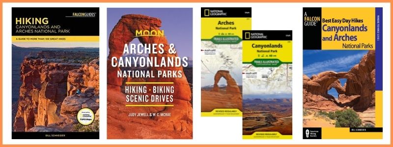
BUY AT AMAZON: Arches and Canyonlands Guides and Maps
Things to Do Near Canyonlands Needles
- Scenic Drive to Needles Overlook
- Visit Goosenecks State Park
- Moab Activities
- Things to Do at Arches National Park
- Canyonlands National Park Island in the Sky
- Dead Horse Point State Park
- TOURS Near Canyonlands