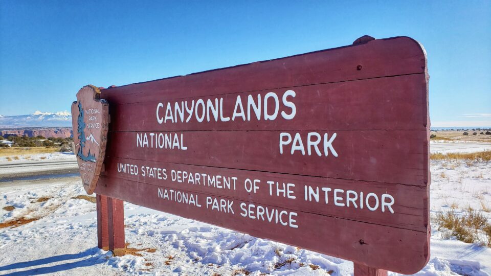
Three Days at Canyonlands National Park: Itinerary and Guide
We recommend a total of three days at Canyonlands National Park. Two days to explore the Island in the Sky district and one day at Needles to enjoy scenic drives, hiking, river rafting, and off-roading, and more!
Use this Canyonlands National Park guide to plan your 3-day trip: things to see and do, best time to visit, what to pack, and where to stay.

This guide will focus on spending two days at Canyonlands Island in the Sky and one day at Needles Canyonlands!
As you’re planning your Utah National Park road trip, this three-day itinerary will allow you to check off Canyonlands Island in the Sky, Dead Horse Point State Park, and Needles Canyonlands from your bucket list!

This site contains affiliate links which means WE may receive commissions for purchases made through these links. We only provide links to products we actually use and/or wholeheartedly recommend! As an Amazon Associate, we earn from qualifying purchases. Read the full Disclosure Policy.
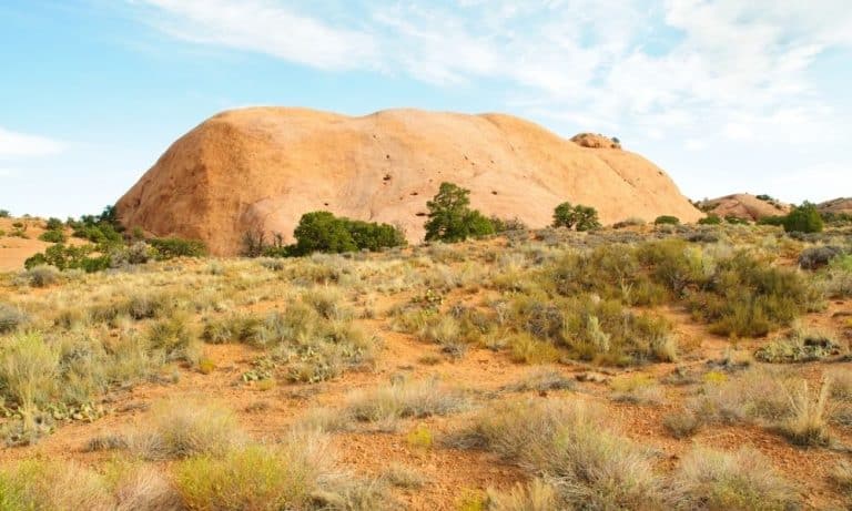
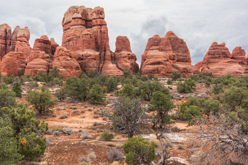
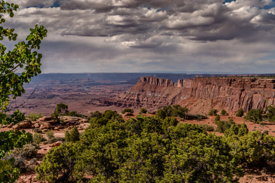
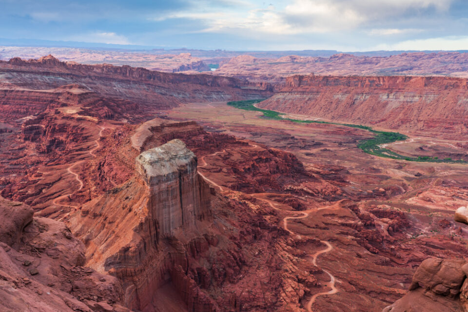
A Photo Tour of Canyonlands National Park
Take a visual tour through Canyonlands National Park (and Dead Horse Point) to see the stunning landscape in the parks!
Things to Know Before Visiting Canyonlands
Canyonlands National Park has four unique districts:
- Canyonlands National Park Island in the Sky – the most accessible and offers fantastic, panoramic views of the park along the scenic drive.
- Needles Canyonlands – remote, backcountry experience with an assortment of natural geologic formations that can only be reached by using one of the many Canyonlands hiking trails or four-wheel driving trails.
- The Maze
- The Rivers
Canyonlands is a remote area with few services. There is no food, lodging (only camping), or gas available in the park.
Before creating your Canyonlands itinerary, it’s important to know the Canyonlands National Park weather and what activities you can do when visiting during the spring, summer, fall and winter.
- Canyonlands National Park in the Spring
- Canyonlands National Park in the Summer
- Canyonlands National Park in the Fall
- Canyonlands National Park in the Winter
The time of year you visit will determine the Canyonlands packing list you’ll need to use!
Itinerary for Three Days at Canyonlands National Park
This 3-day itinerary includes two days at Island in the Sky and one day at Needles: Canyonlands Island in the Sky vs Needles.
You will spend three days taking sunrise and sunset photos, exploring scenic drives, hiking the trails, river rafting on the Colorado River, and off-roading!
When hiking in Canyonlands, your safety depends on your good judgment, adequate preparation, and constant awareness.
- Stay on the trail.
- Stay back from cliff edges.
- Observe posted warnings.
- Please watch children.
Before you set out on any Canyonlands hikes, be sure you pack the proper gear, plenty of water and healthy snacks.
- Day Hike Checklist
- What to Bring on a Hike
- Photography Gear for Hiking
- Hiking Gear for Kids & Tips for Hiking with Kids
Day 1 at Canyonlands National Park
Here’s what we recommend your Canyonlands National Park one day itinerary.
Island in the Sky Sunrise
The unique landscape results in jaw-dropping Canyonlands National Park photography! You’ll need to plan ahead in order to get to the park in time for sunrise. Since you’ll be driving in the dark, you might need to drive a bit slower than you would during the day.
We recommend giving yourself 1.5 hours from Moab to get to either Grand View Point or Mesa Arch to capture the Canyonlands sunrise!
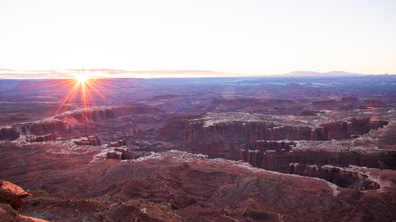
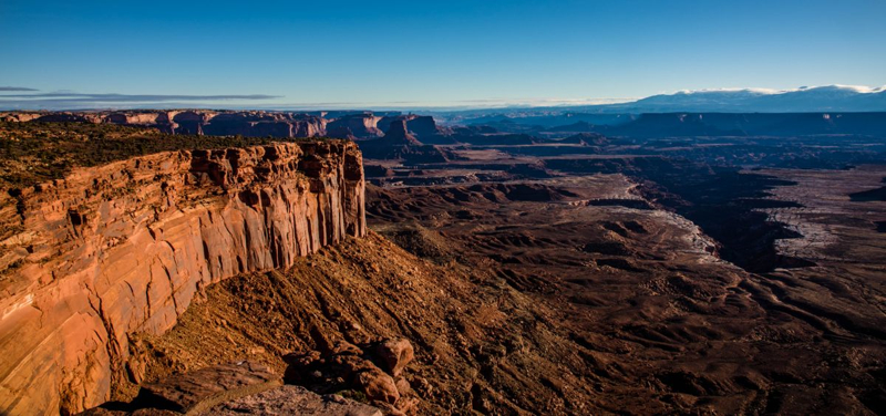
Grand View Point at Sunrise – At the end of the Island in the Sky scenic drive is the Grand View Point lookout. From here, you’ll see great views of the White Rim road below and The Maze, The Needles, and mountain peaks in the distance.
A short, paved, 300 foot sidewalk leads to a spectacular viewpoint. Just beyond this paved platform, follow the trail down a stone staircase. From this point the trail is a mix of dirt and slickrock marked by cairns to the second viewpoint which is 2 miles round trip from the parking area. Be careful not to get too close to the edge.
Anywhere at this overlook is the perfect spot for sunrise to capture the sun coming up on the horizon.
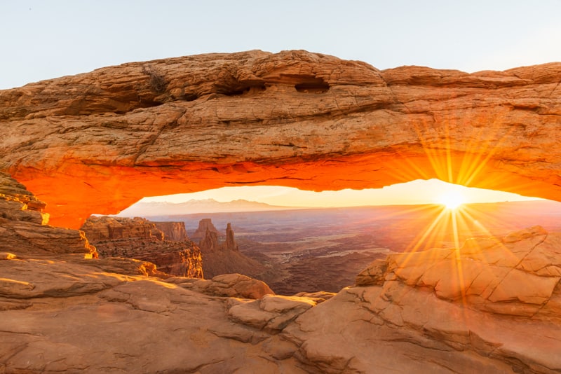
Mesa Arch at Sunrise – If you’re up for a bit of a hike, then consider Mesa Arch at sunrise. It’s a popular destination for visitors and photographers since it’s an iconic view and only takes 30-minutes to access the arch. The trail is an easy 0.5 mile loop marked by stone cairns and driftwood.
You’ll see the arch on the right side, near the edge of the sheer cliff face and can even spot the famous Washer Woman through the crest of the arch.
Our best tip for photographing Mesa Arch: stay after sunrise! The golden glow on the under side of the Arch continues for quite a while, and you can capture awesome photos when all the other photographers have left.
Due to the popularity of Mesa Arch, you’ll need to plan ahead and arrive WELL BEFORE sunrise or the appearance of the milky way in order to get a good spot. The area for taking the iconic Canyonlands shot is small.
Island in the Sky Scenic Drive
Use this Google map of the Canyonlands Island in the Sky scenic drive points of interest to navigate around the park.
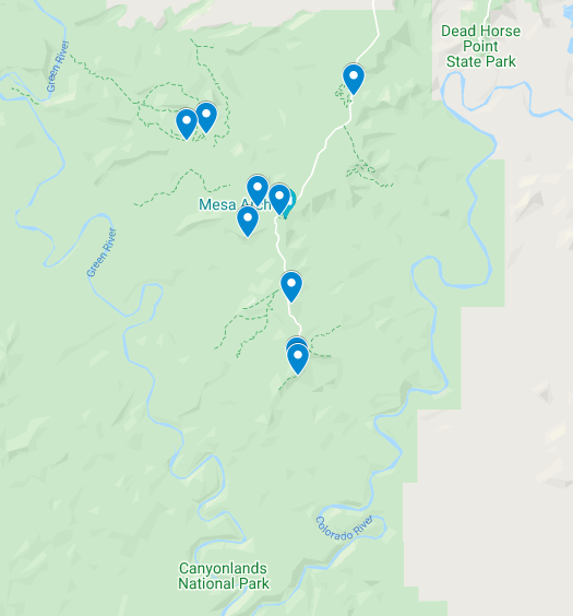
After you’ve captured your sunrise photo, you’ll explore the rest of the overlooks and viewpoints along the Island in the Sky scenic drive to enjoy and photograph the spectacular landscape at this park!
The paved scenic drive and spur trails total about 20 miles. Plan to spend 1-2 hours to see all the overlooks. Your time doing this will depend on how long it takes you to photograph each viewpoint.
Here’s a list of the points of interest we recommend along the Grand View Point road and scenic drive at Island in the Sky starting from the entrance. Some of the locations we list below are not overlooks, but are Island in the Sky hikes that take you to cool things to see.
The hard part for you is deciding what Island in the Sky hiking trails and activities you want to do today.
We recommend the Canyonlands GyPSy Guide App to hear fun behind-the scenes stories and local tips that play automatically as you drive, based on your GPS location.
Visitor Center Viewpoint – We recommend you stop at the Canyonlands Island in the Sky Visitor Center. You’ll love the view of this first overlook. It’s also good to talk to the rangers about road and trail conditions as well as any ranger programs scheduled for the time you visit.
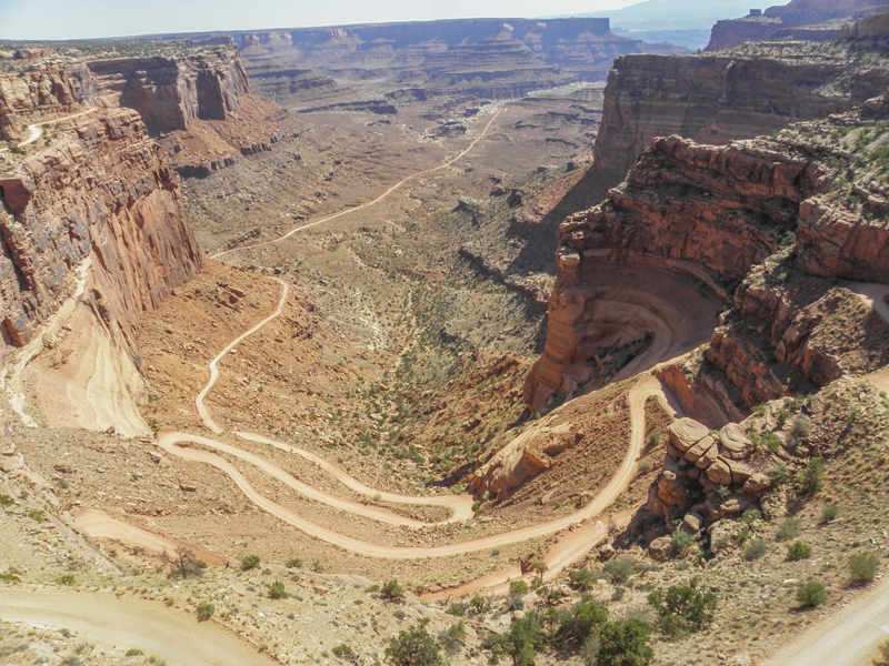
Shafer Canyon Overlook – Shafer Canyon Overlook is a great place to see the crazy switchbacks people traverse riding or driving on Shafer Trail Road. The Shafer Trail road is a fun adventure we have scheduled for the Day 2 itinerary. It’s definitely a once-in-a-lifetime experience!
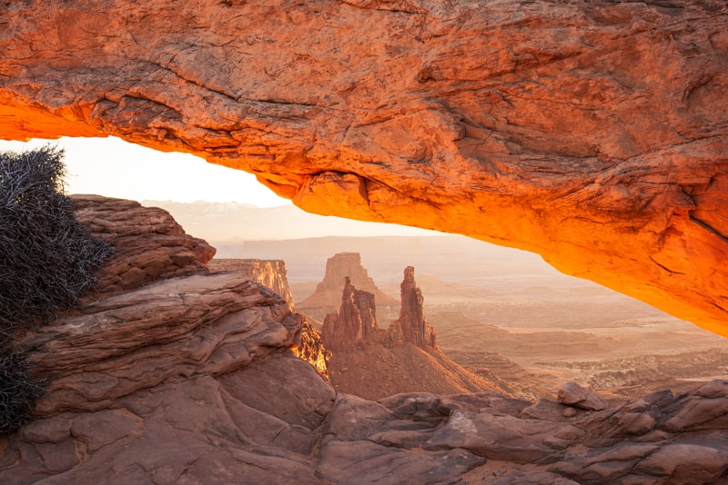
Mesa Arch Trail – Since you can’t view Mesa Arch from the scenic drive, it does require you hike about 1 mile there and back. Mesa Arch is one of the most popular sunrise photo spots at Canyonlands Island in the Sky. We consider this a must-do hike for your 2-day itinerary at Canyonlands. Mesa Arch is a popular spot so if the parking lot is full, don’t risk parking outside a designated stall. Instead, keep trying at other times during the day.
Aztec Butte – You can see Aztec Butte from the road, but you can’t see the panoramic views atop the butte. This hike has very steep sections so it’s not for anyone afraid of heights!
An easier hike off the main trail takes you to some granaries tucked away in the rocks. We consider this one of the best hikes at Island in the Sky to see a fascinating piece of history! You should be able to fit this short hike into your Canyonlands itinerary for the first day.

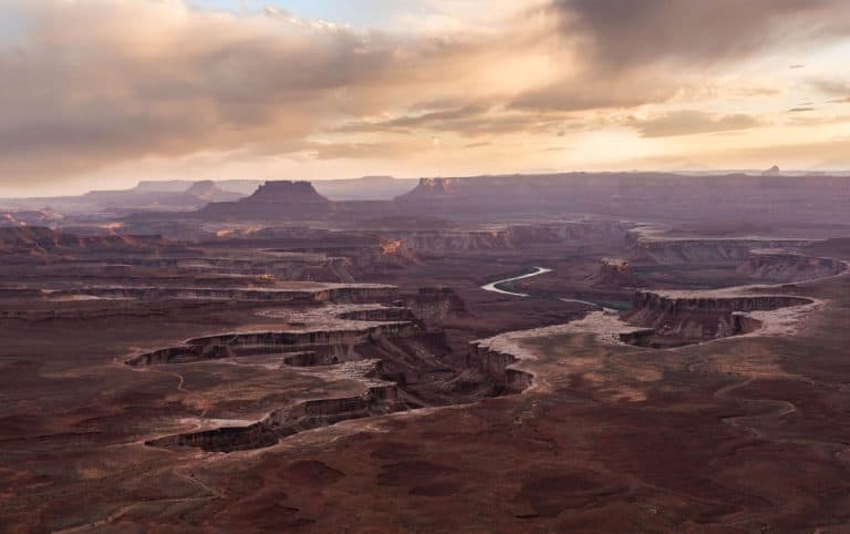
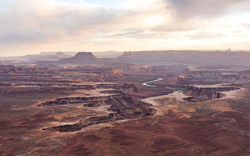
Green River Overlook – The Green River Overlook is located at the end of the paved road past the Willows Campground. The views you’ll see atop the 6,000 foot elevated plateau are incredible! The landscape here features the water-carved canyons created by the Green River.
It’s just a short walk along the paved trail to the overlook, making it wheelchair accessible. This overlook is the best spot at Island in the Sky to watch and photograph the sunset.
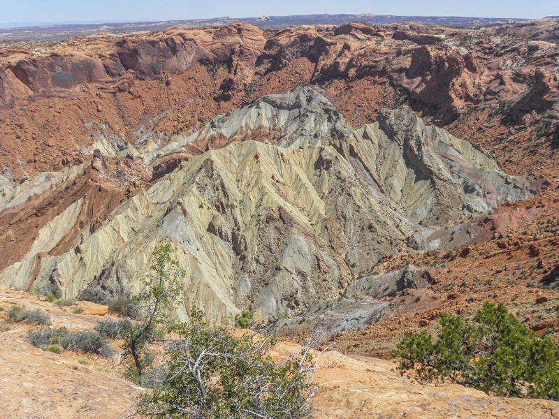
Upheaval Dome Hike – No one knows what created the Upheaval Dome feature at Canyonlands. One theory suggests that the crater must have been left due to meteorite activities, while another says the formation was created when a salty dome forcibly pushed its way to the sandstone rock.
It’s a moderate hike that takes about an hour so you’ll need to decide if you can fit this longer hike into today’s schedule.
Buck Canyon Overlook – you’ll see panoramic views of the Colorado River Basin with its numerous canyons and the White Rim in the foreground. In the distance, you can also enjoy an expansive view of the La Sal Mountains.
This spot does not require a strenuous hike. It is also wheelchair accessible. The views from here look so surreal that you sometimes find yourself getting lost in the moment. And don’t forget to look behind you because that direction is also picture-worthy.
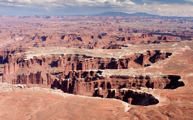
Grand View Point Overlook – The Grand View Point sits at the southernmost edge of the Island in the Sky. From here, you can see the dramatic views of the White Rim Road, LaSal Mountains, Needles District of Canyonlands, Abajo Mountains and the Maze District.
From the parking lot there’s a paved 100-yard trail to the first viewpoint. This trail is accessible to wheelchairs. There’s another trail beyond the first viewpoint that takes you to a second viewpoint about 1 mile away. The easy hike follows a trail that’s not paved, has some rock stairs, uneven surfaces and cliff edges so be sure to watch children carefully! Again you’ll need to decide if this is a trail you want to explore based on the time.
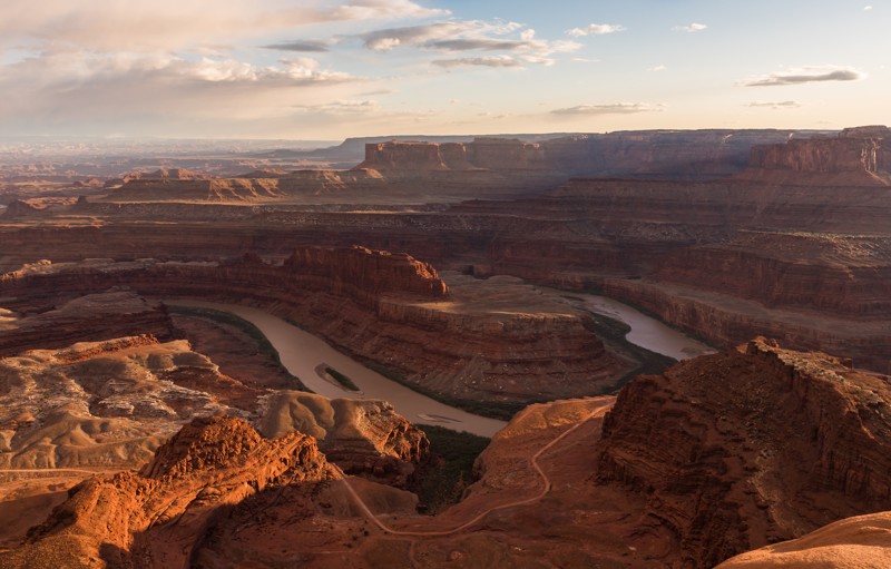
Sunset at Dead Horse Point
Next on the Canyonlands National Park itinerary is a visit to Dead Horse Point State Park. Return back to the park entrance to leave. Drive north along UT 313 toward Moab for about 4 miles. Turn right on UT 313 to reach Dead Horse Point State Park.
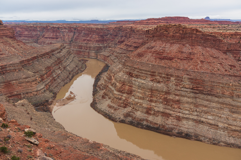
Dead Horse Point is a spectacular Utah State Parks you can’t miss! The stunning views of the bend in the Colorado River, dramatic vertical cliffs and canyons you’ll see at Dead Horse Point cannot be seen from Canyonlands Island in the Sky.
Yes, there is a day-use park fee to visit Dead Horse Point because the US National Park pass is not valid here since it’s a Utah State Park. But we feel the additional fee to visit this park is well worth it to view this iconic scene!
There might be quite a few people there to watch the sunset, but there is plenty of room along the canyon rim for everyone to have a great view!
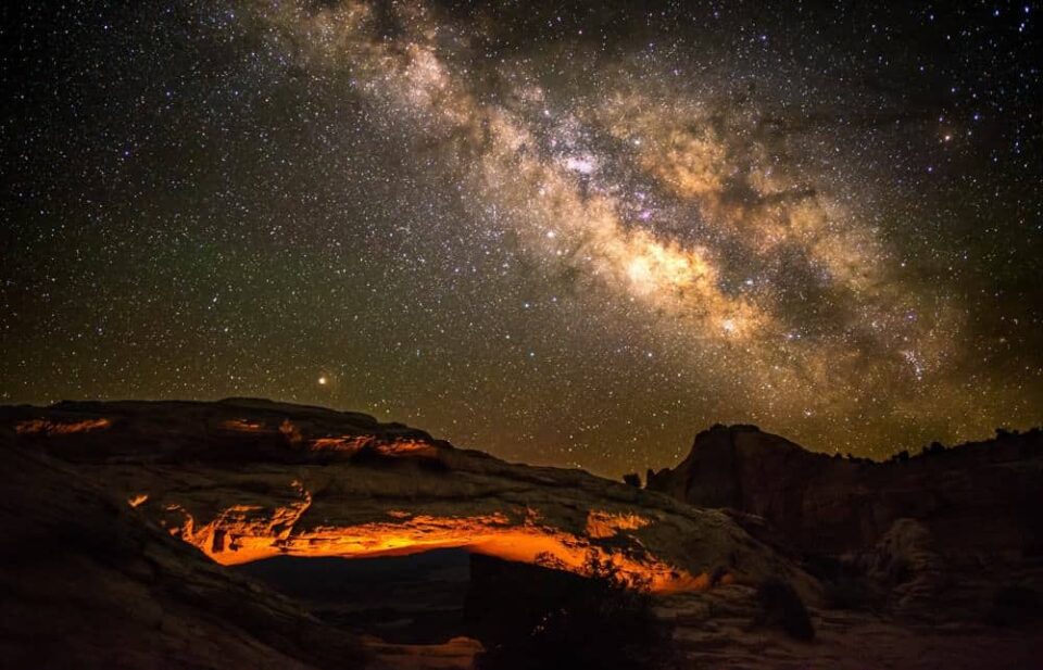
Stargazing at Canyonlands
Dead Horse Point State Park and Island in the Sky are the best areas to go stargazing due to their location on the high plateau.
If you’ll be staying the night in the Moab area, we encourage you to take time for stargazing at Canyonlands or Dead Horse Point! We recommend you use a headlamp with red light for navigating around in the dark.
We really like Mesa Arch and Grand View Point for photographing the milky way at Island in the Sky. Anywhere along the rim at Dead Horse Point is great!
Day 2 at Canyonlands National Park
Here are two tours we recommend when spending two Days at Canyonlands National Park.
You can adjust this schedule to include Canyonlands National Park activities, hikes, or photography you didn’t get to do on Day 1!
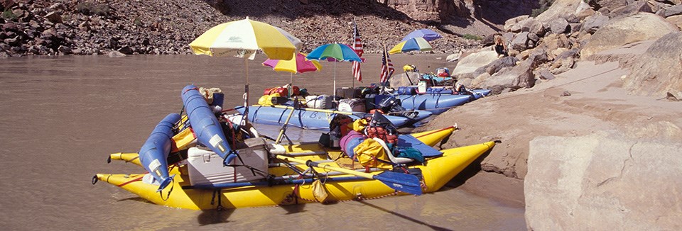
Canyonlands Half-Day River Rafting the Colorado River
Take a half-day jet boat or river rafting tour down the Colorado River into Canyonlands National Park. You’ll get the unique experience to see Canyonlands from the river!
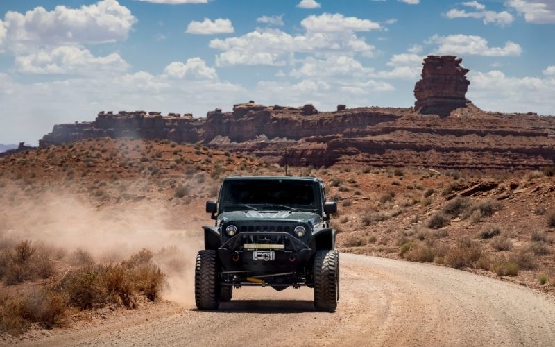
Half-Day Canyonlands Island in the Sky 4×4 Tour
A half-day Canyonlands 4×4 Tour is a fun and adventurous way to see a part of the park many visitors don’t see!
From Moab this tour follows the Potash Road Scenic Byway on the way to Canyonlands. You’ll see ancient Native American rock art that was carved into the cliffs by the Ancestral Puebloans.
Soon you’ll reach the dirt jeep trail that leads up to the Island in the Sky district. Along the way, you’ll stop at vistas such as Fossil Point and Musselman Arch.
The tour also travels along a section of the White Rim trail to see Gooseneck Overlook. You’ll then wind up the switchbacks of the famous Shafer Trail to the Island in the Sky mesa before driving back to Moab.
Sunset at Green River Overlook
From the Green River Overlook you can get a breathtaking view of the landscape for hundreds of miles in every direction. You can even see the Green River meandering through the canyons.
The viewpoint here faces southwest, making it a great location to track the sun as it sets on the horizon. At this Canyonlands sunset photo spots at Island in the Sky, you’ll want to capture the red-orange glow of the light as it falls on the landscape. And look for creative ways to photograph this location.
Day 3 at Canyonlands National Park
There are plenty of things to do at Needles Canyonlands to fill up your Day 3:
- Scenic drive and short hikes at each point of interest
- One day hike, plus scenic drive if there’s time
- One 4×4 trail, plus scenic drive if there’s time
or sunset, we recommend visiting the Needles Overlook and Anticline Overlook. They are technically NOT part of Canyonlands National Park, but they are on the boundaries that provide amazing views of Needles and the Moab area!
Needles Canyonlands Scenic Drive Points of Interest
For the first part of the day we recommend driving to the various points of interest at Canyonlands Needles along the scenic drive. Plan about half a day to explore the scenic drive and short hikes at each location.
This is the list of the points of interest and things to do in order as you drive into the park along UT 211.
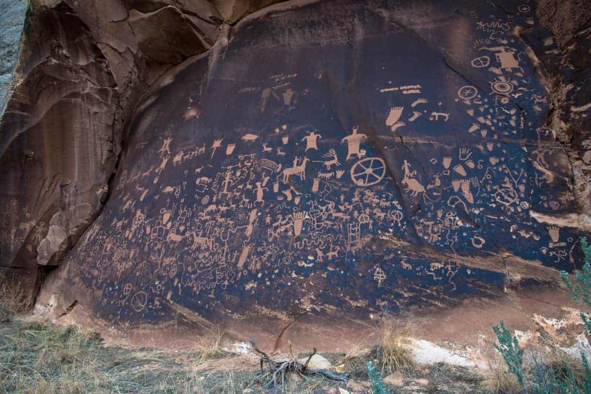
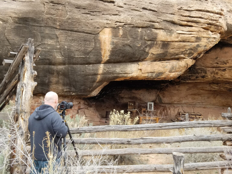
Newspaper Rock – Utah State Historic Monument – this isn’t part of Needles Canyonlands. It is a Utah State Historic Monument you pass as you drive the road toward the entrance of the Needles District. At this short stop you’ll see the rock panel carved with one of the largest known collections of petroglyphs dating back 2,000 years!

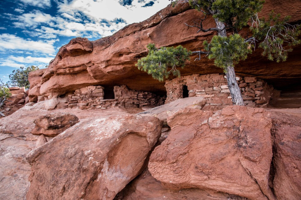
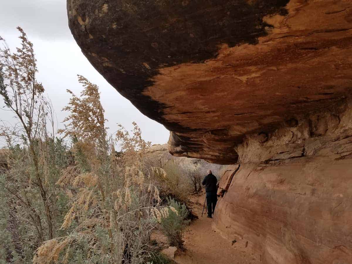
Roadside Ruin Trail – You can’t see the Roadside Ruin from the road. It’s an easy 0.25 mile long loop trail leading to a Pueblan-era granary, estimated to be around 800 years old, that is tucked beneath a charming rock overhang. As you hike, read the trail markers that describe the species of flora that indigenous people typically used throughout their daily lives.
Cave Spring Trail and Cowboy Camp – This short and easy 0.6 mi loop trail takes about 45 minutes to complete. There are two ladders to climb to complete the route, but you can also walk to the Cowboy Camp and back.
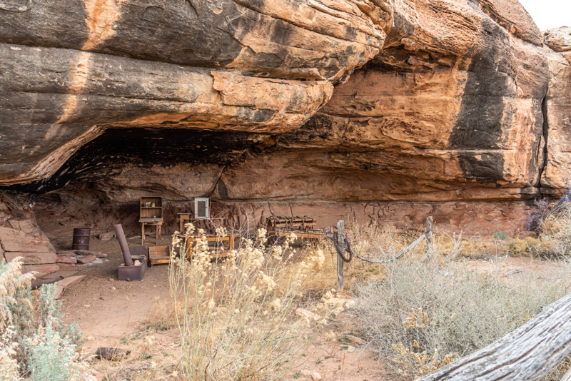
The first point of interest is the Cowboy Camp that dates back to the early 1900’s. Throughout this camp you’ll find remnants of the past like a simple stove, wooden tables, storage chests, assorted kitchen tools, and frying pans.
Entering, touching, or climbing on archeological sites is strictly prohibited. View structures from a distance to protect fragile walls.
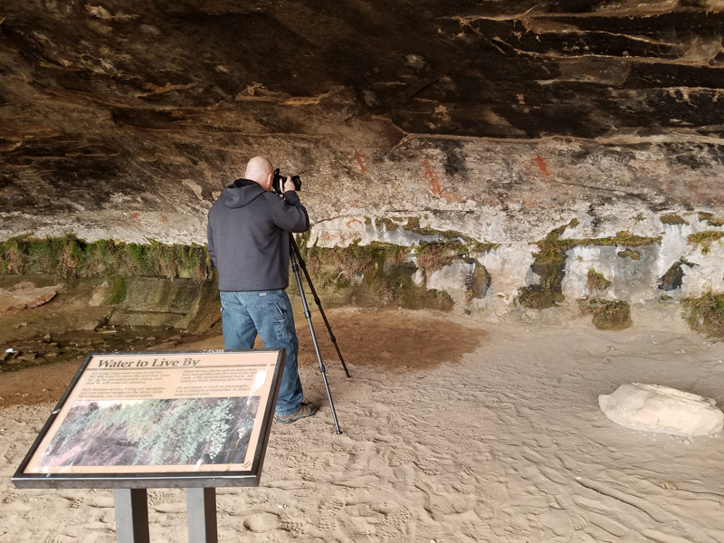
Continue along the trail and you’ll see several alcoves in which the cowboys used to sleep. In the final alcove, you’ll find the Cave Spring.
Look for some handprints and simple pictographs at the back of the alcove. They were placed here by Indians who arrived long before the cowboys ever did.
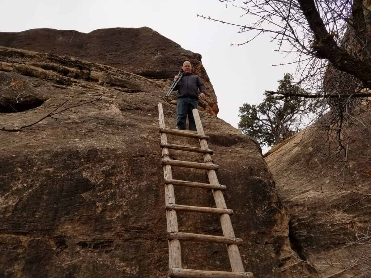
As you continue you’ll encounter two wooden ladders where the trail continues up and onto a slickrock plateau above the alcoves.
Small children and anyone with a fear of heights may not want to continue along the trail. You can return at this point back to the parking lot.
Enjoy the breathtaking scenery of the Canyonlands Needles District atop the sandstone plateau. The trail will then drop down and rejoin the original trail back to the trailhead.
Wooden Shoe Arch Overlook – This quick stop gives you a view of a large sandstone arch that looks like a Dutch wooden shoe. The arch is visible from the paved pullout along the scenic drive.
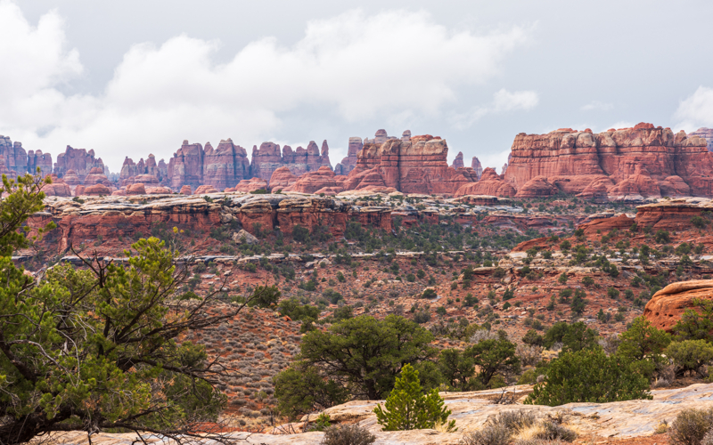
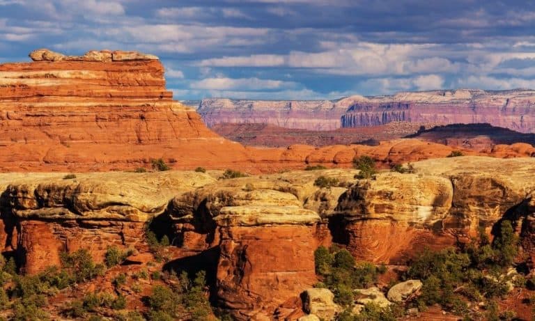
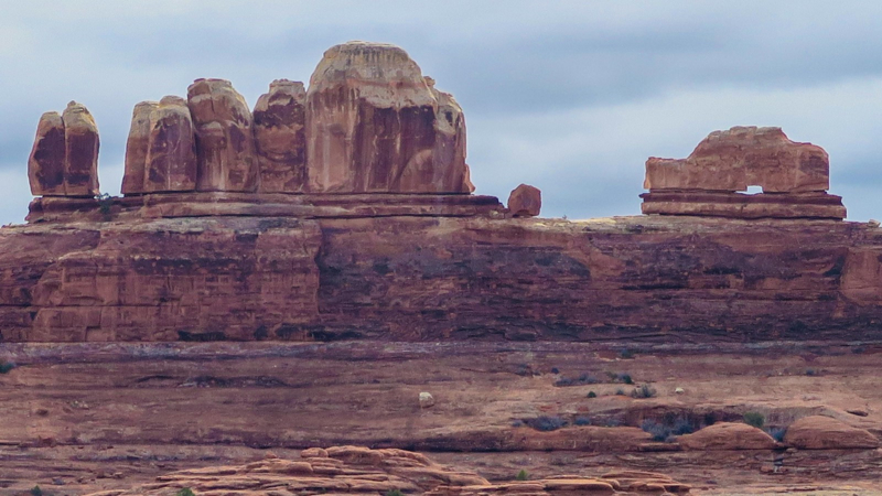
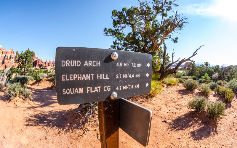
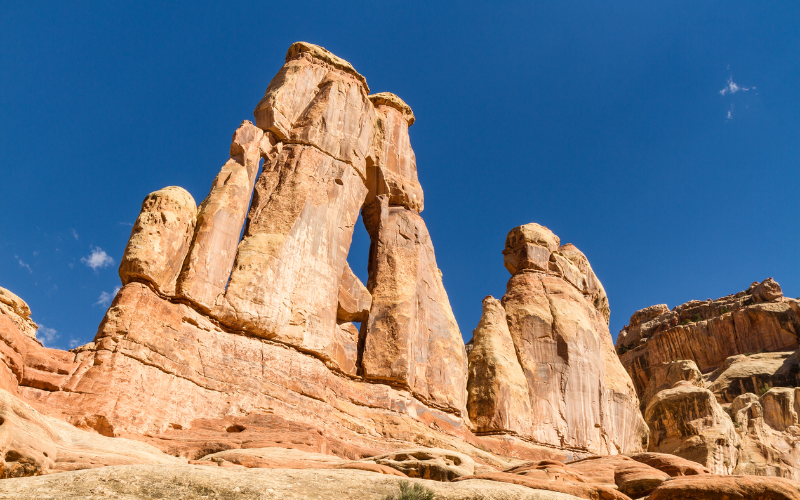
View of the Needles – To get a good view of the needles formations in Canyonlands National Park, drive along Elephant Hill road. At the top of the hill you will get a spectacular, panoramic view of the needles. Stop and enjoy the 360 degree view and the geologic processes that lead to the formation of this amazing landscape.
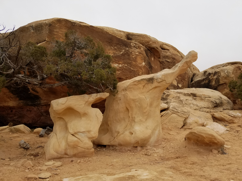
Pothole Point Trail – This is a short, 0.6 mile loop trail along uneven slickrock. Plan between 30 and 60 minute to complete the hike. You’ll see potholes along the trail that will fill with water when it rains. The sign indicates you could see pothole puddles teeming with life. It had been raining, and there were puddles, but we saw nothing alive in the pools.
For us, the best part of this trail were the interesting rock formations in one area. If you don’t have a lot of time to spend at Needles Canyonlands, this is definitely one trail you can skip.
Day Hikes at Needles Canyonlands
If you’re interested in doing a longer trail, there are Canyonlands Needles hikes you can do in one day.
Chesler Park Viewpoint Trail – 5.8 mile roundtrip hike takes 3-4 hours. This is a popular hike that leads to views of the sandstone spires.
Chesler Park/Joint Trail – 10.7 mile roundtrip hike takes 5-7 hours. The trail continues beyond the viewpoint (above). The southern part along the Joint Trail traverses through deep, narrow fractures in the rock.
Druid Arch Trail – 11 mile roundtrip hike takes 5-6 hours. The first part of the hike follows the Chesler Park Trail, then travels along the bottom of Elephant Canyon. This hike includes deep sand, loose rock, steep climb with one ladder, and some scrambling.
Confluence Overlook Trail – 11 mile roundtrip hike takes 5-6 hours. This trail crosses open country to a cliff that overlooks the joining of the Green and Colorado Rivers.
Big Spring Canyon to Squaw Canyon Trail – 7.5 mile roundtrip hike take 3-4 hours. It connects two canyons across varied terrain with steep grades; not recommended for anyone with a fear of heights.
Big Spring Canyon to Elephant Canyon Trail – 10.5 mile roundtrip hike takes 4-6 hours. This loop trail runs along slickrock benches and the mesa top providing views of sheer cliff walls and unique rock formations. Two ladders must be climbed to pass between the canyons.
Squaw Canyon to Lost Canyon Trail – 8.7 miles roundtrip hike takes 4-6 hours. This loop hike includes difficult sections climbing between the canyons, including one ladder.
Peekaboo Trail – 10.8 mile roundtrip hike takes 5-6 hours. The trail crosses both Squaw and Lost canyons passing high slickrock benches with amazing views. Steep slopes, cliff edges, and two ladders make this a challenging hike!

4×4 Trails at Canyonlands Needles
Over 50 miles of challenging backcountry roads access campsites, trailheads, and park attractions.
Before you attempt any 4×4 trails through Needles Canyonlands, be aware that all these roads require high-clearance, four-wheel-drive vehicles. They should not be attempted by inexperienced drivers since there is a high risk of vehicle damage that could lead to towing costs in excess of $1,000.
4X4 OFFROAD GUIDELINES AT NEEDLES:
- keep all vehicles on designated roads
- only licensed drivers may operate vehicles
- ATVs, UTVs, and OHVs are strictly prohibited
- pets are not allowed on trails or in vehicles
- closely monitor weather conditions since flooding can make roads impassable
Permits are required for most of the 4WD roads at Needles. The permits are in high demand throughout the spring and fall so be sure to make reservations well in advance.
Colorado River Overlook 4×4 Trail – Time: Half Day – NO PERMIT: The Colorado River Overlook trail begins at the end of the visitor center parking lot and starts as an easy sandy road and continues that way for about 2 miles, until you reach the overlook. There will be large rocks and stair-step drops the last 1.5 miles. If you don’t have a high clearance 4WD vehicle, park on the road (leaving room for other vehicles to pass) and walk to the overlook.
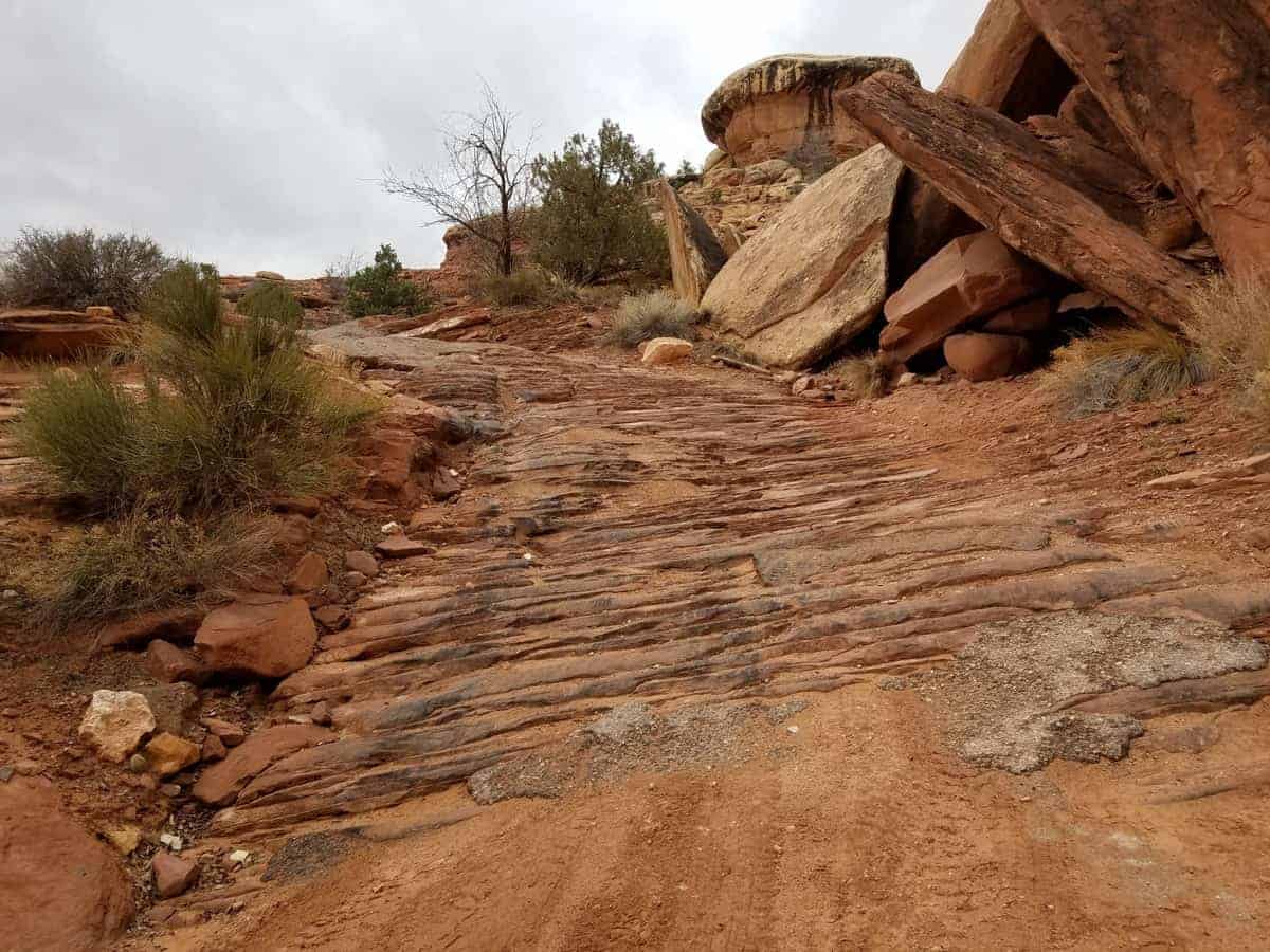
Elephant Hill 4×4 Trail – PERMIT REQUIRED: Plan ahead since only 24 Canyonlands day use permits are allowed per day for Elephant Hill. Drivers are challenged with steep grades, loose rock, stair-step drops, tight turns and tricky backing, so many consider Elephant Hill in Needles Canyonlands one of the most technical four-wheel-drive roads in Utah.
It was raining when we visited which made the technical trail too dangerous for us to drive. So we walked to the top of Elephant Hill instead to enjoy the views in this section of the Canyonlands Needles.
HIKNG TIP: If you don’t have a vehicle that can navigate this trail, it’s worth the hike up to some amazing views!
Salt Creek (Peekaboo) / Horse Canyon – PERMIT REQUIRED: You’ll need a permit for day and overnight use along this trail. The Salt Creek / Horse Canyon Trail travels along canyon bottoms where you could encounter deep sand, water, and quicksand depending on the time of year and weather conditions. Horse Canyon Road leads to several arches and to Tower Ruin.
Lavender Canyon – PERMIT REQUIRED: You’ll need a permit for day and overnight use along this trail. The Lavender Canyon trail information on the NPS website is pretty basic: “the road follows a canyon bottom where deep sand, deep water, and quicksand are common. There are two major creek crossings with steep banks. You may see many arches and archeological sites from the road.”
We found this article with photos to be very informative for anyone interested in exploring Lavender Canyon in Needles Canyonlands.
Afternoon and Sunset at Needles & Anticline Overlook
Late afternoon and sunset are the best times to photograph these locations!
To access both overlooks, look for the turnoff along Highway 191 on County road 133 between Moab and Monticello.
Needles Overlook – the 22-mile drive to the overlook is a scenic side trip and worth the time to see the sweeping 360-degree views of the La Sal Mountains, Navajo Mountain, and Monument Valley.
The Needles Overlook sits 1,600 feet above the Needles District of Canyonlands National Park. It’s not within the Canyonlands boundaries, or part of the National Park, but managed by the Bureau of Land Management (BLM).
Anticline Overlook – about 14.5 miles after turning off Highway 191, there’s a Y intersection: go left to access Needles Overlook and go right to access Anticline Overlook. The road to Anticline is also called Hatch Point Road.
You’ll see stunning views from the Anticline Overlook:
- Kane Creek area for 4x4s and ATVs. It’s fun to watch the vehicles traverse the trails from the overlook
- Colorado River and Arches National Park in the distance
- Island in the Sky, Dead Horse Point, and the Potash Ponds
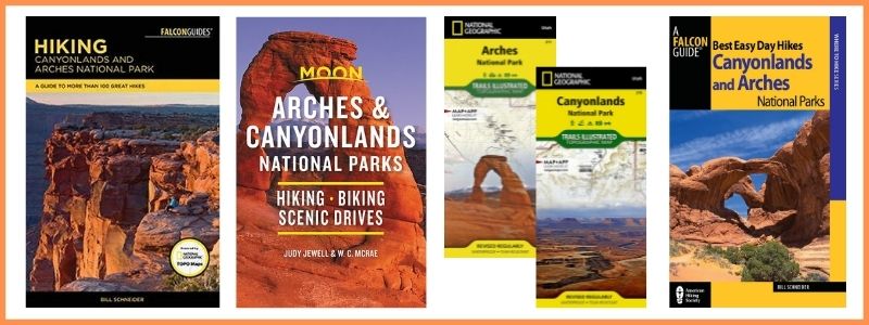
BUY AT AMAZON: Arches and Canyonlands Guides and Maps
Where to Stay Near Canyonlands
There are no lodging facilities in the park, but there are campgrounds:
- Island in the Sky Campgrounds
- Needles Canyonlands Camping
- Where to Stay Near Canyonlands
- Hotels Near Canyonlands National Park
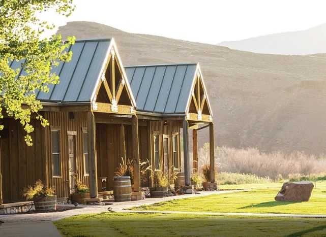
- Holiday Inn Express Hotel & Suites Moab – we enjoyed our stay and highly recommend this hotel due to its location close to Canyonlands.
- Purple Sage – our all-time favorite place to stay in Moab – walking distance to shopping, full kitchen, and only 8 units so you don’t feel lost in a large hotel.
- Red Cliffs Lodge – rooms up to 6 people – located 17 miles from Moab, this lodge is known for its beautiful location, winery and activities like horseback riding, fishing and more!
- Townhomes south of Moab – we really like the townhomes in Spanish Valley with kitchen, washer and dryer in the unit and a swimming pool/hot tub (just a 5 minute drive south of Moab).