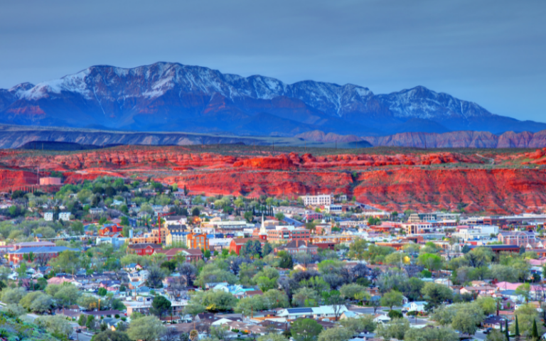
Alpine Loop Scenic Drive in Utah
The Alpine Loop Scenic Drive is one of the places to visit in Utah to see stunning landscape views
It’s a terrific day trip from Salt Lake City, Park City, and Provo. You’ll be treated to mountain views, lakes, a river and springs found along this road through American Fork Canyon and Provo Canyon.
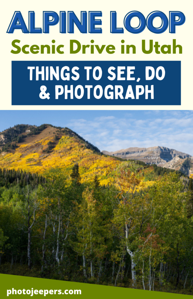
The Alpine Loop scenic drive is a must-do to add to your Utah Bucket List. The drive is 20 miles along Highway 92 from the mouth of American Fork Canyon to the connection with Highway 189 in Provo Canyon.
In this guide we’ll detail the things you can see, do and photograph along the Alpine Loop route.
We also provide a map, best times to visit, what to pack, and even where to stay if you want to extend the adventure beyond a day trip.
This site contains affiliate links which means WE may receive commissions for purchases made through these links. We only provide links to products we actually use and/or wholeheartedly recommend! As an Amazon Associate, we earn from qualifying purchases. Read the full Disclosure Policy.
Alpine Scenic Loop Backway Facts
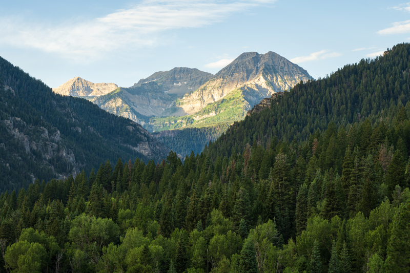
This 20-mile drive on a paved road winds through rugged alpine canyons of the Wasatch Range offering stupendous views of Mount Timpanogos and other glacier-carved peaks. The route follows Utah Hwy. 92 up American Fork Canyon and then continues through Uinta National Forest into Provo Canyon on U.S. 189.
The Alpine Loop is a paved road that’s open from approximately late May to late October. Snow closes part of the road for the rest of the year.
It’s a narrow road with sharp turns so it’s not recommended for vehicles more than 30 feet long.
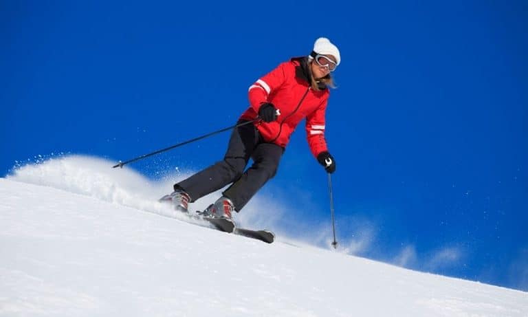
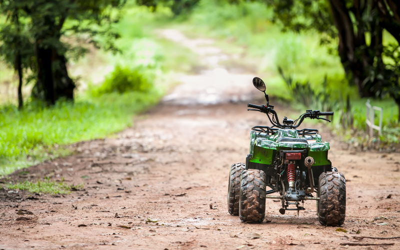
Recreational activities in the area along the scenic drive include camping, fishing, ATV riding and hiking in the summer with snowshoeing, cross-country skiing, and snowmobiling in the winter.
A camera is a must on this drive! There are short detours to lakes and natural springs, plus views of Mount Timpanogos you’ll want to photograph along the way.
Several campgrounds along the highway are available for overnight stays. Numerous day use picnic areas along the route access the river.
Parking and restrooms are provided in a few areas along the route. Various trailheads offer a chance for a short hikes.
Cellphone service is spotty along the Alpine Loop, so a downloaded Google map or a physical map to navigate through the area is useful.
Is There a Fee to Drive the Alpine Loop?
Visitors who only drive on the Alpine Loop (State Road 92) and do not use recreation facilities are not subject to fees.
If you plan to stop anywhere or use the facilities (including the cave tour) in the American Fork Canyon and Provo Canyon areas, you must purchase a recreation pass. A $6 pass is good for 3 days; a $12 pass is good for 7 days; and there is a $45 annual pass. The passes are good for recreation along both the Alpine Scenic Loop and the Mirror Lake Scenic Byway.
National Park America the Beautiful Passes are honored in the Alpine Loop Area, except for campground and cave tour fees.
Best Time to Visit the Alpine Loop Scenic Drive
Summer: late May through October the full Alpine Loop Road is open to personal vehicles. Recreational activities in the summer include ATV riding, hiking, fishing, horseback riding, and hunting. and waterfalls full of snowmelt water!
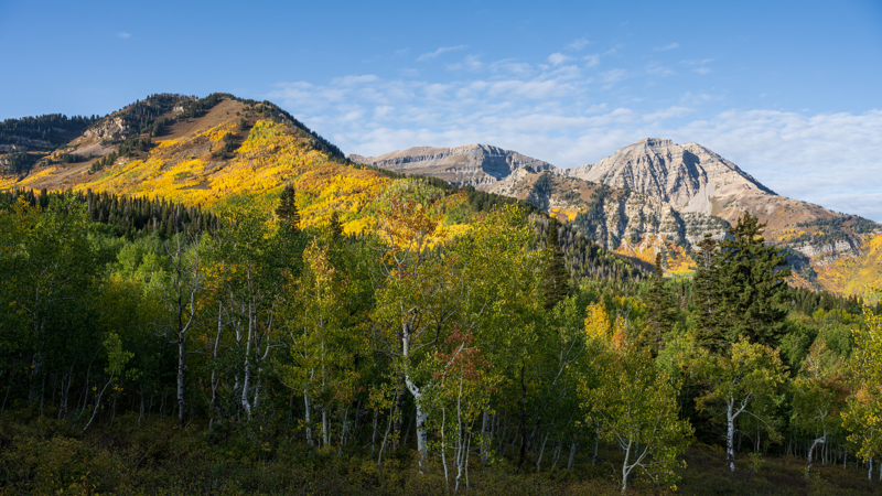
Fall: The morning and evening temperatures begin to cool off so a fleece jacket is always nice to have along! In the fall, Alpine Loop Scenic Drive is a terrific place to see fall foliage, but the road will get crowded. We recommend early morning to avoid the crowds!
Winter: early to late November the road closes to personal vehicles when the snow is too deep to plow. The road then transitions to winter grooming for snowmobiling, cross-country skiing, dog sled racers, and some ATV riding.
Remember to stay hydrated and use sun protection all year long:
- WATER: Drink plenty of water – we use hydration packs or carry refillable bottles in our backpack.
- FOOD: Pack and eat healthy snacks
- SUN PROTECTION: Sunscreen, lip balm with sunscreen and hydrating lotion
- LAYERS: The high elevation temperatures are cool in the mornings and evenings so we recommend: fleece jacket, winter hat, and gloves.
You’ll want to wear winter clothing to enjoy all those fun outdoor activities!
When is the Alpine Loop Open
The road is typically open from late May through October for personal vehicles. The closure occurs when the snow is too deep to plow. You can check the current status at UDOT TRAFFIC.
There are two sections of this road that are open year-round:
- American Fork Canyon fee station to Tibble Fork Reservoir along the North Fork spur road.
- Provo Canyon turnoff to Sundance Resort.
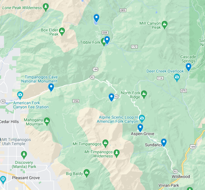
Map of Alpine Loop Scenic Drive Points of Interest
Use this Google map of the Alpine Loop to navigate along the road to all the points of interest.
The places to stop are in order beginning at the mouth of American Fork Canyon. Simply reverse the order if you start in Provo Canyon.
Places to Stop Along the Alpine Loop Scenic Byway
These are the popular points of interest in both canyons along the scenic drive that we recommend:
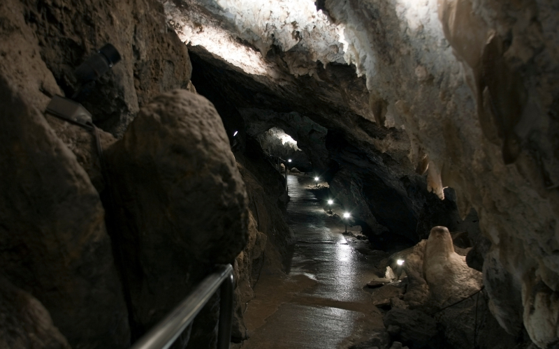
Timpanogos Cave National Monument
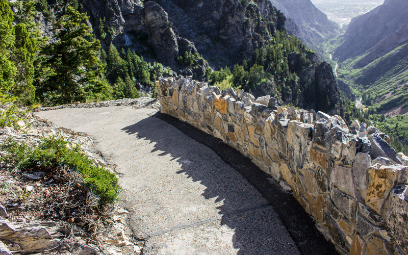
About 2 miles up the road you’ll reach Timpanogos Cave National Monument. The caves may only be entered with a guided tour by park rangers. Tours through the cave are 55 minutes long and they’re offered daily during the summer season.
Cave tours are limited to 16 people per tour. **Purchase tour tickets before your visit online! Advance tickets may be purchased up to 30 days prior to your visit. All persons entering the cave must have a ticket, even infants.
It’s not uncommon for visitors without advance tickets to wait several hours before beginning their tour or are turned away because all tours for that day are sold.
NOTE: The only way to reach the cave is by walking a strenuous 1.5-mile-paved trail. It’s a steep incline of 1,092 feet, reaching an elevation of 6,730 feet above sea level. The round-trip hike and tour of the cave system takes about three hours.
In the summer, temperatures on the trail can reach 100 degrees F. BUT in the cave the temperatures average 45 degrees F so you’ll need a light jacket. We also recommend wearing good hiking shoes and using sunscreen since there’s not much shade on this trail. It’s also good to pack water, flashlight, and jacket.
No pets are allowed on the cave trail or in the cave.
It’s not allowed to touch the delicate environment of the features found inside the cave.
Is it Ok to Take Young Children on the Timpanogos Cave tour?
Due to the steep incline of the cave trail, strollers and other wheeled vehicles are not allowed.
You may bring a baby backpack or carrier for hiking to the caves. External frame backpacks (including baby carriers) are not allowed in the cave. Infants may be carried through the cave in front packs.
Will your child enjoy the steep and frequently hot hike? Will your child enjoy being a cave that is cold and dark? Will this affect you and others on the tour? Please keep this in mind as you plan to participate in this activity.
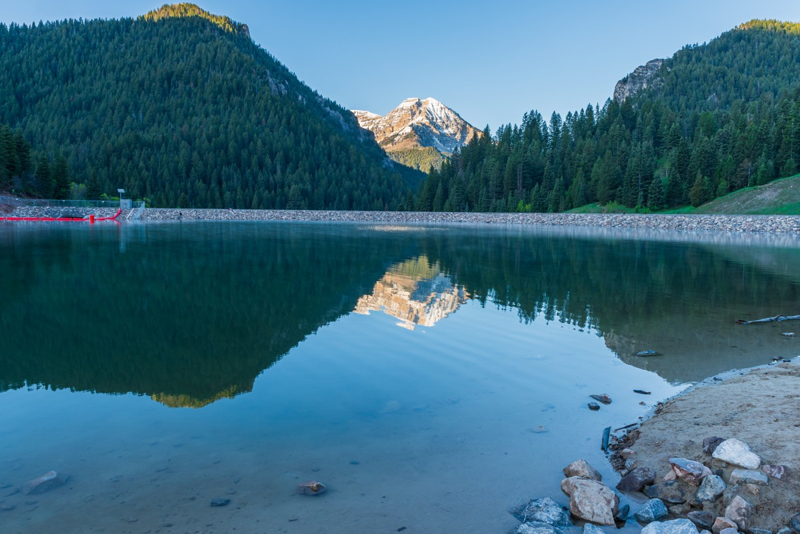
Tibble Fork Reservoir
You’ll come to a fork in the road, with a spur road to the left called the North Fork. This leads to Tibble Fork Reservoir, Granite Flat Campground, Silver Lake Flat, and access to hiking and off-road trails.
Remember there’s a day-use fee to access any of these locations.
Tibble Fork Reservoir – popular medium sized lake for fishing, swimming, kayaking, and paddle boarding. The new sandy beach at Tibble Fork Reservoir is a draw for families. The parking lot accesses ATV trails and camping sites along Forest Road 085. You’ll want to get here early in the day to get a parking spot, especially on the weekend! Restroom with flushing toilets.
PARKING: You MUST park in designated areas or you may be fined AND towed!
Granite Flat Campground – this large campground includes three group sites and several single and double-family sites, most of which are accessible. Picnic tables and campfire rings are provided, as are vault toilets. Horseshoe pits and a grassy baseball field are located on-site. Roads and parking spurs are paved.
Silver Lake Flat Reservoir – about 15 minutes beyond Tibble Fork Reservoir is another lake for fishing (stocked with brook trout, rainbow trout, arctic grayling and cutthroat trout), kayaking, and paddle boarding. The north shore of the lake is the start of the Silver Lake hiking trail and access to ATV trails and camping sites. It’s another popular destination so we recommend you get there early to find a parking spot. Restrooms available at the north end of the lake.
NOTE: The road beyond Tibble Fork to Granite Flat and the spur road to Silver Lake Flat is paved. The three miles to Silver Lake Flat is a bumpy dirt road – some holes in the road can be quite deep. There’s a narrow section of road along the switchbacks that can be tricky for two cars to pass. Watch out for ATVs too!!
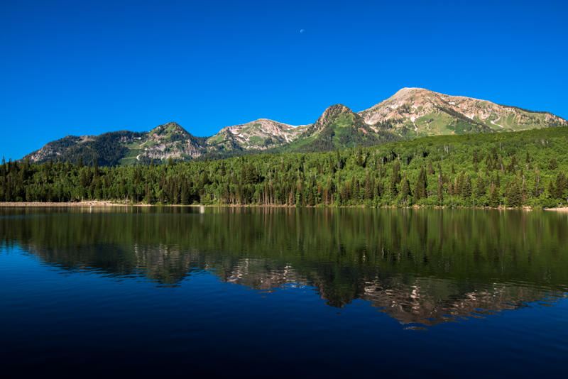
Overlooks
Just past the North Fork / South Fork Y, there’s an overlook on the right with a small parking lot. It has no name, but think it’s worth a quick stop.
We find it’s a great spot for sunrise photography to catch the first light of day illuminating Mount Timpanogos!
The drive from the North Fork cutoff to Aspen Grove near Sundance offers many pullouts to stop, enjoy the views, and take photos.
Keep in mind the road is narrow with many sharp turns so watch for bikers and other cars!
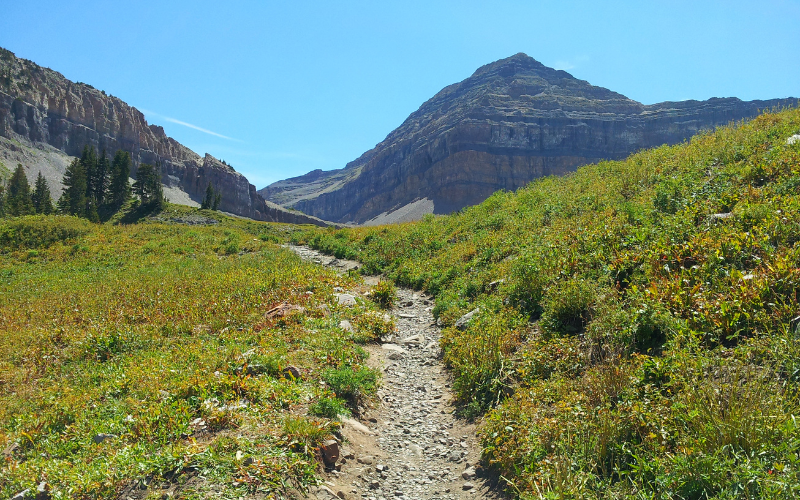
Mt. Timpanogos Hiking Trails
As you continue along the Alpine Loop scenic drive, you’ll pass campgrounds and hiking trails (we’ll list them all below).
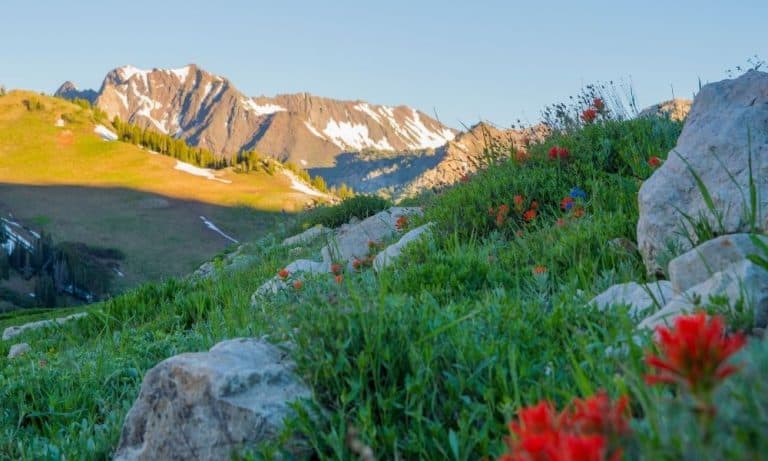
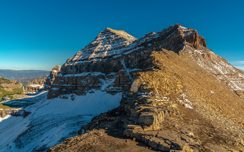
But the most notable and popular hike accessed along this road is the one to Mt. Timpanogos Summit! Mount Timpanogos is one of Utah’s most recognizable mountains. At 11,749 feet, it is the second-highest summit of the Wasatch Mountains (only Mt Nebo is higher).
You can do the hike in one long day, or enjoy two days with an overnight backpack.
Wildflowers are spectacular along both trails, especially early August. Fall colors can be seen from mid-September through October. You’ll see all types of wildlife, including a herd of mountain goats.
Daytime temperatures along the trail are usually warm during summer, but it can get very chilly at high altitudes during stormy weather and at night, so dress in layers and bring a jacket. Hiking boots with good socks are recommended footwear.
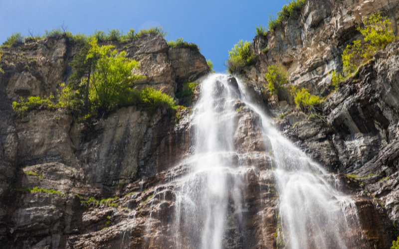
Aspen Grove Trail
- Trailhead coordinates: 40.40438, -111.60431
- 15.6 miles out & back
- 5,383 ft elevation gain
- Difficulty: hard, with steep sections
- Lots of waterfalls, including Stewart Falls
- Passes by Emerald Lake (popular camp spot)
- Dogs are allowed but must be on leash
- No campfires allowed
There’s a parking lot at the Aspen Grove trailhead along with a few picnic tables and vault toilets. The trail is very scenic and passes several waterfalls. The first mile of the trail is paved to the first waterfall.
Timpooneke Trail
- Trailhead coordinates: 40.43141, -111.63908
- 15 miles out & back
- 4,425 ft elevation gain
- Difficulty: hard, though less steep than Aspen Grove Trail
- Lots of wildflowers & scenery
- Must hike an additional 1.8mi RT to visit Emerald Lake
- Dogs are allowed
- No campfires allowed
The trailhead is located at the signed Timpooneke Campground, along the Alpine Loop Road. Drive through the campground to the far side and park in the lot signed as the trailhead. A vault toilet is provided there.
Both trails are well marked and maintained. At forks, signs are provided showing the route to the summit. Water is available along the trail but needs to be filtered to make it safe to drink.
PARKING: Both trails get a lot of traffic on the weekends so plan to get to the trailhead early or you’ll find parking a big problem. You MUST park in designated areas or you may be fined AND towed!
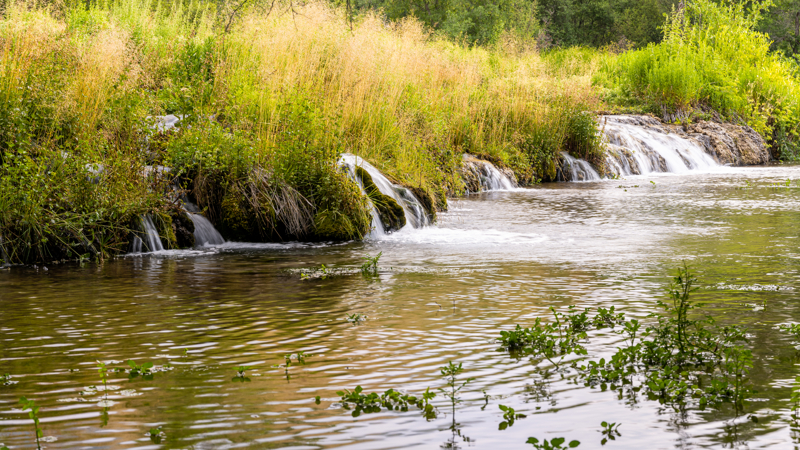
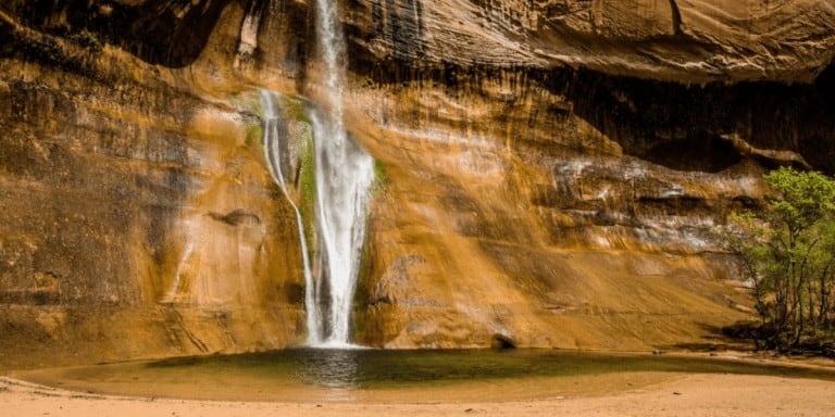
Cascade Springs Detour
When you come to Forest Road 114, there’s a 14 mile round trip detour to Cascade Springs we recommend. At FR 114 (Cascade Scenic Drive), turn left then drive until you reach Cascade Springs. Keep driving past the upper parking lot and park in the lower lot if you can.
To help preserve the area and keep it clean you won’t find any picnic tables at the location. There is water at the lower parking lot, and vault toilets at both parking areas. Fishing is not permitted at the springs.
From the lower parking lot, the main marked trail is steep. There is a handicap/stroller access trail to the right of the main trail, but it’s unmarked so it may be hard to spot.
Cascade Springs consists of a number of natural springs that produce over 7,000,000 gallons of water daily! You’ll see it flowing over a series of travertine ledges and through a series of pools into Provo Deer Creek.
The total distance along the well-defined paved trail (with areas of wooden boardwalk) is 1.25 miles roundtrip. It’s a refreshing walk with a number of view areas and benches for leisurely enjoyment of the springs and cascades.
From here head back to the Alpine Loop scenic drive.
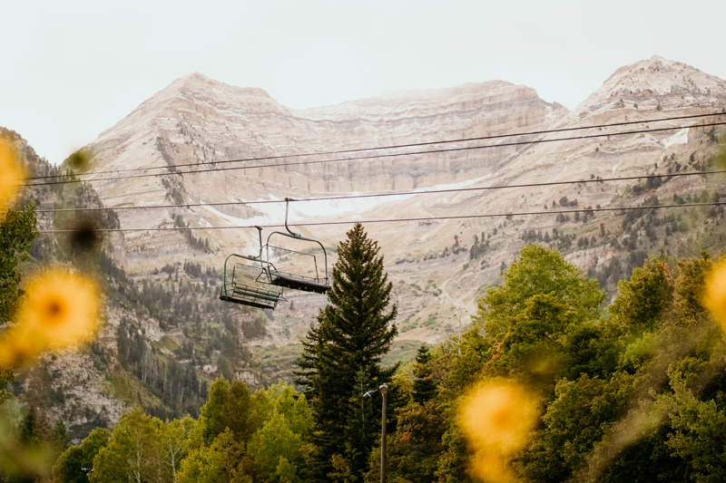
Sundance Resort
The final stop we recommend is Sundance Mountain Resort. Yes, Sundance is best known as a winter ski resort, but you’d be surprised at all the activities you can do in the summer and fall months!
- Scenic Lift Rides
- Full Moon Lift Rides
- Sundance ZipTour
- Mountain Biking (rentals and clinics available)
- Hiking
- Horseback Riding
- Art Studio Classes
- Summer Theatre (bench and lawn seating)
- Spa Treatments
- Dining – we recommend the Foundry Grill!
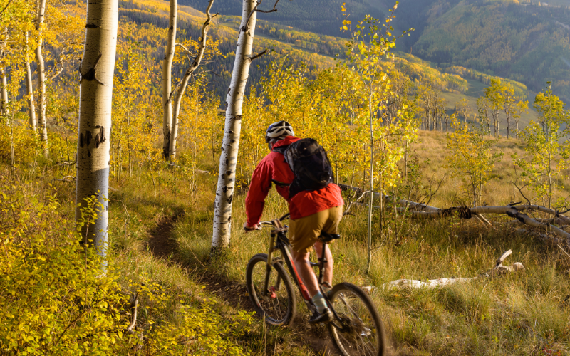
Alpine Loop Hiking & Biking Trails
The scenic byway travels through American Fork Canyon and Provo Canyon. In addition to the Timpanogos Cave and Timpanogos Summit trails listed above, here are more hikes you’ll find in the area:
- Stewart Falls
- Tibble Fork Trail
- Silver Lake Trail and Silver Glance Lake
- Timpooneke-Chris Flat Trail
- Scout Falls
- Pine Hollow Trail
- Willow Hollow Trail
- Salamander Flat Trail
- Ridge Trail
- Horse Flat Trail
- Lame Horse Trail
- Island Meadow Trail
Alpine Loop Scenic Byway Photography
We are lucky to live about 30 minutes from this stunning location to capture memorable landscape photos. Here are a few of our tips for photographing the Alpine Loop area:
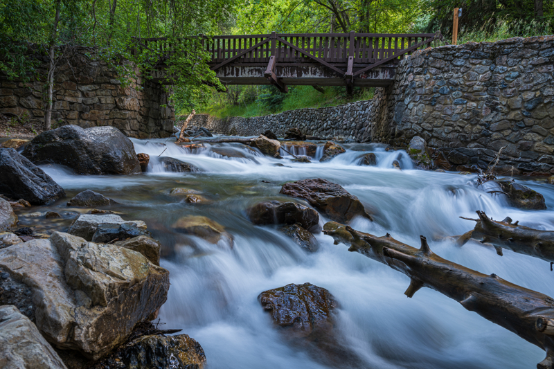
River and waterfall photography – The sun is not your friend when photographing waterfalls or rivers because it creates bright spots and dark shadows in the image.
Our favorite river spot is the Swinging Bridge picnic area. And of course we love to photograph Stewart Falls, but the requires a hike!
We recommend getting to your location around sunrise, before the sun starts to light up the water.
PHOTO TIP: If light conditions are too bright for the long exposures to be captured with only camera settings, then we recommend you use neutral density filters to help balance the light in the scene.
The cool thing about Swinging Bridge is it can be photographed year-round: spring, summer, fall, and winter!
Late fall and after, you’ll need winter clothing and gear – we LOVE rechargeable hand warmers and photography gloves!
Use a variety of basic photography techniques to compose your photos for interest and impact.
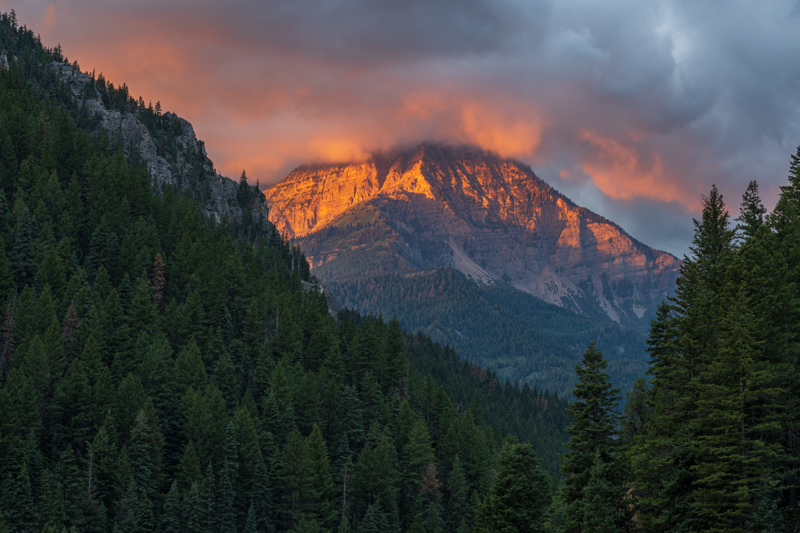
Sunrise and Sunset photography – Mt. Timpanogos is the main mountain peak you see along the Alpine Loop drive. Sunrise and sunset are amazing time to take pictures, especially when you can capture a colorful sky with clouds!
We’ve found a few favorite places to take photos of this majestic peak:
- Tibble Fork Reservoir
- First parking overlook on the right just past the North Fork / South Fork Y in the road
- Parking areas along the scenic drive
- Sundance
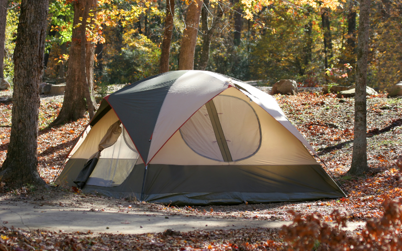
Alpine Loop Camping
There are many places to camp in American Fork Canyon and Provo Canyon as you explore the Alpine Loop.
Alpine Loop Campgrounds
The campsites range from basic sites to ones with more amenities, such as flushing toilets. Reservations must be made at least 5 days in advance through recreation.gov.
- Little Mill Campground
- Altamount Campground
- Timpooneke Campground
- Mount Timpanogos Campground
- Granite Flat Campground
- Salamander Flats Campground
Alpine Loop Dispersed Camping
Dispersed camping is when you want to camp anywhere in the National Forest outside of a designated campground. This type of camping means no toilets, no treated water, and no fire pits are provided.
Dispersed camping is not allowed near developed recreation areas such as campgrounds, picnic area, or trailheads. Here are the guidelines for dispersed camping in American Fork Canyon and Provo Canyon.
- Dispersed camping is allowed within 150 feet from a designated Forest Service Road.
- No dispersed camping within 100 feet of water (the Forest Service recommends 200 feet).
- No dispersed camping in the lower half of American Fork Canyon.
- Camp on bare soil if possible, to avoid damaging plants and grass.
- Do not camp in the middle of a clearing or meadow; try to make your campsite less visible so that other visitors will see a “wild” setting.
- Do not try to level or dig trenches in the ground at your campsite. Select a campsite with good natural drainage.
- Try to use existing dispersed sites whenever possible to minimize impacts.
- Fire restrictions: weather conditions vary throughout the year; to find out about current fire restrictions contact your local Forest Service office.
Sundance Mountain Resort Lodging
We know this isn’t camping, but this option needs to be included in this guide. The Sundance Mountain Resort lodging ranges from luxurious mountain homes to comfy and cozy cabin rooms, each fully equipped with everything you would need for an enjoyable stay.
Things To Do Along the Alpine Loop Scenic Byway
Here’s a list of recreational activities you can do along the Alpine Loop scenic drive:
- ATV tours in Utah
- Biking tours in Utah
- Horseback riding tours in Utah
- River rafting tours in Utah
- Swimming
- Fishing
- Backpacking
- Hiking
- Kayaking
- Canoeing
- Paddle boarding
- Landscape Photography
- Birding and Wildlife Viewing
In the winter you can do these activities in the Alpine Loop areas:
- Skiing and Snowboarding – Sundance
- Cross-Country Skiing
- Snowmobiling
- Snowshoeing
Utah Vacation Ideas
- Utah Bucket List – FREE printable
- Best Time to Visit Utah
- Utah National Parks
- Utah State Parks
- Tours in Utah
Places to Stay in Utah
- Coolest Hotels in Utah
- Places to Stay Near Arches National Park
- Bryce Canyon Places to Stay
- Where to Stay Near Canyonlands
- Places to Stay at Capitol Reef National Park
- Places to Stay at Zion National Park