Canyon Area Day Hikes in Yellowstone National Park
Hiking at Yellowstone is a great way to explore the beauty of this large National Park. Here’s a list of Canyon area day hikes in Yellowstone: hike length, difficulty, trailhead location, and important things to know.
This Yellowstone National Park travel guide also includes important things like what to pack, where to stay, and other things to do on your vacation.

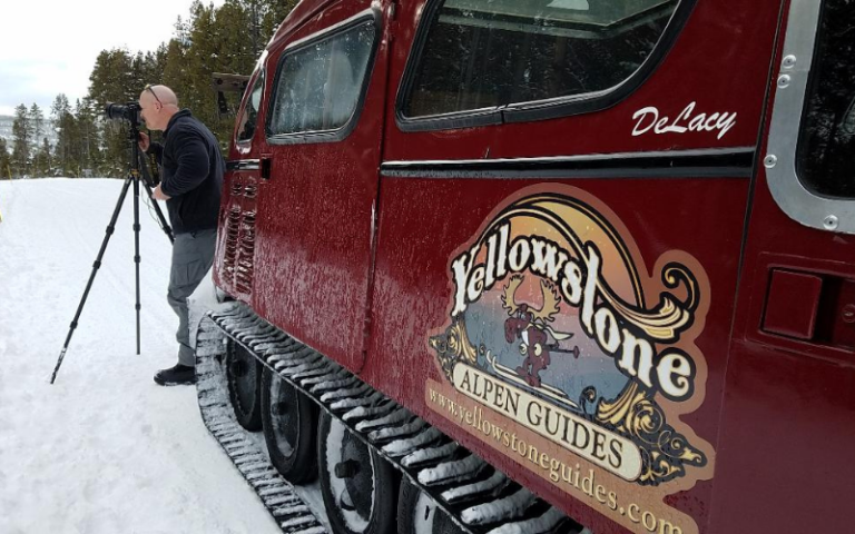
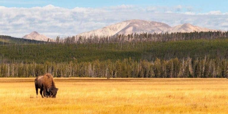
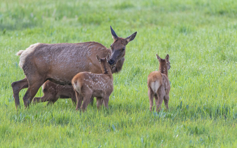
Yellowstone National Park has 2 million acres of land with numerous trails where wildlife is abundant. Many visitors stick to the roads or boardwalks, so venturing out on a Yellowstone hike is a great way to escape the crowds!
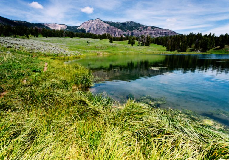
Hiking in the Canyon area of Yellowstone National Park offers visitors a chance to experience some of the most breathtaking scenery in the entire park. The Grand Canyon of the Yellowstone River, with its colorful rock walls and thundering waterfalls, serves as the centerpiece for many of the area’s trails.
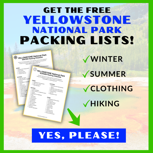
Use our Yellowstone National Park Packing List to make sure you have the right clothing and gear for hiking any time of year! Grab your free printable packing checklist by clicking the image below!
This site contains affiliate links which means WE may receive commissions for purchases made through these links. We only provide links to products we actually use and/or wholeheartedly recommend! As an Amazon Associate, we earn from qualifying purchases. Read the full Disclosure Policy.
Best Time of Year for Hiking at Yellowstone
If you plan to do any hiking, there are definite best times to visit Yellowstone National Park for exploring the trails.
Many Yellowstone hiking trails can be wet and muddy during the spring and early summer months. Snow may linger on higher elevation trails until July. Make sure you have waterproof hiking shoes to handle wet trail conditions.
Canyon Area Day Hikes in Yellowstone National Park
When planning a hike in the Canyon area, it’s important to consider factors such as elevation, weather conditions, and trail difficulty. Many trails in Yellowstone are above 7,000 feet, which can affect hikers unaccustomed to high altitudes.
It’s also crucial to practice proper safety measures, including carrying bear spray, staying on designated trails, and being prepared for sudden weather changes.
Most of the Canyon Area day hikes in Yellowstone are moderate to strenuous. You’ll find hikes that take a few hours, and hikes that take all day. There are easy hikes in Yellowstone National Park in other areas of the park.
This list of day hikes in the Canyon Area of Yellowstone provide all the details and highlighted features you need to know before setting out! We recommend you check the Yellowstone backcountry situation report for the most up-to-date information on park trails.
You’ll be exploring the Yellowstone wilderness on many hikes in this park so be prepared and pack all essentials needed for the hike:
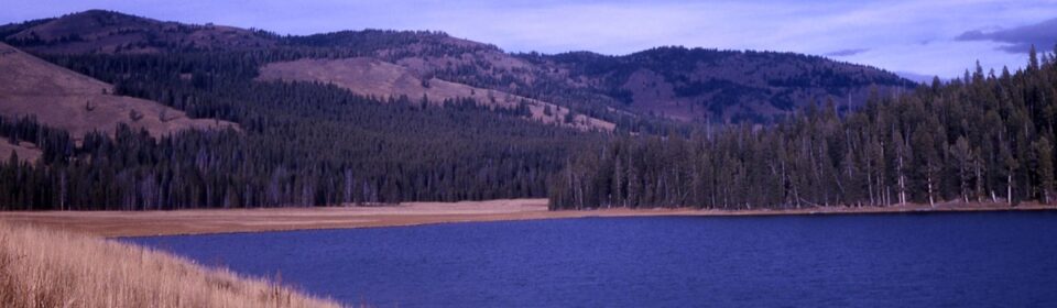
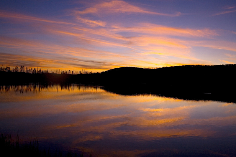
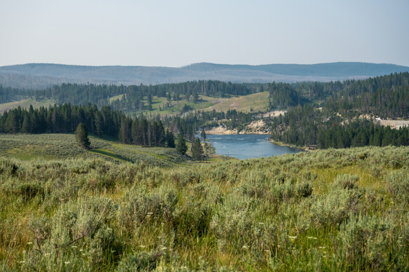
1. Cascade Lake Trail
- Hike length: 4.4 miles
- Time required: 2 to 3 hours
- Hike difficulty: Moderate
- Season: Summer, Fall
- Trailhead Location: The Cascade Lake Trail is located on Norris-Canyon Road, west of Canyon Village.
The Cascade Lake Trail is the shortest and the best route to get to the Cascade Trail. It starts through a dense forest filled with lodgepole pines and crosses a small meadow. The first few miles are comfortable to hike. After 2.7 miles, the Cascade Lake will peek through the meadows as it is surrounded by tallgrass and other thriving plants.
After going through all of the things we mentioned above, a beautiful meadow awaits. Every hiker must remember that this specific trail can be wet and muddy during the spring and early summer months, and snow may linger on the trail until July. The Cascade Lake is an excellent fishing spot in Yellowstone National Park.
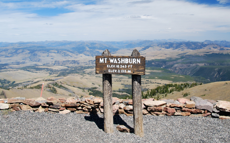
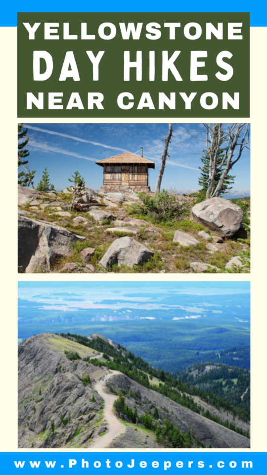
2. Chittenden Road – Mount Washburn Trail
- Hike length: 5.8 miles
- Time required: 3 to 5 hours
- Hike difficulty: Moderate
- Season: Summer, Fall
- Trailhead Location: The Chittenden Road – Mount Washburn Trail starts at the Chittenden Road’s parking area, 10.3 miles north of Canyon.
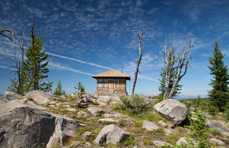
The Chittenden Road to Mount Washburn Trail is the fastest route to the most famous peak in Yellowstone. It is one of the most popular day hikes because it climbs 1,400 feet of moderate switchbacks while offering an expansive view of Yellowstone’s best scenery.
It also offers an endless panorama of Canyon, the Tetons, and beyond. Mount Washburn is a summit with a fire lookout tower. Look for bighorn sheep and wildflowers along the trail.
If you’ll be planning a Yellowstone vacation in the fall take note that grizzly bears frequent the Mount Washburn area this time of year. Hiking this trail is not recommended in September and October!
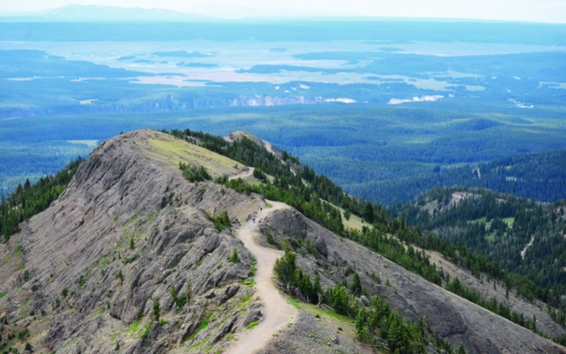
3. Dunraven Pass – Mount Washburn Trail
- Hike length: 6 miles
- Time required: 3 to 6 hours
- Hike difficulty: Moderate
- Season: Summer, Fall
- Trailhead Location: The Dunraven Pass to Mount Washburn Trailhead is found directly on Dunraven Pass, a few miles to the south of the Chittenden Road Trailhead while driving along the highway.
The Dunraven Pass to Mount Washburn Trail is another route to reach the most famous peak in Yellowstone. This pass is considered the highest in Yellowstone National Park and the same one that can catch snow any time of the year.
This trail also provides ample opportunities for visitors and hikers to have a first-hand encounter with grizzly bears, bighorn sheep, and other amazing animals.
The summit of Mount Washburn owns one of the best sceneries in the world. With an elevation of 10,243 feet, the views are incomparable. Compared to the Chittenden Road, the Dunraven Pass gives you a realistic “trail” experience.
4. Grebe Lake Trail
- Hike length: 6.2 miles
- Time required: 3 to 4 hours
- Hike difficulty: Moderate
- Season: Summer, Fall
- Trailhead Location: The Grebe Lake Trailhead is located 3.5 miles west of Canyon Junction on the Norris-Canyon Road.
The Grebe Lake Trail is mainly used by fishers, hikers, and backpackers. It begins on an old roadbed and narrows into a footpath, following a forest filled with thriving lodgepole pines. The lake is home to loons, swans, and ducks.
Yellowstone National Park is bear country so be prepared and carry bear spray. Hiking this trail at Yellowstone in the summer, prepare for mosquitoes by wearing insect repellent.
5. Howard Eaton Trail (Canyon Area)
- Hike length: 10.7 miles
- Time required: 5 to 6 hours
- Hike difficulty: Moderate
- Season: Summer, Fall
- Trailhead Location: The Howard Eaton Trail is located one-fourth mile west of Canyon Junction on the Norris-Canyon Road.
The Howard Eaton Trail was once famous for being “one of the most scenic trails in America for horseback riders” since it passes by four lakes, forest, meadow, and marsh.
This is a one-way trail with various locations to begin and end (Cascade Lake, Grebe Lake, Wolf Lake, or Ice Lake). Arrange for someone to pick you up or leave a vehicle at your ending point.
This trail can be wet and muddy through July so be prepared for biting insects!
6. Observation Peak Trail
- Hike length: 9.6 miles
- Time required: 5 to 6 hours
- Hike difficulty: Moderate
- Season: Summer, Fall
- Trailhead Location: The Observation Peak Trail starts at the Cascade Lake Trailhead, located at one and one-fourth miles north of Canyon Junction on the Grand Loop Road.
The Observation Peak Trail will take you to one of the best summits in the world. This trail gradually climbs to the summit with an elevation gain of 1,400 feet, making this hike a moderate one.
You may find wet and snowy trail conditions through July so waterproof hiking boots are recommended up to that time.
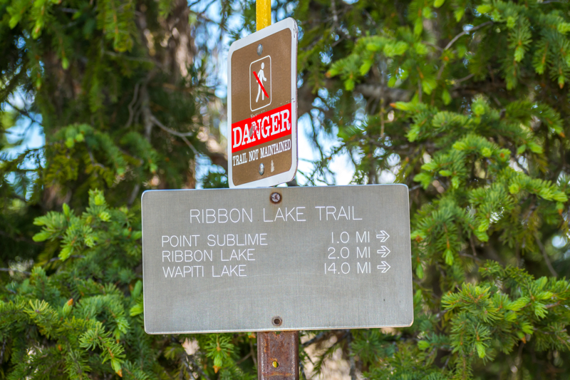
7. Ribbon Lake Trail
- Hike length: 5.8 miles
- Time required: 2 to 3 hours
- Hike difficulty: Strenuous
- Season: Summer, Fall
- Trailhead Location: The Ribbon Lake Trailhead is located 2.3 miles south of the Canyon Junction, on the South Rim Drive at Uncle Tom’s Point Parking Area.
The Ribbon Lake Trail beings at the southeast side of the Upper Falls Viewpoints parking lot – look for the path that leads across South Rim Drive to the Clear Lake trailhead. At the Clear Lake junction turn left. Continue on the trail following the junction signs until you reach Ribbon Lake.
You can return the way you came, or you can hike the alternate loop by taking a right at the Lily Pad Lake Junction. After .03 mile (0.4 km,) you will reach another junction for Point Sublime and Artist Point. Head west towards Artist Point. Continue to the Artist Point parking area. At the southwest end of the Artist Point parking area connect with the paved South Rim trail. Follow the South Rim Trail along the canyon edge back to your car.
Carry bear spray on this hike because encounters with grizzly bears are common. As much as possible, always hike in groups.
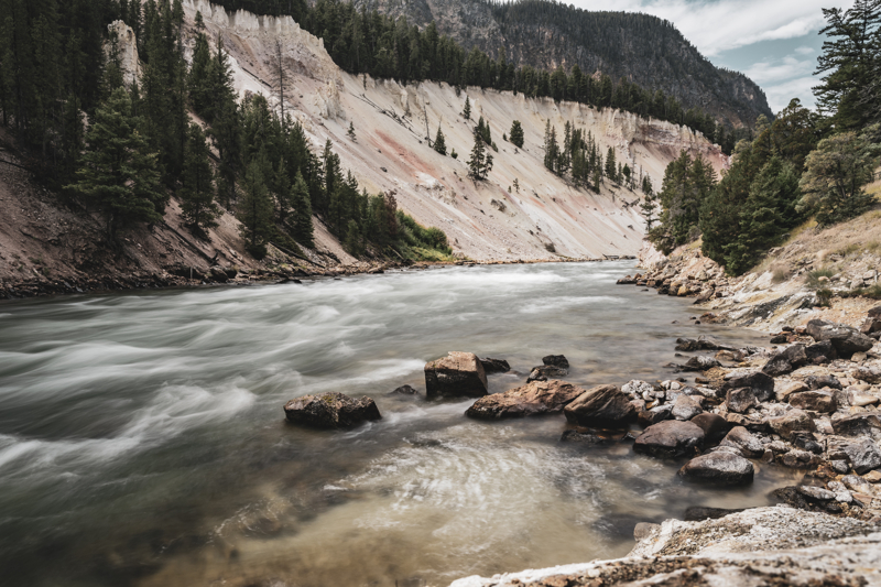
8. Seven Mile Hole Trail
- Hike length: 10 miles there-and-back
- Time required: 5 to 8 hours
- Hike difficulty: Strenuous
- Season: Summer and Fall
- Trailhead Location: The Seven Mile Hole Trailhead is located at the Glacial Boulder pullout, on the road to Inspiration Point.
The Seven Mile Hole Trail starts along the famous Grand Canyon rim for 1-1/2 miles. About 1/2 mile after that the trail will join the Washburn Spur Trail. About 3/4 miles later turn right onto the Seven Mile Hole trail. Note the drop in elevation of 1,000 feet in 2.3 miles until it reaches the Yellowstone River’s edge, which you’ll climb back up when you return!
Along the way, watch for dormant and active hot springs. Carry hydration packs with water and supplies since this is a Yellowstone Backcountry hiking trail.
More Yellowstone Day Hikes
- Old Faithful Area Day Hikes in Yellowstone
- Mammoth Hot Springs Area Day Hikes in Yellowstone
- Lake and Fishing Bridge Area Day Hikes in Yellowstone
- Madison Area Day Hikes in Yellowstone
- Grant and West Thumb Area Day Hikes in Yellowstone
- Tower and Northeast Area Day Hikes in Yellowstone