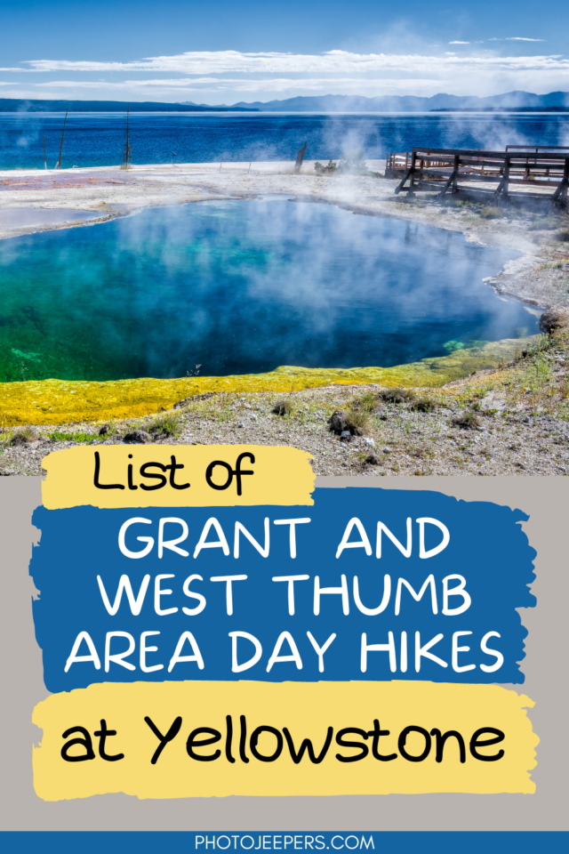
Grant and West Thumb Area Day Hikes in Yellowstone
A fun way to explore the beauty of Yellowstone National Park is hiking the trails in the different areas of the park. Here’s a list of Grant and West Thumb area day hikes in Yellowstone: hike length, difficulty, trailhead location, and important things to know.
This Yellowstone National Park travel guide also includes important things like what to pack, where to stay, and other things to do on your vacation.
The Grant and West Thumb areas are located along the Yellowstone National Park Southern Loop. The name West Thumb is derived from the odd shape of the lake, which stands out like a sore thumb.
Due to its proximity to Grant Village, park literature often refers to the area as Grant Village-West Thumb Area. While it may not be well-known, the area has hidden jewels like hiking trails, waterfalls, and geothermal regions.
Use our Yellowstone National Park Packing List to make sure you have the right clothing and gear for hiking! Grab your free printable packing checklist by clicking the image below!
Best Season for Hiking at Yellowstone
If you plan to do any hiking, there are definite best times to visit Yellowstone National Park for exploring the hiking trails in the Madison area.
Many Yellowstone hiking trails can be wet and muddy during the spring and early summer months. Snow may linger on higher elevation trails until July. Make sure you have waterproof hiking shoes to handle wet trail conditions. In the winter you’ll need snowshoes to explore the trails!
- Yellowstone in the Spring
- Yellowstone in the Summer
- Yellowstone in the Fall
- Yellowstone in the Winter
Grant and West Thumb Day Hikes in Yellowstone
Here is a list of Grant and West Thumb Area Day Hikes: hike length, difficulty (quite a few are easy hikes in Yellowstone), hike length, difficulty, trailhead location, and essential things to know:
Be prepared and pack all essentials needed for any hiking trail in Yellowstone:
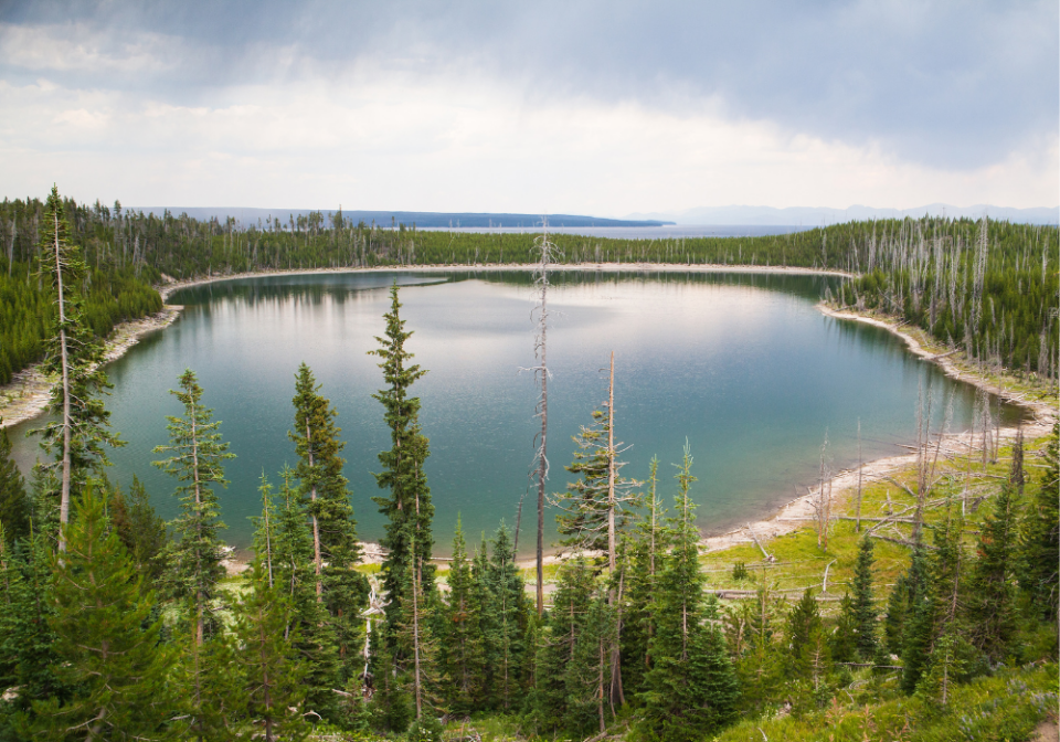
Duck Lake Trail
- Hike length: 1 mile
- Time required: 1 to 2 hours
- Hike difficulty: Moderate
- Trailhead location: The trailhead is located at the north end of the parking area at West Thumb Geyser Basin.
There is a short but steep climb up a hill, through an area affected by the 1988 fires, and then a descent to Duck Lake’s shores. Duck Lake Trail is relatively quiet, and it is common to see bunnies along the way.
Riddle Lake Trail
- Hike length: 4.8 miles
- Time required: 2 to 4 hours
- Hike difficulty: Easy
- Trailhead location: The trailhead is situated approximately 3 miles (5 km) south of Grant Village, directly south of the Continental Divide sign.
Riddle Lake Trail runs through dense grizzly habitat and usually opens mid-July due to Bear Management Area Closure. To ensure a safe journey, it is recommended to travel in groups of four or more. And be sure to carry bear spray! It is a relatively easy trail that meanders through meadows until reaching the picturesque Riddle Lake.
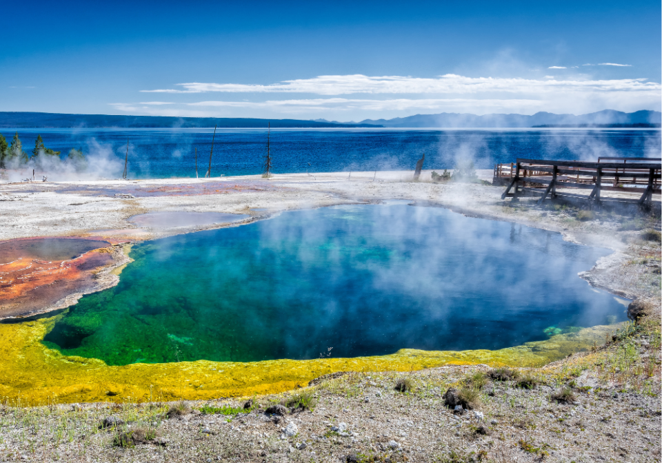
West Thumb Geyser Basin Trail
- Hike length: 0.6 mile
- Time required: 30 to 60 minutes
- Hike difficulty: Easy
- Trailhead location: The trailhead is located at the West Thumb Geyser Basin Parking Area.
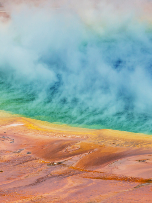
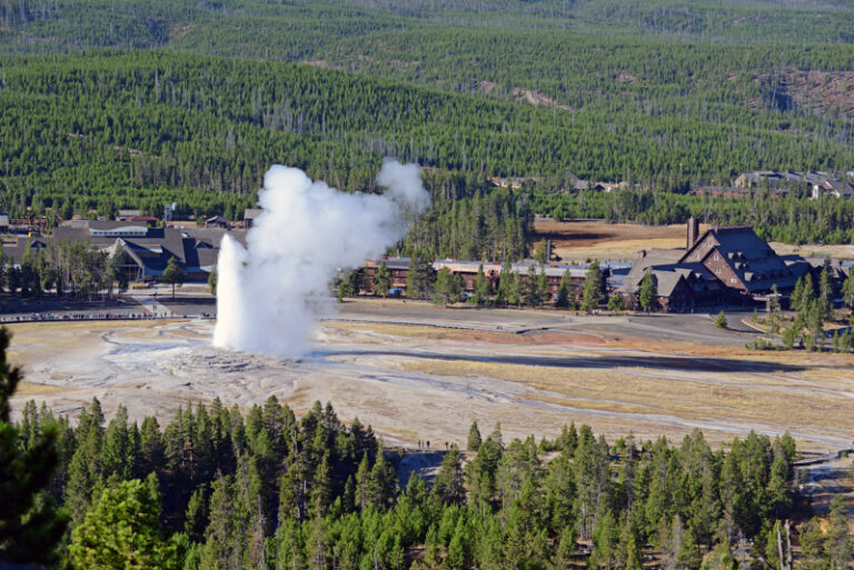
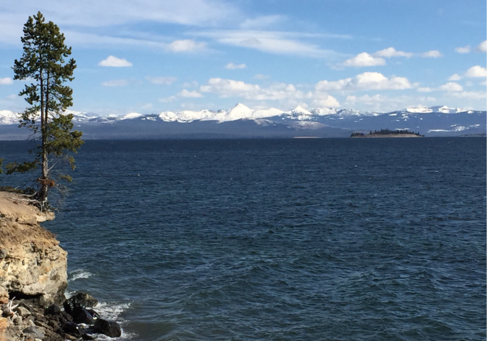
The West Thumb Geyser Basin overlooks the West Thumb portion of Yellowstone Lake, the largest lake in North America for its size. You can find some of Yellowstone’s most fascinating and beautiful hot springs in this basin, but its geysers are rare and predictable.
During your journey around the basin, you will see the following important features:
Abyss Pool: In the park, the Abyss Pool is one of the deeper hot springs, with a depth of 53 feet. There are a variety of colors in the pattern, including turquoise, emerald green, and brown.
Black Pool: In the past, Black Pool was black. The pool appears black due to thick mats of dark green and brown thermophiles growing in the lower water temperature. As a result of the rise in water temperature in 1991, these organisms were killed. Several times during the following winter, Black Pool also erupted.
Fishing Cone: According to mountain dwellers, there was a geyser on the shore of an alpine lake where one could catch trout, swing the pole around, dip it into boiling water, and cook the fish without removing it from the line. A member of the 1870 Washburn Expedition described this feat of cooking on the hook at Fishing Cone, and it became famous.
Lakeside Spring: This blue-green spring drains into Yellowstone Lake. As a result of the abundant plant life that grows in the hot waters of West Thumb, many of the colors you see in the pools are created.
Blue Funnel Spring: It has long been recognized for its distinctive ring of color surrounding its perimeter. After the Abyss pool erupted during the winter of 1992, the water in Blue Funnel and adjacent Perforated Pool and Ephedra Spring cooled and sank considerably.
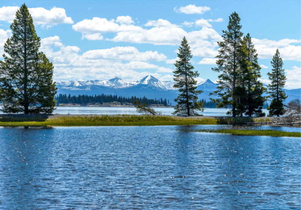
Yellowstone Lake Overlook Trail
- Hike length: 1.7 miles
- Time required: 1 to 3 hours
- Hike difficulty: Moderate
- Trailhead location: The trailhead is located at the southeast corner of the parking area for West Thumb Geyser Basin.
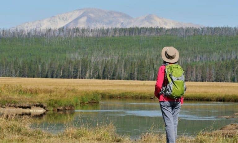
Hikers can enjoy a beautiful view of Yellowstone Lake’s West Thumb and the Absaroka mountains from this trail. It climbs 100 feet in the first .1 mile, but it does not become too steep. Upon reaching the canyon’s edge, you will see the Yellowstone River. For almost two miles, the trail follows the rim of the canyon. It is a breathtaking view, but watch your step!
Lewis River Channel/Dogshead Trail
- Hike length: 10.8 miles
- Time required: 5 to 8 hours
- Hike difficulty: Moderate
- Trailhead location: The trailhead is located on the west side of the road approximately 5 miles south of the Grant Village intersection.
The Lewis River Channel/Dogshead Trail will give you a taste of Yellowstone’s backcountry. You can make a shorter version of this trail by hiking through the forest to the crystal-clear waters of the Lewis River Channel. Pets are prohibited on this trail.
DeLacy Creek Trail
- Hike length: 5.8 miles
- Time required: 3 to 5 hours
- Hike difficulty: Moderate
- Trailhead location: The trailhead is located at the DeLacy Creek Parking Area, approximately 8.8 miles (14 km) west of West Thumb Junction.
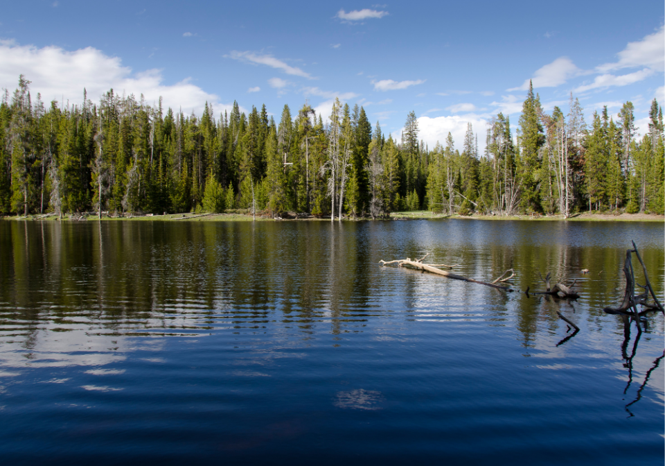
Located along the Old Faithful to West Thumb Road, the DeLacy Creek Trail crosses DeLacy Creek and ends near the outlet of Shoshone Lake to the Lewis River Channel.
The trail follows DeLacy Creek for three miles before dropping 150 feet to reach Shoshone Lake’s inlet. Within a mile, the trail emerges from the forest and enters the beautiful DeLacy Meadows.
Several miles of the trail follows the eastern edge of the meadows, providing pleasant views of the surroundings. As the meadow approaches the lake, it becomes more expansive. By the end of the third mile, the trail reaches the lake and the North Shore Shoshone Lake Trail, which branches left.
After crossing the creek, the trail enters the trees and begins a 4.3-mile ride along Shoshone Lake’s eastern shore. Most of the trail is covered with trees, but there are occasional glimpses of the lake along the way. The trail ends after reaching its junction with the South Shore Shoshone Lake Trail and the Dogshead Trail.
Yellowstone Day Hikes
- Old Faithful Area Day Hikes in Yellowstone
- Canyon Area Day Hikes at Yellowstone
- Mammoth Hot Springs Area Day Hikes in Yellowstone
- Lake and Fishing Bridge Area Day Hikes in Yellowstone
- Madison Area Day Hikes in Yellowstone
- Tower and Northeast Area Day Hikes in Yellowstone
Plan a Yellowstone Vacation
- Yellowstone National Park Travel Guide
- Things to Do at Yellowstone National Park
- Best Time to Visit Yellowstone National Park
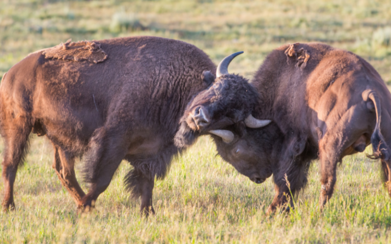
- Best Time to Visit Yellowstone for Wildlife
- Yellowstone Tours
Places to stay in West Yellowstone
- Holiday Inn, West Yellowstone
- ClubHouse Inn, West Yellowstone
- Kelly Inn, West Yellowstone
- West Yellowstone hotels!
Places to stay in Gardiner
- Yellowstone Gateway Inn, Gardiner – full kitchen and comfy bed, one of our favorite places to stay!
- Park Hotel Yellowstone, Gardiner – charming place to stay and loved by guests!
- Absaroka Lodge, Gardiner – beautiful location with river views!
- Gardiner hotels!
Places to stay in Cooke City or Silver Gate
- Sunny Log Home on the Creek, Silver Gate (VRBO) – the most AMAZING location with an awesome fireplace and comfy bed!
- High Country Motel and Cabins – local owners who love what they do, and make you feel so welcome!