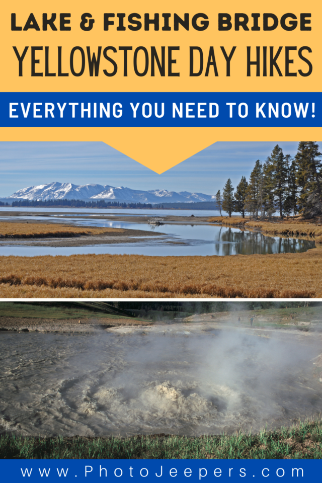
Lake and Fishing Bridge Area Day Hikes in Yellowstone
A fun way to explore the beauty of Yellowstone National Park is hiking the trails. Here’s a list of Lake and Fishing Bridge area day hikes in Yellowstone: hike length, difficulty, trailhead location, and important things to know.
This Yellowstone National Park travel guide also includes important things like what to pack, where to stay, and other things to do on your vacation.
Lake and Fishing Bridge are located along the Yellowstone National Park Southern Loop.
Check out this list of hikes in the Lake and Fishing Bridge area of Yellowstone to see spectacular landscape scenes!
Best Season for Hiking at Yellowstone
If you plan to do any hiking, there are definite best times to visit Yellowstone National Park for exploring the hiking trails in the Lake and Fishing Bridge area.
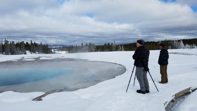
Many Yellowstone hiking trails can be wet and muddy during the spring and early summer months. Snow may linger on higher elevation trails until July. Make sure you have waterproof hiking shoes to handle wet trail conditions. In the winter you’ll need snowshoes to explore the trails!
- Yellowstone in the Spring
- Yellowstone in the Summer
- Yellowstone in the Fall
- Yellowstone in the Winter

Lake and Fishing Bridge Area Day Hikes in Yellowstone
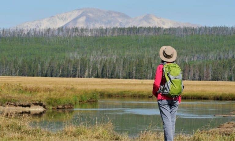
The area around Lake and Fishing Bridge has several incredible day hikes. You’ll find quite a few of the easy hikes in Yellowstone National Park here.
This list of day hikes to explore Lake and Fishing Bridge provides all the details and highlighted features you need to know before setting out!
We recommend you check the Yellowstone backcountry situation report for the most up-to-date information on park trails.
You’ll be exploring the Yellowstone wilderness on many hikes in this park so be prepared and pack all essentials needed for the hike:
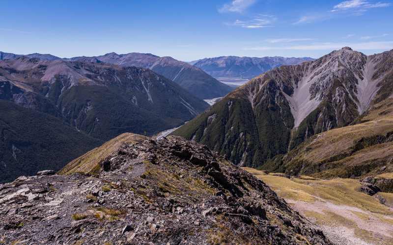
Avalanche Peak Trail
- Hike length: 4.2 miles round trip
- Time required: 3 to 4 hours
- Hike difficulty: Moderate to Strenuous (high elevation trail is not recommended for people with heart and/or respiratory problems.
- Trailhead location: At Eleanor Lake, you will find a pullout (19 miles) east of Fishing Bridge Junction (8 miles west of East Entrance). From the pullout, you can get to the trailhead.
The Avalanche Peak Trail is snow-covered until July. Due to the high elevation you’ll want to pack rain gear, wool hats, and gloves even if it’s a warm sunny day.
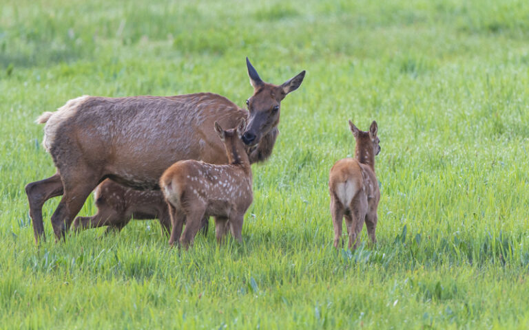
Grizzly bears like this area in the fall so hiking this trail is not recommended in September and October. Carry bear spray at all times.
The trail enters the forest directly across the parking area and begins a steep climb of 2,100 feet over 2.1 miles. One mile later, it reaches Avalanche Peak and follows the left side to an open space below the summit.
As hikers approach the narrow ridgeline, you should exercise extreme caution when crossing it. You will be rewarded with impressive views of some of the park’s highest alpine peaks at the end of this trail.
Pets are not allowed on this trail.
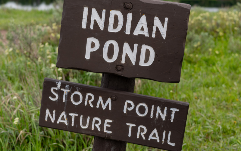
Storm Point Trail
- Hike length: 2.3 mile loop trail
- Time required: 1 to 2 hours
- Hike difficulty: Easy
- Trailhead location: As you travel east towards Cody, Wyoming, you will find the trailhead 2.5 miles past the Fishing Bridge Visitor’s Center.
If you’re looking for a family-friendly hike, we recommend the Storm Point Trail. Kids will enjoy the variety of things to see along the hike.
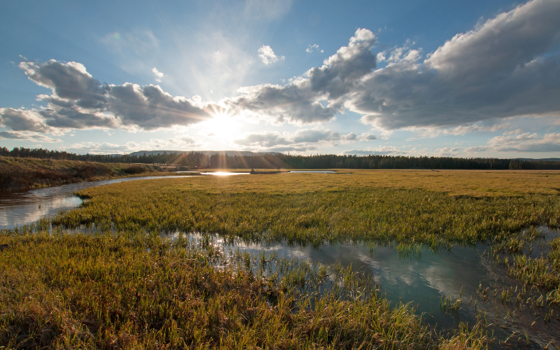
The trail begins by passing Indian Pond and through a meadow until you reach the expansive views of Yellowstone Lake.
In the nearby rocky area of Storm Point, you will find a colony of yellow-bellied marmots. A loop trail crosses the shoreline to the west and eventually returns to Indian Pond through a lodgepole forest.
Due to bear activity, the Storm Point Trail is often closed around the end of spring and the beginning of summer. Be sure you know trail closures at the Fishing Bridge Visitor Center before setting out. It’s always good to carry bear spray on this hike.
In the summer, this trail will be fully exposed to the sun so wear a hat, sunglasses, and sunscreen.
Elephant Back Mountain Trail
- Hike length: 3.5 mile lollipop loop trail
- Time required: 2 to 3 hours
- Hike difficulty: Easy
- Trailhead location: There is a pullout approximately one mile (1.5 kilometers) south of Fishing Bridge Junction.
The Elephant Back Mountain Trail begins at a small parking area near Lake Village along the Grand Loop Road, south of Fishing Bridge Junction, over a mile south of Lake Lodge.
The trail ascends 800 feet in 1.5 miles through dense forest. At 0.8 miles the trail splits into a loop. Both trails meet at the overlook. The left fork is the shortest route to the top.
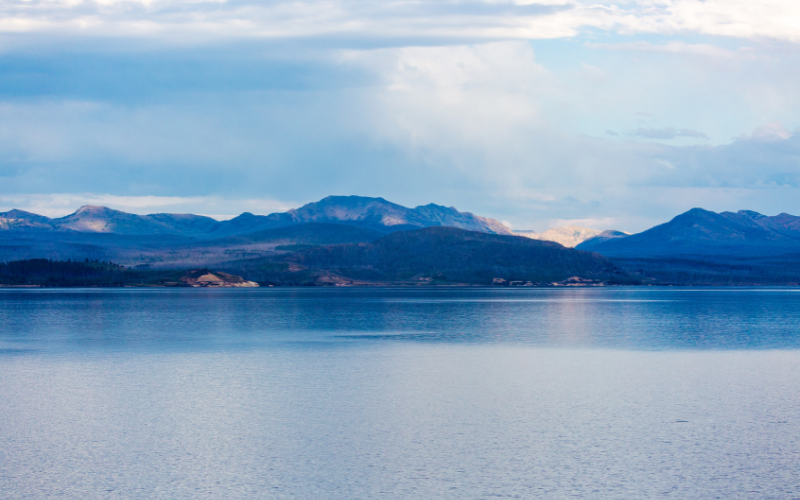
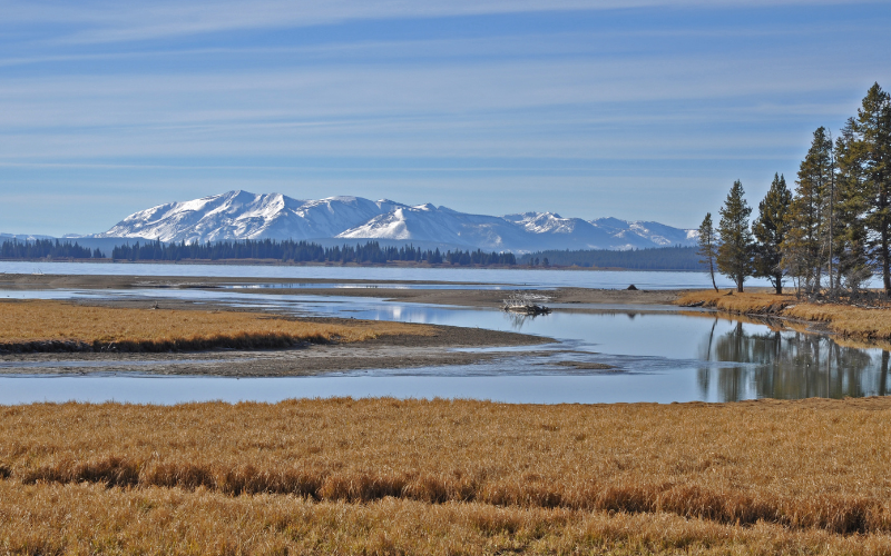
At the overlook you get a panoramic view of Yellowstone Lake, Pelican Creek, Storm Point, Mary Bay, Steamboat Point, and Stevenson Island.
Always keep an eye out for grizzly bears and carry bear spray for this hike!
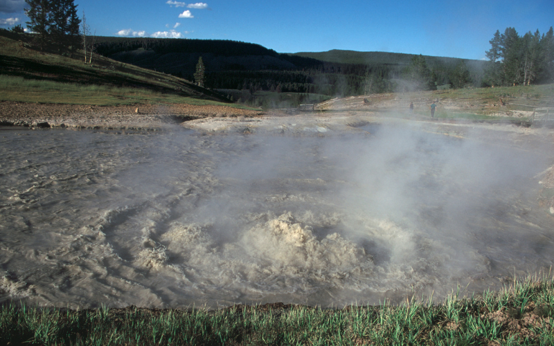
Mud Volcano Trail
- Hike length: 0.6 mile loop boardwalk trail
- Time required: 1 to 2 hours
- Hike difficulty: Easy
- Trailhead location: On the Yellowstone National Park Southern Loop north of Yellowstone Lake, you will find the Mud Volcano boardwalk.
The Mud Volcano Trail is an unusual landscape characterized by turbulent pools of hot, muddy water, hillsides dotted with trees cooked by steam, pungent rotten egg-like odors, and strange shapes.
In the 1800s, early explorers described Mud Volcano as “most repulsive.” The volcano-shaped cone is 30 feet high and 30 feet wide, and its steep slopes are covered in mud that erupts and covers nearby trees.
There are extreme soil temperatures in the surrounding area, which is why it’s called “Cooking Hillside.” Among the other attractions in the area are Mud Cauldron, Mud Geyser, Sizzling Basin, Churning Cauldron, Sour Lake, and Dragon’s Mouth Spring.
The Sulphur Cauldron, one of the most acidic features in the park, can be found on this trail.
Due to bear activity, the wildlife area may also be closed at times. It’s recommended you carry bear spray when exploring the area.
Pelican Valley Trail
- Hike length: 6.2 miles round trip
- Time required: 3 to 4 hours
- Hike difficulty: Moderate
- Trailhead location: Drive 3 miles (5km) east of Fishing Bridge Visitor Center and park at the end of the gravel road.
The Pelican Valley Trail area is known as some of the best grizzly bear country in the lower 48 states. Definitely carry bear spray!!
Bear management safety notes: the trail is closed until early July, day-use only trail from 9am to 7pm, and groups of four or more hikers are recommended.
Starting off you’ll cross a few bridge through a meadow then enter a forest. After leaving the forest, it ascends a steep hill to a picturesque view of the creek below and the Absaroka Mountain range to the east. After passing through a small hydrothermal area, the trail turns slightly to the right.
From here continue following the trail. Once you cross a small creek, the trail ascends a cut bank and turns left to provide an excellent vantage point for viewing Pelican Creek. In one mile’s distance, the trail comes to a washout bridge and you’ll return the way you came.
Pelican Creek Nature Trail
- Hike length: 0.6 mile loop trail
- Time required: 30 to 60 minutes
- Hike difficulty: Easy
- Trailhead location: One mile (1.6 km) east of the Fishing Bridge Visitor Center is the west end of Pelican Creek Bridge.
As an excellent place for birding, the Pelican Creek Nature Trail provides a scenic introduction to Yellowstone’s habitats on a short but diverse trail.
Pets are prohibited in this area. Be aware of your surroundings as you hike. Carry bear spray.
Natural Bridge Trail
- Hike length: 2.5 miles round trip
- Time required: 1 to 2 hours
- Hike difficulty: Easy to Moderate
- Trailhead location: Parking lot near the campground entrance for Bridge Bay Marina.
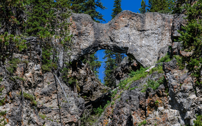
The Natural Bridge Trail leads to a 51 foot cliff of rhyolite rock that’s been cut through by Bridge Creek.
You’ll start hiking through the forest for .7 of a mile. The pathway then connects with a service road and continues to the right for .4 of a mile until it reaches the Natural Bridge.
You can access the bridge via a short but steep switchback trail at the interpretive exhibit’s entrance. Hiking and biking are prohibited on the top of the bridge to conserve this delicate resource.
Following the Natural Bridge, the trail crosses a creek and follows the cliff edge before rejoining the road. Be aware of wet and slippery rocks along the creek bed.
The trail is closed in early summer due to bear activity feeding on spawning trout in Bridge Creek. Check with the Fishing Bridge Visitor Center for the most updated trail information.
Yellowstone Day Hikes
- Old Faithful Area Day Hikes in Yellowstone
- Canyon Area Day Hikes at Yellowstone
- Mammoth Hot Springs Area Day Hikes in Yellowstone
- Madison Area Day Hikes in Yellowstone
- Grant and West Thumb Area Day Hikes in Yellowstone
- Tower and Northeast Area Day Hikes in Yellowstone
Plan a Yellowstone Vacation
- Yellowstone National Park Travel Guide
- Things to Do at Yellowstone National Park
- Best Time to Visit Yellowstone National Park
- Best Time to Visit Yellowstone for Wildlife
- Yellowstone Tours
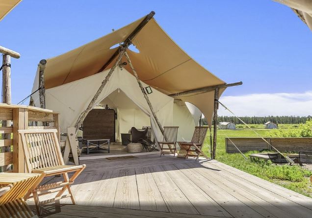
Places to stay in West Yellowstone
- Holiday Inn, West Yellowstone
- ClubHouse Inn, West Yellowstone
- Kelly Inn, West Yellowstone
- West Yellowstone hotels!
Places to stay in Gardiner
- Yellowstone Gateway Inn, Gardiner – full kitchen and comfy bed, one of our favorite places to stay!
- Park Hotel Yellowstone, Gardiner – charming place to stay and loved by guests!
- Absaroka Lodge, Gardiner – beautiful location with river views!
- Gardiner hotels!
Places to stay in Cooke City or Silver Gate
- Sunny Log Home on the Creek, Silver Gate (VRBO) – the most AMAZING location with an awesome fireplace and comfy bed!
- High Country Motel and Cabins – local owners who love what they do, and make you feel so welcome!