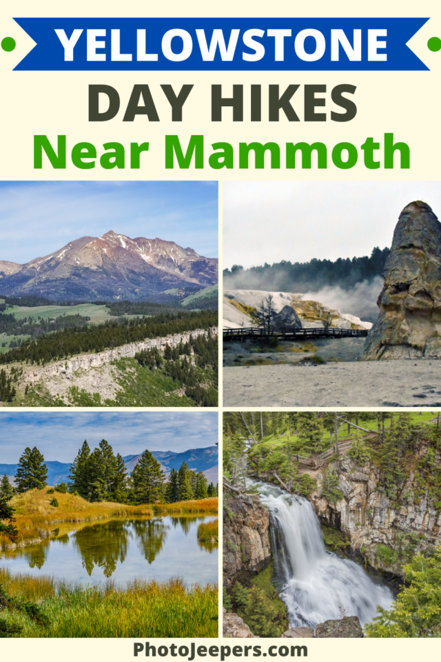
Mammoth Hot Springs Area Day Hikes in Yellowstone
A fun way to explore the beauty of Yellowstone National Park is hiking the trails. Here’s a list of Mammoth Hot Springs area day hikes in Yellowstone: hike length, difficulty, trailhead location, and important things to know.
This Yellowstone National Park travel guide also includes important things like what to pack, where to stay, and other things to do on your vacation.
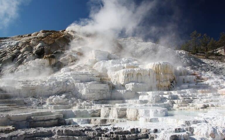
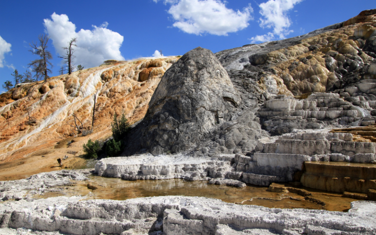
Mammoth Hot Springs is located along the Yellowstone National Park Northern Loop. The area is famous for its preserved travertine terraces, which are the largest on Earth.
Mammoth is a vital rutting ground for elk, and many plan their Yellowstone vacation in the fall to see this event.
Check out this list of hikes in the Mammoth Hot Springs area to see spectacular landscape scenes!
Best Season for Hiking at Yellowstone
If you plan to do any hiking, there are definite best times to visit Yellowstone National Park for exploring the hiking trails in the Mammoth Hot Springs area.
Many Yellowstone hiking trails can be wet and muddy during the spring and early summer months. Snow may linger on higher elevation trails until July. Make sure you have waterproof hiking shoes to handle wet trail conditions. In the winter you’ll need snowshoes to explore the trails!
- Yellowstone in the Spring
- Yellowstone in the Summer
- Yellowstone in the Fall
- Yellowstone in the Winter

Mammoth Hot Springs Area Day Hikes in Yellowstone
The area near Mammoth has several incredible day hikes. You’ll find quite a few of the easy hikes in Yellowstone National Park in this area.
This list of day hikes in the Mammoth Hot Springs area of Yellowstone provides all the details and highlighted features you need to know before setting out!
We recommend you check the Yellowstone backcountry situation report for the most up-to-date information on park trails.
You’ll be exploring the Yellowstone wilderness on many hikes in this park so be prepared and pack all essentials needed for the hike:
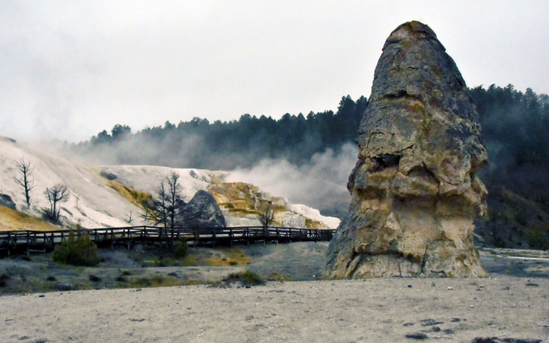
Mammoth Hot Springs Trail
- Hike length: varies depending on multiple access points and ways to explore the terraces
- Time required: 30 to 90 minutes
- Hike difficulty: Easy to Moderate
- Trailhead location: As you approach Yellowstone’s north entrance near Gardiner, Montana, drive 5.7 miles south along Route 89, past the Mammoth Hot Springs Hotel or the Albright Visitor Center, and you will reach the parking area for Liberty Cap.
Easily accessible from a parking area and restrooms, this trail offers a great family outing among some of the park’s geothermal formations.
The Mammoth Hot Springs trails are along boardwalks, paved trails, or along roads. However, there are steep grades and stairs throughout the trail network. Both the top of Canary Springs and Palette Springs are accessible via wheelchair when snow is not on the ground.
The trail from the Lower to Upper Terraces includes steep boardwalks and several hundred stairs. This strenuous trail is not recommended for people with heart, lung, or other health conditions.
It remains a mystery how Mammoth Hot Springs obtain their heat from volcanic sources. Several theories have been put forward regarding the source of heat in Yellowstone Caldera. These include the enormous magma chamber below it or a smaller source closer to the Mammoth.
A network of fractures and fissures allows hot water to reach the surface at Mammoth via the plumbing system. Water is collected from rain and snow that falls on the surrounding mountains and seeps deep into the ground, where it is heated. The final ingredient is limestone, deposited here millions of years ago when a vast sea covered this area. A weak carbonic acid solution is formed when hot water is mixed with dissolved carbon dioxide.
After exposure to the open air, some of the carbon dioxides are released from the solution. As a result, limestone no longer remains in solution and is deposited in beautiful travertine formations, the rock that forms the terraces at Mammoth Hot Springs.
Beaver Ponds Trail
- Hike length: 5 miles round trip
- Time required: 2 to 5 hours
- Hike difficulty: Moderate
- Trailhead location: The trailhead is located at the start of Old Gardiner Road, north of Liberty Cap, near the stone house, or behind the Mammoth Hot Springs Hotel.
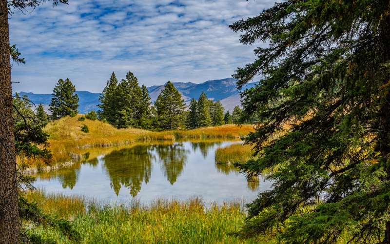
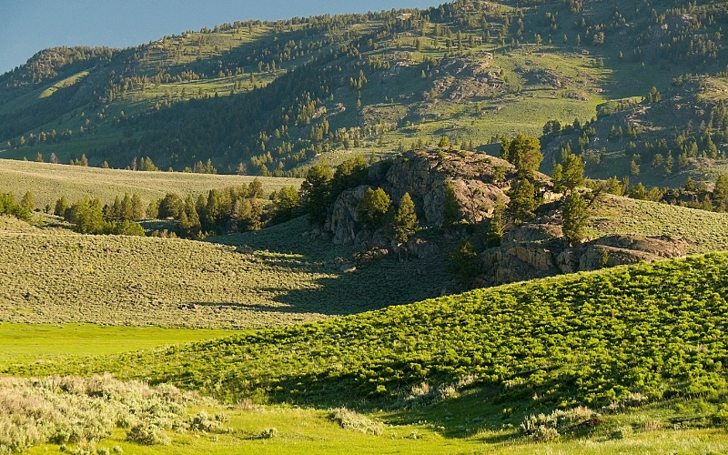
The Beaver Ponds Trail is a popular five-mile loop. As the hike progresses and gains over 350 feet in elevation, you will see some aspen-dotted forests and sagebrush-covered scenery, a favorable location for viewing deer, elk, dusky grouse, and other animals, which is always a spectacular sight. Beavers or their signs may be visible, but muskrats and water birds are more likely to be observed. Also, this area is home to grizzly and black bears so carry bear spray!
Following your northward hike, you will eventually reach the ponds, which you will circle before heading back south. Mammoth Hot Springs can be seen from above as the loop ends.
In the summer, expect a very hot and exposed route on the return trip, mainly through sagebrush flats. Wear a hat, sunglasses, and sunscreen to protect yourself from the sun.
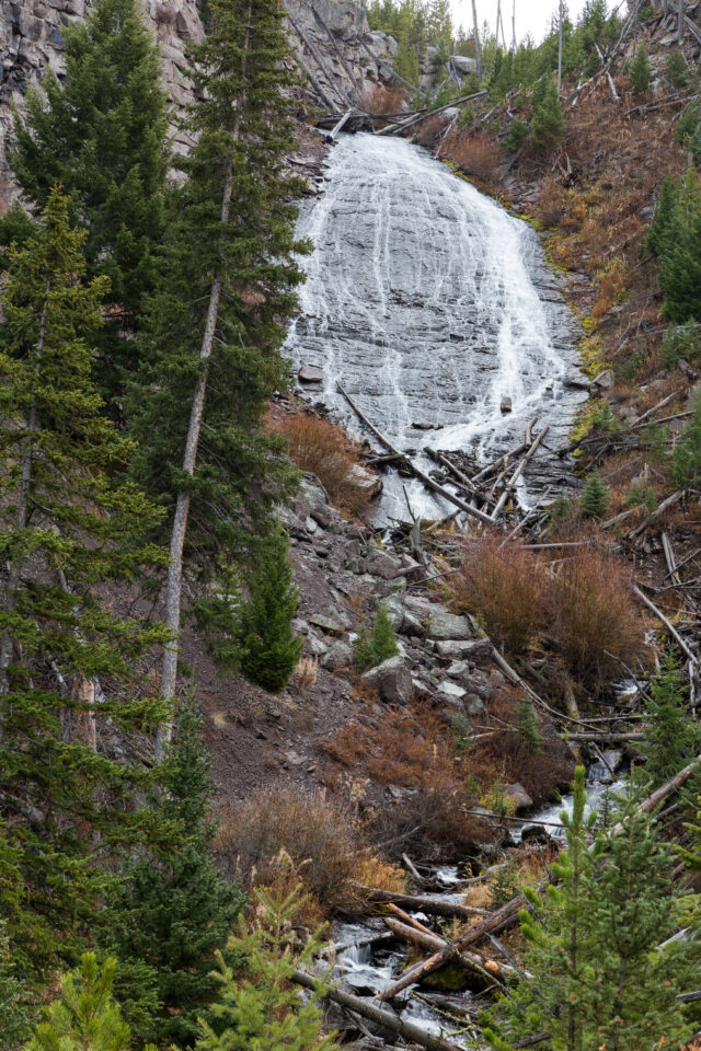
Wraith Falls Trail
- Hike length: 1 mile round trip
- Time required: 30 to 60 minutes
- Hike difficulty: Easy
- Trailhead location: The trailhead is at a pullout on the Grand Loop Road, 12 miles (0.8 km) east of Lava Creek Picnic Area.
Wraith Falls Trail leads through sagebrush meadows and marshland to the spectacular Yellowstone waterfall, Wraith Falls. It is a relatively flat trail that is easy for the whole family to explore!
This trail is best hiked from May through October. Carry bear spray for this hike!
Bunsen Peak Trail
- Hike length: 4.6 miles round trip
- Time required: 2 to 3 hours
- Hike difficulty: Moderate to Difficult
- Trailhead location: The trailhead is located on the Grand Loop Road, approximately 5 miles (8 km) south of Mammoth. You can park in the gravel lot adjacent to the Glen Creek trailhead just south of Golden Gate.
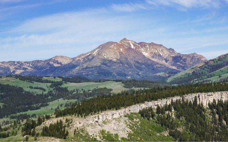
When the Absaroka volcanics were at their peak of mountain building, Bunsen Peak formed some 50 million years ago. The Bunsen Peak Trail was named after German physicist Robert Bunsen, who invented the Bunsen burner and studied geysers.
At the top of the mountain are small buildings, a few pieces of communication equipment (radio towers that serve Mammoth and the surrounding communities), and stunning views.
Standing at the summit, you can enjoy panoramic views of Mammoth Hot Springs, Mount Everts, Blacktail Deer Plateau, Swan Lake Flat, Gallatin Mountain Range, Yellowstone River Valley, and the Absaroka Mountains in the distance. Grizzly bears frequent this area so carry your bear spray.
Blacktail Deer Creek to Yellowstone River Trail
- Hike length: 7.4 miles round trip
- Time required: 4 to 5 hours
- Hike difficulty: Moderate
- Trailhead location: The trailhead is located on Grand Loop Road, 7 miles (11.3 km) east of Mammoth.
In a picturesque setting, the Blacktail Deer Creek to Yellowstone River Trail descends 1,100 feet (335m) through rolling hills and Douglas-fir forests to a suspension bridge over the Yellowstone River.
Blacktail Deer Creek is an excellent place for fishing, hiking, and horseback riding. It is best to visit this trail between May and September. Dogs are not permitted on this trail.
Lava Creek Trail
- Hike length: 4.2 miles one way
- Time required: 2 to 3 hours
- Hike difficulty: Easy
- Trailhead location: The trailhead is across the road from the Lava Creek Picnic Area or the road from Mammoth Campground.
On the Mammoth to Tower Road, this one-way, primarily downhill trail begins at Lava Creek Picnic Area and ends on the Mammoth to North Entrance Road, approximately 1/2 mile from Mammoth Hot Springs.
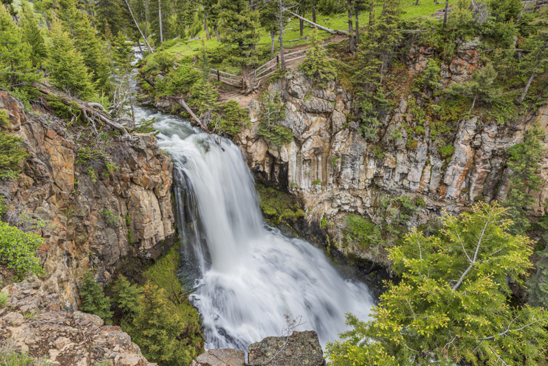
As you hike the Lava Creek Trail, look for people viewing Undine Falls from the opposite side of Lava Creek as the trail passes between a stand of trees and Lava Creek. Check out this stunning Yellowstone waterfall from above by taking the spur trail just off to the left.
After passing the falls, the trail bends to the right and offers spectacular views of Lava Creek Canyon and Mammoth Hot Spring Terraces. The Lava Creek Trail ends on the Mammoth to North Entrance Road, not far from the Mammoth Hot Springs Campground.
Osprey Falls Trail
- Hike length: 8 miles round trip
- Time required: 4 to 6 hours
- Hike difficulty: Difficult
- Trailhead location: The trailhead is located on the Grand Loop Road, approximately 5 miles (8 km) south of Mammoth. You can park in the gravel lot adjacent to the Glen Creek trailhead just south of Golden Gate.
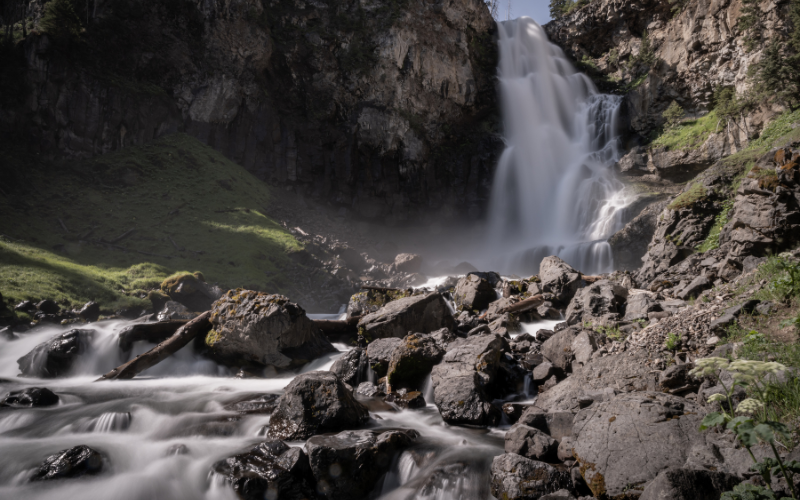
Osprey Falls Trail is a strenuous out-and-back trail that descends into one of the deepest canyons of the park. To reach Osprey Falls Trail, follow Bunsen Peak Road 3 miles (4.9 km) through grassland and burnt forest.
Enter Sheepeater Canyon by descending 700 feet (213 m). As a result of a lava flow on a tributary of the Gardner River, the Osprey Falls plunge 150 feet (46 m) over the edge. This trail is a popular hiking area, and best hiked from May through October. Pets are prohibited in this area.
Yellowstone Day Hikes
- Old Faithful Area Day Hikes in Yellowstone
- Canyon Area Day Hikes at Yellowstone
- Lake and Fishing Bridge Area Day Hikes in Yellowstone
- Madison Area Day Hikes in Yellowstone
- Grant and West Thumb Area Day Hikes in Yellowstone
- Tower and Northeast Area Day Hikes in Yellowstone
Plan a Yellowstone Vacation
- Yellowstone National Park Travel Guide
- Things to Do at Yellowstone National Park
- Best Time to Visit Yellowstone National Park
- Best Time to Visit Yellowstone for Wildlife
- Yellowstone Tours
Places to stay in West Yellowstone
- Holiday Inn, West Yellowstone
- ClubHouse Inn, West Yellowstone
- Kelly Inn, West Yellowstone
- West Yellowstone hotels!
Places to stay in Gardiner
- Yellowstone Gateway Inn, Gardiner – full kitchen and comfy bed, one of our favorite places to stay!
- Park Hotel Yellowstone, Gardiner – charming place to stay and loved by guests!
- Absaroka Lodge, Gardiner – beautiful location with river views!
- Gardiner hotels!
Places to stay in Cooke City or Silver Gate
- Sunny Log Home on the Creek, Silver Gate (VRBO) – the most AMAZING location with an awesome fireplace and comfy bed!
- High Country Motel and Cabins – local owners who love what they do, and make you feel so welcome!