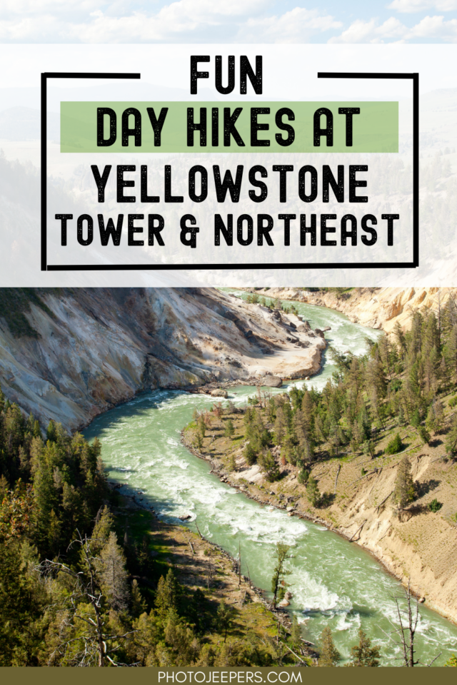
Tower and Northeast Area Day Hikes in Yellowstone
A fun way to explore the beauty of Yellowstone National Park is hiking the trails in the different areas of the park. Here’s a list of Tower and Northeast area day hikes in Yellowstone: hike length, difficulty, trailhead location, and important things to know.
This Yellowstone National Park travel guide also includes important things like what to pack, where to stay, and other things to do on your vacation.
The Tower and northeast area is located along the Yellowstone National Park Northern Loop.
Use our Yellowstone National Park Packing List to make sure you have the right clothing and gear for hiking! Grab your free printable packing checklist by clicking the image below!
Best Season for Hiking at Yellowstone
If you plan to do any hiking, there are definite best times to visit Yellowstone National Park for exploring the hiking trails in the Madison area.
Many Yellowstone hiking trails can be wet and muddy during the spring and early summer months. Snow may linger on higher elevation trails until July. Make sure you have waterproof hiking shoes to handle wet trail conditions. In the winter you’ll need snowshoes to explore the trails!
- Yellowstone in the Spring
- Yellowstone in the Summer
- Yellowstone in the Fall
- Yellowstone in the Winter
Tower and Northeast Area Day Hikes in Yellowstone
Here is a list of of the day hikes in Tower and the northeast that include: hike length, difficulty (quite a few are easy hikes in Yellowstone), hike length, difficulty, trailhead location, and essential things to know:
Be prepared and pack all essentials needed for any hiking trail in Yellowstone:
Lost Lake Trail
- Hike length: 2.8 miles
- Time required: 1 to 2 hours
- Hike difficulty: Moderate
- Trailhead location: The trailhead is located behind Roosevelt Lodge or west of Tower Junction in the Petrified Tree parking lot.
Behind Roosevelt Lodge, the Lost Lake Trail ascends 300 feet to the bench. It joins the Roosevelt horse trail and travels west to Lost Lake.
To reach the Petrified Tree parking area, the trail follows the contour of the hillside, crosses over the parking lot, and climbs up the hill. After traversing the creek, it returns to the lodge behind Tower Ranger Station.
Bears and bison are commonly found in this area, so please exercise caution when traveling. Remember your bear spray too!
You may also run into horseback riders in the area, so if you encounter them on the downhill side of the trail, stay still until they have passed.
Garnet Hill Trail
- Hike length: 7.6 miles
- Time required: 4 to 5 hours
- Hike difficulty: Moderate
- Trailhead location: The trailhead is located approximately 50 yards north of Tower Junction, along the Northeast Entrance Road. At Tower Junction, park in the large parking area east of the service station.
Approximately 1.5 miles up Garnet Hill Trail is a shelter where Yellowstone National Park Lodges offer the Roosevelt Old West Dinner Cookout.
As the trail proceeds north along Elk Creek, it approaches the Yellowstone River. This is the point at which the trail divides: the west fork joins the Hellroaring Trail, and the east fork circumnavigates Garnet Hill and returns to Tower.
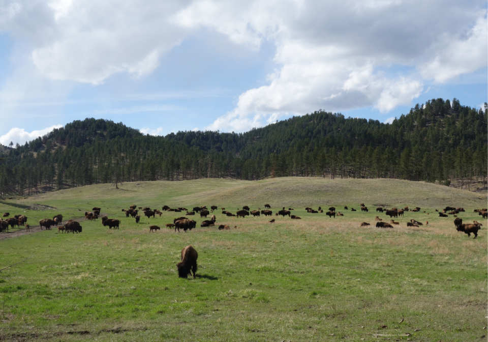
On the east fork, excellent views of the Yellowstone River and various other landscapes exist. The area is home to bears, elk, bison, badgers, mule deer, and wolves. Carry your bear spray for this hike!
As the loop rejoins the stagecoach road, it’s only a short distance to return to the parking area. You will likely encounter other hikers while exploring this area, as it is a trendy hiking area. May through October is the best time to visit this trail.
Hellroaring Trail
- Hike length: 6.2 miles
- Time required: 3 to 5 hours
- Hike difficulty: Moderate
- Trailhead location: There is a short dirt road that leads to a parking area at the trailhead approximately 3.5 miles west of Tower Junction.
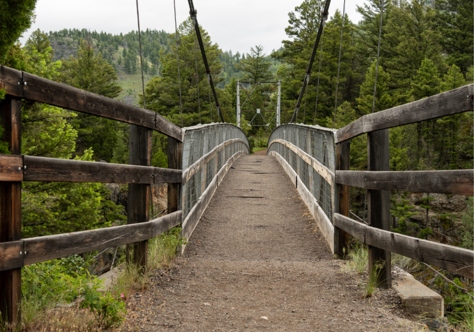
Hellroaring Trail descends steeply to the Yellowstone River Suspension Bridge, crosses a sagebrush plateau, and descends to Hellroaring Creek. Fishing is popular both on the Yellowstone River and on Hellroaring Creek.
There are several major backcountry trail junctions beyond the bridge. Ensure that you remain on the Hellroaring Trail. This trail has limited shade.
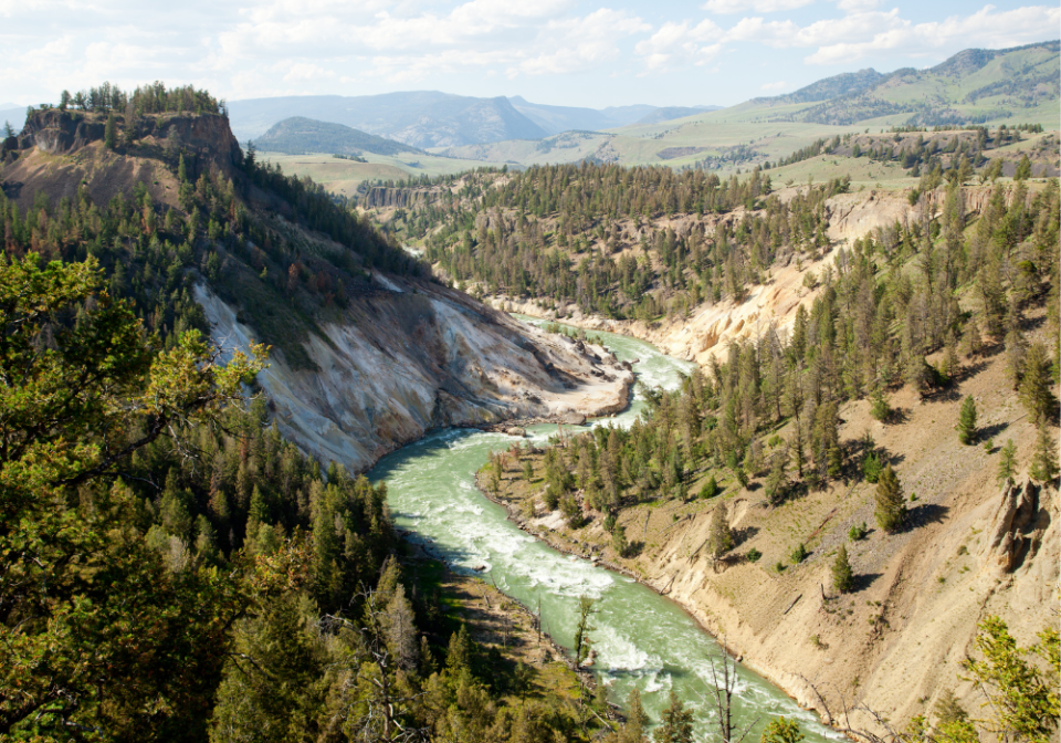
Yellowstone River Picnic Area Trail
- Hike length: 3.7 miles
- Time required: 2 to 3 hours
- Hike difficulty: Easy
- Trailhead location: A picnic area for the Yellowstone River is located on the Northeast Entrance Road, approximately 1.25 miles (2 km) northeast of Tower Junction.
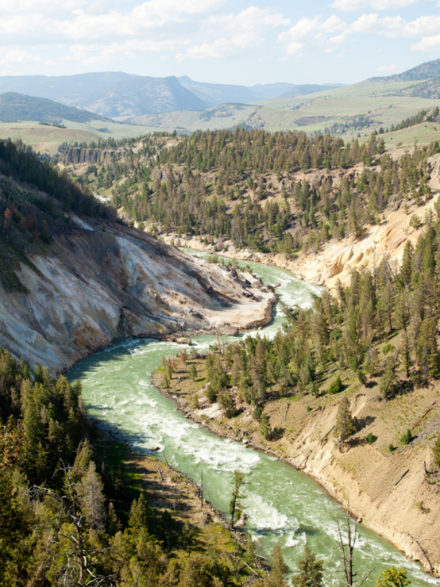
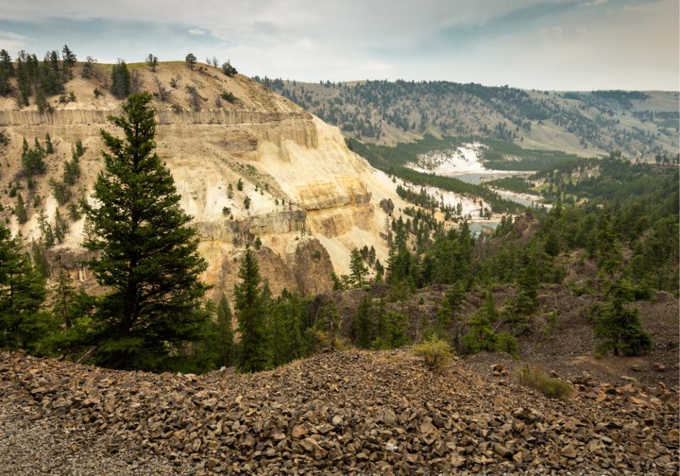
To reach the top of a ridge, the trail climbs moderately steeply from the roadside parking area. It climbs steeply to the eastern rim of the Narrows of Yellowstone, following it in a clockwise direction.
A great place to view peregrine falcons and osprey nests in the canyon, as well as bighorn sheep that live along the rim. You will be able to see the Overhanging Cliff Area, the towers of Tower Fall, basalt columns, and the historic Bannock Ford.
Specimen Ridge Day Hike Trail
- Hike length: 3 miles
- Time required: 2 to 4 hours
- Hike difficulty: Difficult
- Trailhead location: On the Northeast Entrance Road, there is a striped pullout located 4.5 miles east of Tower Junction. A sign reading “trailhead” marks the location.
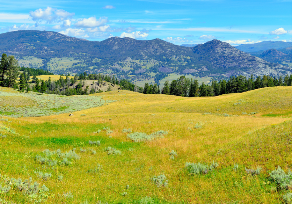
Beginning at the trailhead, the Specimen Ridge Trail ascends through open meadows of sagebrush. A junction with the Yellowstone River Overlook Trail is reached after climbing 350 feet at 1.1 miles.
Continue climbing toward the ridge by turning right onto the intersecting path. To get to the top of the open ridge, remain on the most distinct trail. Continue along the ridge line to the southwest towards the cliff outcrop you may have seen from below.
Below the top of the ridge, several wildlife trails take you through a forested area before reaching the trees. Enjoy the breathtaking view of the valley. The Slough Creek Valley and the Absaroka Range can be seen north of the observation point.
Slough Creek Trail
- Hike length: 3.4 miles
- Time required: 2 to 5 hours
- Hike difficulty: Moderate
- Trailhead location: The trailhead is located south of Slough Creek Campground, two gravel-road miles north of Northeast Entrance Road.
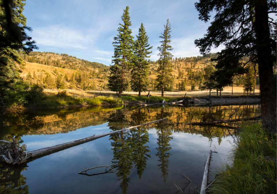
Slough Creek Trail begins with more than 11 miles of old wagon roads that lead to the Silver Tip Ranch, located just beyond Yellowstone’s northern boundary.
The trail starts with a steep climb before descending to the first meadow. You may be able to observe the lower Slough Creek flowing into the Lamar River from the southwest of Little America Meadows. A National Park Service patrol cabin can be seen on the right as you cross Slough Creek via the Buffalo Fork Trail.
Keep an eye out for bears, moose, and wolves!!
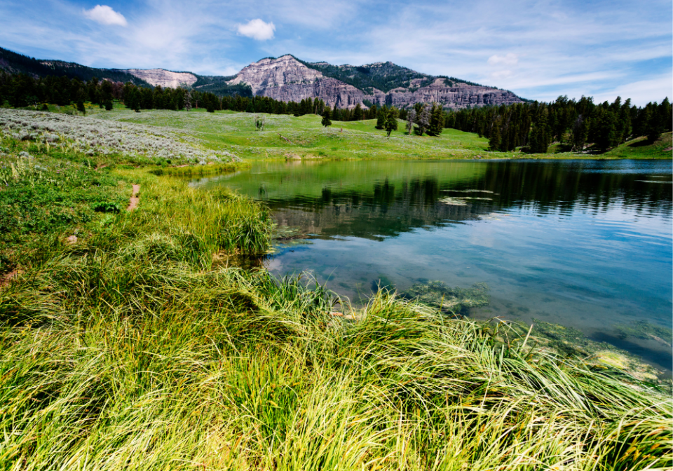
Trout Lake Trail
- Hike length: 1.3 miles
- Time required: 30 minutes
- Hike difficulty: Easy
- Trailhead location: The trailhead is located roughly 1.5 miles south of Pebble Creek Campground on Northeast Entrance Road, which is the starting point of the hike to Trout Lake in Yellowstone National Park.
The trail begins at the roadside parking area and climbs strenuously through a Douglas-fir forest to the top of a ridge. Hikers will climb approximately 200 feet over the first three-tenths of a mile before leveling out and descending to the lakeshore. Aside from its excellent fishing opportunities, this 12-acre lake is well known for its otter population—the trail circles around the lake from the junction near the shore.
Hikers can access a side trail at the lake’s southern end that leads up to a hill with a magnificent view of the Soda Butte Creek Valley and surrounding mountains. The trail crosses the outlet stream near a small waterfall just before completing the 0.6-mile loop around the lake. Along with providing scenic views and a chance to see a variety of wildlife, the trail is also a great place to view a wide range of wildflowers in the spring and early summer.
Yellowstone Day Hikes
- Old Faithful Area Day Hikes in Yellowstone
- Canyon Area Day Hikes at Yellowstone
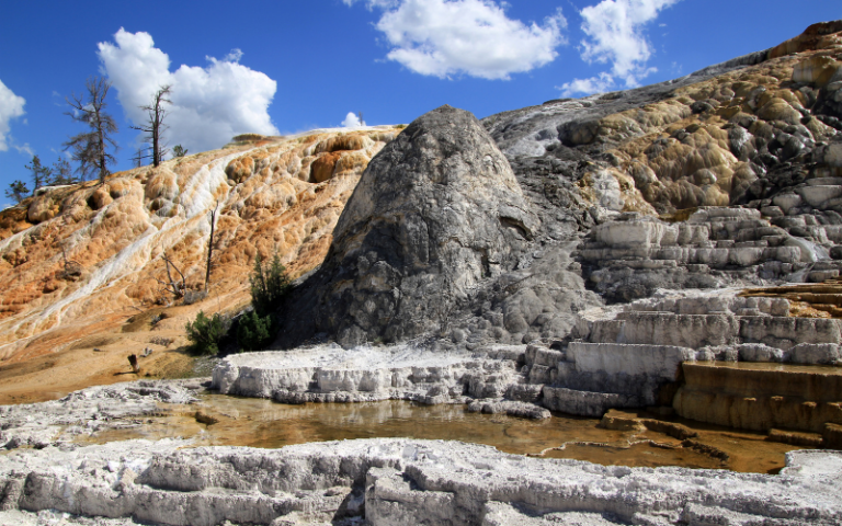
- Mammoth Hot Springs Area Day Hikes in Yellowstone
- Lake and Fishing Bridge Area Day Hikes in Yellowstone
- Madison Area Day Hikes in Yellowstone
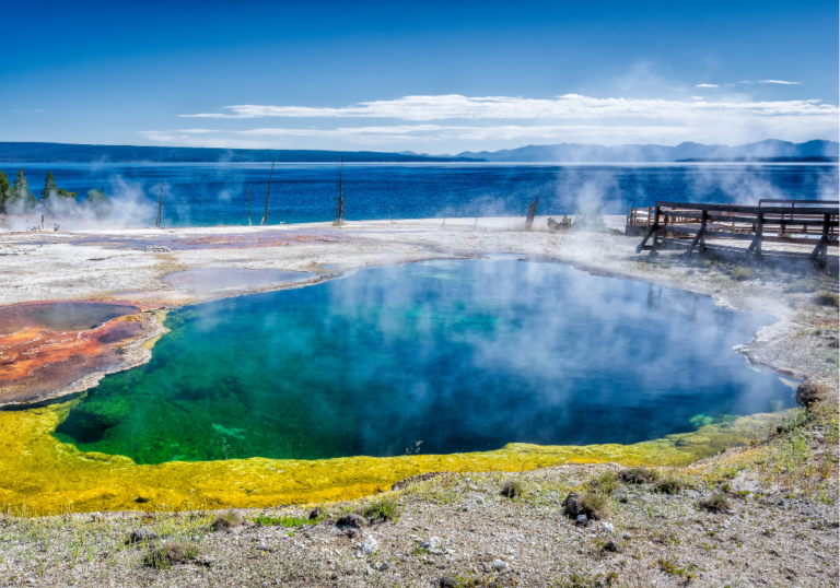
- Grant and West Thumb Area Day Hikes in Yellowstone
Plan a Yellowstone Vacation
- Yellowstone National Park Travel Guide
- Things to Do at Yellowstone National Park
- Best Time to Visit Yellowstone National Park
- Best Time to Visit Yellowstone for Wildlife
- Yellowstone Tours
Places to stay in West Yellowstone
- Holiday Inn, West Yellowstone
- ClubHouse Inn, West Yellowstone
- Kelly Inn, West Yellowstone
- West Yellowstone hotels!
Places to stay in Gardiner
- Yellowstone Gateway Inn, Gardiner – full kitchen and comfy bed, one of our favorite places to stay!
- Park Hotel Yellowstone, Gardiner – charming place to stay and loved by guests!
- Absaroka Lodge, Gardiner – beautiful location with river views!
- Gardiner hotels!
Places to stay in Cooke City or Silver Gate
- Sunny Log Home on the Creek, Silver Gate (VRBO) – the most AMAZING location with an awesome fireplace and comfy bed!
- High Country Motel and Cabins – local owners who love what they do, and make you feel so welcome!