Potash-Lower Colorado River Scenic Byway in Moab, Utah
One of four scenic drives in Moab, Utah is the Potash-Lower Colorado River Scenic Byway. Add this scenic drive to your list of places to visit in Utah to see stunning landscape views!
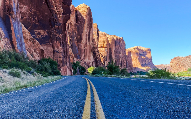
The 34-mile round-trip drive is a terrific half-day excursion from the Moab area. Potash Road or the Lower Colorado Scenic Byway runs along the Colorado River and ends at the border of Canyonlands National Park.
Use our Moab, Utah Vacation Guide to plan your trip: things to do, what to pack, best time to visit, and more!
Be sure to add the Potash Road Scenic Drive to your Utah Bucket List. You’ll see towering sandstone cliffs, petroglyphs, dinosaur tracks, arches, and views of the Colorado River.
In this guide we’ll detail the things you can see, do and photograph along Scenic Byway U-279 accessed just north of Moab.
We also provide a map, best times to visit, what to pack, and even where to stay if you want to extend the adventure beyond a day trip.
This site contains affiliate links which means WE may receive commissions for purchases made through these links. We only provide links to products we actually use and/or wholeheartedly recommend! As an Amazon Associate, we earn from qualifying purchases. Read the full Disclosure Policy.
What To Pack for a Trip to Moab
- Hiking shoes
- Darn Tough hiking socks
- WATER: Hydration packs or carry refillable water bottles in your backpack.
- Healthy snacks – there may be NO services on the trails you’ll hike or drive.
- Lip balm with sunscreen and hydrating lotion – Utah’s high elevation and dry air can be hard on your skin.
- Summer – High temperatures, unrelenting sunlight, and low humidity. To keep cool, wear light colored, loose fitting UV protection clothing that does not absorb sunlight. Also avoid sun burn by wearing a sunhat and by generously applying sunscreen to any parts of your body that are exposed to the sun.
- Winter – Pack winter clothing to stay dry and warm.
- Fleece jacket
- Buff headbands
- Hand sanitizer
- Flashlight or headlamp
- First aid kit
- DOWNLOAD – Camera gear checklist
Potash-Lower Colorado River Scenic Byway Facts
The 17-mile paved road follows the Colorado River with a towering sandstone cliff on the other side. Plan about two hours to drive to Jug Handle Arch and back.
A camera is a must on this drive! There are petroglyphs, dinosaur tracks, arches, and the Colorado River to photograph!
Several campgrounds along the highway are available for overnight stays. Numerous day use picnic areas along the route access the river.
Parking and restrooms are provided in a few areas along the route. Some of the best Moab Utah hiking trails and 4×4 trails can be found along this scenic drive.
Time your return trip to Moab during sunset, and watch the Colorado River and surrounding environs light up at the golden hour for an added bonus.
Best Time to Drive the Potash Road
Do your research to know what the Moab weather is like at various times of the year.
Moab in the Spring: temperatures vary quite a bit from month to month. When visiting Moab in the spring, it’s important to pack for all types of weather because you never know when the weather will change.
- Moab in March: Highs 64 | Lows 35 degrees F
- Moab in April: Highs 71 | Lows 42 degrees F
- Moab in May: Highs 82 | Lows 51 degrees F
It is not unusual to get rain or even snowfall in March. We recommend you watch the weather and pack a winter coat, winter hat, and winter gloves when going to Moab in early spring. A fleece jacket, hat, and gloves should be fine later in the spring.
Moab in the Summer: when planning your trip to Moab in the summer expect HOT temperatures! Since the temperatures are brutal this time of year, plan your outdoor activities for the cooler mornings and evenings!
- Moab in June: Highs 93 | Lows 60 degrees F
- Moab in July: Highs 100 | Lows 67 degrees F
- Moab in August: Highs 97 | Lows 66 degrees F
With the hot summer temperatures, you’ll want to protect yourself from the sun by wearing a sun hat, sunscreen and sunglasses. It’s important to stay hydrated and carry a hydration pack or a refillable water bottle in your backpack. You also need to eat salty healthy snacks!
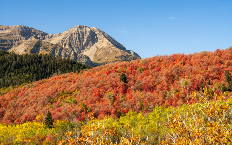
Moab in the Fall: the weather at Moab in the fall starts to cool down making it a great time to explore the park because it will be cooler in the mornings and evenings, and the daytime temperatures aren’t too hot compared to the summer.
- Moab in September: Highs 85 | Lows 54 degrees F
- Moab in October: Highs 71 | Lows 40 degrees F
- Moab in November: Highs 55 | Lows 30 degrees F
With the cooler temperatures at night, you will definitely want to bring a fleece jacket, warm hat and gloves for the nights and early mornings.
Moab in the Winter: the temperatures really drop at Moab in the winter so it’s the least busy season. We don’t mind the colder weather for enjoying outdoor activities, which makes the winter the best time for us to visit to escape the crowds!
BUT the cold winter weather may not be for everyone.
- Moab in December: Highs 45 | Lows 23 degrees F
- Moab in January: Highs 44 | Lows 22 degrees F
- Moab in February: Highs 52 | Lows 28 degrees F
During the winter it is especially important to dress in layers. We recommend an insulted winter jacket, fleece jacket, warm hat and gloves if you’ll be doing any outside activities. Here’s the full list of the outdoor winter clothing we use – especially these awesome photographer gloves and rechargeable hand warmers!
Remember to stay hydrated and use sun protection all year long when visiting Moab:
- WATER: Drink plenty of water – we use hydration packs or carry refillable bottles in our backpack.
- FOOD: Pack and eat healthy snacks
- SUN PROTECTION: Sunscreen, lip balm with sunscreen and hydrating lotion
- LAYERS: The high elevation temperatures are cool in the mornings and evenings so we recommend: fleece jacket, winter hat, and gloves.
You’ll want to wear winter clothing to enjoy all those fun outdoor activities!
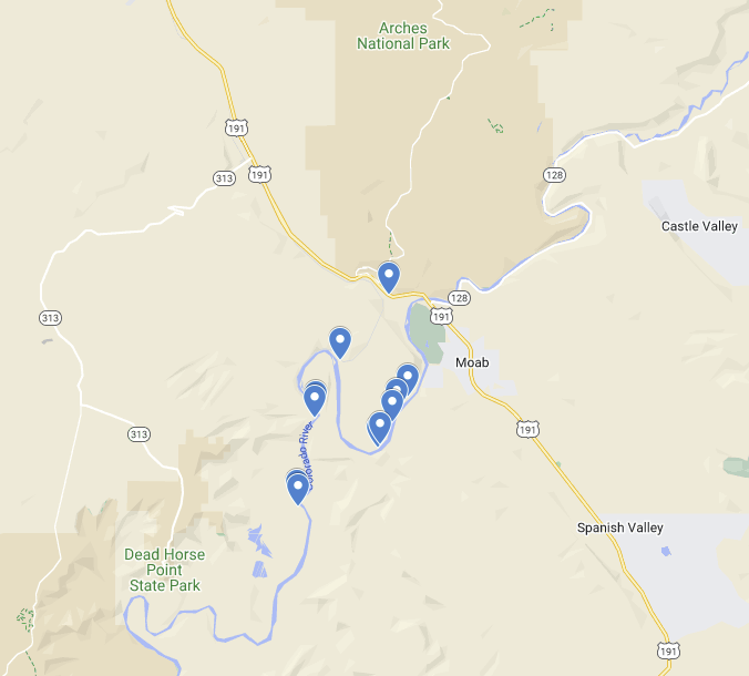
Map of Potash Road Scenic Drive Points of Interest
Use this Google map of the Potash Road Scenic Byway to navigate along the road to all the points of interest.
The places to stop are in order beginning at the junction of Highway 191 and U-279.
Places to Stop Along the Potash-Lower Colorado River Scenic Byway
Find Utah State Route 279 four miles north of Moab, off of Highway 191. You’ll first pass the Moab uranium tailings pile that is currently being relocated.
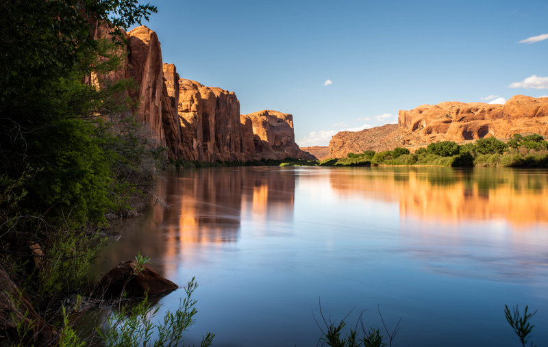
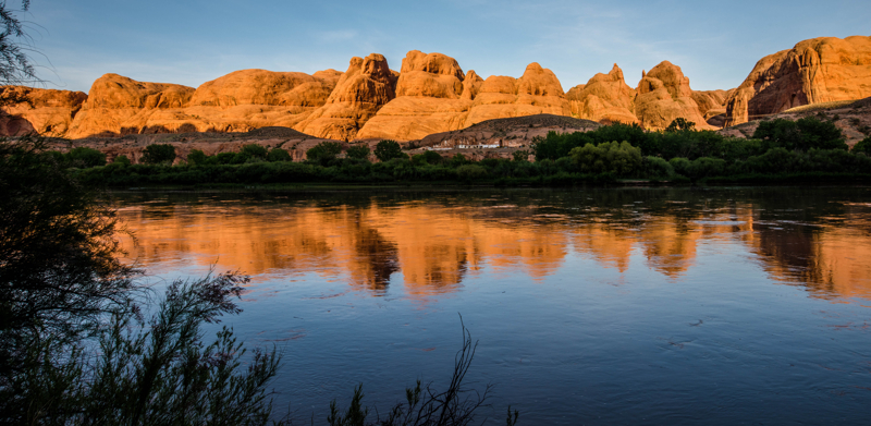
Soon after this, you’ll enter a narrow gorge of the Colorado River where sandstone cliffs tower above the water.
These are the popular points of interest along the scenic drive that we recommend:
Jaycee Park Campground
Around mile 4 you will reach Jaycee Park Campground. You’ll find shady walk-in tent sites (no trailers, RVs or large vehicles) near the popular Wall Street climbing area. Individual sites are available on a first-come, first-served basis.
- Individual Sites: 7 (limited to 10 people & two vehicles per site)
- Water: No
- Toilets: Yes
- Hook-ups: No
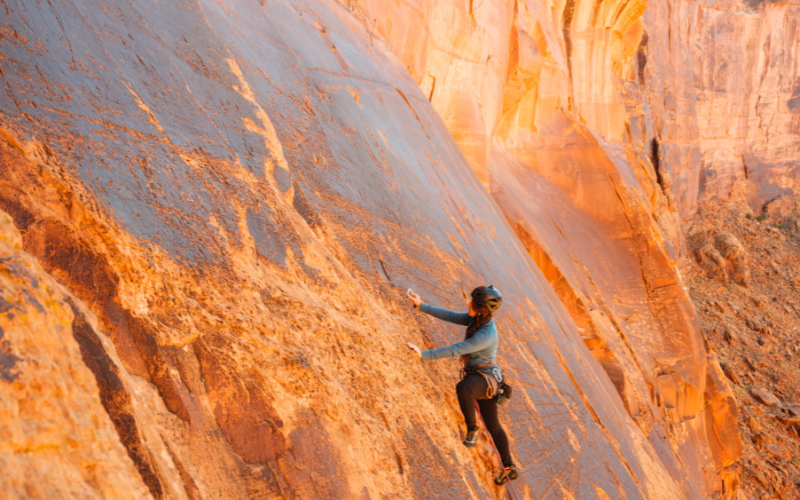
Wall Street Climbing Area
Half a mile up the road from Jaycee Campground will be the start of the Wall Street climbing area. You can see climbers scaling the enormous slickrock wall on the side of the road at all times of the year.
Use caution driving through this congested stretch of road!
This area is popular with rock climbers because it requires little to no approach. You can just pull your car over and begin scaling the technical climbing routes right off the road.
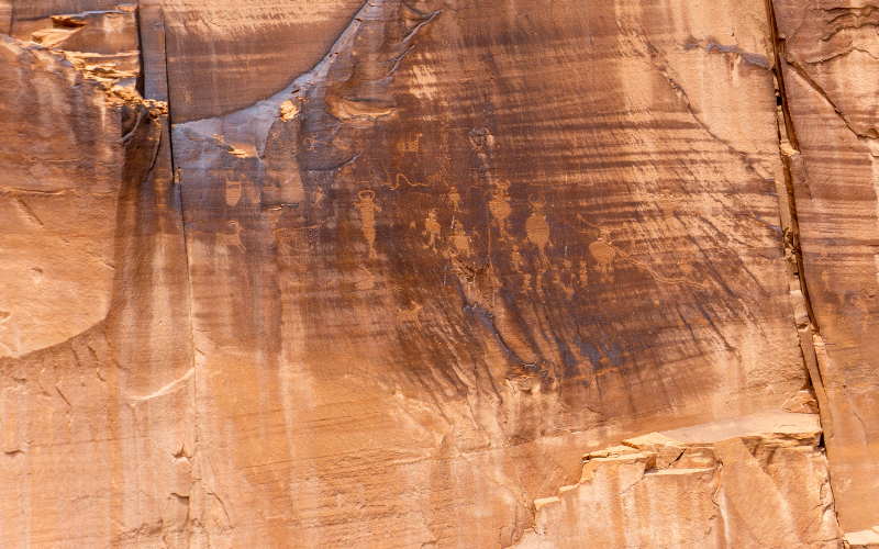
Roadside Petroglyphs
Just past Wall Street, about five miles from the 191 junction, there are several petroglyph panels on your right. Look for the signs indicating “Indian Writing” and park in the pullout along the river.
The BLM (Bureau of Land Management) has posted interpretive signs that offer more information about the rock art as well.
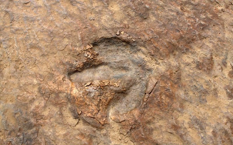
Poison Spider Trailhead & Dinosaur Tracks
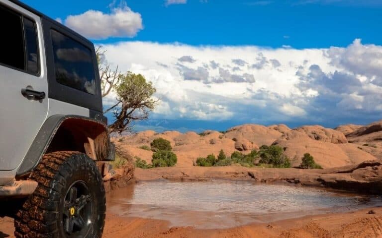
The Poison Spider trail is the next point of interest along this scenic drive. This trailhead leads to a popular 9-mile hike, mountain bike ride or 4×4 trail that winds its way around and on top of the Poison Spider mesa.
Poison Spider Mesa Trail is a popular off-road 13.5-mile loop that takes about 5 hours to complete. You’ll need a 4WD vehicle with high ground clearance, lockers, large tires, and good articulation. There are huge awkward ledges and many tippy spots. We recommend only experienced drivers tackle this trail!
You can rent Jeeps and OHVs in Moab to drive the trail yourself, or sign up for a guided Jeep tour. Outlaw Jeep also offers a guided tour where you drive your own Jeep behind the guide Jeep, and they teach you how to drive the obstacles!
Near the pit toilets here, you’ll see a sign for the trail to the dinosaur tracks viewing area. There are tubes set up to help view the tracks, one of them is lined up so you can see a series of fossilized three-toed dinosaur tracks.
There’s also a rock art panel here, but you will need binoculars to see these petroglyphs.
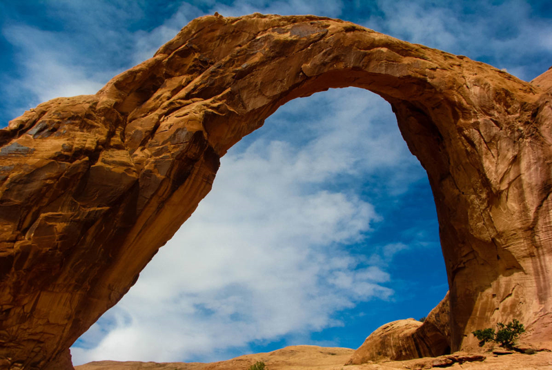
Corona Arch and Bowtie Trail
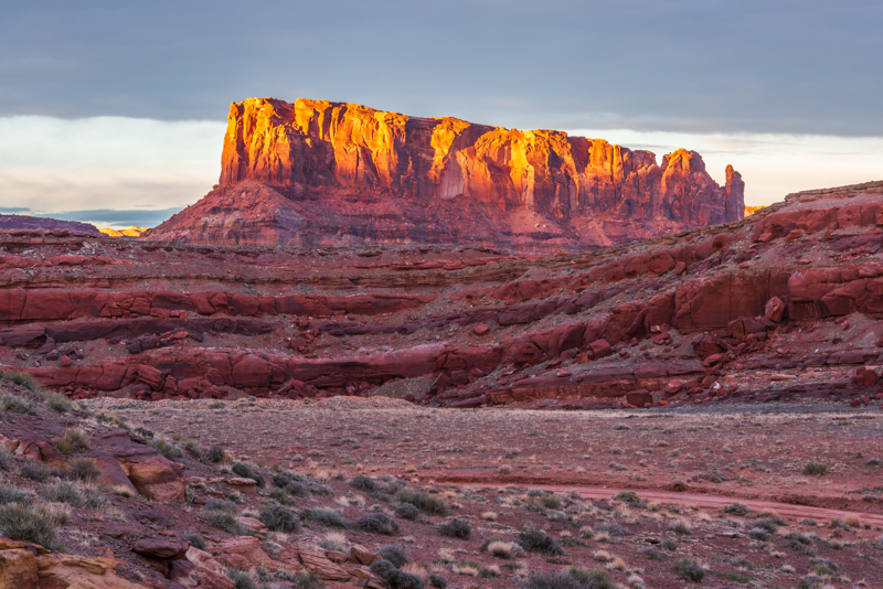
Continue down the road for another 5 miles and you will find the trailhead for Corona Arch on you right-hand side. Enjoy stunning views along the way and the reward at the end is the 140-feet wide and 150-feet high Corona Arch. Bowtie Arch has a narrow opening above stripped sandstone.
Corona Arch Trail is 3 miles round trip and considered moderate due to a few areas where you’ll need to use cables to get up and down the slickrock slopes. There is no shade along this trail so it’s best to hike during the early mornings or early evening hours. Leashed pets are allowed on the trail.
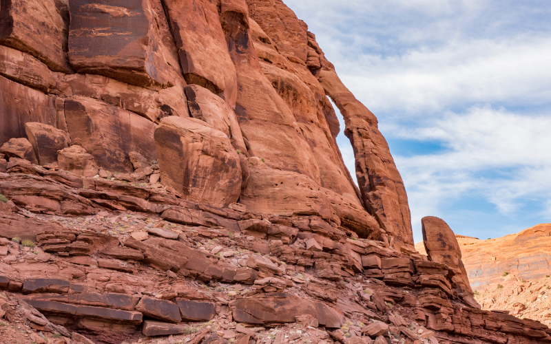
Jug Handle Arch
About 13.5 miles from 191 you’ll see Jug Handle Arch. Park at the turn-off, that also serves as the entrance to Longs Canyon. A short walk back will lead you to the arch’s base and a few petroglyphs.
Long Canyon Road
The Long Canyon Road from Potash Road is a 7.6-mile drive up to the top of the mesa near the entrance to Dead Horse Point State Park and Canyonlands Island in the Sky.
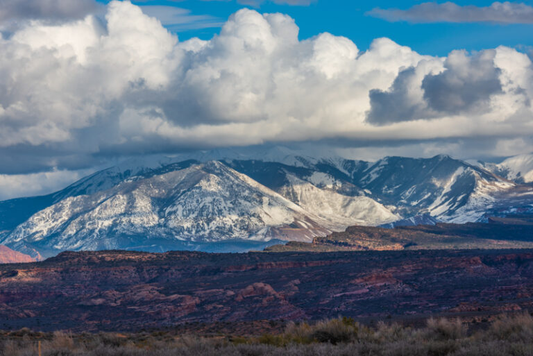
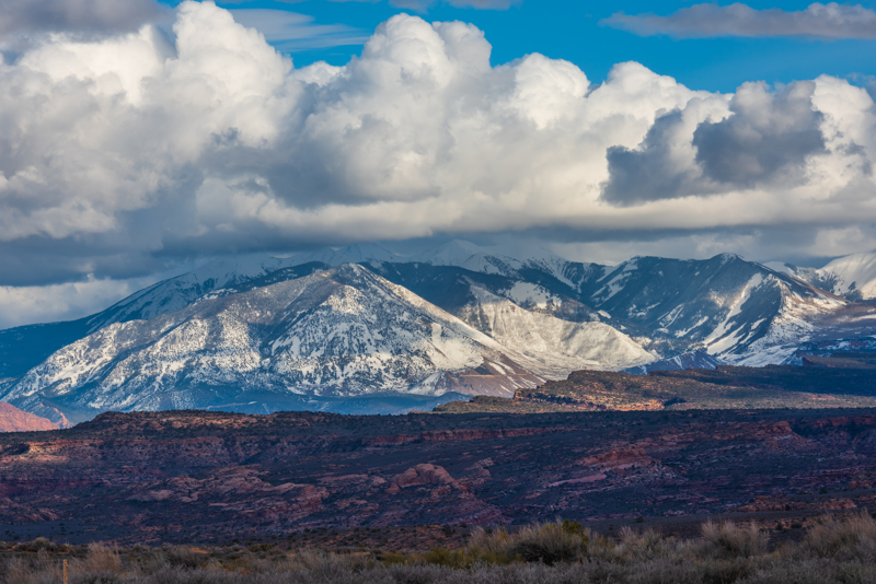
We recommend driving this road west to east so you’re descending from the mesa to the river. This route offers spectacular views of the the Moab area and La Sal mountains!
The dirt road is generally passable with a high clearance 4WD vehicle. You’ll encounter narrow sections, steep switchbacks, and some parts of the road may be rocky and rutted. A huge boulder has fallen from the cliff above and the road goes underneath it. It may seem like your vehicle won’t fit through the opening, but any normal truck or SUV will drive under just fine.
This is one trail you can drive without much experience. If you don’t have your own four-wheel-drive vehicle, then rent a Jeep in Moab (we love Outlaw Jeep)!
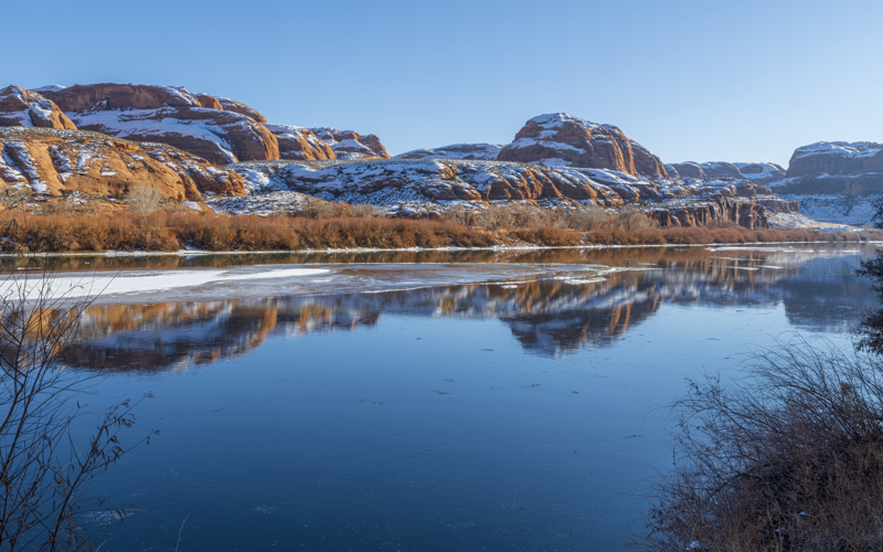
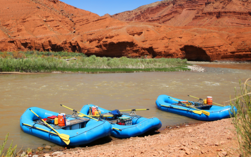
Potash Boat Ramp
From Jug Handle Arch, continue 7 miles down the road until you reach Potash Boat Ramp.
This area is a beautiful spot to stretch your legs, eat a snack, take some pictures, then turn back and return the way you came.
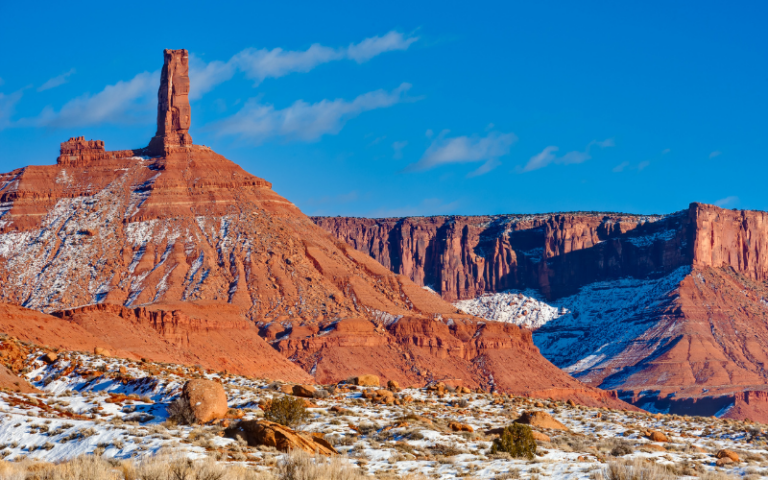
Moab in the winter provides amazing scenery, especially when there’s white snow that contrasts on the red rocks!
Shafer Trail and White Rim Road
From here the road becomes a 4×4 trail leading to Shafer Trail that connects via steep switchbacks with Canyonlands Island in the Sky.
You also access the 100-mile White Rim Road loop from this location. Four-wheel-drive vehicles, motorbikes, and bicycles (including e-bikes) are allowed on the White Rim Road.
Your vehicle must have high-clearance, four-wheel drive (low range) on the White Rim Road.
All vehicles, motorbikes, and bicyclists must have a day-use permit for single day trips on the White Rim.
Potash-Lower Colorado River Scenic Byway Photography
Since we live so close to Moab, we’ve been able to take pictures during every season and all types of weather and light conditions. Here are a few of our tips for taking pictures along the Potash-Lower Colorado River Road:
River and Reflections Photography – The sun is not your friend when photographing rivers because it creates bright spots and dark shadows in the image.
We recommend driving this road in the late afternoon when the light isn’t so bright, and the red rocks have that red/orange glow.
PHOTO TIP: If light conditions are too bright for the long exposures to be captured with only camera settings, then we recommend you use neutral density filters to help balance the light in the scene.
Be sure to find spots along the river to photograph the reflections of the red rocks on the opposite side of the river in the water.
The cool thing about the Potash Road area is it can be photographed year-round: spring, summer, fall, and winter!
We recommend winter clothing and gear when it’s cold – we LOVE rechargeable hand warmers and photography gloves!
Use a variety of basic photography techniques to compose your photos for interest and impact.
Potash Road Camping
Within 20 miles of Moab, camping is only allowed in developed campgrounds. Dispersed camping in Moab is available, but restricted to certain areas. There is no primitive camping along the Potash Road, but you’ll find three campgrounds:
Jaycee Park Campground
Jaycee Park Campground is first come – first served campground. It’s set in a small grove of trees, one of the few campgrounds in the Moab area that offers some tree shade. This spot is the perfect location for those wanting to remain fairly close to town, while also wanting a little quiet from the bustling town of Moab.
- Walk-in sites only (no trailers, RVs or large vehicles)
- Individual Sites: 7 (limited to 10 people & two vehicles per site)
- Water: No
- Toilets: Yes
- Hook-ups: No
Williams Bottom Campground
Williams Bottom Campground is first come – first served that offers shady campsites for tents and small trailers with beautiful views of the scenic Colorado River Canyon.
- Individual Sites: 17 (limited to 10 people & two vehicles per site)
- Water: No
- Toilets: Yes
- Hook-ups: No
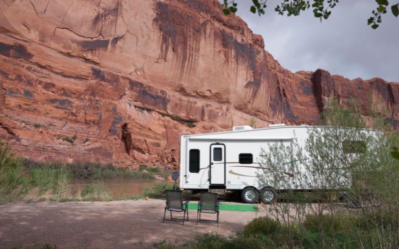
Gold Bar Campground
Gold Bar Campground is conveniently located just up the road from the Corona Arch trailhead. The site includes a boat ramp, beach, individual campsites, group campsites, and facilities. Individual sites are first-come first served, but group sites can be reserved at Recreation.gov. This is the only campground along Potash Road that accommodates RV camping.
- 9 individual campsites available on a first come-first serve basis; limited to 10 persons and 2 vehicles per site. The campsites include fire grate, picnic table, and vault toilets.
- 4 group campsites that must be reserved. Group areas have fire grates, picnic tables, and vault toilets.
- Sites A, B, and C have shade shelters. Site D does not have a shade shelter but is a great site for groups of motor homes. The campground does not have water, dump stations or electric hook ups.
Things To Do Along the Potash-Lower Colorado River Scenic Byway
Here’s a list of recreational activities you can do along the Potash Road scenic drive
- Moab 4×4 tours
- Moab biking tours
- Moab river rafting tours
- Backpacking
- Climbing
- Hiking
- Kayaking
- Paddle boarding
- Landscape Photography
Moab Utah Tours and Resources
Where to Stay in Moab
There are many types of accommodations to choose from in Moab: budget-friendly hotels to higher-priced resorts. You’ll also find vacation rentals, a hostel, campgrounds and RV parks in Moab.

Where to Stay in Moab
There are many types of accommodations to choose from in Moab: budget-friendly hotels to higher-priced resorts. You’ll also find vacation rentals, a hostel, campgrounds and RV parks in Moab.