Arches National Park Scenic Drive: 13 Points of Interest
The Arches National Park scenic drive takes you through a stunning red rock landscape filled with arches, fins and balanced rocks.
Check out this Arches National Park travel guide to plan your vacation and create your itinerary.

Below you’ll find a map of the various points of interest along the scenic drive in the park and tips for things to see, do and photograph at each stop.
Plus we’ve got 1, 2, and 3-Day Arches National Park itineraries:
- Arches National Park in One Day
- Two Days in Arches National Park
- Three Days in Arches National Park
- Arches National Park and Canyonlands in One Day

This site contains affiliate links which means WE may receive commissions for purchases made through these links. We only provide links to products we actually use and/or wholeheartedly recommend! As an Amazon Associate, we earn from qualifying purchases. Read the full Disclosure Policy.
A Photo Tour of Arches National Park
Take a visual tour through Arches National Park to see the stunning landscapes you’ll see when you visit!
Arches National Park Information
There are over 2,000 natural stone arches within park boundaries. You can also see pinnacles, fins, windows and balanced rocks from the scenic drive. You can see even more when you explore the Arches National Park hiking trails.
Arches has a TIMED ENTRY program that runs April through October:
Timed entry tickets will be required to enter the park from 6 a.m. to 5 p.m. daily and will allow visitors to enter the park during a one-hour specified window of availability. After entering, visitors may stay in the park as long as they wish for the remainder of the day. Reservation holders may exit and re-enter the park on the same day with a correctly validated ticket.
Visitors can book reservations first-come, first-served on Recreation.gov. The park will release reservations three months in advance in monthly blocks.
Keep in mind you can visit Arches without a ticket. You just need to plan to enter the park before 6 a.m or after 5 p.m. That’s the best time of day for Arches National Park photography anyway!
Arches National Park Map
Download the map to navigate along the scenic road to each point of interest.
Arches National Park Scenic Drive Points of Interest
The full 43-mile scenic drive, including the spur roads, takes 2 to 3 hours. Add more time if you plan to walk around and take Arches National Park photos or do any hiking at any of the stops.
The road is paved and offers Arches National Park photography spots from the pullouts along the road or in the parking lots. Some of the arches and landmarks can be reached by a short walk from the parking lot.
CHECK OUT our Arches & Canyonlands Itinerary and Photography Guide if you’re serious about taking the best photos at Arches!
Moab Fault
Stop at the overlook on your right near the top of the switchbacks as you drive from the Visitors Center. You’ll see Highway 191 below and evidence of the shift in the geologic landscape.
From this viewpoint, look across the park road and above Arches Visitor Center, where a diagonal line separates lower wavy rock from the smooth vertical cliff above.
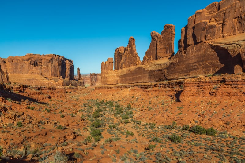
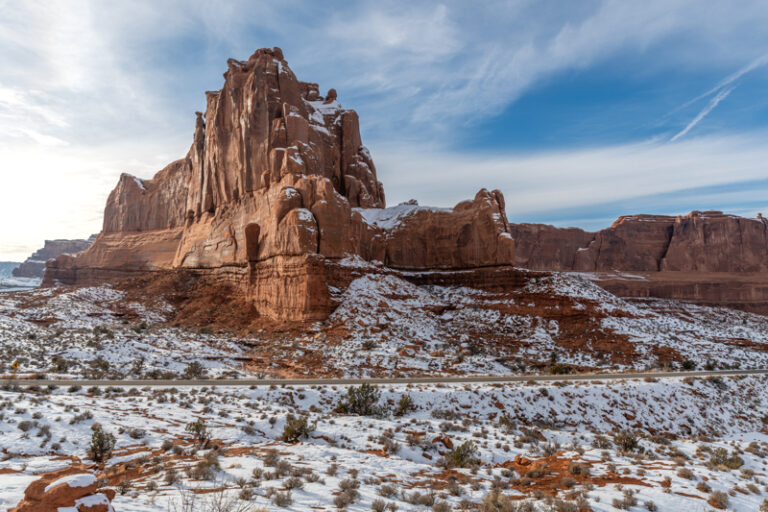
Park Avenue
Park Avenue is the next stop, on your left, as you continue along the scenic drive. From the parking area follow the wide, paved trail for about 100 yards to the viewpoint.
It’s an impressive view, but to understand why it’s called Park Avenue, follow the trail down and walk between the immense sandstone monoliths on either side.
Photo Tip: Park Avenue is best middle to late afternoon when the valley is in shadow and the sun lights up the east wall.
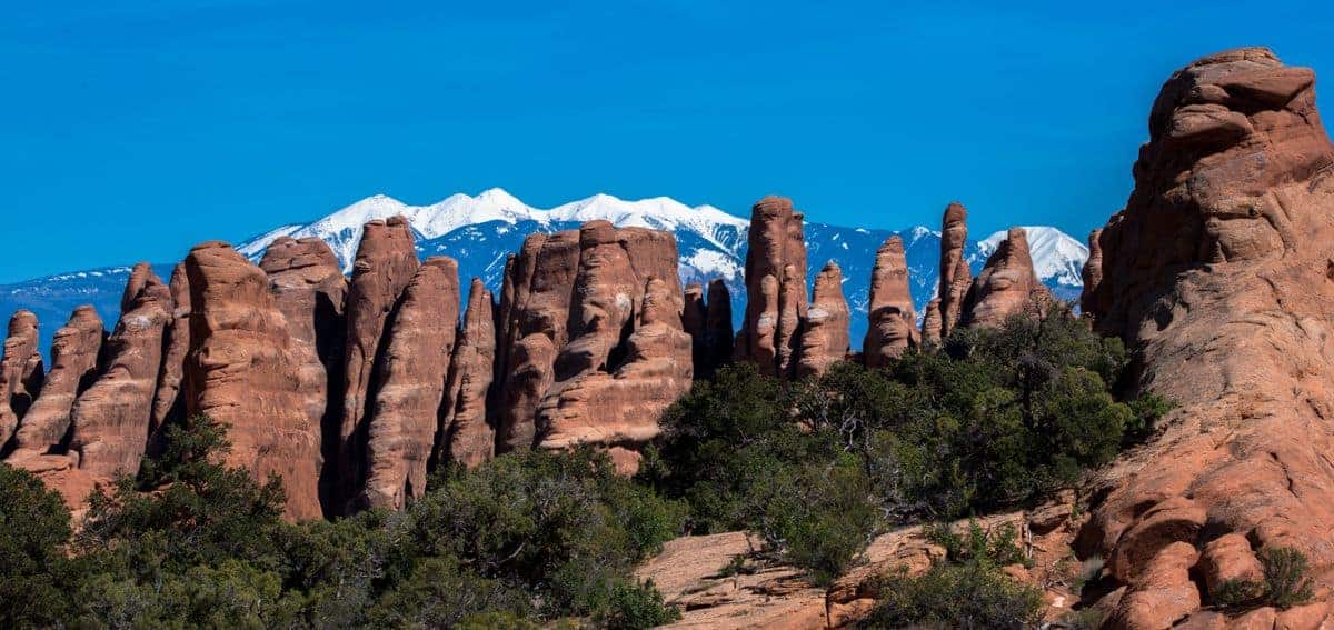
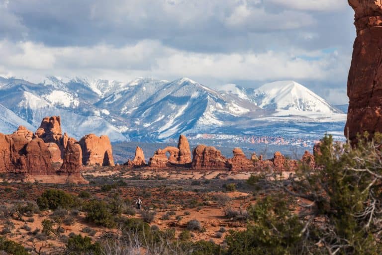
La Sal Mountain Viewpoint
The next point of interest will be on your right where you’ll enjoy a 360-degree view. See the La Sal Mountains to the east and distinctive formations like Three Gossips, Sheep Rock, and The Organ in the Courthouse Towers area. Look to the horizon for a distant view of Balanced Rock and the Windows Section.
Photo Tip: La Sal Mountain Viewpoint is best at sunrise. The light from the rising sun washes the rock formations with a warm red glow. → READ MORE: Sunrise Photography Tips
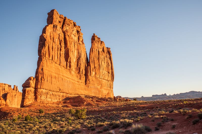
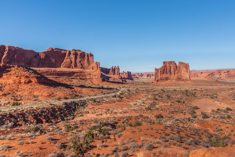
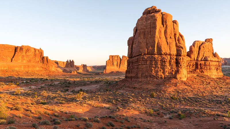
Courthouse Towers
The Courthouse Towers area has unique rock formations to photograph: Three Gossips, Sheep Rock, and The Organ. We found the best places to take photos are from the pullouts between the La Sal Viewpoint and the Courthouse Towers parking lot.
Photo Tip: Courthouse Towers area is best at sunrise when the warm light in the morning produces a glow on the formations.
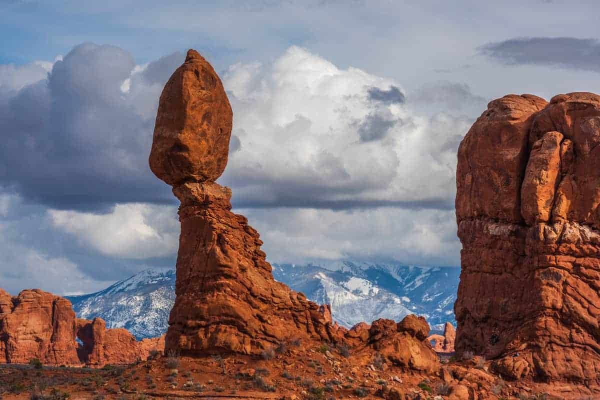
Balanced Rock
Balanced Rock is the next stop found on the right. There are other pullouts between Courthouse Towers and Balanced Rock that provide photographic opportunities, like Petrified Dunes Viewpoint.
Walking along the .3 mile round trip trail around this landmark is a good way to stretch your legs.
Fun fact: the upper portion of the rock that is balancing is as large as three school buses!
Photo Tip: Sunset is a good time to photograph Balanced Rock at Arches National Park. → READ MORE: Sunset Photography Tips
Garden of Eden
From Balanced Rock, turn right toward The Windows area. You’ll pass a sign for Pothole Arch so be on the lookout to find that one as you drive.
On the left you’ll access the Garden of Eden parking lot. This is a popular spot for rock climbers which is fun to watch. It’s a nice place to take pictures and scramble around on the rocks.
Photo Tip: Garden of Eden is a good location to watch the sun setting on the west and get the glow on the formations on the east.
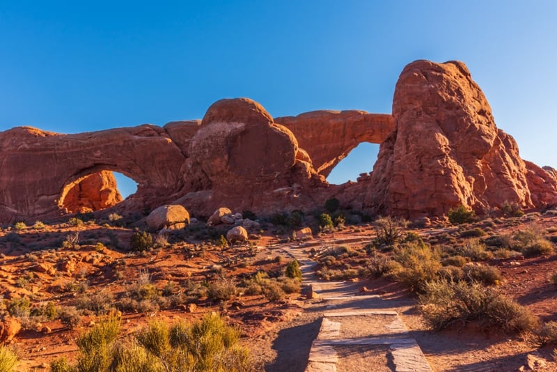
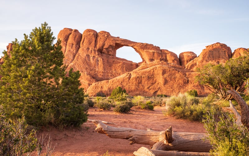
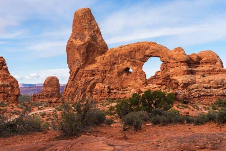
The Windows and Turret Arch
You can see the windows from the parking lot, but we recommend the easy 1 mile round trip hike that takes you to the North and South Windows, also known as the Spectacles.
Walk along the primitive trail from the South Window to the back side to see a more attractive view of these arches.
Continue along the trail in the Windows area to access Turret Arch.
Photo Tip: Get here early if you want photos without people climbing the windows or arch. The area is amazing in the morning, evening and night/milky way photography.
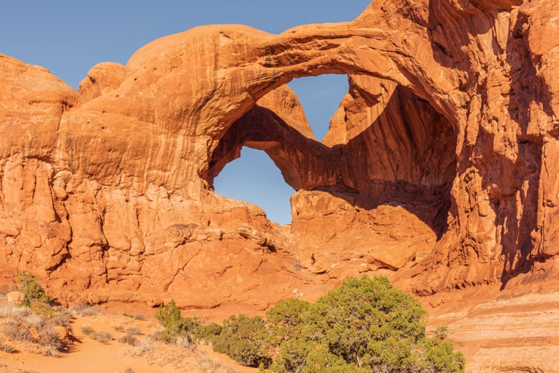
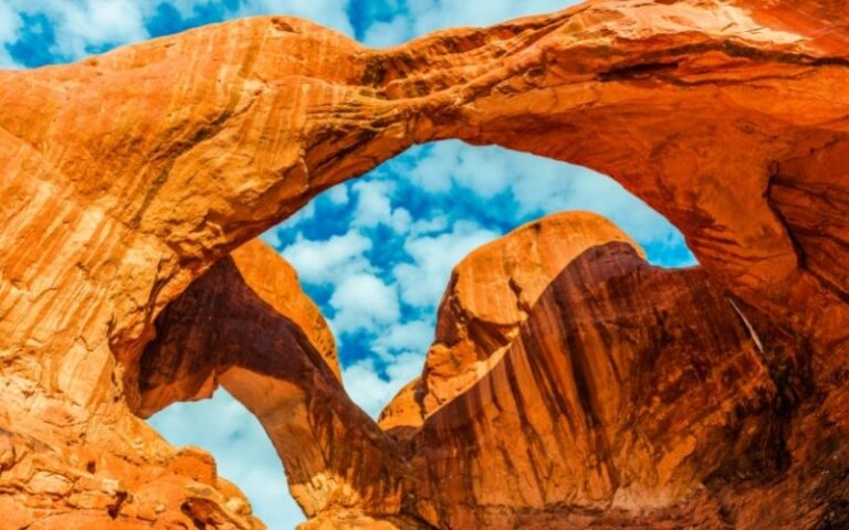
Double Arch
Double Arch is across the parking lot from the Windows. You’ll see two arches that share the same stone foundation formed by downward water erosion instead of side-to-side water erosion like most of the other arches in the park.
As you hike to Double Arch look to your left to see the Parade of Elephants, a rock formation that resembles a herd of elephants holding each others’ tails. Enjoy the short, leisurely trail.
Photo Tip: Early is better if you don’t want people in the photo scrambling over the rocks.
From here head back out to the main road and turn right.
Panorama Point
This viewpoint is at the top of a hill so you get a panoramic view of the park! You can see the La Sal mountains, Fiery Furnace and Devil’s Garden.
We recommend this location for stargazing if you have time to visit the park after dark!
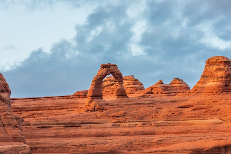
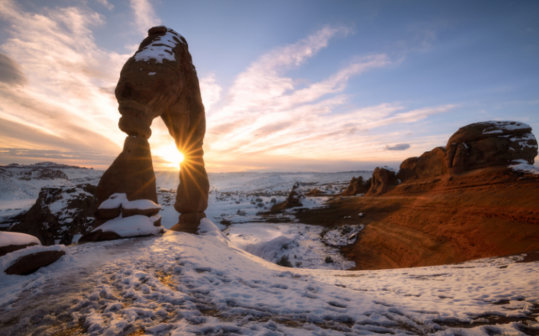
Delicate Arch
Continue along the main road then turn right to access Delicate Arch.
This iconic arch is a must-see when visiting Arches National Park! Unfortunately, it can’t be viewed from the main road.
It’s worth the short 100 yard walk along a level path to see the arch one mile away from the Lower Delicate Viewpoint.
If you’re up for a half mile hike with some stairs to climb, there is an Upper Viewpoint that takes you a little closer.
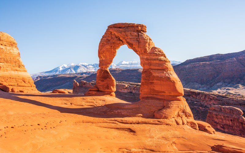
To see Delicate Arch up close, you’ll need to hike the 3 mile roundtrip trail that climbs 480 feet in elevation. The hike is mostly uphill and takes 1 to 1 ½ hours if you are reasonably fit.
Photo Tip: Sunset is the best and most popular time to photograph Delicate Arch. Take a headlamp for the hike down after sunset.
→ READ MORE: Arches National Park hiking trails
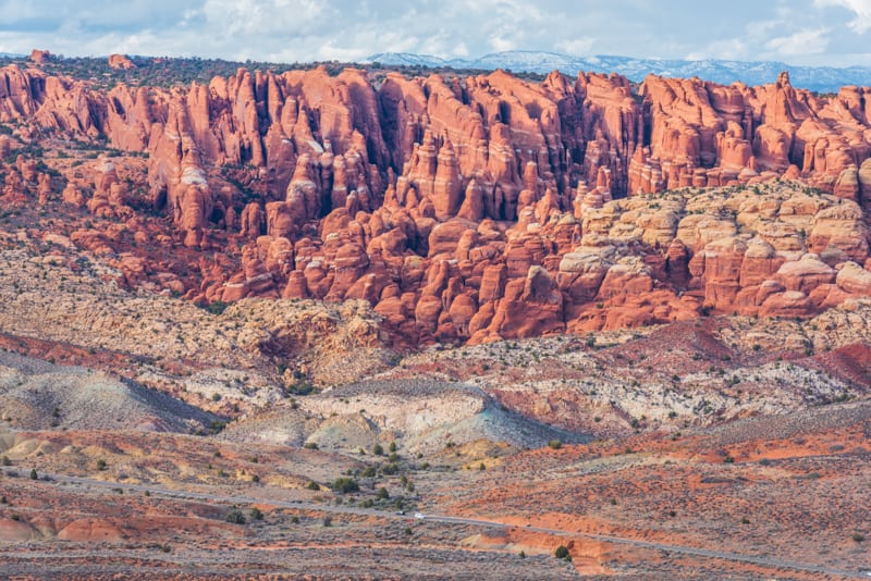
Fiery Furnace
Go back to the main road and turn right. You’ll pass Salt Valley Overlook then come to the Fiery Furnace Viewpoint. It’s a short walk from the parking lot to see the fins and spires.
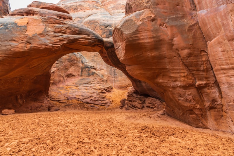
Sand Dune Arch & Broken Arch
The next point of interest along the scenic drive is a popular place to take the kids!
Sand Dune Arch is one stop that’s usually shaded and cool. The easy hike takes you through a narrow slot between fins to a sandy area with many places for the kids to explore and play in the sand.
Take note that it’s against park policy to climb on the arch.

If you’re up for hiking, check out the 1.7 mile Broken Arch loop trail. It’s accessed from the same trailhead as Sand Dune Arch and can be seen off in the distance.
The trail is fairly level most of the way, then has a few sloping sections as you get closer to the arch.
Skyline Arch
Skyline Arch is the next point of interest along the scenic drive. It sits high atop rocks in the Devils Garden area and can be seen from the road.
Photo Tip: You can take a photo from the pullout, but the short and easy trail gets you closer to the arch.
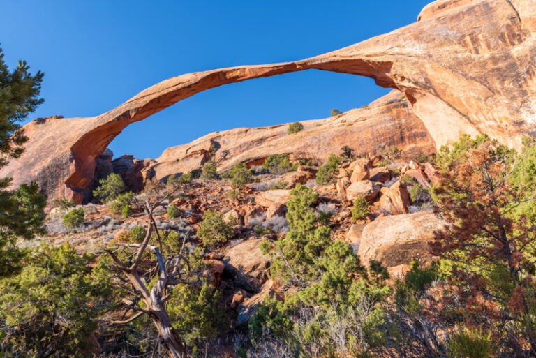
Devil’s Garden
The scenic drive ends at Devil’s Garden where you can see massive fins. There is a nice picnic area to take a break surrounded by amazing landscape.
Exploring the Devil’s Garden trail takes you to a number of arches. At 7.2 miles round trip, including all spur trails, it’s the longest maintained trail at Arches National Park.
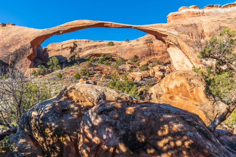
There’s also the option to hike 1 mile to the famous Landscape Arch then turn around and head back.
This arch is longer than a football field and the thinnest part of the archway is 8 feet thick.
That’s the end of the paved scenic drive at Arches National Park. Return the way you came back to the Visitor Center and entrance to the park.
BUY AT AMAZON: Arches and Canyonlands Guides and Maps
Planning an Arches National Park Vacation:
- Best Time to Visit Arches National Park
- Things to Do at Arches National Park
- Arches National Park Packing List
- Arches National Park with Kids
- Arches National Park Photography
- Arches National Park Tours
Where to Stay Near Arches National Park:
There are no hotels in Arches so most people stay in the nearby town of Moab. There are all types of lodging in and near Moab from budget-friendly hotels to higher-prices resorts. You’ll also find vacation rentals, a hostel, campgrounds and RV parks.
- Places to Stay Near Arches National Park
- Hotels Near Arches National Park
- Places to Stay Near Arches National Park with Kids
- Arches National Park Camping
Here are a few of our favorite places to stay near Arches:
- Holiday Inn Express Hotel & Suites Moab – we enjoyed our stay and highly recommend this hotel due to its location close to Arches.
- Purple Sage – our all-time favorite place to stay in Moab – walking distance to shopping, full kitchen, and only 8 units so you don’t feel lost in a large hotel.
- Red Cliffs Lodge – rooms up to 6 people – located 17 miles from Moab, this lodge is known for its beautiful location, winery and actiities like horseback riding, fishing and more!
- Vacation Rentals Near Arches – we really like rentals with a kitchen, washer and dryer and amenities like a swimming pool and hot tub.

WOW amazing, that must be an awesome trip.
Thanks so much for participating and sharing at SSPS 292. See you again next week!
Do not forget to come and share your posts at #WW, yes words are allowed, Wednesday to Saturday weekly.